From dual-polarization radar that reconstructs hailstone structures in three dimensions to AI algorithms analyzing thousands of storm trajectories in real time, you’re witnessing a fundamental convergence reshaping hailstorm research. Hailsondes capture firsthand atmospheric data inside active updrafts, while high-resolution simulations model complex microphysical processes with unprecedented accuracy. Projects like ICECHIP integrate aircraft, drones, and radar into unified storm datasets. Each advancement you explore reveals another layer of how far this science has come.
Key Takeaways
- Dual-polarization radar distinguishes hail from rain, providing precise identification of hailstone size, concentration, and three-dimensional structural distribution within active storms.
- Hailsondes deployed into storm updrafts capture real-time atmospheric conditions, validating theoretical models and improving hailstone formation forecasting with direct measurement data.
- The ICECHIP project integrates aircraft, radars, drones, and hailsondes into one comprehensive platform, transforming fragmented storm observations into actionable datasets.
- AI and machine learning analyze thousands of hail trajectories, generating synthetic datasets and location-specific risk assessments that fundamentally improve hail forecasting accuracy.
- High-resolution simulations and high-performance computing model complex storm microphysics across multiple scenarios, improving forecast lead times and observational data validation.
Why Traditional Hailstorm Research Can No Longer Keep Up
Traditional hailstorm research has long relied on sparse observational networks, simplified numerical models, and post-event damage surveys—methods that can’t capture the full complexity of hailstone formation and storm dynamics.
You’re dealing with rapidly shifting climate patterns that intensify storm behavior, yet legacy approaches lack the resolution to detect critical microphysical processes inside active storms.
Emergency response teams need precise, real-time data, but conventional radar systems and ground-based instruments consistently fall short.
When lives are on the line, outdated radar systems and ground instruments simply cannot deliver the real-time precision emergency teams demand.
Insurance implications compound the problem—inaccurate damage estimates cost billions annually when risk models rely on outdated methodologies.
Hurricane impacts have demonstrated how inadequate forecasting infrastructure creates catastrophic knowledge gaps.
Traditional frameworks simply can’t process the scale, speed, or complexity modern hailstorm research demands, making technological transformation not optional, but essential.
How AI and Machine Learning Are Rewriting Hail Prediction
Where conventional methods hit a wall, AI and machine learning are breaking through with unprecedented analytical power.
You’re now seeing AI algorithms generate synthetic data sets that sharpen location-specific risk assessment beyond what traditional models can deliver.
Machine learning processes tens of thousands of hail trajectories, extracting data patterns that reveal which storm dynamics produce the most destructive hailstones.
Facial recognition technology, adapted for meteorological analysis, strengthens predictive models by evaluating hailstorm severity with remarkable precision.
Deep learning tools sidestep the computational limitations that once constrained pattern recognition across complex atmospheric variables.
You’re fundamentally gaining access to integrated analytical frameworks that identify conditions generating damaging hail faster and more accurately.
These AI-driven advancements aren’t incremental improvements—they’re fundamental shifts in how researchers understand and forecast hail events.
What Dual-Polarization Radar Reveals Inside a Hailstorm
When you look at how dual-polarization radar operates, you see a technology that distinguishes hail from rain by measuring both horizontal and vertical signal returns simultaneously. This capability gives researchers precise identification of hailstone size, concentration, and distribution within a storm cell.
You can use radar-based metrics like Maximum Estimated Size of Hail (MESH) to map internal ice formation processes, revealing how hailstones develop and travel through a storm’s updraft structures.
Detecting Hail With Precision
Dual-polarization radar has fundamentally transformed how scientists detect and characterize hail inside active storms. By transmitting pulses in both horizontal and vertical orientations, you get precise measurements of hydrometeor shape, size, and phase—capabilities single-polarization systems simply can’t match.
This technology peers inside mesocyclones, mapping internal ice formation processes with remarkable accuracy. When integrated with holographic imaging, researchers reconstruct three-dimensional hailstone structures without physical retrieval.
The Maximum Estimated Size of Hail (MESH) product, derived directly from dual-pol data, correlates with insurance claims to quantify damage potential before storms dissipate. Predictive analytics then synthesizes these radar signatures with atmospheric variables, sharpening forecast accuracy and extending lead times.
You’re looking at a detection framework that gives researchers—and ultimately communities—measurable advantages against damaging hail events.
Mapping Internal Ice Formation
Inside a hailstorm’s mesocyclone, dual-polarization radar reveals structural complexities that single-polarization systems can’t resolve. You’re now able to peer directly into active storms, mapping internal ice formation processes with unprecedented precision.
The technology differentiates precipitation types, identifies size distributions, and tracks formation dynamics across multiple atmospheric layers simultaneously.
Dual-polarization systems transmit horizontal and vertical pulses, returning data that distinguishes liquid water from internal ice structures. You can analyze how hailstones accumulate mass while cycling through updrafts, identifying exact atmospheric zones where density and composition shift.
This granular dataset eliminates guesswork that previously constrained researchers.
When integrated with meteorological information, radar-derived internal ice mapping directly supports computational models, validating simulated storm behavior against real-time observational evidence and strengthening predictive accuracy considerably.
Linking Radar To Damage
Three core data streams from radar-based Maximum Estimated Size of Hail (MESH) connect storm behavior directly to insurable losses, giving researchers a quantifiable bridge between atmospheric conditions and ground-level destruction.
When you correlate MESH outputs against insurance claims, you’re measuring radar accuracy against real-world financial impact, exposing where detection models succeed or fail. This damage correlation process strips away assumptions, replacing them with verifiable loss data tied to specific storm signatures.
You can then identify which radar thresholds reliably predict property damage versus those generating false confidence. Dual-polarization systems strengthen this pipeline by distinguishing hail size distributions with greater precision, reducing ambiguity in MESH calculations.
The result is a tighter feedback loop—radar observations inform damage models, and damage records refine future radar interpretation, compressing uncertainty at every analytical layer.
How Hailsondes Directly Measure Hailstone Growth Mid-Storm

Weighing just 24 grams, hailsondes are sensor probes shaped like hailstones that researchers deploy directly into Alberta hailstorm updrafts to capture real-time growth conditions. These probes travel through storm mesocyclones, recording hailstone dynamics and growth measurement data that no ground-based instrument can obtain.
You’re basically getting firsthand atmospheric data from inside the storm itself—something previously impossible with traditional observation methods.
Once retrieved, the hailsonde data directly validates what hailstones actually experience during formation, bypassing theoretical assumptions that previously constrained research accuracy.
Scientists are now planning larger deployments paired with ice retrieval methods for deeper physical analysis. This direct measurement capability fundamentally shifts your understanding of how damaging hailstones form, giving researchers precise, actionable data to improve both forecasting models and suppression strategies.
How the ICECHIP Project Combines Every Research Tool at Once
When you examine the ICECHIP (In-situ Collaborative Experiment for Collection of Hail in the Plains) project, you’ll find it’s the most extensive multi-platform hail research initiative ever assembled, integrating aircraft, dual-polarization radars, drone systems, hailsondes, and ground-based instrument arrays across the Great Plains and Rocky Mountain regions.
You can see how each platform contributes distinct data streams—radar systems map internal ice formation, drones measure real-time damage swaths, and hailsondes capture direct in-storm growth conditions—creating a coordinated dataset no single instrument could generate alone.
This integrated approach lets you analyze hailstone formation, storm dynamics, and surface impacts simultaneously, effectively closing the observational gaps that have historically limited hail research precision and forecast accuracy.
ICECHIP’s Multi-Platform Approach
The ICECHIP project—short for In-situ Collaborative Experiment for Collection of Hail in the Plains—represents the most operationally extensive hail research initiative assembled to date.
It deploys aircraft, ground-based radars, hailsondes, drones, and real-time cameras simultaneously, achieving multi-platform synergy that no single instrument can replicate.
You’re looking at a system where each technology validates and extends the others—radar maps internal storm structure while hailsondes capture direct growth-condition data inside updrafts.
Drones then measure post-storm damage swaths with precision, correlating destruction paths against collected atmospheric measurements.
This collaborative innovation eliminates the data gaps that isolated methods historically produced.
Coordinated Data Collection Methods
Achieving multi-platform synergy requires more than deploying instruments simultaneously—it demands a coordinated data collection architecture where each tool feeds information into a unified analytical framework.
ICECHIP’s coordinated strategies integrate aircraft, dual-polarization radars, hailsondes, and drone systems into a single operational pipeline. You’re looking at real-time data fusion across platforms that would otherwise generate isolated, incompatible datasets.
Hailsondes transmit growth-condition measurements while radar systems simultaneously map internal ice formation processes, allowing analysts to cross-validate findings instantly. Drones characterize damage swaths with spatial precision, while cameras and radar together define accurate hail path boundaries.
This architecture eliminates analytical gaps that traditionally delayed research conclusions. By synchronizing every instrument’s output, ICECHIP transforms fragmented observations into a thorough, actionable storm dataset you can immediately interrogate.
Advancing Hail Research Integration
By consolidating aircraft, dual-polarization radars, hailsondes, drones, and ground-based camera arrays into a single operational framework, ICECHIP represents the most extensive hail research integration effort ever attempted across the Great Plains and Rocky Mountain regions.
You’re witnessing a paradigm shift where data integration across multiple simultaneous platforms eliminates the observational gaps that previously constrained hailstone formation models. Each instrument captures distinct storm variables—updraft velocities, ice nucleation layers, damage swath dimensions—feeding synchronized datasets into predictive analytics engines that machine learning algorithms process in real time.
This convergence lets researchers validate computational simulations against direct in-situ measurements simultaneously, dramatically improving forecast precision. ICECHIP fundamentally dismantles traditional research silos, giving scientists unprecedented freedom to cross-reference radar signatures, laboratory crush-test data, and hailsonde trajectories within one unified analytical structure.
Can High-Resolution Simulations Predict Hail Before It Forms?
High-resolution computational modeling has fundamentally changed how researchers approach hail prediction by enabling simulations that capture storm dynamics and microphysics before a single hailstone forms.
You’re now working with tools that model complex atmospheric interactions across precise temporal and spatial scales, giving you predictive insight that traditional methods couldn’t deliver.
These simulations integrate statistical and physical approaches to evaluate hail formation conditions with measurable simulation accuracy. High-performance computing enables large ensemble runs, meaning you’re analyzing multiple storm scenarios simultaneously rather than relying on single-model outputs.
The practical payoff is real: improved forecast lead times give you earlier detection capabilities, and seamless integration with observational data strengthens validation.
You’re no longer reacting to hail—you’re anticipating it, armed with computational precision that transforms raw atmospheric data into actionable storm intelligence.
How Drones and Satellites Map Hail Damage as It Happens
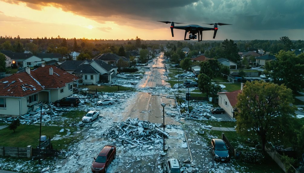
While high-resolution simulations tell you what’s coming, drones and satellites tell you what’s already happened—and they’re doing it in real-time.
Drone technology maps hail damage swaths immediately after—or even during—storm events, measuring destruction paths with precision that ground teams can’t match. You get spatial data layered across affected zones, enabling rapid damage quantification without bureaucratic delays.
Satellite imagery complements this by monitoring hailstorm development and tracking from above, feeding high-resolution observational data into coordinated research platforms.
When you combine both technologies with radar analysis and real-time camera monitoring, you’re building thorough storm datasets that capture damage extent, trajectory, and intensity simultaneously.
This multi-platform integration gives researchers—and ultimately you—actionable intelligence faster, compressing the gap between storm occurrence and informed response decisions.
How These Hail Research Advances Are Improving Early Warning Systems
The convergence of machine learning, advanced radar systems, and high-resolution computational modeling is fundamentally reshaping how early warning systems perform.
These technologies work together to deliver faster, more precise impact assessment before hailstorms reach populated areas.
Dual-polarization radar now identifies hail signatures with greater accuracy, while deep learning algorithms bypass traditional model limitations to sharpen predictive modeling outputs.
Dual-polarization radar and deep learning are redefining hail detection—cutting through limitations to deliver sharper, faster forecasts.
You’re seeing forecast lead times extend meaningfully, giving communities actionable time to respond.
Machine learning analyzes tens of thousands of hail trajectories, identifying conditions that generate damaging hailstones with statistical precision.
Combined with high-performance computing simulations, these systems integrate observational data seamlessly into operational forecasts.
The result is a warning infrastructure that’s faster, more location-specific, and increasingly reliable—putting critical decision-making power directly in your hands.
Frequently Asked Questions
How Do Researchers Physically Test Hailstone Strength and Structural Durability in Labs?
You’ll find researchers crushing hailstones using vice-like devices to measure structural strength, while lab simulations analyze hailstone morphology, revealing durability data. They’re also freezing and physically examining collected samples to validate formation mechanisms and characteristics.
What Chemical Analysis Methods Reveal Where Specific Hailstone Layers Actually Formed?
You’ll uncover where specific hailstone layers formed through isotopic analysis, which pinpoints atmospheric levels tied to each layer’s composition. These chemical methods vertically map a hailstone’s journey, revealing precise formation pathways through the storm’s atmosphere.
How Does Facial Recognition Technology Specifically Apply to Hailstorm Severity Analysis?
Researchers adapt facial recognition’s image processing algorithms to analyze hailstorm severity patterns, boosting data accuracy as you’d identify a face—mapping storm characteristics across thousands of hail trajectory datasets analytically.
What Retrieval Methods Are Planned for Recovering Hailsondes After Storm Deployment?
You’ll benefit from drone retrieval and automated tracking systems planned for recovering hailsondes post-deployment. These methods let you collect critical ice samples directly, enabling hands-on analysis of hailstone formation data gathered during live storm mesocyclone traversals.
How Does Crush Testing Equipment Measure Individual Hailstone Resilience and Hardness?
You’ll use vice-like crush testing devices to apply controlled force onto individual hailstones, capturing impact analysis data that quantifies structural strength. These resilience metrics reveal how hailstones withstand pressure, validating formation mechanisms and durability characteristics.
References
- https://www.frontiersin.org/articles/10.3389/fenvs.2025.1699216
- https://www.preventionweb.net/news/movie-inspired-technology-successfully-collects-hail-data-eye-storm
- https://www.sciopen.com/article/10.11676/qxxb2022.061
- https://www.meritalk.com/articles/what-the-hail-facial-rec-tech-ai-tested-for-storm-predictions/
- https://news.ucar.edu/132863/hail-experts-highlight-progress-understanding-damaging-storms
- https://publikationen.bibliothek.kit.edu/1000187009/169841700
- https://www.popularmechanics.com/science/environment/a68988544/hailstone-formation-weather/
- https://www.colorado.edu/today/2025/06/17/chasing-hail
- https://www.youtube.com/watch?v=vrZTZsr93D8
- https://www.britannica.com/technology/weather-modification/Modification-of-other-weather-phenomena


