Nebraska’s best storm chasing zones are central and southern Nebraska during May and June, where supercells, tornadoes, and large hail concentrate along Interstate 80, US-81, US-183, and US-283. You’ll find reliable radar coverage near Grand Island, while the Panhandle and southwestern sections have notable low-level gaps. Target the southern tier for tornado-capable storms and northwestern Nebraska for June supercells. Stick around to sharpen your intercept strategy, navigation tactics, and safety protocols for every region.
Key Takeaways
- Central and southern Nebraska offer the best storm chasing opportunities, with peak tornado potential occurring during May and June.
- Supercells, hail producers, squall lines, and tornado-capable storms are the four primary storm types chasers encounter statewide.
- Key navigation routes include Interstate 80, US-81, US-183, and US-283, providing efficient access to storm intercept positions.
- The Panhandle and southwestern Nebraska have poor radar coverage, creating dangerous blind spots for low-level tornado-producing circulations.
- Always identify two exit routes, maintain a 2–3 mile buffer from mesocyclones, and carry emergency medical and fuel supplies.
Why Nebraska Is a Top Storm Chasing Destination
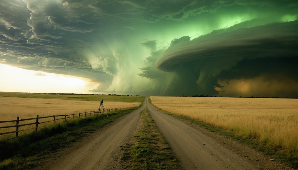
Nebraska sits at the heart of the central Great Plains, placing it squarely within one of the most active severe weather corridors in the United States. Late spring and early summer deliver prime conditions, with supercells, large hail, and tornado-capable storms regularly developing across the state.
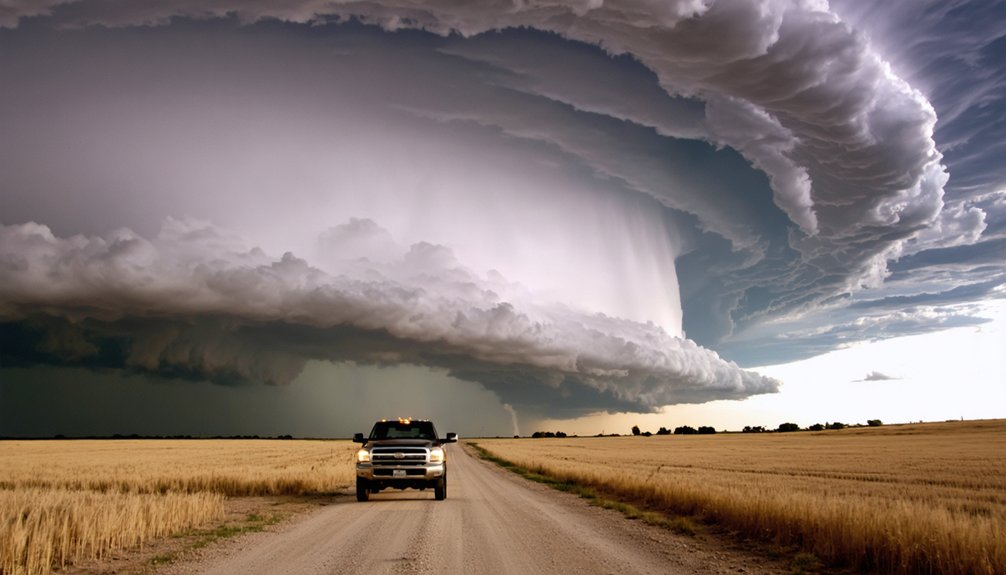
Nebraska’s storm chasing history runs deep, with famous tornadoes cutting through its open landscapes during major outbreaks, drawing chasers who want unobstructed sightlines and reliable road grids. You’ll find that open terrain, straight county roads, and Interstate 80 give you real tactical freedom when repositioning on fast-moving systems.
Storm types vary from isolated supercells to organized squall lines, meaning you’re consistently working with high-impact weather. Nebraska isn’t a fallback destination — it’s a primary target.
When To Chase Storms in Nebraska
If you’re planning a Nebraska chase trip, you’ll want to target May and June, when atmospheric instability and wind shear combine to produce the state’s most prolific severe weather.
Central and southern Nebraska reach peak tornado potential in May, while the northwestern region and Panhandle trend slightly later, peaking in June.
You’ll need to factor in these regional timing shifts when building your chase itinerary, since a blanket schedule risks missing ideal windows in either zone.
Peak Chase Season Months
Storm chasing in Nebraska peaks during late spring and early summer, with May and June representing the highest-probability window for significant severe weather across most of the state.
During this chase season, atmospheric instability, wind shear, and moisture convergence align most reliably, producing tornado-capable supercells, large hail events, and organized squall lines.
Central and southern Nebraska typically activate first, with storm patterns becoming favorable in mid-to-late May.
Northwestern Nebraska and the Panhandle follow in June, when the dryline pushes further north and west.
Outside this core window, April can produce early-season supercells, while July occasionally delivers organized convection.
However, probability drops sharply outside May and June.
Targeting these two months maximizes your intercept opportunities and positions you for the most significant severe weather Nebraska generates.
Regional Timing Differences
Timing your chase trips around Nebraska’s regional activation patterns sharpens your intercept efficiency considerably. Seasonal patterns shift meaningfully across the state, so aligning your schedule to regional variations maximizes productive chase days.
- Central/Southern Nebraska – Peak activity runs May through June, with tornado-capable supercells most frequent during this window.
- Northwestern Nebraska – June dominates as the primary active month, slightly later than southern zones.
- Panhandle Region – June remains peak timing, though limited radar coverage demands extra preparation.
- Transitional Periods – Late April and early July produce occasional significant events worth monitoring statewide.
Tracking these regional shifts lets you position yourself ahead of high-probability setups rather than chasing reactively across long distances.
What Storm Types Can You Expect Across Nebraska?
Nebraska dishes out four primary storm types that chasers encounter across the state: supercells, hail producers, squall lines, and tornado-capable storms. Each demands a different tactical approach.
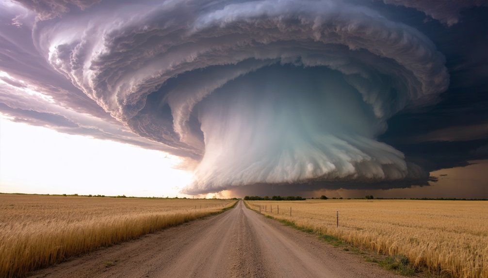
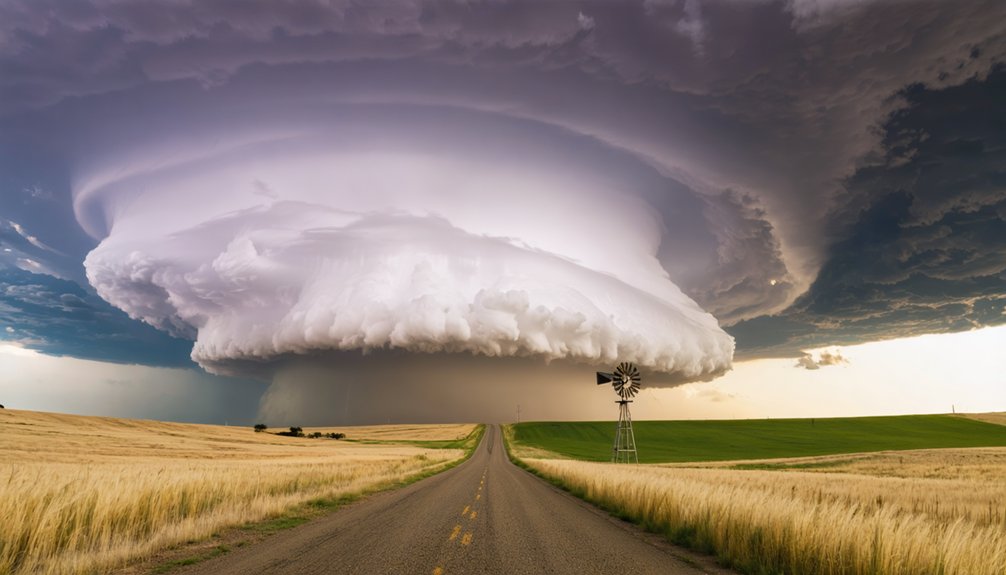
Supercell characteristics include rotating updrafts, persistent mesocyclones, and well-defined wall clouds, making them your highest-value target. You’ll find them most frequently across central and southern Nebraska during May and June. Their tornado dynamics can produce long-track, violent tornadoes during major outbreaks.
Hail producers often travel alongside supercells, delivering large to very large stones that threaten vehicles and equipment.
Squall lines upscale from merging storms and generate widespread damaging winds.
Tornado-capable storms appear statewide but concentrate along the southern tier.
Know your storm type before you commit to an intercept. Each carries distinct risks and repositioning demands.
Storm Chasing Central and Southern Nebraska: Best Road Corridors
Central and southern Nebraska’s road network gives you a practical framework for intercepting storms efficiently. Road conditions here generally support rapid repositioning, with most surfaces paved and grid-aligned.
Your primary chase routes include:
Your primary chase routes serve as lifelines — choose them wisely and know them by heart before storms demand split-second decisions.
- Interstate 80 – Your main east-west spine, ideal for tracking fast-moving supercells across the region.
- US-81 – A reliable north-south corridor for cutting across storm motion vectors.
- US-183 – Connects central targets efficiently, reducing repositioning time.
- US-283 – Covers southwestern approaches where high plains storms develop.
River corridors and localized road patterns can slow intercepts, so pre-load your mapping software before deployment.
Radar coverage ranges from fair to good, meaning you’ll need to account for gaps in southwestern sections when planning chase routes.
Shifting northwest into the Sandhills and Panhandle region demands a fundamentally different chase strategy than central Nebraska’s grid-friendly corridors.
Sandhills navigation requires pre-positioning aggressively, since road options thin dramatically once you’re committed to a sector. The Northwestern terrain — hilly, pond-scattered, occasionally forested — limits sightlines and restricts rapid repositioning. You’ll want to prioritize US-83, US-20, and US-385 as your primary arteries, treating them as fixed anchors rather than flexible detour options.
Radar coverage degrades sharply across the Panhandle, so supplement WSR-88D data with mobile radar apps and ground-truth observations.
LP supercells dominate here, offering exceptional structure but reduced visual tornado warning time. Treat every intercept as high-commitment — bail routes are sparse, and storm motion can quickly eliminate your escape corridors.
Nebraska Panhandle Chasing: Terrain Challenges, Road Gaps, and LP Supercells
The Panhandle presents some of the most technically demanding chase terrain in the state, where poor radar coverage, fragmented road networks, and dominant LP supercell signatures combine to raise the margin for error.
Before committing to Panhandle terrain, you’ll want to account for four critical factors:
- Radar gaps force you to rely heavily on spotter reports and visual confirmation.
- Road networks thin out sharply west of Scottsbluff, cutting repositioning options.
- LP supercells produce deceptive precipitation signatures that mask hail cores and tornado development.
- High cloud bases create visually photogenic structure but complicate lowering identification.
You’re operating with less data and fewer escape routes here.
LP supercells reward chasers who read storm structure precisely and commit to positions early, before road gaps eliminate your options entirely.
Radar Coverage Gaps Every Nebraska Storm Chaser Should Know
Radar coverage across Nebraska isn’t uniform, and those gaps directly shape where you can chase effectively and where you’re operating semi-blind.
Central and southern Nebraska offer fair-to-good coverage, with stronger returns near Grand Island and along the I-80 corridor.
Central and southern Nebraska deliver reliable radar returns, with coverage peaking near Grand Island and the I-80 corridor.
Northwestern Nebraska improves considerably thanks to radar technology positioned to serve that zone.
The panhandle, however, remains problematic—poor low-level coverage means beam overshooting, leaving tornado-producing circulations undetected near the surface.
North-central sections carry similar limitations.
Despite ongoing coverage improvements through dual-polarization upgrades and gap-filling initiatives, low-altitude blind spots persist across significant chase territory.
You need to compensate by using mobile radar apps, spotter networks, and visual confirmation rather than relying solely on WSR-88D returns.
Know where your data weakens before committing to a chase route.
How To Reposition Safely During Fast Nebraska Storms
Fast Nebraska storms can outrun poorly planned repositioning moves, and that gap between storm motion and your escape window closes faster than most chasers expect.
Prioritize these reposition strategies before you’re forced into a reactive decision:
- Track storm structure continuously — a collapsing forward flank signals acceleration and demands immediate repositioning.
- Identify two exit routes before you stop, accounting for river corridors that eliminate options quickly.
- Maintain a 2–3 mile lateral buffer from the mesocyclone when roads run parallel to storm motion.
- Use US-81, US-183, and US-283 as primary north-south reposition corridors across central Nebraska.
You own your decisions out there. Slow repositioning kills your margin.
Keep storm structure updates running, stay disciplined on your buffer distances, and never commit to a single escape route.
Nebraska Storm Chasing Safety: Hail, Terrain, and Rural Distance Risks

Hail, terrain, and rural distance gaps create compounding safety problems across Nebraska that no single mitigation strategy fully resolves. Large to very large hail threatens vehicle glass and equipment across central, southern, and northwestern zones. Hail safety demands constant escape-route calculation before cores develop.
Terrain navigation becomes critical in hilly northwestern Nebraska and panhandle regions, where road options narrow sharply and repositioning distances extend greatly. Rural distances mean emergency response times stretch far beyond urban norms, so storm preparedness must include medical supplies, fuel reserves, and redundant communication tools.
Radar coverage degrades in southwestern and panhandle sectors, reducing your storm data quality precisely where terrain limits your escape options. You must treat each variable—hail size, road grid density, and radar gaps—as an independent risk requiring active mitigation.
Frequently Asked Questions
Do Storm Chasers Need Special Permits to Operate in Nebraska?
You don’t need a mountain of permits — Nebraska imposes zero storm chasing regulations requiring special licenses. You’re free to chase legally, though standard traffic laws and private property legal considerations always apply.
What Emergency Services Are Available in Nebraska’s Most Remote Chasing Areas?
In Nebraska’s remote chasing zones, you’ll find limited emergency response due to poor remote access. You’re often far from hospitals and fire services, so carry satellite communicators, first aid kits, and self-rescue gear always.
Are There Organized Storm Chasing Tours Based Out of Nebraska Cities?
You’ll find tour company options operating out of Nebraska hubs like Grand Island and North Platte. Research operators carefully, verifying their storm chasing ethics, safety protocols, and data-driven intercept strategies before you commit to any organized chase experience.
How Do Nebraska Landowners Typically Respond to Storm Chasers on Rural Roads?
Like a guest on borrowed land, you’ll find Nebraska landowners generally tolerate storm chasers who respect rural access boundaries. Practice proper storm etiquette: stay on public roads, avoid blocking gates, and you’re typically welcomed.
What Communication Networks Do Storm Chasers Rely on Across Nebraska?
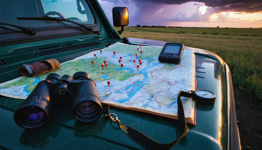
You’ll rely on radar technology like GR2Analyst and communication apps such as Spotter Network and Discord channels. These tools let you stream real-time data, coordinate positioning, and maintain situational awareness across Nebraska’s vast, open chase corridors independently.
References
- https://www.quincyvagell.com/guide-southern-nebraska/
- https://www.quincyvagell.com/guide-northwest-nebraska/
- https://www.stormchasingusa.com/where-do-you-chase/
- https://www.reddit.com/r/stormchasing/comments/ms46ax/best_city_to_live_in_for_convenient_chasing/
- https://cowboystatedaily.com/2026/03/13/wyomings-leading-storm-chaser-is-a-nebraska-farmer-known-as-the-ice-man/
- https://www.youtube.com/watch?v=HSo2dtXLuiY
- https://www.youtube.com/watch?v=isrYlcJUwC8
- https://magazine.outdoornebraska.gov/stories/photography/chasing-nebraska-skies/
- https://www.facebook.com/nebraskastormchasers/
- https://www.youtube.com/watch?v=iDml3dEtXiw