Storm chasing vans carry weather monitoring tools because you need hyper-local, real-time atmospheric data that distant stations simply can’t provide. Onboard anemometers, barometers, and pressure sensors capture instantaneous wind shifts, pressure drops, and dew point spikes tied directly to GPS coordinates. That data feeds live into NWS servers, supporting timely tornado warnings and field-verified ground truth. If you want to understand exactly how each instrument works and why it matters, there’s far more to uncover.
Key Takeaways
- Storm chasing vans use weather tools to capture hyper-local atmospheric readings that distant weather stations often miss entirely.
- Onboard instruments measure real-time pressure drops, wind shifts, and humidity, enabling immediate repositioning decisions for crew safety.
- GPS-integrated sensors provide precise, location-stamped data that eliminates interference from vehicle movement during active storm tracking.
- Collected field data is transmitted directly to NWS servers, supporting timely tornado and severe thunderstorm warning issuance.
- Multiple redundant instruments ensure continuous, accurate monitoring even when extreme winds, debris, or power failures occur.
What Weather Tools Do Storm Chasing Vans Actually Carry?
Storm chasing vans carry a sophisticated array of meteorological instruments that collect real-time atmospheric data, including anemometers for wind speed and direction, barometers for pressure readings, hygrometers for humidity levels, and thermometers for ambient temperature.
Your weather instrumentation setup typically includes GPS-integrated sensors that subtract vehicle movement to calculate true wind speeds, eliminating motion-induced measurement errors. Data loggers store continuous atmospheric records while satellite internet links transmit live streams to cloud servers instantly.
GPS-integrated sensors eliminate motion-induced errors, while satellite links instantly transmit live atmospheric data to cloud servers.
Dual-polarization radar receivers detect hail signatures and rotation patterns within storm structures. Data accuracy depends on portable, durable units built to withstand debris impacts and temperature extremes.
Battery backups maintain functionality during power failures, ensuring you’re never without critical readings when traversing high-risk storm zones independently.
Can Storm Chasing Equipment Actually Survive a Storm?
When you mount meteorological equipment on a storm chasing van, you’re trusting hardware engineered to endure debris impact, sustained high winds, and extreme temperature swings without losing calibration accuracy.
Durable housings protect sensors against flying projectiles while maintaining structural integrity under wind loads that exceed standard commercial thresholds.
Battery backup systems guarantee your instruments keep recording and transmitting even when a storm’s electromagnetic interference or physical damage disrupts the vehicle’s primary power supply.
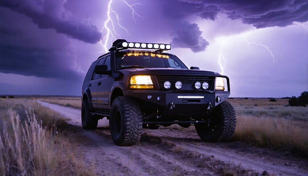
Built for Extreme Conditions
Equipment mounted on storm chasing vehicles doesn’t just face rain—it endures wind-driven debris, rapid temperature swings, and pressure fluctuations that would disable consumer-grade instruments within minutes.
You’re operating in environments where storm dynamics shift violently, demanding tools built to military-grade durability standards.
Manufacturers engineer these systems with reinforced housings, corrosion-resistant materials, and sealed electronics that withstand sustained winds exceeding 100 mph.
Battery backups maintain functionality when vehicle power fails, ensuring continuous data collection during critical moments.
Portable mounting systems allow rapid installation and removal without compromising sensor accuracy.
Safety protocols depend entirely on equipment remaining operational when conditions deteriorate fastest.
If your instruments fail mid-chase, you lose the real-time atmospheric data that keeps you alive and your escape routes calculated.
Debris and Wind Resistance
Debris impacts during active tornadoes reach projectile velocities exceeding 100 mph, and the instruments mounted on your chase vehicle must absorb that punishment without sensor drift or housing failure.
Manufacturers engineer sensor housings from aircraft-grade aluminum and polycarbonate composites rated for debris impact forces exceeding 150 mph equivalent loads. Wind resistance specs matter equally — aerodynamic mounts reduce drag coefficients, preventing instrument vibration that corrupts anemometer readings at sustained wind speeds above 80 mph.
You’ll find that quality units maintain calibration tolerances within ±0.1 mph after debris strikes that would destroy consumer-grade hardware. Stainless steel fasteners lock mounting brackets against rotational wind forces, while sealed sensor ports block particulate infiltration.
Your data integrity depends entirely on whether your equipment’s structural ratings match the atmospheric violence you’re deliberately driving toward.
Power Backup Systems
Your vehicle’s electrical system becomes a single point of failure the moment a tornado’s outflow boundary stalls your engine or a debris strike severs the alternator belt.
Power reliability isn’t optional when your sensors, GPS, and communication links depend on continuous voltage. Backup strategies must layer redundancy into every critical system.
- Dedicated deep-cycle lithium batteries sustain instrument arrays independently from the main vehicle circuit.
- Battery backups maintain sensor functionality when alternator failure cuts primary power.
- Inverters convert stored DC power to AC, keeping data loggers and satellite uplinks operational.
- Automatic transfer switches redirect power sources within milliseconds, preventing data gaps during shifts.
Without these redundancies, you’re blind exactly when atmospheric data matters most—inside the storm’s highest-risk envelope.
How Does Real-Time Data Keep Storm Chasers Safe?
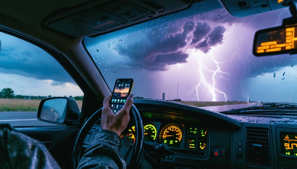
When you’re operating in a severe weather environment, real-time atmospheric sensors give you instantaneous readings of pressure drops, wind shifts, and temperature gradients that signal an approaching tornado or microburst.
Your equipment transmits live alerts that trigger immediate vehicle repositioning before dangerous conditions reach your location.
You’re not relying on distant station reports—your onboard sensors detect localized threats with precision, giving you the response time needed to evacuate safely.
Instant Alerts Enable Evacuation
Real-time atmospheric data gives you an immediate edge when severe conditions escalate faster than forecast models predict. Instant notifications trigger when pressure drops or wind shifts exceed safe thresholds, giving you critical seconds to execute evacuation strategies before conditions deteriorate.
- Atmospheric pressure changes signal approaching tornadoes, letting you move your vehicle before rotation reaches ground level.
- Wind shift alerts warn you of microburst activity that can destabilize your vehicle instantly.
- Lightning frequency data tells you exactly when to evacuate open areas or exposed positions.
- Real-time radar integration confirms storm acceleration, allowing immediate route recalculation away from danger zones.
You’re not guessing when alerts fire—you’re responding to measured, localized data that distant weather stations can’t provide. That precision keeps you mobile and alive.
Sensors Detect Approaching Dangers
Sensors mounted on your chase vehicle continuously sample the atmosphere, converting raw atmospheric data into actionable warnings before dangerous conditions reach your position.
Pressure transducers register rapid drops signaling tornado proximity, while anemometers flag sudden wind shifts from microbursts threatening your vehicle’s stability. Your humidity sensors detect moisture surges preceding heavy precipitation, and temperature gradient instruments distinguish unstable air masses from stable ones.
Effective storm detection depends on integrating these simultaneous readings into a coherent danger assessment. When multiple sensors converge on critical thresholds simultaneously, you’ll recognize compounding hazards faster than relying on any single instrument.
GPS-corrected wind data eliminates vehicle movement interference, ensuring measurements reflect true atmospheric conditions. This layered sensor architecture lets you maintain positional awareness while accurately gauging whether conditions ahead are intensifying or dissipating.
How Storm Chasers Track Development From Inside the Van
Inside a storm chasing van, you’re fundamentally operating a mobile meteorological station that synthesizes radar, surface observations, and atmospheric data in real time. You track storm dynamics by correlating atmospheric pressure drops with radar rotation signatures, giving you actionable intelligence before conditions escalate.
Key tools you’ll monitor continuously include:
- Pressure sensors detecting rapid drops that confirm storm center proximity
- Dual-polarization radar feeds identifying hail signatures and rotating updrafts
- Wind shear instruments measuring vertical gradients that organize severe thunderstorms
- Data loggers recording storm lifecycle stages from initiation through decay
You’re not passively watching weather unfold — you’re actively cross-referencing multiple live data streams. This integrated approach lets you distinguish developing supercells from dissipating systems and adjust your position with precision and confidence.
Why Hyper-Local Readings Beat Distant Weather Stations
While your van’s integrated systems give you a powerful view of storm dynamics, that data only becomes truly actionable when it reflects what’s happening at your exact location. Distant weather stations can sit miles from your position, missing critical micro-scale temperature shifts, wind direction changes, and pressure drops that directly affect storm prediction accuracy.
Hyper local accuracy gives you readings tied to your GPS coordinates, not some station across the county. You’re capturing dew point spikes, sudden wind shear, and pressure gradients that regional networks completely overlook. Those details matter when a supercell is reorganizing two miles ahead.
Remote stations report averages. Your onboard sensors report truth. That distinction lets you make faster, more informed decisions about positioning, escape routes, and when conditions have crossed into genuinely dangerous territory.
How Storm Chasing Tools Feed Live Data to the NWS

Every reading your onboard equipment captures becomes actionable intelligence the moment it hits NWS servers. Your tools transmit wind speed, pressure drops, and precipitation rates directly into official warning pipelines, strengthening live data accuracy where radar alone falls short.
NWS communication strategies depend on field-verified ground truth to issue timely tornado and severe thunderstorm warnings.
Your setup enables this seamlessly:
- Spotter Network integration tags your GPS-stamped reports for immediate NWS dispatcher review
- SKYWARN-compatible outputs format your data into standardized reports amateur radio operators relay instantly
- Satellite uplinks push continuous atmospheric streams to cloud servers NWS forecasters monitor directly
- Pressure and rotation data validates radar signatures, confirming wall cloud development before warnings are issued
You’re not just observing storms — you’re actively shaping official response decisions.
Frequently Asked Questions
How Much Does a Fully Equipped Storm Chasing Van Typically Cost?
You’ll typically invest $50,000–$150,000 for a fully equipped storm chasing van. Your cost analysis must factor in van features like radar systems, GPS, sensors, and communication tools driving expenses considerably higher.
Do Storm Chasers Need Special Licenses to Operate Meteorological Equipment?
Like traversing open skies, you’re mostly free here — licensing requirements don’t typically bind storm chasers, and equipment regulations rarely restrict meteorological tools. You’ll operate freely, though SKYWARN volunteer training sharpens your data-driven reporting precision considerably.
How Long Can Storm Chasing Vans Remain Deployed During a Single Chase?
You can sustain chase duration for 12–18 hours, depending on fuel considerations, battery reserves, and equipment load. Monitor your fuel levels actively, as extended deployments across vast storm corridors demand precise resource management to maintain operational freedom.
Are Storm Chasing Vans Modified Differently for Tornadoes Versus Hurricanes?
Yes, you’ll find tornado adaptations focus on armored plating and ground anchoring, while hurricane equipment prioritizes waterproofing, sustained wind sensors, and corrosion resistance—each configuration’s tailored to the specific atmospheric threats you’re actively pursuing.
Who Typically Funds the Purchase of Storm Chasing Meteorological Equipment?
You’ll find funding sources vary widely—research grants, equipment sponsors, and educational institutions often cover your meteorological gear costs. Universities, NOAA, and private backers actively finance storm chasing operations, ensuring you’ve got precise, data-driven tools ready.
References
- https://www.stormtours.com/information/storm-chasing-technology/
- https://www.acurite.com/blogs/who-uses-acurite/acurite-helps-storm-chaser
- https://www.youtube.com/watch?v=qi8ffPqDkFE
- https://www.reddit.com/r/stormchasing/comments/1qa9hh6/what_radar_app_do_storm_chasers_usually_use/
- https://www.youtube.com/watch?v=cIUl5oFtwCM
- https://www.youtube.com/watch?v=yVkPOUHgYiM
- https://stormtrack.org/threads/recommended-chaser-equipment-list.23013/
- https://www.acurite.com/blogs/who-uses-acurite/how-acurite-atlas-helps-a-storm-spotter
- https://policeradioencryption.com/learn/storm-chaser-gear-guide
- https://www.frontlinecomm.com/vehicles/broadcast/weather-chaser-vehicle