Storm patterns are shifting because greenhouse gases are warming ocean surfaces, giving hurricanes more thermal energy to intensify. You’re seeing stronger winds, heavier rainfall, and more Category 4 and 5 storms as a direct result. Warmer air holds roughly 7% more moisture per degree Celsius, amplifying precipitation totals dramatically. Storms are also migrating poleward, threatening regions previously considered safe. The full picture of what’s driving these changes—and what’s coming next—is more complex than you might expect.
Key Takeaways
- Greenhouse gases trap heat, warming oceans and providing more thermal energy that fuels stronger, more intense hurricanes.
- Warmer air holds 7% more moisture per degree Celsius, increasing rainfall totals and flooding risks significantly.
- Rapid intensification is becoming more frequent, compressing storm development from days into hours and reducing warning times.
- Climate change is shifting hurricane maximum intensity zones poleward, exposing mid-latitude regions to unprecedented storm threats.
- Climate models predict fewer total hurricanes but significantly more Category 4 and 5 storms with higher wind speeds.
How Greenhouse Gases Are Making Hurricanes More Dangerous
When greenhouse gases trap heat in the atmosphere, they set off a chain reaction that makes hurricanes considerably more dangerous. Warmer oceans fuel stronger wind speeds, driving a measurable rise in Category 4 and 5 storms. NOAA’s data confirms this upward trend, particularly across the Atlantic.
Simultaneously, warmer air holds more moisture, producing 10-15% more precipitation per storm. Harvey’s 60-inch rainfall totals and Florence’s 35-inch deluge aren’t anomalies—they’re previews. Slower storm movement compounds the destruction, extending exposure to high winds and flooding.
You can’t separate hurricane preparedness from understanding these compounding variables. Each shift—intensification, wetter systems, stalling patterns—stacks risk upon risk. Building community resilience means acknowledging that greenhouse-driven warming isn’t just raising temperatures; it’s fundamentally restructuring how dangerous these storms become.
Why Warmer Oceans Fuel More Powerful Hurricanes
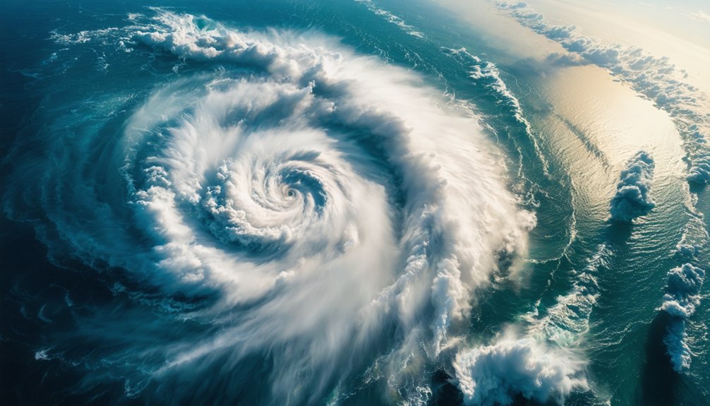
When you examine the mechanics of hurricane formation, you’ll find that warmer sea surface temperatures directly convert ocean heat into intensified wind speeds, increasing a storm’s destructive potential.
You can trace this pattern in the data: from 1979 to 2017, the number of major hurricanes climbed while smaller storms declined, signaling a clear shift toward more powerful systems.
NOAA’s projections confirm you should expect more Category 4 and 5 hurricanes ahead, as warming oceans continue to supply the thermal energy that drives peak wind speeds higher.
Ocean Heat Powers Storms
As ocean temperatures rise, hurricanes tap into that heat like fuel, growing stronger and more destructive. Warmer sea surface temperatures directly amplify storm intensity, supplying the energy hurricanes need to escalate wind speeds and expand their destructive reach.
You’re seeing this climate feedback play out in real data: major Atlantic hurricanes have increased measurably from 1979 to 2017, while weaker storms have declined.
Heat waves across ocean surfaces accelerate this process, pushing storms past critical intensity thresholds faster than historical baselines suggest. NOAA projects continued growth in Category 4 and 5 hurricanes as ocean temperature climbs.
Greenhouse gases trap heat, warming both air and water, creating a compounding cycle. Understanding this mechanism matters because it directly determines how much risk you’ll face from future storms.
Rising Wind Speed Threats
Warmer oceans don’t just strengthen hurricanes gradually—they accelerate wind speeds past dangerous thresholds with increasing frequency.
You’re now facing a measurable shift in storm intensity, where rising wind events aren’t anomalies—they’re trends.
Key data points you should understand:
- Major hurricane frequency increased considerably between 1979–2017, while weaker storms declined.
- NOAA projects more Category 4 and 5 storms carrying higher sustained wind speeds.
- Rapid intensification events in the Atlantic have increased over recent decades.
- Warmer sea surfaces directly fuel the energy transfer driving rising wind acceleration.
These aren’t projections you can dismiss.
Climate models, satellite tracking, and historical records consistently confirm that destructive wind potential is climbing.
Understanding this trajectory lets you make informed decisions about preparation, policy support, and infrastructure resilience before the next major storm makes landfall.
Major Hurricane Frequency Increases
The oceans don’t just set the stage for hurricanes—they determine how powerful those storms become. As sea surface temperatures rise, you’re seeing a measurable shift in hurricane trends: major storms are increasing while smaller ones decline.
Data from 1979–2017 confirms this pattern, with NOAA projecting more Category 4 and 5 hurricanes carrying higher wind speeds ahead.
You need to understand what this means for storm impacts. Warmer water transfers more energy into developing systems, accelerating destructive potential at scale. These aren’t marginal changes—they’re structural shifts in how hurricanes behave.
The Atlantic has already registered noticeable increases in major storm frequency. If you value protecting lives and infrastructure, recognizing this trajectory isn’t optional. The data demands it, and the trend won’t reverse without addressing the underlying warming.
Why Rising Temperatures Are Fueling Heavier Hurricane Rainfall
When air temperatures rise, the atmosphere holds more moisture—a direct consequence of the Clausius-Clapeyron relationship, which dictates roughly 7% more water vapor per degree Celsius of warming. This directly amplifies hurricane moisture, fundamentally reshaping rainfall patterns across affected regions.
Key data points you should understand:
- Hurricane Harvey dumped 60+ inches in localized areas
- Florence (2018) delivered 35+ inches; Imelda (2019) reached 44 inches
- Climate projections forecast 10-15% precipitation increases in future storms
- Warmer oceans continuously feed storms with additional moisture
You’re facing a compounding dynamic: warmer air absorbs more water vapor, storms carry heavier payloads, and infrastructure absorbs unprecedented flood volumes.
Climate simulations consistently confirm this trajectory isn’t reversing anytime soon.
Why Are Hurricanes Dropping So Much More Rain?

As ocean temperatures climb, hurricanes draw exponentially more moisture into their circulation systems, converting warmer seas into catastrophic rainfall engines.
Warmer air fundamentally alters moisture retention—every degree Celsius increases atmospheric water capacity by roughly 7%, directly reshaping rainfall patterns across storm systems.
You’re seeing this play out in real numbers. Harvey dumped 60+ inches in localized zones, Florence delivered 35 inches, and Imelda reached 44 inches.
These aren’t anomalies—they’re predictable outcomes of thermodynamic physics.
Climate simulations project 10-15% precipitation increases in future hurricanes.
Slower-moving storms compound this problem, extending exposure windows and maximizing ground saturation.
When you combine intensified moisture retention with stalled movement, you get unprecedented flooding events that overwhelm infrastructure designed for yesterday’s climate baselines.
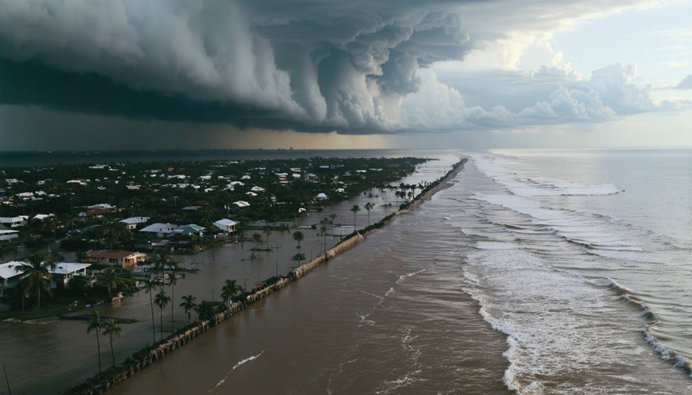
How Slow-Moving Hurricanes Are Causing More Destruction
Rainfall totals don’t just reflect how wet a storm is—they reflect how long it sits over you. Storm stagnation is becoming a measurable threat, as hurricanes slow down and extend their rainfall impacts over populated areas.
Disrupted atmospheric circulation patterns in a warming climate are likely contributing to this slowdown. When a storm stalls, destruction compounds:
- Total rainfall accumulation surges dramatically
- High winds batter infrastructure for extended periods
- Storm surge lingers, deepening coastal flooding
- Evacuation windows shrink, limiting your options
Harvey’s record-breaking 60-inch rainfall totals resulted directly from stagnation over Texas.
Scientists continue debating the exact mechanisms driving slower storm movement, and a direct human-activity link isn’t fully established yet. But the pattern is real, and your exposure time increases with every stalled system.
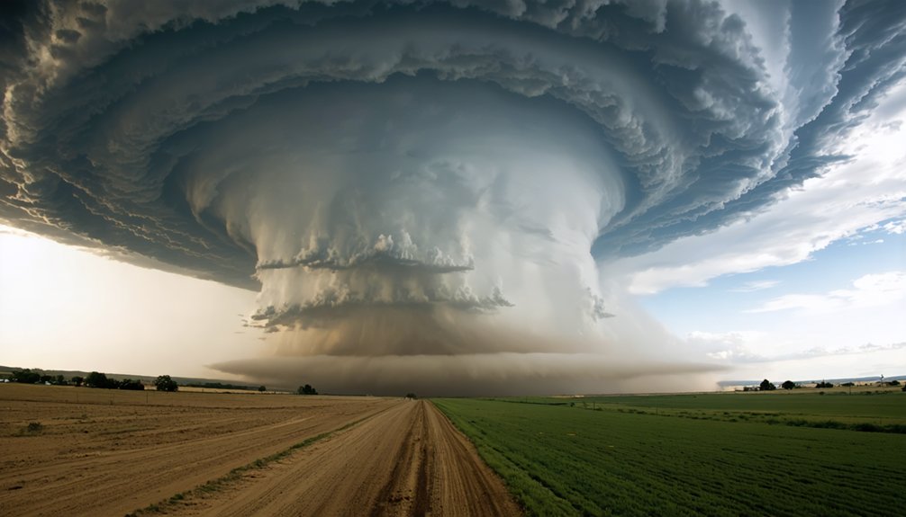
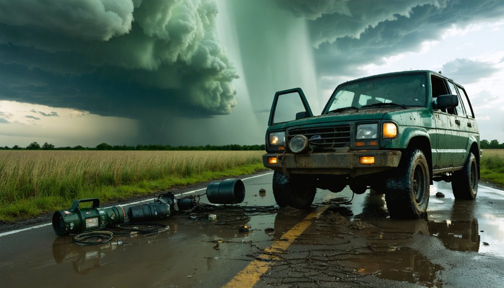
How Hurricanes Can Go From Tropical Storm to Category 4 Overnight
Rapid intensification—defined as a wind speed increase of at least 35 mph within 24 hours—has become more frequent in Atlantic hurricanes over recent decades, and global warming is a likely driver.
Warmer ocean temperatures fuel this accelerated tropical storm evolution, providing the thermal energy hurricanes need to strengthen remarkably.
You’re fundamentally watching a feedback loop: warmer seas transfer more heat and moisture into the storm system, compressing what once took days into hours.
NOAA’s data confirms that Category 4 and 5 storms are increasing in frequency, with peak intensity locations shifting poleward.
Rapid intensification reduces your warning window considerably, leaving coastal communities less time to prepare.
Understanding this mechanism isn’t optional—it’s critical for making informed decisions about infrastructure, evacuation planning, and climate policy.
Why Are Hurricanes Shifting Toward Higher Latitudes?
As the mid-latitudes warm under rising greenhouse gas concentrations, you’re seeing a disruption in the atmospheric conditions that once confined peak hurricane intensity to regions closer to the equator.
This warming shifts the thermal gradient that drives storm dynamics, pushing the locations where hurricanes reach maximum strength progressively poleward.
In the Pacific, you can track this northward migration clearly in satellite data, though the North Atlantic shows a less uniform pattern, signaling that multiple competing drivers are still under active investigation.
Mid-Latitude Warming Effects
Warming mid-latitudes are pushing tropical storms toward higher latitudes, exposing regions once considered beyond hurricane reach to increasing risk. Mid-latitude feedbacks are actively reshaping atmospheric patterns, driving peak storm intensity poleward.
Key shifts you should understand:
- Warming mid-latitudes disrupt traditional storm corridors, redirecting hurricane tracks into unfamiliar territories.
- Atmospheric patterns are destabilizing as Arctic warming compresses temperature gradients between poles and tropics.
- Northward intensity shifts are most documented in the Pacific, with less uniform changes across the North Atlantic.
- Higher air temperatures and humidity levels amplify energy available to storms reaching previously low-risk zones.
These changes aren’t uniform globally, and researchers are still identifying exact drivers. However, the data confirms you’re facing a fundamentally altered storm risk landscape.
Poleward Intensity Location Shifts
Tropical storms are reaching their peak intensity at higher latitudes than historical baselines recorded, a measurable poleward shift driven by warming mid-latitudes expanding the zone of favorable storm development.
You’re watching intensity trends reorganize storm geography in real time. Pacific data shows the clearest northward migration, while the North Atlantic signal remains weaker and less uniform.
Researchers attribute these poleward shifts to rising ocean temperatures, increased atmospheric humidity, and Arctic warming altering large-scale circulation patterns.
These shifts aren’t trivial — they expose densely populated mid-latitude regions to destructive wind speeds and rainfall previously uncommon at those locations.
The underlying drivers aren’t fully resolved, but satellite records and climate models consistently confirm the pattern, reinforcing that warming fundamentally restructures where and how storms reach maximum destructive force.
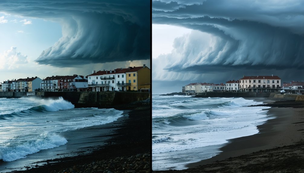
Which Regions Are Most at Risk as Storm Tracks Shift?

Where storm tracks shift matters enormously, because the regions absorbing peak hurricane intensity are changing as warming mid-latitudes push cyclone activity toward higher latitudes.
Storm track shifts mean vulnerable regions that historically faced fewer major storms now confront escalating risk.
As storm tracks shift, regions once spared from major hurricanes now face dramatically rising danger.
Key areas facing elevated exposure include:
- Mid-latitude coastlines in the U.S. Northeast and Europe, previously shielded by geography
- East Asian coastlines, where Pacific typhoon peak intensity migrates poleward
- Inland communities unprepared for infrastructure-damaging wind and rainfall events
- Higher-latitude island territories lacking storm-resilient construction standards
You’re watching a fundamental redistribution of destructive energy across the planet.
Populations outside traditional hurricane belts haven’t built infrastructure, emergency systems, or cultural preparedness for these intensifying threats.
Understanding which regions face shifting exposure lets communities make informed, freedom-preserving decisions about resilience investments.
What Climate Models Predict About Future Hurricane Behavior
Climate models give you a forward-looking picture of hurricane behavior that’s increasingly hard to ignore.
Storm prediction models consistently project fewer total hurricanes globally, but a higher proportion of Category 4 and 5 storms with greater wind speeds. That’s a critical distinction—lower frequency doesn’t mean lower risk.
Future hurricane trends point toward storms carrying 10-15% more precipitation, driven by warmer air holding greater moisture.
Rapid intensification events are expected to increase, giving coastal populations less warning time. Peak intensity locations are also shifting poleward, exposing mid-latitude regions previously outside typical hurricane zones.
The IPCC’s 2021 report directly links greenhouse gas emissions to these accelerating patterns.
You’re not looking at distant projections—these shifts are already measurable in current satellite data and historical storm records.
What These Hurricane Changes Mean for Coastal Communities
What climate models project matters most when you translate those numbers into human exposure and economic loss. Intensifying storms, slower movement, and heavier rainfall compound coastal preparedness gaps and strain infrastructure adaptation timelines.
Key implications for coastal communities include:
- Economic impacts and insurance challenges: Rising Category 4–5 frequency drives up insured losses, tightening coverage availability and affordability.
- Evacuation planning: Slower, wetter storms compress decision windows, demanding faster, better-coordinated disaster response systems.
- Community resilience and habitat restoration: Restored wetlands and barrier ecosystems measurably reduce surge penetration inland.
- Policy implications and public awareness: Transparent risk communication empowers you to hold officials accountable for evidence-based zoning and investment decisions.
Ignoring these shifts doesn’t reduce your exposure — it compounds it.
Frequently Asked Questions
Can Hurricane Season Length Change as Global Temperatures Continue Rising?
Yes, hurricane duration can extend as global temperatures rise. You’ll see warmer oceans and higher humidity fuel longer active seasons. Temperature impact drives intensification, potentially stretching hurricane duration beyond traditional boundaries, threatening more communities annually.
How Do Hurricanes Affect Inland Areas Far From Coastlines?
Hurricanes can drown entire regions in catastrophic hurricane impacts far beyond coasts. You’ll face relentless inland flooding as storms carry torrential rainfall hundreds of miles inward, with events like Harvey dumping 60+ inches, devastating infrastructure and communities you’d never expect.
Are There Any Historical Examples of Hurricanes Shifting to Higher Latitudes?
Yes, you’ll find hurricane migration in historical records. Latitude shifts show Pacific storms moving poleward since the 1980s. Climate impact data confirms this trend, though North Atlantic shifts remain less pronounced and drivers aren’t fully understood.
How Do Hurricanes Interact With Other Extreme Weather Events Simultaneously?
When hurricanes collide, stack, and amplify, you’re witnessing dangerous hurricane dynamics at work. Extreme weather interactions—like floods merging with storm surges—can intensify destruction exponentially, as warmer oceans and moisture-laden air simultaneously fuel multiple overlapping catastrophic events.
Can Individuals or Communities Do Anything to Prepare for Stronger Hurricanes?
You can strengthen community resilience by building emergency kits, establishing evacuation plans, and identifying storm shelters. Leverage local resources for hurricane preparedness, as data shows proactive communities considerably reduce casualties when stronger, slower-moving storms strike.
References
- https://www.floridamuseum.ufl.edu/exhibits/online/hurricanes-climate-change/
- https://www.c2es.org/content/hurricanes-and-climate-change/
- https://science.nasa.gov/climate-change/extreme-weather/
- https://firststreet.org/environmental-changes/wind?from=riskfactor.com
- https://www.usgs.gov/faqs/how-can-climate-change-affect-natural-disasters