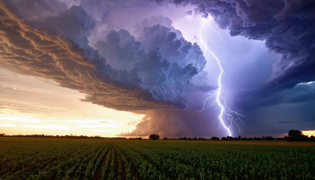
Lightning strikes vary because atmospheric energy isn’t constant—it shifts with moisture, instability, and temperature contrasts. When warm, humid air collides with cold air aloft, you get aggressive updrafts that drive charge separation inside cumulonimbus clouds. Higher moisture and stronger temperature differences produce more frequent discharges. Seasonal patterns, regional geography, and wind shear all control how often and where lightning fires. The full picture behind these variables is more complex than it first appears.
Key Takeaways
- Temperature contrasts between warm surface air and cold upper air create instability, fueling aggressive updrafts that increase lightning frequency.
- Higher humidity levels enhance deep convection, providing essential energy for cumulonimbus development and greater lightning production.
- Summer conditions maximize lightning activity through peak moisture, instability, and lifting triggers, while winter reduces these factors significantly.
- Wind shear sustains organized deep convection by tilting updrafts away from downdrafts, preventing storm collapse and enhancing charge separation.
- Lightning concentrates where atmospheric lifting mechanisms intersect with moisture and instability, making its occurrence highly pattern-dependent.
How Charge Separation Inside Clouds Produces Lightning
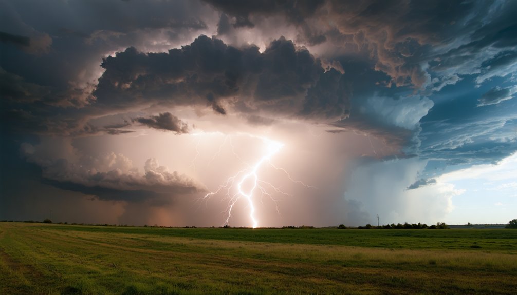
When a thunderstorm matures, charge separation inside the cloud drives the entire lightning process. You’ll find that graupel and ice particles collide repeatedly within the updraft, generating the charge dynamics that define storm intensity.
Lighter, positively charged ice crystals rise toward the cloud’s upper regions, while heavier, negatively charged graupel settles near the middle and lower layers. This vertical separation creates powerful electric fields. Once those fields exceed the atmosphere’s insulating capacity, a discharge occurs.
Most discharges happen as cloud interactions between these charged regions, making intra-cloud lightning far more frequent than cloud-to-ground strikes. Understanding this mechanism explains why lightning can strike well outside the rain core, since charge imbalances extend beyond where precipitation actually falls.
Why Moisture Levels Control Lightning Frequency
When you examine what drives lightning frequency, moisture stands out as the foundational variable.
Higher low-level humidity means more water vapor is available to fuel deep convection, and as that warm, moist air rises, it releases latent heat through condensation, intensifying vertical motion and storm growth.
You can think of moisture as the energy reservoir that determines whether atmospheric instability actually produces lightning-generating cumulonimbus clouds or simply dissipates.
Humidity Fuels Storm Development
Moisture sits at the foundation of every thunderstorm, directly controlling how often and how intensely lightning fires. When you examine humidity types — surface-level absolute humidity versus mid-level relative humidity — you’ll see each plays a distinct role in storm evolution.
High low-level moisture reduces the lifting condensation level, letting convection build deeper, faster clouds. Moisture sources like the Gulf of Mexico and Atlantic feed warm, vapor-rich air masses northward, greatly elevating lightning potential across affected regions.
As water vapor condenses inside developing clouds, it releases latent heat, accelerating vertical motion and intensifying charge separation. Without adequate moisture input, instability alone can’t sustain cumulonimbus development.
You’re fundamentally watching a fuel supply problem — cut the moisture, and lightning frequency drops sharply regardless of other atmospheric conditions.
Warm Air Rises Readily
Warm, moist air rises more readily than dry air because water vapor is lighter than nitrogen and oxygen, reducing overall air density and lowering the threshold for convective lift.
When you reduce air density, buoyant lift intensifies, accelerating thermal ascent and driving stronger atmospheric convection. Rising parcels gain momentum as latent heat releases during condensation, sustaining vertical motion deep into the troposphere.
Warm fronts amplify this process by pushing moist, unstable air upward along frontal boundaries, triggering storm initiation before surface heating even peaks.
Convective currents strengthen as heat exchange between the surface and atmosphere increases temperature contrast.
You’re fundamentally watching a self-reinforcing cycle where moisture lowers density, density drives lift, and lift sustains the convective engine that ultimately separates electrical charge and produces lightning.
Latent Heat Strengthens Storms
As water vapor condenses inside a rising air parcel, it releases latent heat—energy originally absorbed when liquid water evaporated from the surface. That released energy warms the parcel further, making it more buoyant than surrounding air and accelerating its vertical climb.
You’re fundamentally watching a self-reinforcing feedback loop drive storm intensity higher.
This process matters because stronger updrafts carry more supercooled water droplets and ice particles deeper into the storm’s upper regions. There, charge separation accelerates, increasing lightning frequency and flash rate.
Drier air masses can’t sustain this feedback effectively—condensation slows, latent heat release drops, updrafts weaken, and lightning production falls sharply.
Moisture isn’t just a background condition; it’s the fuel actively controlling how powerful a thunderstorm becomes and how frequently it discharges electricity.
How Atmospheric Instability Makes Lightning More Likely
When warm surface air sits beneath colder air aloft, you’ve got the temperature contrast that drives atmospheric instability and forces air parcels to rise rapidly.
That rapid vertical motion fuels the deep cumulonimbus clouds where charge separation and lightning production occur.
The greater the temperature difference between surface and upper levels, the stronger the updrafts you can expect and the more frequent the resulting lightning.
Instability Drives Rapid Updrafts
Atmospheric instability is the engine behind rapid updrafts, and without it, thunderstorms and lightning rarely develop. When unstable air exists near the surface, rising parcels accelerate upward because the surrounding environment can’t suppress their vertical motion. That updraft strength determines whether convective energy builds into a full lightning-producing storm.
You’re looking at a system where temperature gradient between surface warmth and cold air aloft directly controls how aggressively air rises. A steeper gradient means stronger vertical motion, faster cloud formation, and more organized storm structures.
Atmospheric pressure drops within intense updrafts, pulling additional moisture upward and accelerating the process.
Storm organization depends heavily on how well the air mass supports sustained convection. Without sufficient instability, thermal dynamics collapse, updrafts weaken, and lightning production drops considerably.
Temperature Contrast Fuels Storms
Temperature contrast between surface warmth and cold air aloft is what drives atmospheric instability into a state that actively produces lightning. When warm, buoyant air sits beneath a cold layer, atmospheric pressure gradients accelerate vertical motion. You get rapid, explosive updrafts that build cumulonimbus clouds capable of generating powerful electrical activity.
A temperature inversion temporarily traps warm air near the surface, building energy like a compressed spring. Once that inversion breaks, the stored instability releases violently, launching air parcels upward at exceptional speeds.
That rapid ascent drives charge separation inside the cloud, directly increasing lightning frequency.
You can track this dynamic by monitoring surface temperatures against upper-atmosphere readings. The greater that contrast, the more aggressively the atmosphere responds with lightning-producing storm systems.
How Fronts, Heat, and Boundaries Start a Thunderstorm
Thunderstorms don’t simply appear — they require a trigger to force unstable air upward into the colder atmosphere above. Front boundaries, daytime heat, and convergence zones each drive storm initiation through distinct atmospheric lifting mechanisms.
Frontal systems create sharp thermal gradients where air mass interactions force warm, moist air upward along the boundary.
Heat triggers work differently — solar heating destabilizes the lower atmosphere by warming the surface, accelerating convective processes through rapid vertical motion. Weather fronts concentrate this energy across defined corridors, making lightning more predictable along those boundaries.
Convergence zones intensify upward motion further, compressing unstable air until cumulonimbus development begins.
Understanding these thunderstorm dynamics means you can anticipate where lightning activity concentrates — not randomly, but precisely where atmospheric lifting mechanisms collide with favorable moisture and instability.
How Wind Shear and Jet Streams Drive Lightning-Producing Storms
Wind shear and jet streams don’t just influence where storms form — they determine whether those storms can sustain the organized, deep convection necessary for frequent lightning production.
When you analyze storm dynamics, vertical wind shear tilts updrafts away from downdrafts, preventing storms from choking themselves out. This structural separation sustains convective processes longer, increasing charge separation and lightning frequency.
Jet stream influence amplifies these shear effects by concentrating wind speed differentials across storm layers, forcing stronger vertical motion within developing cells.
Atmospheric patterns shaped by upper-level jet positioning dictate storm organization across entire regions — explaining why certain corridors experience recurring, high-lightning events.
Without sufficient shear, storms collapse quickly, producing minimal lightning. With it, you get sustained cumulonimbus towers capable of generating thousands of flashes per storm cycle.
Why Does Summer Produce Far More Lightning Than Winter?
Seasonal lightning disparities trace directly back to the thermodynamic conditions each season provides.
Summer maximizes all three critical thunderstorm dynamics: moisture, instability, and lifting triggers. You’re dealing with high surface temperatures, elevated humidity, and daytime heating that continuously destabilizes the atmosphere, allowing convective columns to surge upward aggressively.
Summer stacks the deck: peak moisture, maximum instability, and relentless daytime heating all collide simultaneously.
Winter strips away these advantages. Cold air holds less moisture, surface heating weakens dramatically, and atmospheric instability collapses. Without sufficient instability, charge separation inside clouds becomes far less efficient, suppressing lightning production considerably.
Seasonal patterns reflect this thermodynamic reality statistically. Florida’s summer months generate exponentially more cloud-to-ground strikes than its winter months precisely because moisture and instability peak simultaneously.
You can’t generate frequent lightning without both ingredients operating at high capacity together.
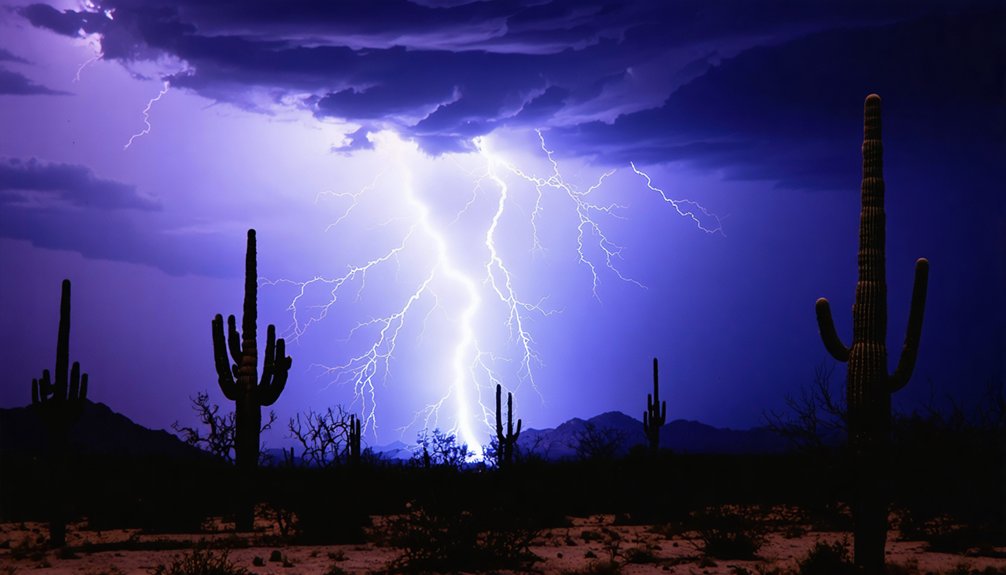
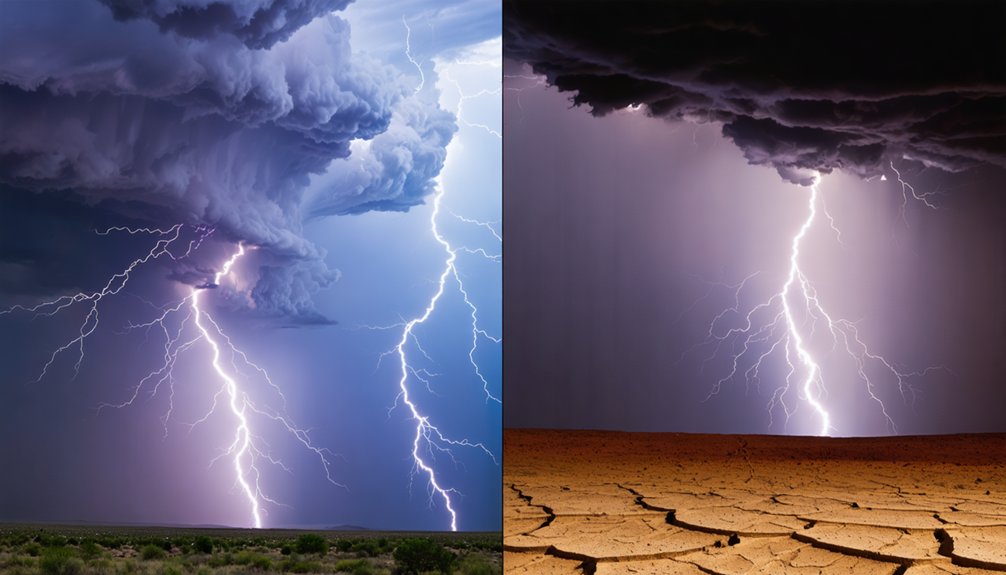
Why Some Regions Get Far More Lightning Than Others
The same thermodynamic logic that separates summer from winter also explains why Florida records more cloud-to-ground lightning than nearly anywhere else in the contiguous United States while arid regions like the Southwest desert floor see comparatively little.
Florida’s lightning hotspots emerge from converging sea breezes, persistent humidity variations, and reliable afternoon instability. Those atmospheric conditions combine daily, producing storm patterns that inland desert climates simply can’t replicate.
Geographic factors like elevation effects matter too—mountainous terrain forces air upward mechanically, triggering convection where flat terrain wouldn’t. Regional climates dictate moisture availability, and moisture drives everything.
Seasonal trends reinforce these patterns; Florida’s warm Gulf and Atlantic waters sustain humidity year-round. You’ll find the highest strike densities wherever geography, moisture, and instability consistently intersect—and Florida checks every box.
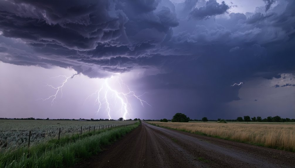
Does Lightning Always Strike Where Rain Is Falling?
Lightning doesn’t always strike where rain is falling—that assumption costs people their lives every year. Bolts can travel several miles horizontally from a storm’s core before striking ground in completely dry air.
These “bolts from the blue” originate near the anvil cloud, where charge separation still occurs even without precipitation reaching the surface.
Rain shadows create particularly dangerous conditions—terrain blocks precipitation while electrical activity continues overhead. You might feel no raindrops yet remain fully exposed to strike risk.
Modern lightning detection networks track electrical discharge independently of precipitation radar, giving you a clearer picture of actual threat zones.
Never rely solely on whether rain is falling. If lightning detection systems show activity within ten miles, you’re already in a danger zone regardless of dry skies above you.
Frequently Asked Questions
Can Lightning Occur During a Snowstorm or Blizzard?
Yes, you can experience snowstorm lightning during rare winter thunderstorms. When moist southern air meets cold upper levels, it creates enough instability and charge separation to produce lightning, even amid heavy snowfall.
Does Daytime Heating Always Increase the Chance of Lightning?
No, daytime heating doesn’t always increase lightning chances. You need daytime humidity and unstable atmospheric pressure to spark storms. Bright skies contrasting with dry air suppress convection, so heating alone won’t trigger lightning without moisture.
Can Outflow Boundaries From One Storm Trigger a New Thunderstorm?
Yes, outflow boundaries can trigger new thunderstorms. When a storm’s cold outflow dynamics surge outward, they’ll lift warm, moist air, initiating storm initiation along the boundary. You’re fundamentally watching one storm independently generating the next convective cycle.
Do Converging Winds Directly Increase Lightning Production in Storm Systems?
Yes, converging winds intensify rising motion, directly boosting storm dynamics and lightning production. When winds collide, you’re forcing warm, moist air upward rapidly, enhancing instability, charge separation, and ultimately increasing the frequency of lightning strikes within storm systems.
Does Ground Conductivity Influence Where a Lightning Strike Lands?
Yes, ground conductivity influences where lightning strikes land. You’ll find that higher ground moisture increases conductivity, directing strikes toward wetter areas. Understanding this improves your lightning safety awareness, helping you avoid conductive surfaces during active storm conditions.
References
- https://crazystormchasers.com/capturing-lightning-strikes-in-different-weather-conditions/
- https://glenallenweather.com/alink/20thunder/lightninginfo.pdf
- http://lightningsafetycouncil.org/LSC-Science-Detailed.html
- https://www.stellarnet.us/spectroscopy-of-lightning-colors-and-composition/
- https://www.weather.gov/safety/lightning-thunderstorm-development
- https://www.nssl.noaa.gov/education/svrwx101/lightning/
- https://www.nssl.noaa.gov/education/svrwx101/lightning/types/
- https://cbs2iowa.com/weather/weather-iq/how-lightnings-color-changes-from-temperature-to-atmosphere
- https://scied.ucar.edu/learning-zone/storms/thunder-and-lightning
- https://www.weather.gov/safety/lightning-science-overview