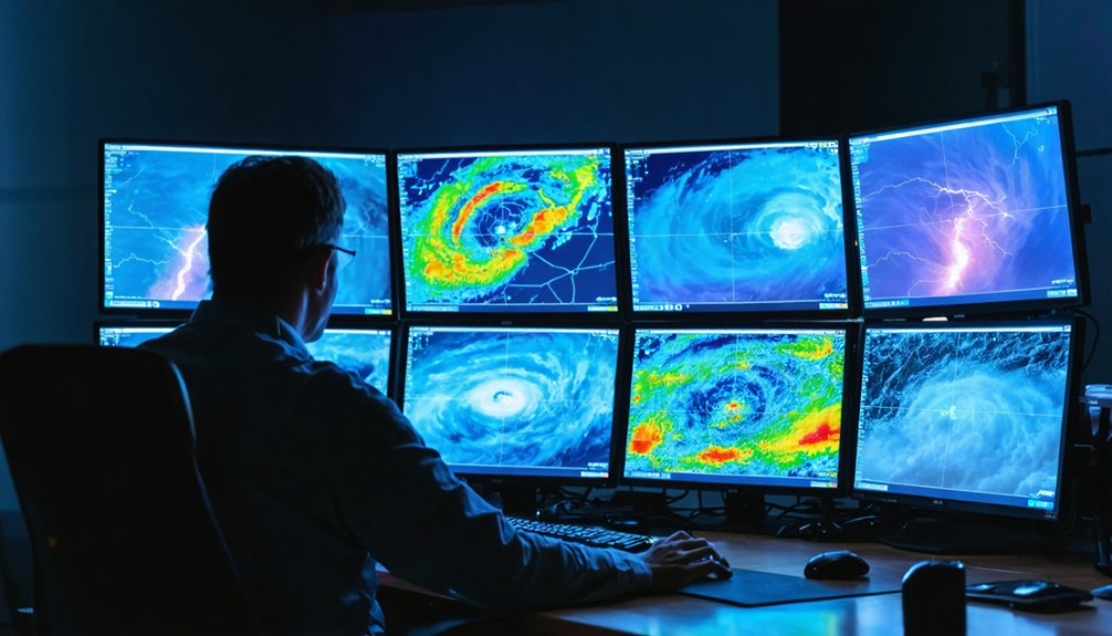
Doppler radar resolution determines whether you’re seeing a tornado develop or just a blurry cluster of data. Spatial resolution separates distinct storm cells from merged noise, preserving critical boundaries like mesocyclone cores. Temporal resolution controls how frequently that data refreshes — phased-array systems deliver 16 scans where NEXRAD manages 2. Every gap in resolution is a gap in warning time. The full picture of how these systems work together reveals just how much resolution impacts survival.
Key Takeaways
- Higher spatial resolution allows radar to distinguish individual storm cells, preserving critical boundaries like gust fronts and mesocyclone cores from blurring.
- Faster temporal resolution enables minute-by-minute storm monitoring, reducing warning latency and significantly improving situational awareness during rapidly evolving severe weather.
- Doppler radar tracks radial velocity data to identify rotation signatures, making it essential for accurately detecting and pinpointing tornado development.
- Dual-polarization technology enhances storm observation by distinguishing precipitation types and detecting tornado debris signatures through differential reflectivity and correlation coefficient data.
- Resolution limitations at long ranges, including beam spreading and overshooting, can delay warnings and cost critical lead time, directly impacting public safety.
What Is Doppler Radar Resolution and Why Does It Matter?
Doppler radar resolution defines how much detail a radar system captures about a storm’s structure, and it directly shapes the quality of forecasts and warnings you rely on.
Resolution impact spans two critical dimensions: spatial and temporal. Spatial resolution determines whether you’re distinguishing individual storm cells or seeing blurred clusters. Temporal resolution controls how frequently updated data reaches forecasters, enabling accurate storm detection during rapid intensification events.
Imaging accuracy depends heavily on technology advancements like dual-polarization and phased-array systems, which refine data integration across multiple scan layers.
Without sufficient resolution, radar limitations become dangerous — small-scale features like microbursts or tornado vortices go undetected.
Weather forecasting precision directly correlates with how sharply your radar resolves atmospheric structures, making resolution not a technical preference, but an operational necessity.
How Spatial Resolution Shapes What Radar Actually Sees
Spatial resolution determines what your radar actually resolves versus what it smears into noise. When your beam width is too coarse, it merges distinct convective cells into a single return, compromising storm feature identification. You lose critical boundaries—gust fronts, mesocyclone cores, precipitation gradients—that define hazard intensity.
Finer resolution preserves those structural boundaries. At close range, WSR-88D achieves roughly 1-kilometer gate spacing, enabling precise atmospheric structure analysis.
As range increases, beam broadening degrades that precision, spreading energy across larger volumes and diluting weak-signal features.
You’re fundamentally trading detail for coverage the farther you push radar interrogation. Understanding this trade-off lets you interpret data accurately—recognizing where your system resolves genuine storm architecture versus where geometry forces ambiguity into your analysis.
Why Temporal Resolution Is Critical During Fast-Moving Storms
When you’re tracking a fast-moving storm, temporal resolution determines whether your radar data reflects current conditions or a dangerous lag in reality.
Rapid update cycles let you monitor minute-by-minute thunderstorm intensification, giving you the data density needed to catch sudden wind shear, tornado genesis, or microburst development before conditions deteriorate.
Phased-array radar systems demonstrate this advantage concretely, capturing 16 full-volume scans in the same window that NEXRAD completes just 2, dramatically compressing your decision-making timeline.
Rapid Update Cycle Benefits
During fast-moving storms, temporal resolution determines whether radar data remains operationally useful or becomes dangerously outdated. When you’re tracking rapidly intensifying convection, scan frequency directly impacts your situational awareness.
Phased-array radar captures 16 volumetric scans within the same window that NEXRAD completes just 2, giving you a decisive advantage in real time tracking of evolving hazards.
This increased update rate transforms storm feature analysis from a lagging snapshot into a precise, continuous data stream. You’re not guessing where a tornado is developing—you’re watching rotation signatures tighten in near real time.
Faster cycles reduce the gap between atmospheric change and your response window, cutting warning latency considerably. For fast-evolving microbursts or flash flood triggers, every additional scan represents critical decision-making time you wouldn’t otherwise have.
Tracking Fast Storm Evolution
Fast-moving storms don’t wait for sluggish scan cycles to catch up, and neither can your forecasting workflow. When storm dynamics shift within minutes, outdated data costs critical lead time.
Phased-array radar advancements directly address this gap—delivering 16 volumetric scans within the same window NEXRAD produces just 2. That’s an 8x improvement in temporal resolution, giving you granular visibility into rapid intensification, rotation onset, and mesocyclone development.
You’re not interpolating between data points; you’re observing real changes as they unfold. Every missed scan interval represents a window where a tornado could form, a microburst could accelerate, or a gust front could reorganize.
Higher update frequency isn’t a luxury—it’s the operational baseline your storm-tracking capability demands when fast-evolving events leave no margin for delay.
How Doppler Radar Detects Tornadoes and Wind Hazards
Because tornadoes and wind hazards develop rapidly, Doppler radar‘s velocity detection capabilities are critical for identifying them before they reach the ground. You can track radial velocity data to pinpoint rotation signatures within thunderstorms, enabling tornado detection well before touchdown occurs. The radar measures motion toward and away from the beam, revealing mesocyclone structures that signal imminent wind hazard escalation.
Dual-polarization technology strengthens this process further. It distinguishes tornado debris signatures from precipitation, confirming active tornadoes with greater confidence. You’ll also identify microbursts and gust fronts through sudden velocity divergence patterns.
Reflectivity data complements velocity readings by indicating hail cores and extreme precipitation intensity near hazardous wind zones. Together, these measurements give you precise, actionable intelligence for issuing earlier warnings and protecting lives before dangerous conditions fully materialize.
What Dual-Polarization Doppler Radar Sees That Standard Radar Misses
When you use standard single-polarization radar, you’re limited to reflectivity data that can’t distinguish rain from hail or snow from sleet.
Dual-polarization technology transmits pulses on both horizontal and vertical planes simultaneously, giving you differential reflectivity (ZDR) and correlation coefficient (CC) values that precisely identify precipitation type, size, and shape.
When a tornado’s on the ground, you’ll also detect a Tornado Debris Signature (TDS)—a region of high reflectivity paired with low CC values near 0.6 or below, confirming lofted debris that standard radar simply can’t see.
Identifying Precipitation Types Accurately
Standard Doppler radar measures only reflectivity and radial velocity, giving forecasters a one-dimensional picture of what’s falling from the sky. You’re left guessing whether that return signal represents rain, hail, or snow.
Dual-polarization technology eliminates that guesswork entirely. By transmitting horizontal and vertical pulses simultaneously, dual-pol radar captures differential reflectivity (ZDR) and correlation coefficient (CC) values that enable precise precipitation classification.
You can distinguish large raindrops from tumbling hailstones, wet snow from dry aggregates, and biological clutter from actual precipitation—distinctions standard radar simply can’t make.
This dramatically improves radar efficiency by reducing false alarms and refining quantitative precipitation estimates. You’re no longer interpreting ambiguous data; you’re analyzing multi-dimensional signatures that accurately characterize hydrometeor type, size, and orientation with measurable confidence.
Detecting Tornado Debris Signatures
Dual-polarization’s ability to classify hydrometeors extends beyond precipitation into one of its most operationally significant applications: tornado debris detection.
When a tornado lofts irregular objects, signature analysis reveals distinct polarimetric fingerprints standard radar simply can’t produce:
- Low correlation coefficient (CC): Values drop below 0.80, indicating chaotic, non-meteorological scatterers.
- Reduced differential reflectivity (ZDR): Tumbling debris lacks consistent orientation, collapsing ZDR toward zero.
- Elevated reflectivity (Z): High reflectivity confirms substantial debris concentration aloft.
- Collocated velocity couplet: Doppler wind data confirms rotation precisely where tornado debris signatures appear.
You’re fundamentally reading a multi-variable fingerprint.
Standard single-polarization radar shows reflectivity alone, leaving debris unconfirmed.
Dual-polarization gives you independent, corroborating variables, dramatically sharpening tornado confirmation and cutting warning lead-time uncertainty.
How Resolution Directly Improves Severe Weather Warnings
Higher spatial and temporal resolution directly translates into faster, more accurate severe weather warnings. When radar captures finer storm details, you gain extended lead times for tornadoes and flash floods, giving communities critical minutes to act.
Finer spatial resolution distinguishes individual storm cells rather than blending them into ambiguous echoes, sharpening storm prediction considerably. Phased-array systems scanning 16 images versus NEXRAD’s 2 in equivalent time dramatically boost warning effectiveness by tracking rapid intensification before it becomes catastrophic.
Dual-polarization data further refines precipitation classification, separating heavy downpours from lighter rain with measurable precision. You’re not relying on guesswork—you’re working with quantifiable, real-time atmospheric data.
Every resolution improvement reduces false alarms, strengthens public trust, and ultimately protects lives by delivering actionable intelligence precisely when it matters most.
Which Radar Systems Offer the Best Resolution Today?
When evaluating today’s top-performing radar systems, phased-array radar leads with unmatched temporal resolution, capturing 16 volumetric scans where NEXRAD’s WSR-88D produces only 2 in the same window.
Advanced systems give you sharper storm analysis, but resolution trade-offs vary by technology:
- Phased-Array Radar – Fastest update cycles, ideal for rapid tornado development tracking.
- Dual-Polarization WSR-88D – Distinguishes precipitation types and detects debris signatures with strong spatial clarity.
- S-Band Systems – Deliver superior precipitation sampling without signal attenuation at long ranges.
- C-Band Radars – Offer cost-effective medium-range coverage with acceptable spatial resolution for regional networks.
You’ll notice each system balances speed, range, and detail differently.
Choosing the right platform depends entirely on which resolution trade-offs your operational priorities can absorb.
How Radar Frequency Affects Resolution and Storm Coverage
Radar frequency fundamentally shapes both resolution and storm coverage, forcing you to weigh competing performance trade-offs before selecting a system.
S-band radar operates at 10 cm wavelengths, delivering superior precipitation sampling across long ranges without signal attenuation—ideal when you need broad storm coverage.
C-band systems offer cost-effective medium-range performance, though heavy precipitation can attenuate their shorter wavelengths, reducing reliability during intense storms.
Higher frequencies produce finer spatial resolution, letting you distinguish tighter storm structures, but they sacrifice range and suffer greater signal degradation through rain.
Lower frequencies penetrate precipitation more effectively but capture coarser detail.
Understanding this frequency-resolution relationship lets you strategically select systems matching your operational priorities—whether you’re prioritizing wide-area storm coverage or pinpointing small-scale severe weather features with maximum precision.
Why Doppler Radar Loses Accuracy at Long Range and High Altitude
As range increases, Doppler radar’s accuracy degrades in two compounding ways: beam spreading reduces spatial resolution, and beam altitude climbs above the critical storm-scale features you’re trying to measure. Long range degradation and high altitude challenges directly compromise storm observation integrity.
Here’s what’s happening at extended distances:
- Beam width expands — a 1° beam reaching 200 km covers roughly 3.5 km, blurring individual storm cells together.
- Beam overshooting — the radar beam elevates above low-level rotation, missing tornado-producing wind shear.
- Reflectivity undersampling — precipitation intensity near the surface goes undetected beneath the beam.
- Radial velocity limitations — Doppler only captures motion along the beam’s axis, masking crosswind components entirely.
You lose ground-truth accuracy precisely when severe weather demands it most.
How Higher Doppler Radar Resolution Saves Lives
Those long-range accuracy gaps aren’t just technical inconveniences — they cost warning lead time, and lost lead time costs lives.
Higher resolution directly reduces storm impact by giving you sharper, faster data when decisions matter most. Phased-array radar captures 16 volume scans versus NEXRAD’s 2 in the same period, compressing detection-to-warning cycles dramatically.
Dual-polarization advances in radar evolution now distinguish tornado debris signatures from precipitation, confirming violent rotation before damage reports arrive.
Finer spatial resolution isolates individual storm cells rather than blending them, letting forecasters pinpoint threats within specific neighborhoods.
Earlier tornado and flash flood detections extend lead times, giving communities actionable minutes to respond.
You’re not just observing storms more clearly — you’re intercepting hazards earlier, and that precision translates directly into preserved lives.
Frequently Asked Questions
How Does Wind Farm Interference Specifically Degrade Doppler Radar Resolution Quality?
Wind farms degrade your Doppler radar’s resolution by generating persistent radar clutter that masks authentic wind patterns, attenuates signal returns, and introduces false echoes, forcing you to misinterpret storm data and compromising your analytical accuracy considerably.
Can Doppler Radar Resolution Differ Between Daytime and Nighttime Storm Observations?
Yes, you’ll find Doppler radar resolution doesn’t greatly change between daytime visibility and nighttime sensitivity conditions, as radar’s microwave signals operate independently of sunlight, maintaining consistent spatial and temporal data accuracy around the clock.
How Does Anomalous Propagation Create False Storm Echoes in Radar Imagery?
When atmospheric conditions bend radar beams toward the ground, you’ll encounter anomalous propagation generating false echoes that mimic precipitation. These misleading returns corrupt your storm imagery, forcing analysts to carefully distinguish genuine storm signatures from deceptive ground clutter artifacts.
What Training Do Meteorologists Need to Interpret High-Resolution Doppler Radar Data?
Like a compass guiding you through uncharted skies, you’ll master data analysis of dual-polarization outputs, signal interpretation of Doppler velocities, reflectivity patterns, and storm-scale dynamics through hands-on meteorological training, simulation exercises, and real-time case studies.
How Does Doppler Radar Resolution Compare Between Mobile and Stationary Radar Units?
When you deploy mobile units, you’ll gain mobile advantages by positioning closer to storms, sharpening spatial resolution markedly. Stationary limitations arise as resolution degrades with range, causing distant storm features to blur, reducing analytical precision considerably.
References
- https://www.rainviewer.com/blog/weather-radar-resolution-a-key-to-sharper-forecasts.html
- https://www.nssl.noaa.gov/education/svrwx101/thunderstorms/detection/
- https://www.nsf.gov/impacts/doppler
- https://severeweather.wmo.int/TCFW/RAIV_Workshop2023/12_WeatherRadarPrinciples_WallaceHogsett.pdf
- https://www.jma.go.jp/jma/en/photogallery/WMO-ASEAN_Radar_Workshop_Jan2024/3_2_Basics of Weather Radar.pdf
- https://www.weather.gov/mkx/using-radar


