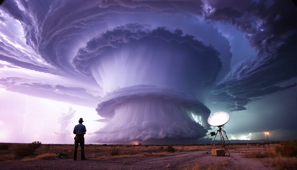
Predicting storm formations challenges you because the atmosphere operates as a coupled, nonlinear system where small errors in initial conditions amplify exponentially. Temperature, humidity, wind speed, and pressure interact through feedback loops that shift faster than models can track. Data gaps from remote monitoring failures worsen forecast reliability further. Solutions include ensemble modeling, which runs multiple simulations simultaneously to quantify uncertainty, and cross-agency collaboration to strengthen warning pipelines. Keep exploring to understand exactly how forecasters are closing these critical gaps.
Key Takeaways
- The atmosphere’s nonlinear, chaotic nature causes small initial condition errors to amplify exponentially, making accurate storm formation predictions extremely difficult.
- Multiple variables like temperature, humidity, wind, and pressure interact simultaneously through feedback loops, preventing reliable single-variable storm analysis.
- Data gaps from remote monitoring failures and incomplete historical records leave forecast systems with insufficient inputs for accurate storm modeling.
- Different storm types present unique forecasting challenges, including tornado lead times of only 13 minutes and hurricane intensity prediction struggles.
- Ensemble modeling runs multiple simultaneous model configurations, generating probability distributions of storm scenarios to improve forecast accuracy and uncertainty quantification.
Why Is Storm Formation So Hard to Predict?
Because the atmosphere operates as a coupled, nonlinear system, even minor deviations in initial conditions can cascade into dramatically different forecast outcomes—a problem known as sensitive dependence, or colloquially, the butterfly effect.
The atmosphere is a nonlinear system—minor deviations in initial conditions cascade into wildly different outcomes.
Atmospheric chaos isn’t a modeling failure; it’s a physical reality you can’t engineer away.
Storm dynamics compound this difficulty. Temperature, humidity, pressure, wind shear, and instability interact simultaneously, and convection operates at scales most models can’t fully resolve.
When conditions shift rapidly, storm development accelerates beyond your model’s update cycle, leaving forecasts outdated before you’ve acted on them.
Predicting exact timing, intensity, and location remains harder than tracking broad movement.
You’re not dealing with linear inputs producing proportional outputs—you’re maneuvering through a system where small errors compound exponentially across every forecast horizon.
The Atmospheric Variables That Make Storm Forecasting Unreliable
When you examine why storm forecasts fail, you’ll find that atmospheric behavior operates nonlinearly, meaning small shifts in temperature, humidity, or pressure can cascade into vastly different outcomes over short timeframes.
You can’t treat each variable in isolation, because wind shear, instability, and moisture interact simultaneously, compounding forecast errors as each uncertain input amplifies the next.
These compounding interactions make it nearly impossible for even high-resolution models to maintain accuracy once initial conditions diverge beyond a critical threshold.
Nonlinear Atmospheric Behavior
Although atmospheric variables like temperature, humidity, wind speed, pressure, and instability each carry predictive weight individually, it’s their simultaneous interaction that makes storm forecasting unreliable.
You’re dealing with nonlinear dynamics, where variables don’t simply add together — they amplify, suppress, and redirect each other unpredictably. These chaotic systems respond disproportionately to minor input changes, meaning a small shift in initial conditions can produce drastically different storm outcomes over time.
That sensitivity compounds across forecast hours, degrading model accuracy precisely when you need it most. No single variable drives the failure — it’s the cascade of interactions between all variables simultaneously that erodes confidence.
Understanding this nonlinearity isn’t optional; it’s foundational to grasping why even sophisticated models can’t guarantee precision in storm formation forecasts.
Compounding Variable Interactions
Nonlinearity sets the stage, but the specific variables driving it demand closer examination.
You’re dealing with temperature, humidity, wind speed, pressure, and instability—none of which behave independently. Each variable feeds into the others through atmospheric feedbacks, creating compounding interactions that destabilize forecast accuracy.
A slight humidity shift alters convective potential; that change modifies pressure gradients, which then redirects wind patterns. These cascading adjustments produce chaotic dynamics that even high-resolution models struggle to track precisely.
The math isn’t forgiving—nonlinear systems amplify small errors exponentially rather than linearly. You can’t isolate one variable and expect reliable outputs.
Accurate storm formation prediction requires simultaneously resolving every interacting component at sufficient spatial and temporal resolution, which remains computationally and observationally beyond current operational forecasting capabilities.
Why Is Storm Track Easier to Predict Than Intensity?
Storm track prediction has improved remarkably over recent decades, while intensity forecasting still lags behind—and understanding why reveals a lot about how atmospheric dynamics work.
Storm track depends largely on large-scale atmospheric steering flows—patterns that satellites and global models capture well. That’s why track errors have steadily decreased.
Intensity forecasts, however, depend on smaller-scale variables: sea surface temperatures, wind shear, moisture gradients, and upper-level conditions. These interact nonlinearly, making them harder to model precisely.
Rapid intensification is the clearest example—a storm can strengthen remarkably within hours, faster than current model resolution detects.
You’re fundamentally dealing with processes that operate below the threshold of what even high-resolution models consistently resolve, which is why intensity forecast uncertainty remains considerably higher than track uncertainty.
Data Gaps That Make Storm Prediction Less Reliable
Even the most advanced forecast models are only as reliable as the data feeding them, and gaps in observational coverage directly degrade prediction quality. Data limitations compound modeling deficiencies, reducing predictive accuracy precisely when you need it most.
Three core observation gaps drive this problem:
- Remote monitoring failures — Sparse networks in oceanic and polar regions leave critical weather variability untracked.
- Historical records deficiencies — Rare extreme events remain underrepresented, weakening model training for high-impact scenarios.
- Real-time instrument saturation — Sensors fail or saturate during severe conditions, hiding peak intensity readings.
These observation gaps mean your forecast system operates on incomplete inputs.
When data limitations persist, models can’t accurately represent rapidly evolving storm structures, leaving extreme events dangerously under-forecasted until conditions are already upon you.
Which Storm Types Are the Hardest to Forecast?
Not all storm types present equal forecasting difficulty, and understanding where models consistently underperform helps you allocate warning resources more effectively.
Hurricane forecasting has improved notably for track prediction, yet intensity errors persist, especially during rapid intensification events.
Tornado prediction remains constrained by lead times rarely exceeding 13 minutes, limiting your response window considerably.
Flash flood forecasting struggles because localized rainfall variability exceeds what current observational networks can resolve spatially.
Severe thunderstorm challenges compound when convective initiation accelerates faster than model update cycles allow.
Each storm type exposes distinct weaknesses: hurricanes in intensity modeling, tornadoes in spatial precision, flash floods in rainfall-rate resolution, and thunderstorms in initiation timing.
Recognizing these gaps lets you prioritize targeted investments in radar density, ensemble resolution, and community alert infrastructure accordingly.
Practical Ways Forecasters Are Closing the Storm Prediction Gap
Identifying where forecast systems consistently fail gives you the foundation to understand why targeted improvements are already narrowing those gaps.
Forecasters aren’t waiting—they’re actively deploying solutions through:
- Real-time monitoring and technology integration — Expanded satellite networks and radar arrays feed higher-resolution models, reducing observational blind spots that historically masked rapid intensification signals.
- Predictive analytics and data visualization — Ensemble modeling paired with machine learning converts raw atmospheric data into actionable probability maps, sharpening short-range storm alerts.
- Collaboration efforts, training programs, and community engagement — Cross-agency partnerships strengthen forecast-to-warning pipelines, while public awareness campaigns guarantee communities interpret probabilistic guidance accurately.
These aren’t isolated fixes.
Each layer reinforces the others, compressing the uncertainty window between storm development and your ability to respond decisively.
How Ensemble Modeling Helps Forecasters Predict Storms More Accurately

When a single model run gives you one deterministic forecast, you’re fundamentally betting everything on one atmospheric snapshot—and small errors in initial conditions can cascade into wildly different storm outcomes.
Ensemble simulations solve this by running dozens of slightly varied model configurations simultaneously, generating a probability distribution of possible storm scenarios rather than one rigid prediction.
Instead of one rigid forecast, ensemble simulations run dozens of varied configurations, mapping the full probability landscape of possible storm outcomes.
This approach enables uncertainty quantification—you’re no longer guessing whether a storm intensifies; you’re calculating the likelihood across multiple atmospheric states.
When ensemble members converge, confidence rises. When they diverge wildly, that spread signals forecast instability, prompting forecasters to issue broader risk communications.
You gain actionable intelligence: ensemble data identifies low-confidence windows, helping emergency managers prioritize resources before conditions deteriorate beyond model-update cycles.
Frequently Asked Questions
How Far in Advance Can Forecasters Reliably Detect a Forming Storm?
You’ll find that storm prediction varies by type—you can typically detect tropical systems 5–7 days out, but forecasting accuracy drops sharply for severe thunderstorms, often giving you only 1–2 hours’ reliable warning.
Can Artificial Intelligence Fully Replace Traditional Meteorologists in Storm Forecasting?
AI isn’t a silver bullet—you still need meteorologists. Machine learning enhances data integration and pattern detection, but human expertise interprets complex atmospheric anomalies, contextualizes model uncertainty, and makes critical judgment calls AI can’t fully replicate.
How Do Climate Change Trends Affect the Frequency of Unpredictable Storm Formations?
Climate change amplifies climate variability, making you face more frequent unpredictable storm formations. Rising sea temperatures boost storm intensity, destabilizing atmospheric conditions and generating rapid development events that challenge traditional forecasting models you’d normally rely on.
What Role Do Ocean Temperatures Play in Sudden Storm Development Changes?
When you track ocean dynamics, you’ll find temperature anomalies directly fuel sudden storm intensity shifts. These rapid changes overwhelm predictive models, making accurate forecasts harder since warmer sea surfaces accelerate energy transfer, triggering unpredictable rapid intensification events.
How Do Forecasters Communicate Storm Uncertainty to the General Public Effectively?
Ensemble models run 50+ simulations simultaneously. Forecasters use storm communication tools like cone graphics and probability maps for uncertainty messaging, helping you interpret forecast confidence ranges, track variability, and make informed, autonomous decisions before dangerous conditions arrive.
References
- https://crazystormchasers.com/storm-formation-prediction-challenges-and-solutions/
- https://theconversation.com/its-challenging-to-predict-extreme-thunderstorms-improving-this-will-help-reduce-their-deadly-and-costly-impacts-261071
- https://www.reddit.com/r/explainlikeimfive/comments/se7en7/eli5_what_makes_some_storms_more_difficult_to/
- https://energy.briggsandstratton.com/en-us/resources/article-categories/resource-articles/storm-predictions-just-how-accurate-are-they
- http://www.theweatherprediction.com/hardtoforecast/
- https://www.starnewsonline.com/story/news/2011/08/27/challenges-in-predicting-the-intensity-of-storms/30870330007/
- https://issnationallab.org/case_study/improving-tropical-storm-forecasts/
- https://www.weather.gov/car/weatherforecasting
- https://www.nesdis.noaa.gov/events/forecast-challenges-associated-rapidly-developing-storm-systems-limited-observations-and-verification
- https://www.scribd.com/document/938362495/Why-Forecasting-Thunderstorms-is-Still-So-Hard-The-New-York-Times


