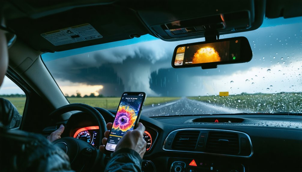
Storm chasing apps give you live Super-Resolution Level II radar data and storm-relative motion displays that basic weather apps can’t match. You’ll get near-NWS-grade intelligence directly in the field, with automated alerts triggered the moment mesocyclone signatures cross velocity thresholds. GPS integration overlays storm motion vectors onto detailed maps, optimizing your routes in real time. Keep going to discover exactly how these tools work together to keep you ahead of the storm.
Key Takeaways
- Storm chasing apps provide Super-Resolution Level II radar data at near-real-time speeds, enabling precise storm analysis unavailable on standard weather apps.
- Minute-by-minute radar updates allow chasers to continuously monitor storm movement and make timely route adjustments for safety.
- Storm-relative motion displays help identify critical features like mesocyclone rotation and hook echoes within dangerous supercells.
- GPS integration overlays storm motion vectors onto maps, providing real-time positioning and emergency alerts when rotation shifts toward users.
- Apps consolidate radar, satellite, and mesoanalysis data into one interface, streamlining decision-making during fast-moving chase situations.
What Features Separate Storm Chasing Apps From Basic Weather Apps
While basic weather apps deliver general forecasts and surface-level radar imagery, storm chasing apps operate on an entirely different technical tier.
Storm app comparisons reveal stark differences immediately: dedicated chasing platforms stream Super-Resolution Level II data at near-National Weather Service speeds, while standard apps display heavily processed, delayed imagery.
You gain access to storm-relative motion displays that identify mesocyclone rotation, hook echo signatures, and downdraft formation — details consumer apps omit entirely.
User interface features in professional platforms like RadarScope render more pixels per scan, enabling precise identification of small-scale phenomena including tornadoes.
Professional platforms like RadarScope render more pixels per scan, making small-scale phenomena like tornadoes precisely identifiable.
Basic apps notify you about weather.
Storm chasing apps let you analyze it, predict it, and position yourself accordingly.
That distinction determines whether you’re reacting to dangerous conditions or staying ahead of them.
Why Doppler Radar Outperforms Satellite Tracking for Storm Chasers?
When you’re tracking a supercell in real time, precision matters more than broad coverage — and that’s exactly where Doppler radar separates itself from satellite tracking.
Doppler Advantages include detecting precipitation intensity, hail, and rotating mesocyclones with near-zero error across defined geographic areas. You’re getting Super-Resolution Level II data streams at 99 percent reliability, delivered almost as fast as National Weather Service forecasters receive it.
Satellite Limitations become critical when seconds determine your safety margin. Satellites capture broad atmospheric imagery but can’t resolve small-scale phenomena like hook echoes or tight mesocyclone rotation.
Doppler’s higher sensitivity detects cloud structure changes and downdraft formation that satellites simply miss. When you need actionable data to reposition your route ahead of a developing tornado, Doppler radar delivers the granular accuracy that keeps you in control.
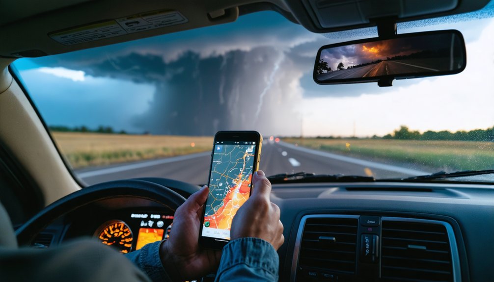
How Storm Chasing Apps Track Supercells in Real Time
When you’re tracking a supercell, storm chasing apps deliver minute-by-minute radar updates that let you monitor storm movement with precision, adjusting your route in real time based on speed and direction data.
You can analyze storm relative motion displayed on advanced radar systems to identify rotating features, including mesocyclones, which carry considerably higher tornado production potential.
With Super-Resolution Level II data streams operating at 99 percent reliability, you’re receiving information nearly as fast as National Weather Service forecasters, giving you a critical edge in the field.
Minute-By-Minute Storm Tracking
Tracking a supercell in real time demands data that updates faster than the storm can evolve, and modern storm chasing apps deliver exactly that.
With Super-Resolution Level II data streams operating at 99 percent reliability, you’re receiving information nearly as fast as National Weather Service forecasters. That speed transforms storm tracking from reactive guesswork into precise, proactive maneuvering.
Real time updates refresh minute-by-minute, letting you monitor a supercell’s speed, direction, and structural changes continuously. You can identify mesocyclone rotation, hook echo signatures, and downdraft formation before conditions deteriorate.
Apps displaying storm relative motion give you the rotational data needed to assess tornado production potential instantly. This level of resolution means you’re always working with current conditions, not data that’s already outdated when it reaches you.
Identifying Rotating Storm Features
Identifying rotation within a developing supercell separates a manageable intercept from a life-threatening miscalculation. Storm chasing apps display storm relative motion data, letting you detect rotating features before they escalate into confirmed tornadoes.
Advanced radar systems highlight mesocyclone signatures by isolating inbound and outbound velocity fields side by side, sharpening your storm identification process considerably.
You’re not guessing when you’ve got Super-Resolution Level II data streaming directly to your device. Hook echo patterns and tight rotational couplets become visible at resolutions standard interfaces can’t match.
Apps like RadarScope deliver that data at nearly the same speed National Weather Service forecasters receive it. That real-time advantage keeps you positioned correctly, maintaining safe distances while staying ahead of storms rotating toward populated areas.
The Best Storm Chasing Apps Professional Chasers Actually Use
When you’re serious about storm chasing, you’ll find that professional chasers rely on a core set of apps built around Super-Resolution Level II radar data, with RadarScope and GRLevel3 standing out as industry standards for their high-resolution storm signature identification.
You can integrate multiple data streams—radar, satellite, mesoanalysis, and weather models—through these platforms to build a thorough picture of atmospheric conditions before and during a chase.
Combining these tools with GPS-based mapping apps and National Weather Service alert systems gives you the layered, real-time data infrastructure that professional teams depend on for accurate storm interception.
Top Radar Apps Used
Professional storm chasers rely on a core set of radar applications that deliver the raw, high-resolution data necessary for accurate storm analysis and safe interception.
When you’re in the field, radar data accuracy determines whether you intercept safely or make a critical positioning error.
Three storm app features define professional-grade tools:
- RadarScope – Super-Resolution Level II data streams at 99% reliability, delivering near-NWS-speed updates
- GRLevel3/GRLevel II – Cross-platform compatibility across Windows, Linux, and macOS for thorough storm signature analysis
- Doppler-based apps – Hook echo detection and storm-relative motion displays identifying mesocyclone rotation
You’re not guessing when you’ve got these tools running simultaneously.
Each application fills a specific analytical role, giving you layered situational awareness that no single data source can provide independently.
Professional Storm Tracking Tools
Beyond raw radar data, the apps professional chasers actually run in the field span a broader ecosystem of tools covering GPS positioning, weather modeling, satellite analysis, and real-time hazard alerts.
Storm tracking at this level demands data accuracy across multiple integrated platforms simultaneously.
You’ll find professionals relying on mesoanalysis apps for atmospheric condition snapshots, Linux-based GEMPAK software for custom weather modeling, and dedicated weather model websites for storm prediction refinement.
GPS mapping tools plot your live position against storm analysis layers, enabling dynamic route adjustments.
Safety features built into alert systems notify you the moment rotation develops.
When conducting honest app comparisons, user experience matters less than monitoring technology reliability.
Professional tools consolidate temperature, moisture, wind, and pressure data into actionable intelligence that keeps you positioned correctly and moving safely.
Data Integration App Features
The best storm chasing apps don’t just display data—they integrate multiple streams simultaneously, pulling radar, satellite, mesoanalysis, and weather model outputs into a single operational picture.
This consolidated data visualization eliminates the need to toggle between platforms during critical chase decisions.
Professional-grade integration delivers:
- Real-time storm prediction accuracy through temperature, moisture, wind, and pressure data processed simultaneously
- Custom forecasting models built on Linux-based platforms like GEMPAK, tailored to your specific chase operation
- National Weather Service feeds combined with commercial providers into one accessible interface
You’re not dependent on any single data source when systems fail or coverage gaps appear.
That redundancy matters when you’re positioning ahead of a developing supercell.
The right app keeps every critical variable visible, letting you chase smarter and stay operationally free.
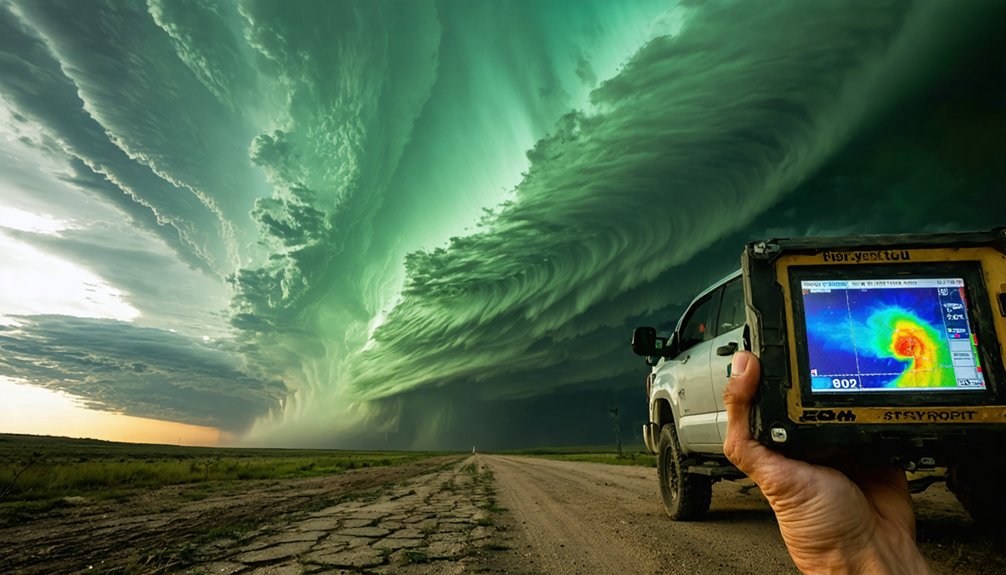
Hook Echoes and Rotation Signatures: What They Look Like on Radar Apps
Hook echoes and rotation signatures are two of the most critical radar features you’ll learn to identify when storm chasing. A hook echo appears as a distinct curved appendage on the southwestern edge of a supercell’s reflectivity display, indicating precipitation wrapping around a rotating mesocyclone. High-resolution apps like RadarScope render these signatures with exceptional clarity using Super-Resolution Level II data.
Rotation signatures appear through storm relative motion data, where contrasting colors indicate inbound and outbound velocities side by side — a strong couplet signals mesocyclone development and elevated tornado potential.
The tighter and more intense the couplet, the greater the rotational velocity. You’ll want apps delivering data at near-National Weather Service speeds, ensuring you’re reading current conditions rather than making decisions on delayed information.
How Storm Chasing Apps Alert You the Moment Rotation Develops
When a developing storm’s velocity data crosses the rotational threshold programmed into your app, the alert system triggers an immediate push notification directly to your device.
Apps like RadarScope and National Weather Service platforms continuously process incoming Super-Resolution Level II data streams, detecting mesocyclone signatures the moment they form and pushing warnings before conditions escalate.
You’ll receive real-time rotation alerts with storm-specific data including intensity, location, and movement speed, allowing you to make immediate route adjustments before the situation turns dangerous.
Rotation Detection Alert Systems
Rotation detection alert systems give storm chasers a critical edge by delivering automated notifications the moment radar algorithms identify rotational signatures within a developing storm.
These systems process Doppler velocity data continuously, pushing alerts directly to your device before conditions escalate.
Key capabilities these alert systems provide:
- Instant rotation flags triggered when mesocyclone signatures cross velocity thresholds
- Hook echo notifications identifying tornado development potential on high-resolution radar displays
- Storm-relative motion alerts distinguishing ordinary convection from high-probability tornado-producing supercells
You’re not waiting on broadcast media or manual radar scanning. The alert reaches you simultaneously with National Weather Service forecasters receiving the same data stream.
That independence keeps you mobile, informed, and positioned ahead of dangerous rotation rather than reacting after conditions have already deteriorated.
Real-Time Warning Notifications
The moment storm chasing apps detect rotational velocity signatures crossing predefined thresholds, they push warnings directly to your device through layered notification systems that don’t require you to be actively monitoring radar.
Real-time alerts fire the instant National Weather Service data confirms rotation, giving you actionable intelligence before conditions deteriorate. You’re not waiting on broadcast media or manually updating data feeds—automated systems handle continuous background processing while you focus on positioning and route decisions.
Storm updates integrate seamlessly across multiple data streams, combining Doppler signatures, hook echo identification, and mesocyclone tracking into consolidated notifications.
Each alert carries specific storm coordinates, movement vectors, and intensity ratings, letting you assess threat level immediately. This architecture keeps you operationally ahead of developing severe weather without sacrificing the situational awareness that determines chaser safety.
How Doppler Radar Spots Dangerous Downdrafts Before You See Them
Doppler radar detects dangerous downdrafts long before they’re visible to the naked eye, giving you critical lead time to reposition or retreat.
By analyzing storm dynamics through velocity data, radar reveals descending air masses that ground-level observation simply can’t capture.
High-powered Doppler systems enable precise downdraft detection by measuring:
- Precipitation signatures indicating collapsing storm cores before surface impacts occur
- Wind shear patterns showing diverging outflow boundaries that signal imminent downdraft development
- Hook echo formations identifying rotation and associated rear-flank downdraft intensification
You’re not guessing when you’ve got Super-Resolution Level II data streaming directly to your device.
That data delivers 99 percent reliability, letting you read developing storm structures with the same accuracy professional forecasters use to issue warnings.
How GPS and Storm Chasing Apps Work Together for Safer Route Planning
Knowing where a storm is heading means nothing if you can’t plot your position against it in real time. GPS integration combines your live coordinates with storm pathing data, giving you a dynamic picture of both positions simultaneously.
Route optimization algorithms process real-time updates from Doppler feeds, calculating safer corridors before conditions deteriorate. Safety features trigger emergency alerts the moment rotation signatures shift toward your location, letting you reroute instantly.
Navigation support overlays storm motion vectors directly onto detailed maps, so you’re never guessing distances or intercept angles. Data accuracy depends on Super-Resolution Level II streams feeding continuously into your app, keeping positional errors minimal.
This seamless user experience means trip planning adapts dynamically to storm behavior, putting you in control of every positioning decision you make.
How Radar, Satellite, and Mesoanalysis Data Work Together in the Field
Precision in field storm chasing comes from layering multiple data streams rather than relying on any single source. Radar integration delivers real-time storm structure, rotation detection, and precipitation intensity.
However, satellite limitations mean you’ll miss fine-scale storm details that only high-resolution Doppler captures. Mesoanalysis techniques fill critical gaps by revealing atmospheric moisture, wind shear, and instability patterns before storms develop.
Together, these sources sharpen your storm prediction accuracy markedly:
- Radar pinpoints rotation and hook echo signatures with superior data reliability
- Satellite identifies broad convective development where radar coverage weakens
- Mesoanalysis maps surface boundaries and moisture corridors driving tornado potential
You’re not guessing—you’re cross-referencing verified data streams, positioning yourself ahead of dangerous weather with confidence and calculated precision.
What Storm Chasing Apps Still Can’t Do Without Professional Forecasting Support
Layering radar, satellite, and mesoanalysis data gives you powerful situational awareness, but apps alone can’t replace the interpretive judgment that professional forecasting support provides.
Forecasting limitations emerge when advanced algorithms misread storm interactions or predictive analytics fail to account for localized atmospheric variables. Data dependency becomes a liability when connectivity drops during operational challenges in remote chase environments.
Apps optimize user experience but can’t replicate real-time collaboration between experienced meteorologists interpreting subtle signature patterns that automated systems flag incorrectly. Professional insights calibrate raw outputs into actionable decisions, distinguishing genuinely tornadic circulations from false positives.
Without that expert layer, you’re executing autonomous decisions on incomplete contextual understanding. Integrating professional forecasting support alongside your app stack isn’t optional—it’s what separates informed interceptions from dangerous miscalculations in the field.
Frequently Asked Questions
Are Storm Chasing Apps Legal to Use While Actively Driving During a Chase?
Walk the fine line carefully — legal considerations vary by state, but you’re generally permitted to use storm chasing apps while driving. Always follow safety guidelines, ensuring a co-pilot operates apps to maintain your focus on hazardous conditions.
Do Storm Chasing Apps Work in Areas With Limited or No Cellular Coverage?
Some storm chasing apps offer offline functionality, letting you access pre-downloaded radar data without cellular coverage. Your GPS accuracy remains reliable since it’s satellite-based, keeping you traveling freely through remote, storm-prone regions independently.
Can Beginners Safely Use Storm Chasing Apps Without Formal Meteorological Training?
You can use storm chasing apps for beginner safety, but app usability alone won’t protect you. Without formal meteorological training, you’ll misinterpret radar signatures, hook echoes, and storm-relative motion data, creating life-threatening decision-making errors.
How Much Data Do Storm Chasing Apps Consume During an Active Chase Operation?
Surging streams of super-resolution radar data consumption varies, but you’ll typically use 1–2GB per chase session. App performance depends on how frequently you’re updating live feeds, storm alerts, and GPS navigation simultaneously.
Do Storm Chasing Apps Require Paid Subscriptions to Access Professional-Grade Radar Data?
Yes, many professional-grade radar apps require paid subscription models, but they’re worth it—you’ll gain superior radar accuracy through Super-Resolution Level II data streams, giving you the precise, real-time storm intelligence you need to chase freely and safely.
References
- https://www.preventionweb.net/news/what-do-storm-chasers-really-do-two-tornado-scientists-take-us-inside-chase-and-tools-studying
- https://www.rainviewer.com/blog/how-to-use-rain-radar-for-storm-chasing.html
- https://www.youtube.com/watch?v=RE9GemgDryQ
- https://www.weathercentertx.com/weather-101-different-types-of-weather/storm-chasing-101/
- https://www.stormtours.com/information/storm-chasing-technology/


