Choosing the best storm chasing location each day requires you to cross-reference three converging data points: SPC risk polygons, mesoscale atmospheric parameters, and real-time model output. Check CAPE values above 2,000 J/kg, bulk shear exceeding 40 knots, and storm-relative helicity above 150 m²/s². The Great Plains consistently outperforms other regions, offering superior road grids and atmospheric setups. Master these variables, and you’ll position yourself where supercells actually develop.
Key Takeaways
- Check the SPC convective outlook daily for risk tiers and hatched overlays indicating significant tornado potential in concentrated atmospheric forcing zones.
- Target areas where CAPE exceeds 2,000 J/kg, 0-6km bulk shear surpasses 40 knots, and storm-relative helicity exceeds 150 m²/s².
- Prioritize the Great Plains over the Midwest, offering a 47% success rate, superior road networks, and better atmospheric conditions.
- Use HRRR for hourly convective updates and RadarScope for dual-pol data to refine target positioning before intercepting storms.
- Position west of developing storms early during peak season (March–June) to reduce congestion and maximize intercept angles.
How to Read SPC Tornado Maps Before You Chase
Before heading out, you’ll want to pull up the Storm Prediction Center’s (SPC) daily convective outlook, which breaks tornado probability into color-coded risk tiers—marginal, slight, enhanced, moderate, and high—each representing a percentage chance of a tornado occurring within 25 miles of any given point.
Mastering tornado map interpretation means reading beyond color alone. Examine the hatched overlays, which signal significant tornado potential where shear and instability align favorably.
Cross-reference the SPC risk assessment with mesoscale discussions for nuanced, hour-by-hour breakdowns forecasters issue when conditions sharpen. Pay close attention to where risk polygons tighten—those corridors indicate concentrated atmospheric forcing.
Prioritize the western edge of any risk area, since cells typically initiate there first, giving you maximum positioning time before storms mature into organized, tornadic supercells.
Why the Great Plains Pays Off More Than the Midwest
When you’re targeting tornado intercepts, the Great Plains delivers a 47-success rate across 147 attempts, a ratio the Midwest simply can’t match.
Chasing the Midwest forces you to commit roughly twice the chase days for equivalent results, draining time, fuel, and operational margins.
You’ll maximize efficiency by positioning in established Plains hubs like Oklahoma City or Denver, where road networks and storm initiation zones align with forecast convergence boundaries.
Plains Tornado Success Rates
While both regions produce tornadoes, the Great Plains consistently outperforms the Midwest in chase efficiency by a considerable margin. Data shows 47 tornado days from 147 Plains attempts versus roughly double the chase days needed in the Midwest.
Your chase strategies must account for tornado frequency patterns tied directly to regional atmospheric setups.
Key Plains advantages you should factor in:
- Higher CAPE values fuel stronger supercell development
- Superior wind shear profiles increase tornado frequency considerably
- Open terrain enables unobstructed storm intercept positioning
- Road grid density supports flexible chase strategies and rapid repositioning
- Drier boundary layer contrast sharpens storm initiation timing
Targeting the Plains isn’t just preference — it’s statistically defensible. You’ll intercept more tornadoes per chase day, maximizing both your efficiency and operational freedom.
Midwest Chase Day Inefficiency
The Midwest demands roughly twice the chase days to match what the Great Plains delivers, making it a statistically inefficient target for serious chasers.
Midwest inefficiency stems from fragmented storm initiation, weaker shear profiles, and terrain that limits clean intercept angles. You’ll burn time repositioning across congested road networks while watching marginal setups underperform.
That chase frustration compounds over multi-day tours. Every day you commit to a Midwest target is a day you’re not positioned where probability actually concentrates.
The Plains gives you open sightlines, superior road grids, and atmospheric parameters that consistently support supercell development. Unless you’re operating locally, the Midwest simply costs more in time, mileage, and opportunity than it returns in productive intercepts.
Choose your positioning accordingly.
Optimal Great Plains Positioning
Shifting your positioning to the Great Plains resolves the inefficiencies the Midwest creates and puts you inside the highest-probability tornado corridor in North America.
Ideal positioning here means accessing earlier storm development, better road grids, and statistically superior intercept rates.
Key advantages of Great Plains positioning:
- Success rate: 47 tornado days from 147 attempts versus double the chase days required in the Midwest
- Storm development: Cells initiate earlier along western risk edges, giving you more intercept windows
- Hub access: Oklahoma City, Denver, and Kansas City offer rapid repositioning flexibility
- Terrain: Flat topography maximizes visual range and escape route options
- Atmospheric parameters: CAPE, shear, and helicity consistently align during spring peak months
You’re chasing smarter, not harder, by owning your positioning advantage.
When Tornado Season Peaks in the Great Plains
You’ll find the Great Plains tornado season peaks sharply between March and June, with May representing the highest statistical probability for supercell development and tornado production.
During this window, Gulf moisture surges northward, colliding with dry continental air masses to generate the instability and shear parameters that drive the most prolific storm days.
Aligning your chase schedule with this spring pattern maximizes your intercept opportunities while positioning you within the corridor where atmospheric conditions consistently favor tornadic supercells.
Great Plains Peak Months
Peak tornado activity in the Great Plains concentrates between March and June, with May historically delivering the highest frequency of significant tornado events.
During tornado season, atmospheric conditions align most effectively for storm initiation, giving you the highest probability windows for successful intercepts.
Target these peak months strategically:
- March–April: Early season activity, primarily southern Plains, Oklahoma, and Texas
- May: Maximum tornado frequency, strongest CAPE and shear combinations
- June: Activity shifts northward into Kansas, Nebraska, and South Dakota
- Late June–July: Decreasing instability, fewer but still viable chase days
- August: Minimal activity, selective targeting required
You’ll maximize intercept success by concentrating your chase calendar around May, where storm initiation frequency and atmospheric parameters consistently produce supercell-favorable environments across the central Plains.
Spring Season Storm Patterns
Spring storm dynamics emerge from a collision of competing air masses: warm, moisture-laden Gulf air pushing northward meets cold Arctic outflows descending from Canada. That clash creates explosive seasonal instability patterns, supercharging CAPE values while strong jet stream positioning delivers the directional wind shear supercells need to rotate.
Soil warming accelerates surface dewpoints, deepening the moist layer beneath a still-cold mid-level atmosphere. That steep temperature gradient maximizes convective instability.
Simultaneously, increasing solar radiation destabilizes the cap just enough for vigorous storm initiation without completely eliminating it—preserving discrete supercell structures rather than chaotic squall lines.
You’re fundamentally targeting a precise atmospheric window that only spring reliably opens.
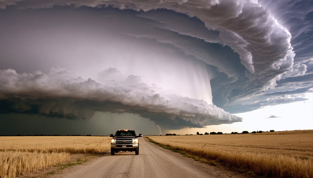
Why Chasers Always Start at the Western Initiation Zone
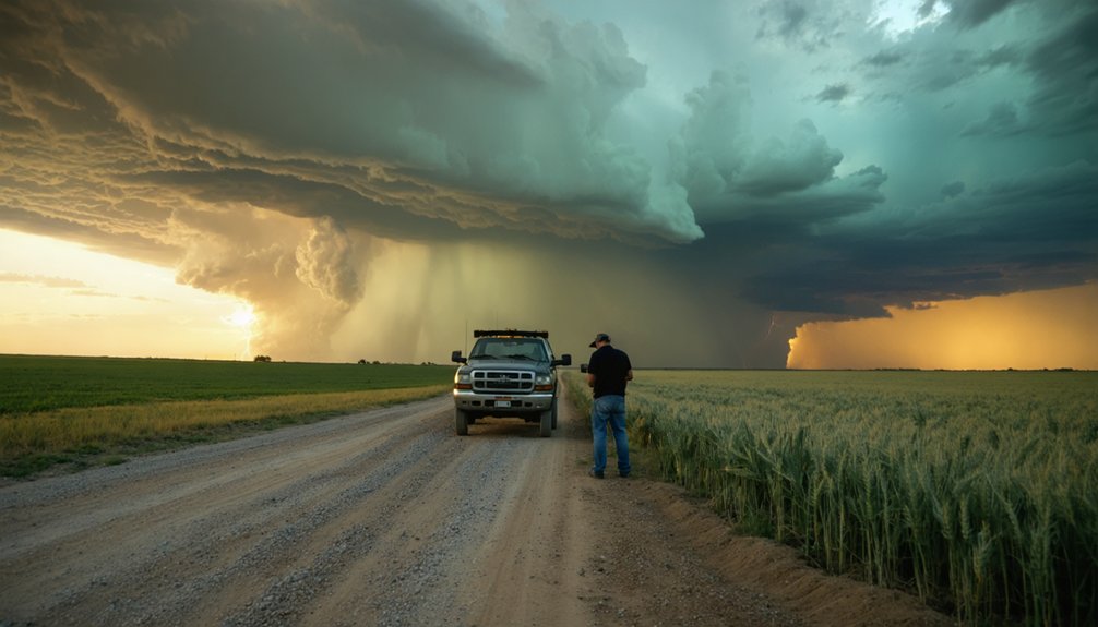
When storm cells begin developing along the dryline, the western edge of the risk zone is where convective initiation happens first—making it your highest-probability starting point. Positioning yourself here maximizes your window for tracking full storm evolution from development through maturity.
Key advantages of western initiation positioning:
Key advantages of western initiation positioning make it the strategic sweet spot for storm chasers chasing full evolution cycles.
- Earlier intercept timing — you’ll catch supercells before they accelerate eastward
- Longer tracking windows — extended observation of complete storm evolution cycles
- Better road access — sparse Plains infrastructure works in your favor early
- Reduced chaser congestion — fewer vehicles competing for the same intercept angles
- Optimal escape routes — westward retreat remains available before storm clusters organize
Start west, move strategically, and let the storm come to you.
How to Read CAPE, Shear, and Helicity Before You Chase
Before you commit to a chase day, three atmospheric parameters—CAPE, shear, and helicity—will tell you more about supercell potential than any surface observation.
CAPE interpretation starts with values above 2,000 J/kg, signaling strong instability factors for explosive updraft development.
Shear assessment requires examining 0-6km bulk shear exceeding 40 knots—anything lower reduces organized rotation probability greatly.
Helicity analysis focuses on 0-3km storm-relative helicity, where values surpassing 150 m²/s² indicate favorable storm potential for mesocyclone formation.
You’ll want all three parameters aligning simultaneously. High CAPE with weak shear produces pulse storms, not supercells. Strong shear with minimal CAPE limits updraft intensity.
When instability factors and directional wind shear converge within your target corridor, you’ve identified a legitimate chase opportunity worth committing to.
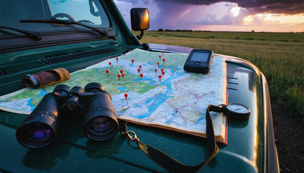
HRRR, RadarScope, and Spotter Network: The Tools Chasers Use
Three tools define the modern storm chaser‘s operational workflow: HRRR, RadarScope, and Spotter Network. Each serves a distinct function in storm tracking, giving you autonomous, real-time decision-making capability in the field.
Leverage these tools effectively:
- HRRR features hourly convective updates, letting you refine target positioning every 60 minutes.
- RadarScope’s radar overlays deliver dual-pol data, velocity, and correlation coefficient at professional resolution.
- Spotter Network enables spotter collaboration by mapping active chasers and verified ground-truth reports simultaneously.
- Monitor mesocyclone signatures on RadarScope before committing to an intercept route.
- Cross-reference HRRR storm motion vectors with live spotter positions to validate your forecast.
These tools eliminate guesswork. You’re operating on verified data, not assumptions, which maximizes both your intercept success rate and your personal safety margin.
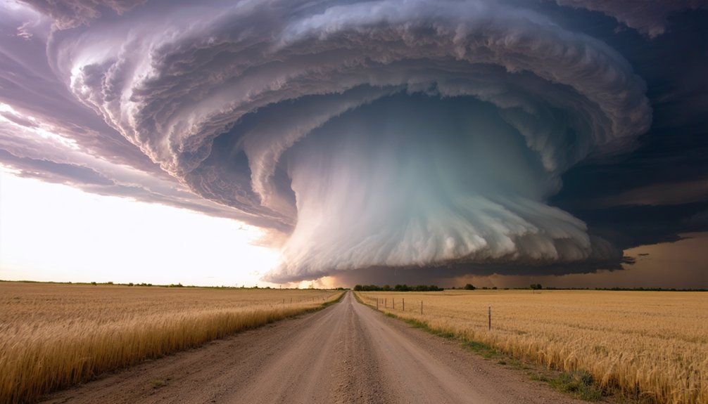
Why the Plains Road Grid Gives You More Intercept Options
Real-time tools only deliver value if you can act on what they’re showing you, and that’s where the Plains road grid becomes a force multiplier.
The region’s dense, section-line road network gives you unmatched flexibility in intercept strategies, letting you reposition rapidly as cell initiation shifts west or east.
Storm tracking becomes surgical when you’re operating on predictable one-mile grid spacing rather than fighting navigation challenges like winding rural highways or dead-end terrain.
You’ll maintain better storm positioning through each stage of supercell development, cutting reaction time considerably.
Chase efficiency improves because your route options multiply at every decision point.
Even safety precautions become more executable — you can exit a deteriorating intercept corridor cleanly without surrendering your next tactical approach window.
Frequently Asked Questions
How Do Chasers Safely Escape When Storms Unexpectedly Change Direction?
When storms shift unexpectedly, you’ll activate pre-planned escape routes immediately, moving perpendicular to the storm’s path. Follow established safety protocols, monitor real-time radar, and maintain situational awareness to guarantee you’re always ahead of dangerous, rapidly evolving conditions.
Which Storm Chasing Tour Operators Offer the Most Reliable Guided Experiences?
Like Odysseus traversing treacherous seas, you’ll find reliable operators such as Silver Lining Tours and Tempest Tours consistently deliver guided experiences rooted in Plains-based expertise, maximizing your tornado intercept probability through analytically sound, safety-prioritized routing strategies.
How Does Chasing During La Niña Years Differ From El Niño Seasons?
During La Niña impacts, you’ll find enhanced Great Plains tornado activity with stronger jet streams. El Niño patterns suppress Plains convection, shifting your chase targets southeast. Adjust your positioning strategy accordingly each season.
What Backup Strategies Work Best When Forecast Targets Completely Bust?
When your forecast busts, you’ll need backup plans fast. Pivot to secondary SPC risk zones, use alternative routes toward residual instability, monitor HRRR updates, and reposition toward any remaining CAPE and shear corridors showing renewed convective potential.
How Do Chasers Manage Fatigue During Multi-Day High-Mileage Chase Tours?
Ironically, your best fatigue management mirrors storm unpredictability—adapt constantly. Rotate drivers, schedule mandatory rest between high-mileage days, and apply disciplined energy strategies: prioritize sleep, optimize nutrition, and monitor cognitive sharpness, ensuring you’re always operationally ready for tomorrow’s chase window.
References
- https://stormchasing.com
- https://midlandusa.com/blogs/blog/storm-chasing-tours
- https://extremetornadotours.com
- https://stormtrack.org/threads/whats-a-good-starting-location-for-a-chase-day-relative-to-the-area-of-tornadoes.33213/
- https://stormhighway.com/tornado_observing_stats.php
- https://stormcenter.app
- https://livestormchasing.com/map
- https://www.tornadotitans.com/p/the-best-places-to-storm-chase