To succeed in storm chasing competitions, you’ll need sharp forecasting skills, disciplined vehicle positioning, and high-quality storm documentation. Judges score on forecast accuracy and proximity to key features like mesocyclones—not reckless behavior. Monitor SPC Convective Outlooks days ahead, maintain at least one mile from active circulation, and use professional radar tools like Radarscope for real-time data. Master these fundamentals, and the tactical details that separate top competitors from the rest become much clearer ahead.
Key Takeaways
- Monitor SPC Convective Outlooks and develop personal forecasts days before competition to accurately predict storm development zones.
- Study supercell storm structure, identifying tornado formation zones on southwest flanks using wall clouds and radar signatures.
- Use professional real-time radar tools like Radarscope while maintaining redundant GPS navigation systems for reliable storm tracking.
- Maintain at least one mile distance from active tornado circulation, always prioritizing escape corridors over closer positioning.
- Review post-chase data by comparing forecasts against actual storm behavior to refine future tactical decisions and positioning.
Understand How Storm Chasing Competitions Are Scored
Knowing how storm chasing competitions are scored gives you a strategic edge before you ever leave the driveway. Most competitions evaluate participants on proximity to storm features, documentation quality, and forecast accuracy. Understanding these scoring categories directly shapes your competition strategies.
Mastering competition scoring criteria before you chase transforms guesswork into deliberate, strategic decision-making from the very start.
You’ll want to prioritize capturing clear visual documentation of storm dynamics, including mesocyclone structure, wall clouds, and tornado formation. Judges typically reward precision over recklessness, meaning disciplined positioning outperforms dangerous intercepts every time.
Study previous competition scoring rubrics carefully. Many weight forecast verification heavily, so developing your own prediction models and comparing them against SPC Convective Outlooks strengthens your analytical foundation.
Knowing point distributions lets you allocate risk intelligently rather than chasing blindly. Compete with purpose, not just adrenaline.
Build Your Forecasting Skills Before Competition Day
Before competition day arrives, you’ll need to sharpen your weather model analysis skills by monitoring atmospheric data days in advance to identify potential thunderstorm development zones.
Study detailed supercell diagrams — including updraft, downdraft, and mesocyclone configurations — so you can accurately anticipate storm behavior during a chase.
You should also consult SPC Convective Outlooks regularly and develop personal forecasts, comparing your predictions against professional outputs to systematically close the accuracy gap.
Master Weather Model Analysis
Weather model analysis forms the backbone of successful storm chasing, and you’ll need to master it well before you’re standing at the edge of a supercell. Understanding weather model intricacies separates competent chasers from reckless ones.
Begin monitoring models days in advance to identify potential thunderstorm development zones, giving yourself maximum decision-making freedom when chase day arrives.
Your analysis techniques should incorporate SPC Convective Outlooks alongside surface and upper air charts to precisely pinpoint target areas. Compare GFS, NAM, and HRRR outputs, noting where models agree or diverge. Disagreement signals uncertainty—respect it.
Create your own forecast independently, then benchmark it against professional predictions. This disciplined practice sharpens your pattern recognition, builds genuine forecasting confidence, and ultimately gives you the tactical freedom to position yourself advantageously when conditions rapidly evolve.
Study Supercell Storm Structures
Supercell storm structure knowledge anchors every positioning decision you’ll make in the field.
You’ll need to internalize supercell dynamics before you’re ever behind the wheel on a chase day. Study detailed diagrams illustrating updraft, downdraft, and mesocyclone relationships until storm morphology becomes second nature.
Understand how the forward flank downdraft and rear flank downdraft interact with the primary mesocyclone, since these interactions directly dictate where tornadoes emerge.
You’ll typically identify tornado development on a storm’s southwest or western flank, so you’ll position accordingly.
Recognizing visual cues—wall clouds, inflow bands, beaver tails—lets you read a storm’s internal mechanics in real time.
Compare your structural analysis against observed radar signatures consistently, building pattern recognition that translates directly into smarter, safer competitive positioning decisions.
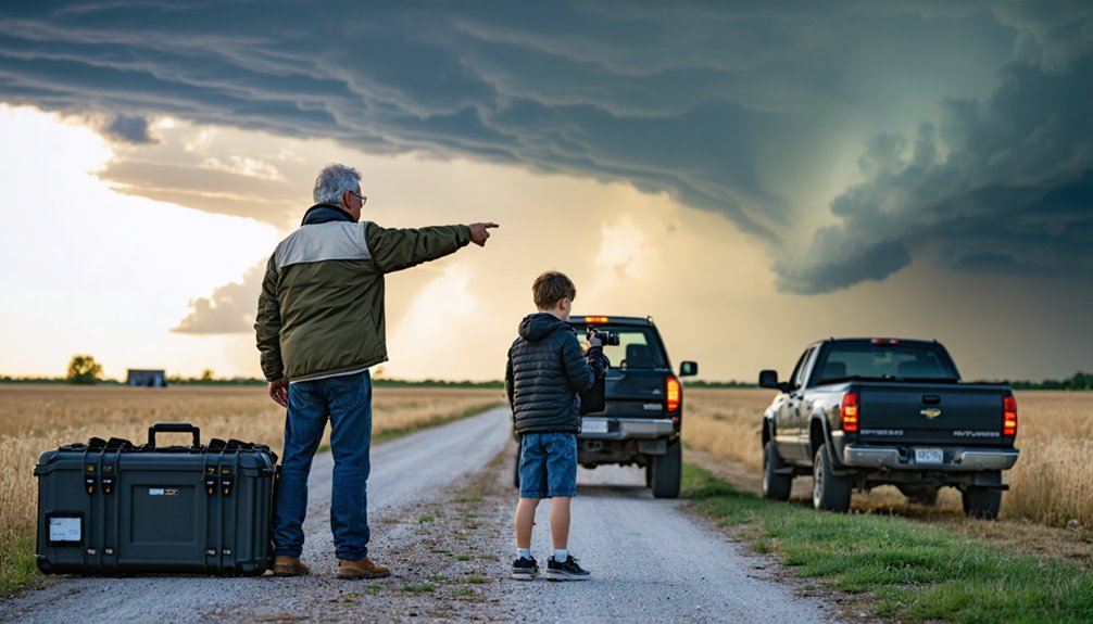
Pack the Right Gear for Competition Day
Having the right gear on competition day can mean the difference between a successful chase and a dangerous situation.
You’ll need a reliable vehicle with a full tank of gas, quality tires, and ideally four-wheel drive, stocked with first aid supplies, food, and water for extended field operations.
Pair your vehicle readiness with real-time radar tools like Radarscope or RadarOmega and a dependable GPS navigation system, ensuring your smartphone or tablet stays charged and connected throughout the chase.
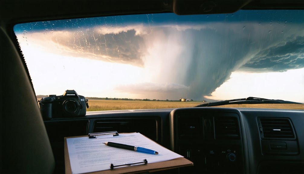
When you’re chasing storms, your navigation and communication tools can be the difference between a successful intercept and a dangerous situation.
Your navigation strategies should combine GPS systems with detailed pre-studied road networks, identifying escape routes and areas with limited crossing options before storms approach. Don’t rely solely on GPS — know your terrain independently.
For communication tools, verify your smartphone or tablet maintains reliable carrier coverage in remote locations by checking cell coverage maps beforehand.
Real-time radar applications like Radarscope or RadarOmega deliver precise, undelayed storm data critical for accurate positioning decisions. Pair these with SPC Convective Outlooks to validate your intercept approach.
Redundant systems matter. If one tool fails, you need backups immediately accessible.
Preparation here directly preserves your operational freedom in the field.
Vehicle Readiness And Supplies
Your communication systems are only as effective as the vehicle supporting them. Before competition day, complete a thorough vehicle maintenance inspection covering tires, brakes, fuel systems, and four-wheel drive functionality.
Muddy, unpaved roads demand mechanically sound equipment — compromised vehicles create dangerous situations that no forecast can anticipate.
Follow a structured supply checklist to eliminate guesswork. Stock extra fuel for remote intercept zones where gas stations don’t exist. Pack a first aid kit, emergency food, water, and a dedicated GPS navigation system independent of cellular networks.
Maintain a full tank before deployment; refueling opportunities disappear quickly during active chase operations.
Your vehicle isn’t just transportation — it’s your operational platform. Treat it accordingly, and you’ll maintain the mobility and independence that successful storm chasing demands.
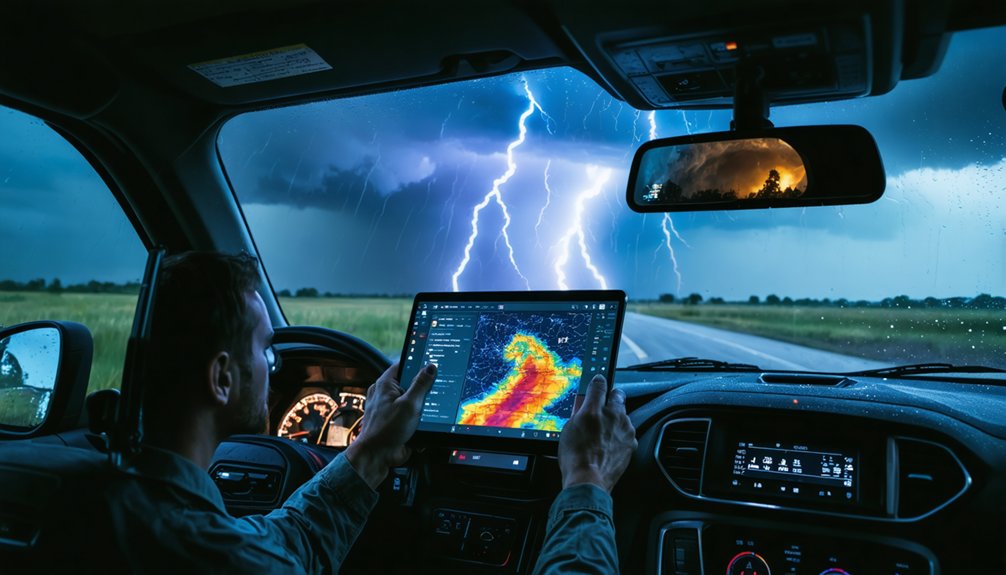
Real-Time Weather Monitoring Tools
Every second counts when a storm develops faster than anticipated, so equip yourself with professional-grade radar tools rather than consumer weather apps that deliver delayed data. Applications like RadarScope or RadarOmega provide real-time alerts with minimal latency, giving you actionable intelligence precisely when storm tracking demands it.
Pair your radar application with a dedicated smartphone or tablet, ensuring your device maintains a reliable charge throughout competition day. Remote chase locations frequently lack consistent cell coverage, so verify your carrier’s signal strength across your planned route beforehand.
Cross-referencing SPC Convective Outlooks alongside live radar imagery sharpens your situational awareness considerably. Delayed data creates dangerous decision gaps, so prioritize tools that deliver current atmospheric conditions rather than generalized forecasts that compromise your positioning accuracy and overall safety.
Use the Radar Tools That Top Chasers Rely On
Real-time radar access separates effective storm chasers from those relying on outdated data.
You’ll need professional-grade tools like RadarScope or RadarOmega, which deliver live imagery without the delays embedded in consumer weather apps. These platforms support advanced radar interpretation, letting you analyze velocity scans, storm structure, and rotation signatures with precision.
Don’t underestimate chaser networking either. Experienced chasers share real-time positional data and radar reads through established communication channels, giving you tactical advantages that solo operations can’t replicate.
Pairing your smartphone or tablet with these tools keeps critical data flowing during active intercepts.
Generic apps won’t cut it when you’re positioning yourself near a developing supercell.
Invest in the tools that professionals trust, and you’ll make faster, more informed decisions when conditions evolve rapidly.
Plan Your Storm Chase Route Before Cells Develop
Before a single storm cell fires, you’ll want a complete picture of the road network in your target area. Route optimization depends on identifying gaps in crossing options before storm prediction models confirm your target zone.
Study road networks, coverage maps, and escape corridors while you still control your timeline.
- Identify limited road crossing areas that could trap you during rapid storm movement.
- Map alternative routes and safe shelter positions along every corridor.
- Verify cell carrier reliability across remote chase locations.
- Cross-reference SPC outlooks with road infrastructure to confirm viable intercept angles.
Maintaining flexibility isn’t optional — it’s tactical. Real-time conditions will force adjustments, but chasers who pre-plan execute faster, safer decisions when storms accelerate unexpectedly.
Position Your Vehicle to Score Points Without Getting Hurt
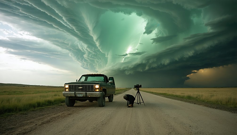
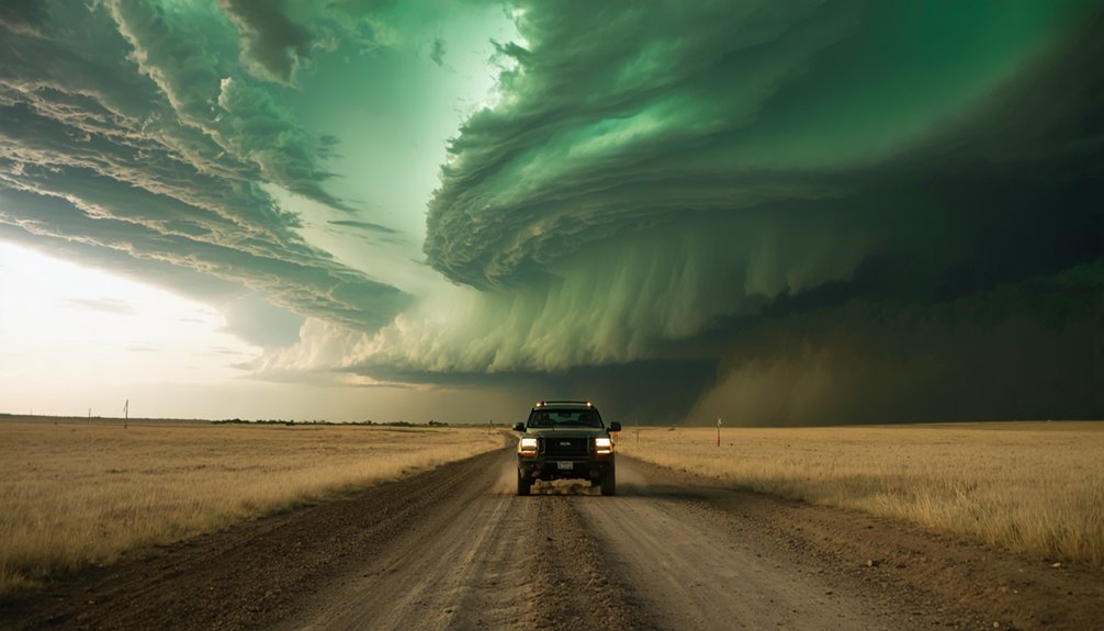
Tactical positioning separates productive chases from dangerous ones. You’ll want to identify tornado formation zones on the southwest or western flanks of supercells, where visibility remains clearest and escape routes stay open.
For ideal vehicle positioning, maintain at least one mile from active circulation while avoiding rain curtains that obscure the tornado’s actual location within the storm structure.
Your scoring strategies depend on proximity and visual clarity simultaneously. Account for storm movement speeds reaching 50-60 knots when calculating intercept angles — faster storms demand earlier positioning decisions.
Surface charts help you target dryline and warm front intersections where tornado probability concentrates.
Never sacrifice your escape corridor for a closer shot. Identify road networks perpendicular to storm movement, giving you lateral repositioning freedom without committing to dangerous forward penetration.
Follow Safety Protocols That Keep You Competition-Ready
Safety protocols aren’t just defensive measures — they’re the foundation that keeps you competition-ready across multiple chase seasons. Ignoring storm risks doesn’t make you bolder — it eliminates you from future competitions permanently.
Integrating safety into your competition tactics sharpens your decision-making rather than limiting it.
- Complete NWS Spotter Safety Classes before independent chasing attempts.
- Maintain at least one mile from tornado circulation as your baseline positioning standard.
- Ride alongside experienced chasers to internalize real-time tactical decisions under pressure.
- Continuously monitor atmospheric deterioration signals — rapid changes demand immediate route adaptation.
You’re building a sustainable chasing career, not gambling on a single event.
Disciplined protocol execution separates competitors who accumulate seasons of data from those who don’t return.
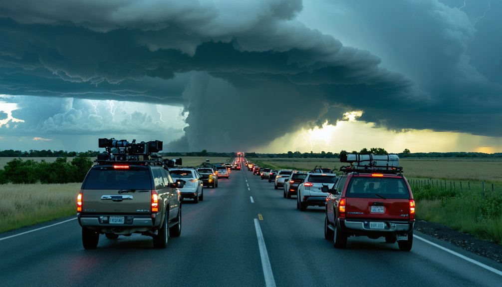
Avoid Traffic and Chaser Convergence Mistakes
On high-risk chase days, traffic management becomes as critical as storm analysis. You’re not just competing against the storm — you’re maneuvering through an increasingly crowded field of chasers, all converging on the same target zone.
Understanding traffic patterns before you deploy prevents costly delays and dangerous bottlenecks.
Practice disciplined chaser etiquette by avoiding no-pass zones, reducing speed near other chase vehicles, and maintaining courteous driving habits under pressure.
GPS accessibility and social media have dramatically increased chaser convergence, meaning your route planning must account for human traffic, not just meteorological variables.
Keep your eyes on road conditions while driving, regardless of storm proximity. Splitting your attention between an active tornado and highway traffic is a calculated mistake that compromises your positioning, your safety, and your competitive edge.
Review Your Chase Data and Improve Next Time
After you’ve managed the road and the crowds, the chase isn’t truly over until you’ve reviewed what happened.
Post-chase data analysis sharpens your competition strategies and accelerates skill development.
Work through these four critical review steps:
- Compare your forecast against actual storm behavior — identify where your predictions diverged from reality.
- Analyze your positioning decisions — evaluate whether your intercept angles optimized visibility while maintaining safe distances.
- Review radar imagery timestamps — cross-reference your real-time reads against documented storm evolution sequences.
- Document tactical errors and wins — build a personal reference log that compounds into long-term competitive advantage.
Each chase generates irreplaceable data.
Chasers who systematically review their decisions gain measurable advantages over those who rely purely on instinct.
Your next successful intercept depends on what you learn today.
Frequently Asked Questions
What Permits or Licenses Are Required to Participate in Storm Chasing Competitions?
Storm chasing regulations don’t mandate federal licenses, but you’ll need to research local permitting requirements in each state or county you’re operating in, ensuring you’ve got valid driver’s licenses and proper vehicle documentation ready.
How Do Competition Organizers Verify and Validate Submitted Storm Chase Data?
Over 70% of submissions get cross-checked against radar archives. Organizers verify your data accuracy through GPS timestamps, radar correlation, and photographic evidence. They’ll use multiple verification methods, comparing your submitted coordinates against official NWS records to validate authenticity.
Are There Age Restrictions or Minimum Experience Requirements for Entering Competitions?
Most competitions don’t enforce strict age eligibility rules, but they’ll expect you to demonstrate solid experience levels. You should complete NWS Spotter Safety Classes and log ride-alongs with seasoned chasers before entering independently.
How Are Competition Boundaries and Chase Zones Officially Determined Beforehand?
You’ll find that organizers define chase zone criteria using SPC Convective Outlooks, radar imagery, and road network analysis. They enforce boundary enforcement through GPS tracking, ensuring you’re operating within designated high-probability storm development regions.
What Insurance Coverage Do Storm Chasers Need for Competition Participation?
Prioritize proper protection: you’ll need extensive vehicle protection coverage for storm damage, plus liability insurance. Confirm competition-specific policies, as standard auto plans often exclude weather-related incidents. Freedom demands financial preparedness before chasing begins.
References
- https://www.foxweather.com/learn/storm-chasing-advice-from-the-pros
- https://www.livingskytours.com/storm-chasing-101/
- https://www.youtube.com/watch?v=FJWWHDFBRLI
- https://www.wiu.edu/SevereWeather/images/presentations/How_to_Effectively_Storm_Chase.pdf
- https://www.gabegarfield.com/blog/zerotohero
- https://stormtrack.org/threads/basic-storm-chasing-process.29691/
- https://www.youtube.com/watch?v=w-5nJ61umeA
- https://www.stormchasingusa.com/blog/learning-the-basics-about-storm-chasing/