Tornado Alley’s best chasing adventures concentrate across Oklahoma, Texas, Kansas, and Nebraska, where dry polar air, Gulf moisture, and desert heat collide to generate violent supercells. You’ll find peak intercept probability from late April through mid-June, when wind shear and atmospheric instability hit their seasonal maximum. Guided tours dramatically improve your odds by integrating real-time radar, surface observations, and dynamic routing. Stick around to uncover exactly which experiences, regions, and strategies deliver the most explosive results.
Key Takeaways
- Expert-led guided tours in Oklahoma, Texas, Kansas, and Nebraska offer the best tornado chasing adventures during late April through mid-June.
- Beginner, intermediate, and advanced tour options allow chasers of all experience levels to safely intercept supercells across Tornado Alley.
- Top chasing regions include the Oklahoma Panhandle, Texas High Plains, and Nebraska, offering defined storm structures and excellent sightlines.
- Expert teams use real-time radar, surface observations, and model data to dynamically maximize tornadic supercell interception opportunities.
- Pre-planned escape routes, team coordination, and proper gear ensure safe, high-quality tornado chasing adventures throughout Tornado Alley.
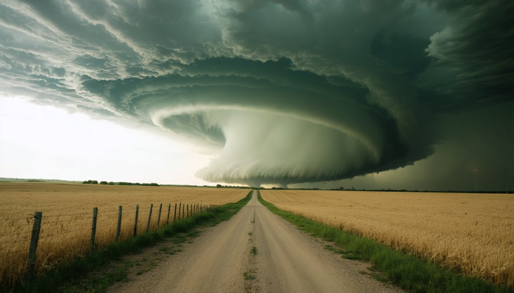
What Makes Tornado Alley the World’s Best Chase Zone?
Tornado Alley dominates global storm-chasing because its atmospheric conditions are almost uniquely engineered for supercell development.
Dry polar air from Canada, warm Gulf moisture, and desert heat from the Rockies converge across the central plains, producing the vertical wind shear and instability that drive tornado dynamics. No comparable geographic configuration exists elsewhere at this scale.
Spring into early summer delivers your highest-probability chase window, when surface dewpoints surge and atmospheric lift intensifies rapidly.
Open terrain across Oklahoma, Kansas, Texas, and Nebraska gives you unobstructed sightlines critical for storm photography and real-time structural analysis. You can track wall clouds, inflow bands, and rotating mesocyclones without dense vegetation blocking your visual field.
That combination of meteorological frequency, terrain access, and storm intensity is why serious chasers return here every season.
When Is the Best Time for Tornado Chasing in Tornado Alley?
Spring delivers your highest-probability chase window, typically running from late April through mid-June across the core of Tornado Alley. During this chase season, atmospheric conditions align most aggressively — Gulf moisture surges northward, jet stream positioning enhances wind shear, and daytime heating destabilizes the atmosphere rapidly.
Storm patterns shift by month, so your timing strategies should account for regional migration. Texas and Oklahoma dominate early May setups, while Kansas and Nebraska become primary targets by late May into June. Tornado frequency peaks during this corridor, driven by strong mesocyclone development within isolated supercells.
Weather forecasting tools — including SPC outlooks, soundings, and hodograph analysis — let you identify high-confidence chase days 24 to 48 hours out, maximizing your positioning before storms initiate across the open plains.
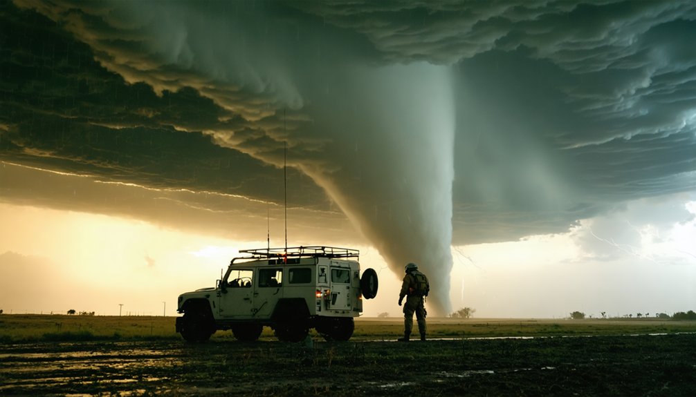
Safety Rules That Keep Storm Chasers Alive in Tornado Alley
Team Coordination keeps communication tight, with designated roles for navigation, radar interpretation, and driving.
Equipment Maintenance guarantees your comms and GPS stay operational under pressure.
Weather Awareness and Chase Etiquette mean reading storm structure accurately and never blocking emergency vehicle access on rural intercept corridors.
Oklahoma Panhandle: The Heart of Tornado Chasing Country
Once you’ve internalized the safety protocols that govern responsible chase operations, the next step is knowing where to apply them—and few regions test those skills more consistently than Oklahoma. Its position near Tornado Alley’s core means you’ll encounter supercells with well-defined mesocyclones, rotating wall clouds, and clear inflow structure—conditions that reward disciplined positioning and sharp storm photography technique.
Oklahoma’s road grid supports rapid repositioning across open terrain, giving you flexibility when storm motion accelerates. You’ll maximize intercept opportunities by monitoring surface observations alongside radar data, adjusting your route before the storm forces your hand.
Chase etiquette matters here: stay off blocked intersections, yield to emergency vehicles, and avoid crowding other chasers near intercept points.
Oklahoma’s high storm frequency makes it an ideal environment to refine both your meteorological judgment and field discipline.
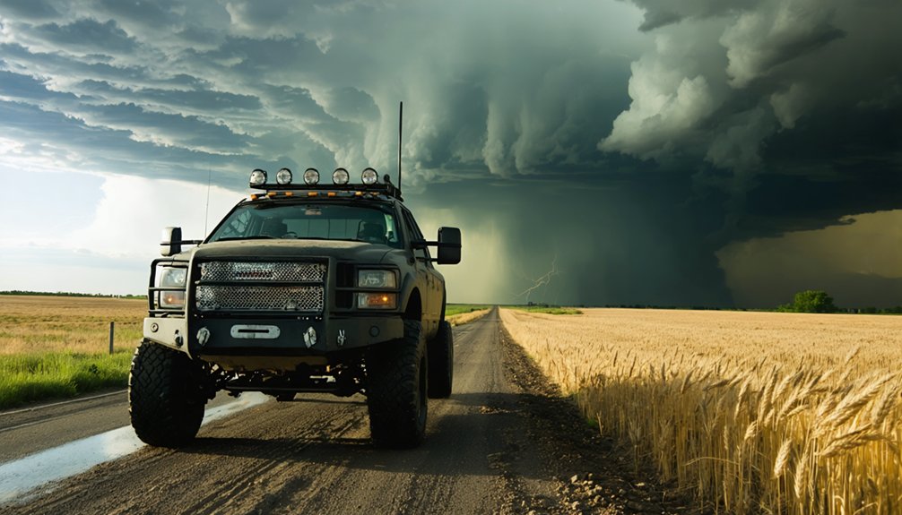
Texas High Plains: Big Storms, Big Distances, Big Payoff
When you target the Texas High Plains early in the spring chase season, you’re positioning yourself for some of the most intense supercell setups in Tornado Alley, often before Oklahoma and Kansas corridors fully activate.
The region’s wide-open highways give you long sightlines, but they also demand that you continuously pre-plan your escape routes, since storm motion can shift across vast distances with little warning.
You should identify secondary and tertiary exit roads before committing to an intercept position, because a single blocked route on a fast-moving supercell can turn a calculated risk into a dangerous trap.
Early Season Storm Intensity
Texas opens the chase calendar earlier than any other Tornado Alley state, with supercell setups frequently firing across the High Plains by late March and April—weeks before Kansas and Nebraska see comparable activity.
Early season dynamics here are driven by strong Gulf moisture surges colliding with dry lines that develop rapidly across western Texas, producing extreme wind shear and convective instability.
You’ll encounter discrete supercell structures that reward disciplined storm chasing techniques—particularly long-range visual tracking across unobstructed terrain.
Dew points, hodograph data, and convective available potential energy readings often peak aggressively during these early setups. That combination delivers intense rotating updrafts and substantial tornado potential.
If you’re committed to maximizing chase days, targeting Texas in spring gives you the earliest and most explosive severe weather window available.
Escape Route Planning Essentials
Escape route planning on the Texas High Plains isn’t optional—it’s the core discipline that separates productive chases from dangerous ones.
You’re operating across long straightaways where storms move fast and road options thin out. Integrate escape route strategies before storm initiation, not after.
Your chase preparation tips should include pre-loaded county road grids, real-time radar on a secondary device, and confirmed perpendicular exits relative to storm motion.
- Identify south and east exits first—most supercells track northeast, making northern and western positions increasingly dangerous.
- Monitor storm speed continuously—a 50 mph storm closes distance faster than rural roads allow repositioning.
- Avoid rain-wrapped cores—reduced visibility eliminates your ability to read storm structure and execute exits cleanly.
You control your position. The storm controls everything else.
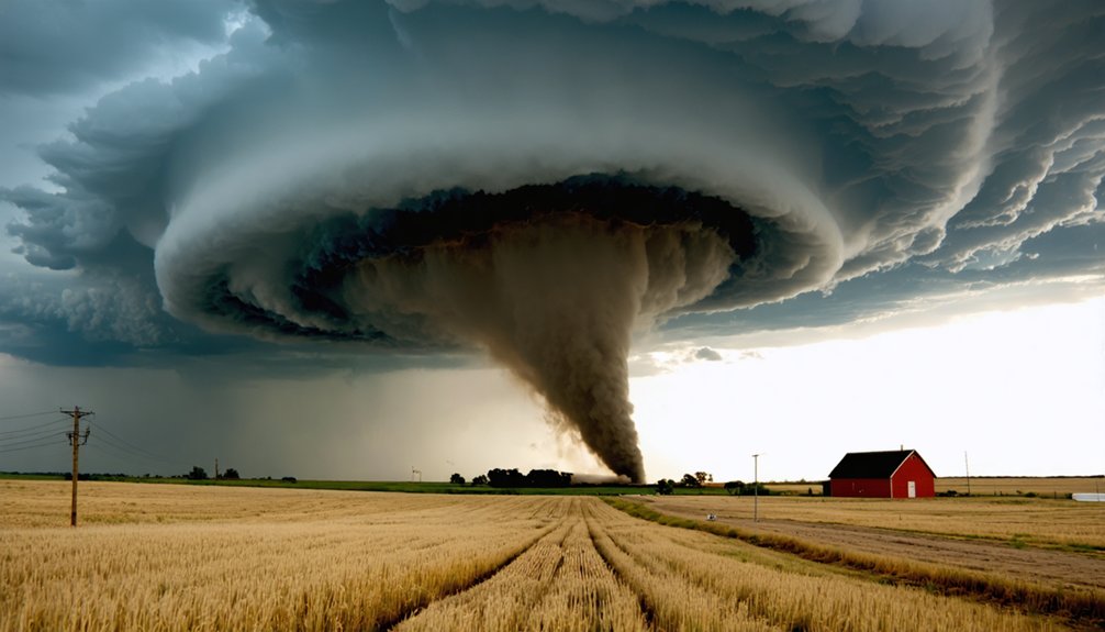
Kansas Supercell Corridors Every Chaser Should Experience
Kansas sits at the heart of Tornado Alley, and its supercell corridors consistently deliver some of the most structurally defined, visually trackable storms in the central plains.
Long sightlines across Kansas landscapes give you unobstructed views of rotating wall clouds, inflow bands, and rear-flank downdrafts—critical reference points for both intercept positioning and storm photography.
Target corridors typically run from the southwest into north-central Kansas, where discrete supercells organize most efficiently under strong wind shear and surface moisture convergence.
You’ll want to track storm motion vectors carefully, since rapid evolution can compress your repositioning window considerably.
Kansas road grids support aggressive route adjustments, but storm mergers reduce visibility and intercept quality fast.
Prioritize isolated cells, monitor mesocyclone signatures continuously, and always maintain your pre-planned exit corridor before committing to any intercept attempt.
Why Nebraska Deserves a Spot on Your Chase Itinerary
Moving north from Kansas, Nebraska adds a distinct layer to your chase itinerary that the southern plains can’t always replicate. Nebraska storms frequently organize into isolated supercells with exceptional storm structure, giving you cleaner visual access to wall clouds, inflow bands, and rotating mesocyclones.
The state’s tornado history confirms its legitimacy as a high-value target during late spring and early summer setups.
Chase photography benefits greatly here when cells remain discrete and widely separated.
- Nebraska storms often develop under high-shear, high-instability parameters that support long-track tornadoes
- Open sightlines across the sandhills and central farmland maximize your positioning flexibility
- Storm structure stays visually defined longer before convective clustering degrades intercept conditions
You’re not just chasing here—you’re reading the atmosphere on your own terms.
Top Guided Tornado Chasing Tours in Tornado Alley
When you book a guided tornado chasing tour, you’re handing your routing decisions to teams who integrate real-time radar, surface observations, and model data to position you near the highest-probability storm targets.
These expert-led crews use meteorological training and road-network knowledge to reduce wasted miles and improve your odds of intercepting a photogenic supercell.
You won’t follow a fixed itinerary—forecast-driven tours adjust dynamically, sometimes repositioning hundreds of miles overnight based on updated atmospheric data.
Expert-Led Chase Teams
Joining an expert-led chase team dramatically increases your odds of intercepting a tornadic supercell compared to self-guided attempts. Experienced operators apply proven expert strategies and chase techniques, combining real-time radar interpretation, surface analysis, and road-network execution to position you effectively relative to the storm’s mesocyclone.
- Forecast-driven routing adjusts continuously based on observed storm motion, shifting your intercept position ahead of rapidly evolving supercells.
- Structured escape planning keeps viable exit routes calculated before you’re ever within visual range of a wall cloud.
- Educational briefings translate complex atmospheric data—wind shear profiles, CAPE values, hodographs—into actionable field decisions.
You’re not surrendering freedom by joining a professional team; you’re multiplying your access to storms that self-guided chasers routinely miss.
Forecast-Driven Tour Routes
Guided tornado chasing tours don’t follow fixed itineraries—they’re built around daily forecast cycles, with operators reassessing target areas each morning based on current model output, surface observations, and mesoscale discussions from the Storm Prediction Center.
Storm prediction accuracy directly shapes your positioning, so chase logistics must remain fluid throughout the day. You’ll likely drive hundreds of miles between breakfast and intercept, repositioning as initiation zones shift.
Teams monitor radar loops, hodographs, and surface boundaries continuously, adjusting routes when shear profiles improve or moisture convergence signals strengthen.
Your departure point on day one might be Amarillo, but convective timing could push the target into southwest Kansas by afternoon.
That flexibility—responding to real atmospheric data rather than a fixed schedule—is what separates successful guided tours from ordinary road trips.
How to Choose a Tornado Alley Chase Tour That Matches Your Experience Level
How do you match a Tornado Alley chase tour to your actual experience level? Operators structure chase tour types around varying experience levels, so evaluating your meteorological background and risk tolerance first saves time and money.
- Beginner tours prioritize educational briefings, structured safety protocols, and conservative intercept positioning.
- Intermediate tours assume basic storm knowledge and allow closer storm-relative positioning with faster repositioning decisions.
- Advanced or research-based tours involve real-time data interpretation, independent navigation input, and higher exposure to intense supercell environments.
Ask operators directly about their client-to-guide ratio, vehicle equipment, and abort criteria.
Review past-season chase statistics if available. Your freedom to experience severe weather safely depends on selecting a tour calibrated to your actual skill set, not your ambition.
Your First Chase Day: Timeline, Gear, and What Actually Happens
Your first chase day starts well before any storm forms—morning briefing typically runs two to three hours as the team analyzes surface observations, upper-air data, and model output to establish a target zone and departure time.
You’ll want core gear ready the night before: weather radio, sturdy footwear, high-capacity phone battery, polarized eyewear for cutting through haze, and layered clothing for temperature swings across hundreds of miles of open plains.
When convection finally initiates, often mid-to-late afternoon, conditions shift fast—storm structure, road options, and escape routes all demand your immediate attention simultaneously.
Morning Briefing And Prep
Before the chase vehicles leave the parking lot, your team leader has already spent hours analyzing model runs, surface observations, and radar trends to identify the day’s target zone.
Morning strategy locks in before wheels roll, with team roles clearly assigned across navigation, radar monitoring, and photography.
- Target zone selection is based on instability indices, wind shear profiles, and moisture convergence boundaries.
- Team roles distribute responsibility so the driver focuses on road positioning while others manage real-time radar and communication.
- Gear checks confirm that cameras, weather apps, handheld radios, and escape-route maps are ready before departure.
You’ll move with purpose and flexibility, prepared to adapt as conditions evolve.
The briefing isn’t ceremonial—it’s your operational foundation for everything that follows.
Gear You Actually Need
Packing for a chase day isn’t about bringing everything—it’s about bringing what functions under pressure. Your essential tools break down into three categories: navigation, communication, and protection.
Navigation demands a reliable GPS unit plus paper county maps as backup—cell coverage drops across rural corridors.
Communication requires a weather-band radio and a charged mobile hotspot for accessing real-time radar.
Protection means quality sunglasses, sun protection, and sturdy footwear since you’re repositioning fast across gravel roads.
Gear maintenance isn’t optional. Inspect camera batteries, charge backup power banks, and verify your radio frequencies before departure. A dead device mid-chase costs you the intercept.
Keep your bag light and organized. When a storm accelerates, you need to move immediately—not search through clutter for what you should’ve already prepared.
When Storms Finally Appear
The alarm goes off before sunrise, and that’s intentional—chase teams typically begin weather evaluation at 0500 to 0600 local time, pulling surface analysis, upper-air soundings, and model output to confirm whether the target area still holds.
Atmospheric conditions shift overnight, so early radar interpretation prevents costly mispositioning. Storm dynamics evolve fast once convective initiation triggers, and chase logistics must match that pace.
When storms finally fire, you’ll track storm evolution through rapid rotation signatures and wall cloud development:
- Chase photography windows narrow quickly—storm behavior can change within minutes of mesocyclone tightening
- Vehicle safety positioning requires constant reassessment against storm motion vectors
- Weather patterns and tornado myths diverge sharply here—visible rotation doesn’t guarantee a tornado’s immediate descent
Stay analytical. The data drives every decision.
Frequently Asked Questions
What Physical Fitness Level Is Required for a Tornado Chasing Tour?
You don’t need elite fitness for tornado safety, but you’ll want solid endurance for long vehicle hours and quick repositioning. Fitness preparation should include stamina for rapid exits and extended road travel.
Are Children Allowed to Participate in Guided Tornado Chasing Adventures?
Like a storm’s unpredictable nature, policies vary by operator. You’ll find most tours enforce strict age restrictions and safety measures, so check directly with your chosen provider to confirm whether children can participate.
What Happens if Bad Weather Cancels All Chase Opportunities During Your Tour?
If conditions shut down all chase opportunities, you’ll analyze updated forecast data, reassess storm preparation protocols, and reposition for the next viable setup—tornado safety always guides your team’s tactical decisions when weather variables don’t cooperate.
Do Tornado Chasing Tours Provide Travel Insurance or Liability Coverage?
Most tours don’t include tornado coverage options, so you’ll need independent travel insurance. They enforce strict storm safety protocols to minimize liability, but you’re responsible for securing personal coverage before joining any chase operation.
How Far in Advance Should You Book a Tornado Chasing Tour?
Like Noah preparing before the flood, you’ll want to book 3–6 months ahead of tornado season. Follow these booking tips: secure your spot early—demand spikes in spring, and prime tour slots fill fast.
References
- https://www.nationalgeographic.com/environment/article/chasing-tornadoes
- https://www.youtube.com/watch?v=1rldvNjzzu4
- https://restless.co.uk/travel/tornado-alley-storm-chasing-tours-for-the-adventure-of-a-lifetime/
- https://www.youtube.com/watch?v=eP-EK8pQ27Y
- https://www.youtube.com/watch?v=rn_2_w0c2_c&vl=es
- https://www.youtube.com/watch?v=nukYjHliTDg
- https://stormchasing.com
- https://www.goodreads.com/en/book/show/2184219
- https://www.youtube.com/watch?v=Cx34MkTlFQ0
- https://www.stormchasingusa.com/tested-and-approved/