Chasing severe thunderstorms in rural areas demands preparation that urban environments don’t require. You’ll face unpredictable road surfaces, limited emergency services, and reduced radio coverage that shrinks your margin for error. Position southeast of tornadic supercells, maintain multiple paved escape routes, and refresh radar data every two to three minutes. Carry RadarScope, binoculars, and a compass, and always operate within legal and ethical boundaries. The details ahead will sharpen every decision you make in the field.
Key Takeaways
- Position southeast of tornadic supercells, approach from the west or south, and never cross in front of a storm to maintain safety.
- Use RadarScope or equivalent apps to monitor VIL layers, storm velocity, and correlation coefficients for informed, proactive decision-making.
- Map multiple paved escape routes heading south or east, updating radar every 2–3 minutes to adapt to storm movement.
- Avoid bridges, overpasses, and open plains during lightning or tornadoes, as wind tunnel effects and strikes pose critical dangers.
- Report tornado activity to local authorities, respect rural infrastructure, and avoid obstructing emergency responders to uphold community responsibility.
Why Rural Storm Chasing Demands a Different Approach
Rural storm chasing strips away the safety nets that urban environments quietly provide. You’re operating in terrain where urban infrastructure — traffic signals, emergency services, and marked shelters — simply doesn’t exist.
Rural storm chasing strips away every safety net. Out here, infrastructure doesn’t exist — only terrain, instinct, and preparation.
Low population density means fewer real-time reports, reduced radio communication coverage, and slower emergency response if conditions deteriorate.
You’ll need to self-manage every variable. Road networks become unpredictable, often shifting from paved surfaces to gravel or mud mid-pursuit. Escape routes require pre-planning because you can’t rely on intersecting streets to redirect your path.
Situational awareness must stay sharp since there’s no crowd behavior to signal danger.
Rural environments demand greater technical discipline, proactive positioning, and redundant equipment. Treat every deployment decision as load-bearing — one miscalculation without support systems nearby carries considerably higher consequences.
Essential Gear Every Storm Chaser Should Carry
Your gear loadout directly determines your operational ceiling in the field. Prioritizing storm safety and weather awareness starts before you ever leave the vehicle. Every item you carry either expands or limits your decision-making capacity under pressure.
Core equipment you shouldn’t deploy without:
- RadarScope or equivalent app — real-time storm structure data at your fingertips
- Two cameras or video devices — maintains continuous timelapse without operational gaps
- Compass and binoculars — essential for orientation and distant rotation identification
- FirstWarn Alerts or NWS premium app — delivers tornado and severe thunderstorm warnings instantly
Secure tripods using bungee cords to prevent wind gust losses. Carry a cell phone strictly for spotter reports and emergency coordination. Lightweight, purposeful, redundant — that’s your gear philosophy.
How to Read Radar and SPC Forecasts Before You Chase
Before you deploy, understanding radar data and SPC forecasts transforms raw atmospheric information into actionable decisions. Download RadarScope and study Vertically Integrated Liquid (VIL) layers, correlation coefficients, and storm velocity to sharpen your radar interpretation skills. These metrics reveal storm structure, intensity, and rotation before you’re anywhere near the field.
For SPC terminology, review daily outlooks and categorized risk levels — Marginal through High — to gauge threat probability across your target region. Understand mesoscale discussions, which detail evolving atmospheric dynamics in real time.
Cross-reference radar signatures with SPC convective outlooks to identify where supercell development is most likely. You’ll position yourself ahead of the crowd, maintain escape route flexibility, and make calculated entry decisions rather than reactive ones. Knowledge is your most critical safety asset.
How to Position Your Vehicle Near a Tornadic Supercell
Positioning your vehicle near a tornadic supercell demands deliberate calculation, not instinct. Effective storm chase techniques require placing yourself southeast of the tornado’s projected track, giving you forward visibility while maintaining a viable exit.
Rural terrain navigation means continuously reading road networks before the storm forces your hand.
Apply these positioning principles:
- Stay southeast of the tornado track or just right of its path
- Approach from the west, south, or east—never drop south from the north
- Maintain buffer zones between your vehicle and the storm’s edge
- Pre-position ahead of the crowd at your next deployment spot before congestion builds
Never cross in front of the storm. Your escape routes must remain open, actionable, and mentally rehearsed at all times.
How to Plan Escape Routes Around a Moving Storm
Before you commit to a chase position, you’ll need to map at least two viable escape routes that lead away from the storm’s projected path.
Maintain a buffer zone between your vehicle and the storm’s core to account for sudden directional shifts.
Avoid crossing north of the circulation at all costs.
Continuously monitor radar updates to track storm movement in real time, adjusting your escape strategy as conditions evolve.
Mapping Multiple Escape Routes
When chasing severe thunderstorms, you’ll need multiple escape routes mapped out before you commit to a position. Storms shift unpredictably, and a single exit strategy leaves you vulnerable. Study road networks around your deployment zone, identifying paved alternatives heading south and east — away from the storm’s typical northeast track.
Prioritize these route-planning fundamentals:
- Avoid northward crossings — never cut across a storm’s forward path
- Maintain southeast positioning relative to the tornado’s projected track
- Test emergency communication devices before deployment to ensure contact with spotters
- Verify safety equipment is accessible, including your compass and mobile radar app
Pre-drive unfamiliar roads when possible. Knowing road surface conditions, dead ends, and low-water crossings before the storm arrives keeps your escape options real and actionable.
Maintaining Safe Buffer Zones
How far you’re from a storm isn’t just a comfort metric — it’s a tactical variable you must actively manage. Your buffer zone must account for the storm’s forward speed, directional shifts, and your vehicle’s exit time on available road networks.
A standard buffer zone places you no closer than two miles from a confirmed tornado. However, storms accelerate unpredictably, compressing your reaction window fast. Storm proximity isn’t static — a storm moving at 40 mph can close two miles in under three minutes.
Calculate your exit time before you need it. Know the nearest paved road heading southeast, your speed capability, and gate-to-gate rotation data from your radar app.
Buffer zones aren’t passive — you’re actively recalibrating them every sixty seconds.
Monitoring Storm Movement Continuously
Escape routes aren’t fixed lines on a map — they’re dynamic corridors that shift as the storm evolves. You must continuously reassess your position against live storm data, adjusting every decision as weather patterns change. Static planning gets you killed; adaptive thinking keeps you mobile.
Track these critical variables in real time:
- Storm heading and speed — update every 2–3 minutes using RadarScope
- Surface road networks — identify perpendicular exits east or south before you need them
- Tornado track shifts — cyclic supercells can produce new circulations rapidly
- Inflow and outflow boundaries — these redefine safe positioning instantly
Never assume yesterday’s weather patterns predict today’s storm behavior. Cross-reference radar with visual cues constantly, keeping your vehicle pointed toward your next deployment point before conditions force the decision.
Hidden Road and Weather Hazards That Catch Rural Chasers Off Guard
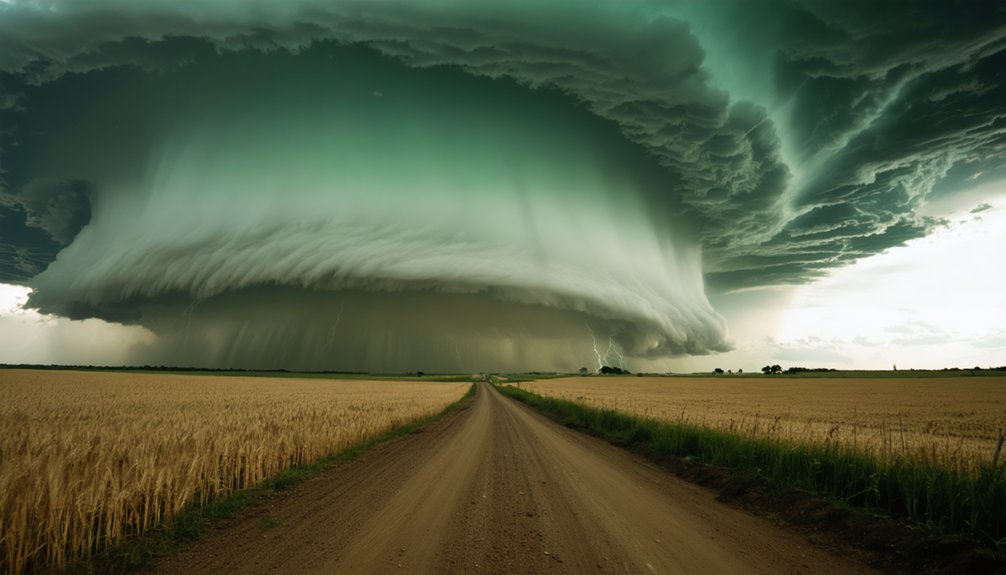
Rural storm chasing exposes you to a category of hazards that don’t announce themselves the way a rotating wall cloud does. Hidden road hazards and weather-related surprises eliminate chasers who’ve already beaten the storm itself.
Standing water on rural roads is deceptively dangerous — hydroplaning at speed causes fatal loss of vehicle control. You won’t always see depth until you’re already committed. Avoid it entirely.
Large hail punishes vehicles and shatters windshields without warning, compromising visibility mid-chase. Lightning becomes critical when you’re isolated on open plains — never position yourself as the tallest structure in proximity.
Avoid bridges and overpasses; they create lethal wind tunnels during tornado passage. Monitor road networks continuously, keep escape routes identified, and never let the storm dictate your options.
Storm Chasing Laws and Ethics on Rural Roads
Storm chasing operates within a legal and ethical framework that you can’t ignore without consequence. Legal compliance isn’t optional—it protects you, rural communities, and other chasers.
Storm chasing demands legal and ethical accountability—consequences follow those who ignore the framework protecting chasers and communities alike.
Community responsibility means you’re accountable for your actions on rural roads.
Follow these non-negotiable ethical and legal standards:
- Stay out of tornado damage areas to avoid obstructing emergency responders
- Report tornado activity to local police or radio stations to protect civilians
- Prioritize rural zones over urban areas to minimize debris hazards and traffic disruption
- Never block rural roads or driveways when deploying equipment
Your freedom to chase depends on maintaining trust with rural communities. Reckless behavior invites restrictions that limit all chasers.
Operate transparently, communicate openly, and treat every rural road as shared public infrastructure deserving respect.
Frequently Asked Questions
What Meteorological Training Programs Are Best for Beginner Storm Chasers?
You’ll want to complete SpotterNetwork.org’s training program, mastering storm prediction fundamentals and weather patterns. Review the Storm Prediction Center’s daily outlooks and study Tim Vasquez’s “Storm Chasing Handbook” for precise, analytical chasing techniques.
How Do You Secure Camera Tripods During High Wind Conditions Outdoors?
Imagine your tripod toppling mid-tornado. You’d secure it using bungee cords tied to street signs, guardrails, or your vehicle, ensuring tripod stability. Wind resistant gear combined with this technique keeps your equipment grounded when gusts surge unpredictably.
Should Storm Chasers Report Tornado Sightings to Local Authorities or Radio?
Yes, you should report tornado sightings using proper reporting procedures—contact local police or utilize radio communication to alert the public swiftly. Timely, accurate reports enhance community safety and empower autonomous decision-making during rapidly evolving severe weather events.
How Many Cameras Should a Storm Chaser Bring on Each Outing?
Bring at least two cameras. Carefully consider camera gear and equipment durability before each outing — having a backup guarantees you’ll maintain timelapse recording without interruption, keeping your footage flowing even when conditions challenge your primary setup.
What Does the ACES Method Stand for in Storm Chasing Safety?
The ACES method keeps you alive: you’ll stay Aware of storm safety conditions, Communicate openly, know your Escape routes, and identify Safe zones — mastering weather awareness guarantees you’re never trapped without options.
References
- https://www.reddit.com/r/stormchasing/comments/1jgc295/a_beginners_guide_to_storm_chasing/
- https://www.youtube.com/watch?v=6otZLjSZvPU&vl=en
- https://www.weather.gov/media/bis/Weather_Spotter_Field_Guide.pdf
- https://www.atms.unca.edu/cgodfrey/courses/swfex/pdf/ChasingSafety.pdf
- https://www.stormchasingusa.com/blog/learning-the-basics-about-storm-chasing/
- https://www.flame.org/~cdoswell/chasesums/Chase_safety.html
- https://www.accuweather.com/en/weather-blogs/weathermatrix/how-to-chase-storms-in-your-local-area/66392
- https://en.wikivoyage.org/wiki/Storm_chasing



