To capture the hailstorm formation process, you need to understand three simultaneous conditions: strong updrafts within cumulonimbus clouds, a freezing level below 11,000 ft (3,400 m), and high liquid-water content with large supercooled droplets. Hailstones grow layer by layer as updrafts circulate them through alternating temperature zones, adding distinct ice layers until gravity overcomes lift. Each variable — elevation, wind shear, updraft strength — determines final hail size, and there’s far more precise detail ahead.
Key Takeaways
- Strong updrafts, a freezing level below 11,000 ft, and high liquid-water content must occur simultaneously for hailstorms to form.
- Supercooled water droplets remain liquid below 0°C until contacting ice nuclei, instantly freezing to form graupel embryos.
- Hailstones grow layer by layer as updrafts and downdrafts circulate them through varying temperature zones repeatedly.
- Opaque layers form through rapid freezing trapping air bubbles, while slower freezing produces clear, transparent ice layers.
- Growth stops when updraft velocity can no longer support the hailstone’s increasing mass, causing it to fall.
What Actually Triggers a Hailstorm to Form
Before a hailstorm can develop, three critical atmospheric conditions must align: strong updrafts within cumulonimbus clouds, a freezing level below 11,000 ft (3,400 m), and high liquid-water content with large water droplets in the cloud layer.
You’re looking at a precise meteorological sequence where each variable directly impacts hailstone structure and final size.
Temperature thresholds drive the entire process. When a significant portion of the cloud layer drops below 0°C (32°F), supercooled water droplets remain liquid until contact with ice nuclei triggers instant freezing.
Continental interiors at mid-latitudes deliver these conditions most consistently.
Solar heating of the ground initiates warm air ascent, generating the thunderstorm updrafts that sustain hail development.
Without all three conditions simultaneously present, hailstone formation simply won’t occur.
Where Hailstorms Form Most Frequently and Why
Continental interiors at mid-latitudes dominate global hail frequency because they consistently deliver the three critical atmospheric conditions: strong updrafts, freezing levels below 11,000 ft (3,400 m), and high liquid-water content. Solar heating drives intense storm energy by warming ground surfaces, triggering powerful updrafts inside cumulonimbus clouds.
You’ll notice these regions experience hail far more than coastal or tropical zones because cloud dynamics operate within colder, drier air masses that sustain hailstone growth cycles. Tropical lowlands rarely produce hail since freezing levels remain too high. Instead, hail there stays confined to elevated terrain.
Wind shear and elevation both amplify growth rates, giving mid-latitude continental zones a decisive structural advantage. Hail can strike within 2 nmi (3.7 km) of the parent storm’s core.
How the Freezing Level Determines Whether Hail Develops
The freezing level acts as the primary atmospheric gate controlling hail development. When it drops below 11,000 ft (3,400 m), you’ve got the critical thermal environment that drives hailstone morphology — determining whether ice layers form transparently or opaquely through wet or dry growth mechanisms.
Above that threshold, water droplets simply don’t freeze consistently enough to sustain embryo formation.
Thunderstorm dynamics intensify this relationship. You need a substantial cloud layer maintaining sub-zero temperatures while strong updrafts circulate embryonic ice through supercooled water zones.
Continental mid-latitude interiors naturally compress the freezing level downward, creating ideal hail-producing conditions.
If the freezing level sits too high, droplets melt before reaching ground.
Understanding this altitude-dependent trigger lets you accurately predict where and when destructive hail will actually develop.
How Supercooled Water Creates a Hailstorm’s First Ice Embryos
Once ordinary water droplets ascend into the cold upper atmosphere, they don’t freeze immediately — they become supercooled, remaining liquid at temperatures below 0°C (32°F). This metastable state is central to cloud microphysics and represents a critical threshold in hailstone development.
When these supercooled droplets contact condensation nuclei or ice nuclei, they freeze instantly, forming small ice pellets called graupel — your hailstone’s first embryos.
Atmospheric instability drives this entire sequence by generating the powerful updrafts that lift droplets into subfreezing altitudes. Without sufficient instability, droplets never reach the temperatures necessary for supercooling.
Warm solar heating energizes ground-level air, initiating the ascent that triggers thunderstorm development. You’re fundamentally watching thermodynamic forcing convert liquid water into structured ice embryos, establishing the foundation for all subsequent hailstone growth.
How Hailstones Build Layer by Layer Through Accretion
As a hailstone moves through the cloud, you’ll see it grow layer by layer when millions of supercooled water droplets collide with its surface and freeze instantly through accretion.
The storm’s updrafts and downdrafts circulate the hailstone vertically, exposing it repeatedly to new droplets and driving continuous ice accumulation.
The freezing rate determines the ice clarity: rapid freezing traps air bubbles, producing cloudy ice, while slower freezing allows bubbles to escape, forming clear ice layers.
Supercooled Droplets Freezing Process
When a hailstone embryo enters the cloud’s supercooled zone, it begins accumulating mass through a process called accretion — millions of supercooled water droplets collide with the stone’s surface and freeze on contact.
The freezing rate directly controls hailstone morphology: rapid freezing traps air bubbles, producing opaque, cloudy layers, while slower freezing allows bubbles to escape, yielding clear, transparent ice. You’re fundamentally watching ice crystal formation dictate the stone’s internal architecture, layer by layer.
Temperatures markedly below 0°C drive dry growth, locking air within the lattice instantly. Near-freezing temperatures trigger wet growth, creating partially transparent zones.
Each vertical circulation cycle through updrafts and downdrafts adds another distinct layer, making cross-sectioned hailstones reliable records of the storm’s internal thermal conditions.
Updrafts Circulating Hailstones Vertically
The layered architecture you see in a cross-sectioned hailstone is the direct physical record of vertical circulation — the mechanism that actually builds those alternating opaque and clear bands. Updrafts and downdrafts cycle hailstones through distinct cloud patterns, each carrying different temperature fluctuations and liquid-water concentrations.
When you’re tracking accretion, you’re watching millions of supercooled droplets freeze sequentially onto the stone’s surface with each vertical pass. Rapid freezing at markedly sub-zero temperatures traps air bubbles, producing opaque layers. Slower freezing near 0°C lets bubbles escape, creating clear ice.
Each circulation cycle deposits one distinct layer. The stone continues growing until the updraft can’t support its increasing mass, at which point gravity wins and it descends to the ground.
Cloudy Versus Clear Ice
Each layer locked inside a hailstone tells you exactly what atmospheric conditions the stone passed through during that circulation cycle. Hailstone textures form based on one critical variable: freezing rate during cloud condensation.
- Instant freezing traps air bubbles, producing opaque, cloudy ice
- Slow freezing lets bubbles escape, creating clear, transparent ice
- Dry growth occurs well below 0°C, locking air into the crystalline structure immediately
- Wet growth occurs near freezing thresholds, allowing partial bubble release for semi-transparent layers
You can literally read a hailstone’s atmospheric history by examining its cross-section. Alternating cloudy and clear bands reveal each vertical circulation pass through zones of varying temperature and liquid-water content.
That layered record gives you precise, unfiltered data about the storm’s internal mechanics.
What’s the Difference Between Wet Growth and Dry Growth?

Hailstone formation follows two distinct mechanisms — wet growth and dry growth — each producing ice with different structural properties. Understanding these processes lets you grasp how hailstone morphology develops under varying thermal conditions.
In wet growth, temperatures hover near 0°C, allowing supercooled water to freeze gradually. Air bubbles escape during slow freezing, producing clear, partially transparent ice layers. Cloud condensation contributes small ice particles that descend and solidify incrementally into distinct shapes.
In dry growth, temperatures fall profoundly below freezing, causing instant solidification upon droplet impact. Trapped air bubbles create opaque, cloudy ice. The freezing rate is the critical variable — fast freezing locks in opacity, slow freezing permits clarity.
Both mechanisms operate within the same thunderstorm, alternating as the hailstone cycles through different temperature zones vertically.
Why Updraft Strength Controls How Large a Hailstorm’s Stones Grow
When a thunderstorm’s updraft velocity matches or exceeds a hailstone’s terminal fall velocity, the stone stays suspended and continues accreting mass.
You can think of this as a direct weight-versus-lift balance: as the hailstone grows heavier, it demands stronger updraft support to remain aloft.
Once the updraft weakens or the stone’s weight exceeds the available lift, the hailstone descends to the ground without further growth.
Updraft Velocity Determines Size
How strong does a thunderstorm’s updraft need to be to keep a hailstone airborne? The answer directly controls final hailstone size. Stronger updrafts suspend stones longer, allowing atmospheric moisture and accretion layers to build hailstone textures ranging from opaque to transparent.
Key factors you’ll need to understand:
- Updraft velocity must exceed the hailstone’s terminal fall speed to maintain suspension.
- Weakening updrafts immediately trigger descent, halting growth.
- Higher atmospheric moisture concentrations accelerate accretion during suspension.
- Wind shear influences updraft consistency, directly impacting maximum achievable size.
Once the updraft can’t support the stone’s weight, it falls. You’re fundamentally watching a physics threshold get crossed.
The storm’s internal dynamics, not external conditions, determine whether you’ll find pea-sized pellets or grapefruit-sized destruction on the ground.
Weight Versus Updraft Balance
Every hailstone aloft represents a live equilibrium between gravity pulling it down and updraft velocity pushing it up. Once a stone’s mass exceeds the updraft’s lifting capacity, it falls. You can think of this as thunderstorm dynamics enforcing a hard size ceiling on every hailstone.
Hailstone composition directly affects this balance. Cloudy, air-trapped ice weighs less per unit volume than dense, clear ice formed during wet growth. Denser stones thus require stronger updrafts to stay suspended and continue growing.
When updraft strength weakens—whether from storm weakening or the stone drifting laterally—descent begins immediately, halting further accretion. The largest documented hailstone, 8 inches in diameter, required extraordinarily powerful updrafts to reach that mass before finally falling to the ground.
Weakening Updrafts Trigger Descent
Updraft velocity isn’t just what keeps hailstones airborne—it’s the primary variable controlling their final size. Once cloud condensation activity peaks and updraft strength begins dropping, hailstones exceed the velocity threshold the storm can sustain.
Lightning triggers often coincide with this structural weakening, signaling internal storm reorganization.
Watch for these descent-triggering conditions:
- Updraft velocity drops below the hailstone’s terminal velocity, initiating immediate descent
- Stone mass increases beyond what weakened airflow can mechanically support
- Storm reorganization redistributes energy, cutting off vertical circulation paths
- Lateral drift moves hailstones outside the updraft core entirely
Once any condition above activates, growth stops permanently. You’re looking at a closed system—no further accretion occurs after descent begins. Final size reflects exactly how long peak updraft conditions persisted.
How Elevation, Wind Shear, and Freezing Zones Accelerate Hail Growth
Several environmental factors — elevation, wind shear, and freezing zone depth — directly control how fast hailstones grow. When you’re analyzing hailstorm conditions, higher elevations accelerate growth rates by compressing the distance between cloud condensation layers and freezing altitudes. This shortens the time supercooled droplets travel before ice nucleation occurs, maximizing accretion efficiency.
Wind shear restructures updraft geometry, tilting the storm column so hailstones recirculate through high liquid-water zones repeatedly. You’ll notice this dramatically extends growth cycles without requiring stones to exit the updraft prematurely.
Lower freezing zones — below 11,000 ft (3,400 m) — expose hailstones to subfreezing conditions earlier, increasing collision frequency with supercooled droplets.
Together, these three variables compound growth rates, producing larger, denser hailstones than any single factor could generate independently.
Why Some Hailstorms Produce Far Larger Stones Than Others
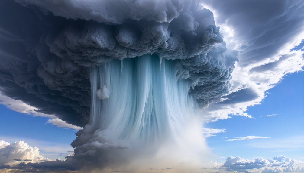
Those compounding environmental variables explain growth rates, but they don’t fully account for why one storm drops golf ball-sized hail while a neighboring cell produces only pea-sized stones. Several precise conditions separate minor hail events from destructive ones:
- Updraft strength: Stronger updrafts suspend hailstones longer, enabling extended accretion cycles.
- Cloud condensation nuclei concentration: Higher concentrations supply more supercooled droplets for continuous hailstone coating.
- Liquid water content: Denser droplet populations accelerate surface accumulation per vertical pass.
- Updraft width: Wider columns prevent hailstones from drifting into downdraft zones prematurely.
You’re fundamentally looking at a competition between gravity and atmospheric energy. When updrafts exceed 100 mph, stones recirculate repeatedly, stacking ice layers until weight finally wins.
Neighboring cells with marginally weaker updrafts simply can’t sustain that growth window.
Frequently Asked Questions
Can Hailstones Melt Completely Before Reaching the Ground?
Yes, hailstones can melt completely before reaching the ground. As you track hailstone composition, warmer air layers below the freezing point accelerate the melting point threshold, causing smaller hailstones to fully liquefy during descent.
How Fast Do Hailstones Typically Travel When Falling?
Falling fast, you’ll find hailstone size directly drives fall velocity. Smaller pea-sized stones descend around 20 mph, while larger grapefruit-sized hailstones can plummet exceeding 100 mph, giving you dramatically different impact intensities.
How Long Does a Typical Hailstorm Last From Start to Finish?
You’ll find a typical hailstorm lasts 5–10 minutes, though storm duration varies with hailstone size. Larger stones indicate stronger updrafts, potentially extending activity. You’re facing peak intensity within the first few minutes of onset.
Can Hailstorms Occur During Winter Months or Only Summer?
You can shatter hailstorm myths—winter hail isn’t some frozen unicorn! You’ll find hail forms whenever freezing levels drop below 11,000 ft, making continental interiors viable year-round, though summer’s intense updrafts dominate frequency.
Are There Any Methods Currently Used to Prevent Hailstorm Damage?
You can leverage hail damage prevention through storm forecasting advancements, hail-resistant roofing materials, protective vehicle coverings, and crop netting systems. Early warning systems let you act swiftly, minimizing structural and agricultural losses before hailstones strike.
References
- https://en.wikipedia.org/wiki/Hail
- https://www.nssl.noaa.gov/education/svrwx101/hail/
- https://mrcc.purdue.edu/living_wx/hail
- https://gpm.nasa.gov/resources/faq/how-does-hail-form
- https://www.youtube.com/watch?v=lcr53s6V5Mw
- https://vortex.plymouth.edu/dept/tutorials/precip/precip2f.html
- https://www.youtube.com/watch?v=TQXUzE1_L_U
- https://www.youtube.com/watch?v=Mlbv7n0phfE
- https://www.youtube.com/watch?v=M3E07b8eCMw
- https://www.cnn.com/2023/04/26/weather/hail-formation-xpn-scn



