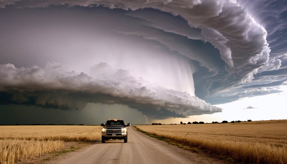
From OKC, you’ll take I-35 or I-235 to I-40 westbound, covering roughly 300 miles to Dodge City. Fuel at Weatherford or Clinton before road density drops past Elk City. Exit at Clinton (Exit 101), Elk City (Exit 80), or Sayre (Exit 20) depending on storm speed and angle. Use KTLX, KVNX, and KDDC radar cross-references to compensate for low-level coverage gaps. There’s a lot more tactical detail that’ll sharpen every decision you make on this corridor.
Key Takeaways
- Start from OKC via I-35 or I-235, merging onto I-40 westbound toward Weatherford, Clinton, and Elk City for storm positioning.
- Fuel at Weatherford or Clinton early, as road infrastructure and services decrease significantly past Elk City toward the Panhandle.
- Exit I-40 strategically at Clinton (Exit 101), Elk City (Exit 80), or Sayre (Exit 20) based on storm speed and direction.
- Enter southwest Kansas via US-83, US-54, or US-283, keeping fuel above half-tank through the sparse tri-corner zone.
- Cross-reference KTLX, KVNX, and KDDC radar sites to compensate for low-level coverage gaps across western Oklahoma and the Texas Panhandle.
Why OKC Is the Ideal Launch Point for Dodge City Chases
Oklahoma City sits at a geographic and logistical sweet spot for launching Dodge City storm chases. You’re positioned roughly 300 miles southeast of Dodge City, giving you time to monitor morning soundings, refine chase strategies, and adjust your departure based on shifting weather patterns.
OKC’s road network connects directly to I-40 westbound via I-35 and I-235, eliminating unnecessary repositioning before you’ve even left the metro. The airport, fuel infrastructure, and hotel density make it a reliable staging hub.
You can push west toward Clinton or Elk City, reassess at midday, then commit north through the Texas Panhandle into southwest Kansas. That flexibility is what makes OKC valuable—you’re not locked into a fixed corridor before the atmosphere has shown its hand.
Leave OKC on the Right Roads West
Leaving OKC on the right roads saves you repositioning time when every minute counts.
From northwest OKC, access I‑40 westbound via I‑35 or I‑235 — both feed directly into your primary storm tracking corridor without backtracking through surface streets.
If you’re launching from Norman or central OKC, merge onto I‑40 west near the I‑35 interchange and hold that heading.
Your first critical fuel stops fall at Weatherford (mile ~80) and Clinton (mile ~100) — don’t skip them.
Western Oklahoma’s road density drops sharply past Elk City, and dry tanks kill intercepts.
Once you clear Sayre, shift off I‑40 onto OK‑152 or US‑183 to position south of developing cells before they cross into the Texas Panhandle corridor.
Drive Western Oklahoma on I-40 Like a Pro
Once you’re westbound on I‑40, treat the corridor between Weatherford and Elk City as your active positioning window — storms initializing over the TX Panhandle or western OK typically give you 60–90 minutes before they become intercept-critical.
Once westbound on I‑40, the Weatherford–Elk City corridor is your positioning window — use every mile of it.
Use that window aggressively for storm tracking and real-time route adjustment.
Apply these driving techniques to stay ahead:
- Fuel at Clinton or Elk City — don’t cross into the Panhandle below a half tank.
- Monitor exit spacing — OK‑34, US‑183, and OK‑152 are your bailout vectors south toward storm cores.
- Pace at 70–75 mph — faster risks missing critical radar checks; slower costs positioning time.
Western Oklahoma’s road grid rewards disciplined drivers who treat every mile as a tactical decision.
Which Oklahoma Exits Give You the Best Storm Angle?
Where you exit I‑40 determines whether you intercept a storm on its ideal inflow side or chase its tail for the next 40 miles. Your exit strategy hinges on storm motion and your target quadrant.
Exit 101 (Clinton) puts you on OK‑73 north, giving you a southeast storm angle on northeastward-tracking supercells.
Exit 80 (Elk City) connects quickly to US‑283 north, ideal when storms initiate near the KS/OK border.
Exit 20 (Erick/Sayre) drops you onto OK‑152, letting you run west-northwest and cut south of rotating updrafts before they cross into the Texas Panhandle.
Match your exit to the storm’s forward speed. A 30 mph northeastward mover rewards earlier exits; a slower storm lets you push further west before committing north.
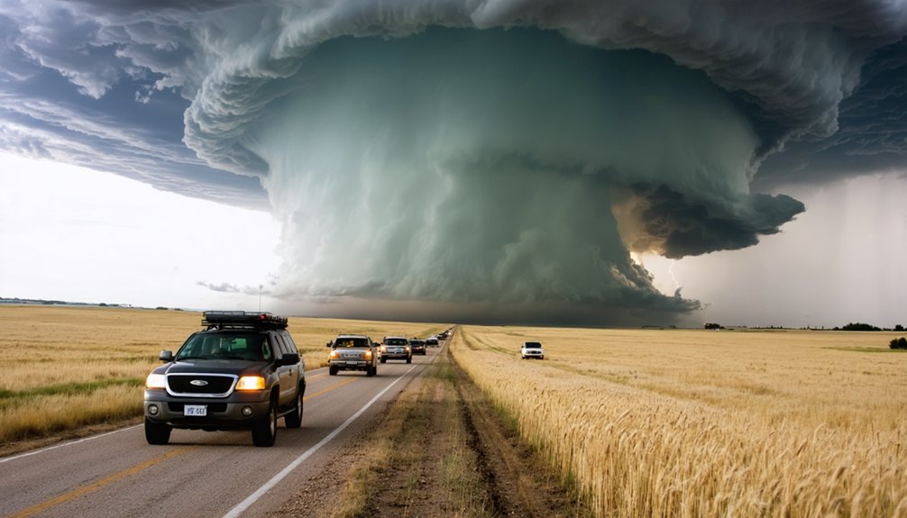
Which Texas Panhandle Roads Keep You Ahead of the Storm?
Crossing into the Texas Panhandle from OK‑152 or US‑283 puts you on a flat, exposed grid where road choice directly controls your margin against a 40–55 mph northeastward-tracking supercell. Your storm strategy here depends on reading road density before committing south.
- FM‑1046 and FM‑592 run parallel to storm motion, letting you pace the mesocyclone while maintaining eastward escape options.
- US‑83 northbound gives you a hard intercept axis toward Liberal, Kansas, but limits lateral flexibility—fuel at Wheeler or Canadian before committing.
- Wheeler‑to‑Shamrock corridor (US‑83/US‑60) offers the best road safety buffer, keeping you southeast of the forward flank while preserving multiple northbound cutoffs.
Avoid dirt county roads after rain—red clay becomes impassable within minutes, eliminating your repositioning window entirely.
Cross Into Southwest Kansas From the South
As you push north out of the Texas Panhandle, your primary entry corridors into southwest Kansas run along US‑83 toward Hugoton or US‑54 toward Ulysses—both offer paved, high-visibility approaches with minimal dead-end risk.
From Ulysses, you can intercept storms tracking northeast by angling onto US‑56 or KS‑25 toward Cimarron and Dodge City. Storm patterns in this corridor typically favor northeast movement at 30–50 mph, so your chase strategies must prioritize eastward flexibility.
Keep fuel above half-tank crossing the tri-corner zone—infrastructure thins quickly. The Minneola–Dodge City axis remains your best repositioning spine once you’re inside Kansas.
KDDC radar gives solid low-level coverage here, letting you time your northern push with precision and maintain forward positioning without overcommitting on secondary roads.
The Best Roads Into Dodge City for Storm Intercepts
Once you’ve crossed into southwest Kansas, you’ll primarily use US-54, US-56, KS-43, or US-283 to enter Dodge City from the south or southeast, depending on storm motion and intercept angle.
Your positioning decision hinges on radar data from KDDC, which gives you reliable coverage to track supercell movement and anticipate ideal intercept windows.
Dodge City’s road grid, anchored by I-135 and US-54 intersections, gives you multiple repositioning options when storms shift track unexpectedly.
Key Entry Roads Listed
Several key roads feed into Dodge City from the south and southeast, and knowing which one to take depends on storm motion and your current position.
Effective storm tracking and route planning hinge on selecting the right corridor before traffic or hail cores cut off your options.
- US-283 – Approaches from the south via Liberal; ideal when storms track northeast and you need a clean intercept angle.
- US-54 – Runs east-west through Dodge City; best for lateral repositioning when storms accelerate northward unexpectedly.
- KS-43 – A southeastern entry offering tighter positioning when supercells initiate near the Oklahoma border and push north-northeast.
Each road provides distinct advantages, so monitor storm motion continuously and commit early to avoid getting caught in the wrong corridor.
Positioning For Storm Intercepts
Knowing which roads feed into Dodge City is only half the equation — you still need to time your approach based on storm motion, speed, and your current GPS position.
Effective intercept techniques demand that you calculate storm vector against your available road grid before committing to a route. If a supercell’s tracking northeast at 35 mph, US-283 northbound may cut off your exit window faster than you’d expect.
Your storm strategies should prioritize parallel positioning — staying south or southwest while the cell matures — then punching north on KS-43 or US-56 at the precise intercept window.
Monitor KDDC radar loops continuously. One wrong turn onto a gravel section costs minutes you won’t recover. Mobility equals safety; never let positioning lock you into a dead-end approach.
Dodge City Road Grid
Dodge City’s road grid gives you four primary intercept vectors worth memorizing before you arrive: US-283 from the south, US-56 from the southeast, US-54 from the east, and KS-43 cutting in from the southwest.
Road accessibility here is strong, but traffic conditions near downtown can bottleneck repositioning when storms approach rapidly.
- Monitor weather alerts before committing to a vector — storm patterns shift fast near Dodge City’s flat terrain, creating visibility issues with little warning.
- Pre-plan fuel availability at Minneola or Ashland; options thin out quickly on southwest KS farm roads.
- Note local landmarks like the Ford County Fairgrounds or US-283/US-54 junction for rapid route planning adjustments.
Emergency services response times vary greatly outside city limits, so self-sufficiency remains essential.
Radar Coverage Gaps Between OKC and Dodge City
As you move from OKC toward Dodge City, you’ll encounter radar coverage gaps—particularly in western Oklahoma near the KVNX and KTLX beam-overlap zones, where low-elevation scans miss storm-base data below 5,000 feet.
You can partially compensate by cross-referencing KDDC’s coverage as you enter southwest Kansas, but the shift zone through the Texas Panhandle remains the most data-sparse corridor on this route.
In low-coverage zones, you’ll need to rely on spotter networks, mobile apps with multi-radar composites, and your own visual confirmation to maintain accurate storm positioning.
Key Radar Coverage Gaps
Radar coverage between Oklahoma City and Dodge City relies on three primary WSR-88D sites—KTLX (Oklahoma City), KVNX (Vance AFB, Enid), and KDDC (Dodge City)—but beam-elevation geometry creates low-level blind spots, particularly in western Oklahoma and the Texas Panhandle.
Understanding these radar limitations lets you chase smarter and stay ahead of developing storms.
Key blind spot zones include:
- Western Oklahoma (near Sayre/Elk City): KTLX beam overshoots low-level rotation beyond ~120 nm.
- Texas Panhandle corridor: KDDC and KVNX overlap weakens below 3,000 ft AGL near the OK/TX border.
- Southwest Kansas approaches: KDDC’s southern range degrades low-level data near Ulysses and Hugoton.
Your coverage strategies should incorporate mobile radar apps, dual-tilt analysis, and real-time spotter networks to compensate for these gaps.
Once you’ve identified the key blind spot zones along the OKC-to-Dodge City corridor, you’ll need concrete strategies to compensate for degraded low-level radar data.
Cross-reference KTLX, KVNX, and KDDC tilt angles simultaneously—when one radar’s beam overshoots below 3,000 feet, another may partially fill the gap.
Integrate mobile apps like RadarScope with dual-pane viewing to track storm patterns across multiple sweep elevations.
In western Oklahoma and the Texas Panhandle, reposition your vehicle southward to reduce slant-range distance, improving your effective resolution.
Deploy spotter network feeds and SPC mesoanalysis to supplement blind-zone gaps.
For southwest Kansas, your chase strategies must account for KDDC’s range limitations near Minneola—surface observations and visible satellite imagery become critical real-time supplements when low-level rotation signatures disappear from standard displays.
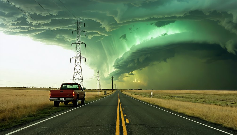
Road Hazards to Expect on This Chase Corridor
Chasers working the OKC-to-Dodge City corridor should plan for surface hazards that vary greatly by segment. Road conditions shift fast, and visibility challenges compound risk during active chase windows.
- Western Oklahoma clay roads — Red clay surfaces west of Clinton become dangerously slick after rain, cutting your exit speed considerably.
- Texas Panhandle isolation — Farm-to-market roads like FM-1046 offer minimal infrastructure; a disabled vehicle here means extended delays with no nearby support.
- Southwest Kansas gravel shifts — Unpaved county roads south of Dodge City produce loose gravel conditions that reduce braking efficiency and compromise tire grip at repositioning speeds.
Pre-run your fuel stops, carry a tire repair kit, and keep margin in your positioning decisions—terrain won’t forgive reactive driving on this corridor.
Frequently Asked Questions
What Time of Year Are OKC to Dodge City Chases Most Productive?
You’ll find the chase season most productive from late April through early June, when storm patterns align peak moisture, instability, and wind shear, driving supercell development across western Oklahoma and southwest Kansas toward Dodge City.
How Much Fuel Should You Carry Crossing the Texas Panhandle?
Sure, just wing it—what could go wrong? Seriously, carry a 5-gallon reserve can. The Panhandle’s sparse infrastructure demands strict route planning and fuel efficiency calculations; you’ll stretch freedom across desolate miles without gambling on empty tanks.
Are There Reliable Cell Data Signals Throughout the Entire Chase Corridor?
You won’t find consistent cell coverage across the full corridor. Signal reliability drops sharply in the Texas Panhandle and western Kansas. Carry a satellite communicator as backup to maintain real-time radar access through dead zones.
What Is the Average Chase Trip Cost From Oklahoma City to Dodge City?
You’ll typically spend $150–$300 per chase trip, covering fuel, food, and lodging. Factor chase expenses into your route planning early—fuel costs dominate, especially across western Oklahoma’s sparse corridors toward Dodge City.
You can navigate solo safely if you prioritize solo safety protocols: monitor KDDC/KVNX radar continuously, use navigation tips like pre-planned escape routes on US-54, and maintain constant communication via GPS tracker and weather radio.
References
- http://www.johnefarley.com/chase51114.htm
- https://www.stormchasingusa.com/departure-cities/oklahoma-city-oklahoma/
- https://meteor.geol.iastate.edu/~jdduda/chasing/2012/041412.html
- https://stormbruiser.com/chase/2016/05/24/may-24-2016-dodge-city-ks-tornadoes/
- https://www.youtube.com/watch?v=GfaUAKSIFkY
- https://www.stormchasingusa.com/blog/day-5-dodge-city-ks-the-perfect-storm/
- https://www.quincyvagell.com/guide-western-oklahoma/
- https://stormtrack.org/threads/chase-case-2.16401/
- https://www.weather.gov/ddc/chaser
- https://www.flame.org/~cdoswell/chasesums/Chase_09.html