Tracking tornadoes like a pro starts with reading surface winds of 30–35 knots, dew point spreads of 15°F or less, and low-level wind shear before a storm develops. You’ll need six core tools, a southeast position for the clearest rotation view, and radar signatures showing bright reds and greens side-by-side. Confirm ground contact with rotating debris, report precise GPS coordinates, and always pre-map escape routes. Every tip ahead sharpens your edge when conditions accelerate fast.
Key Takeaways
- Position yourself southeast of the storm for the clearest view of wall clouds, funnels, and rotation indicators without obstruction.
- Confirm tornadoes by observing rotating debris or spray at ground level, not funnel clouds alone.
- Monitor southerly surface winds of 30–35+ knots and dew point spreads of 15°F or less for high tornado potential.
- Document exact time, GPS coordinates, nearest town, distance, and visual details, updating reports frequently as the storm moves.
- Pre-map multiple escape routes perpendicular to storm movement, keeping your vehicle pointed toward an exit at all times.
Read Wind Speeds and Dew Points Before a Tornado Forms
Before a tornado ever forms, you’ll want to check surface winds for southerly to southeasterly flow hitting at least 30–35 knots, with higher-risk environments pushing 50–60 knots.
Wind stability in the lowest one to three kilometers matters just as much as raw speed—you need good directional turning through that layer to establish rotation potential.
Next, assess your dew point. A dew point depression of 15 degrees or less places you in that 15–20 degree spread zone where tall, classic tornadoes frequently develop.
Tighter spreads mean a lower cloud base, which directly increases touchdown probability.
Finally, confirm surface winds are more easterly than 850-level winds. That directional difference drives the low-level shear that makes dangerous tornado environments distinct from ordinary thunderstorm setups.
Carry These Six Essential Tools Every Time You Spot
You’ll need six core items every time you deploy: a watch, pencil, notebook, cell phone, colored Spotter Quick Reference Guide, and a reliable vehicle with a planned escape route.
Each tool serves a precise function—the notebook and pencil capture exact times, locations, and visual details that digital devices can fail to record under field conditions.
Your Quick Reference Guide keeps critical identification criteria—radar signatures, wind thresholds, and reporting protocols—immediately accessible without relying on memory under high-stress observation.
Core Gear Essentials
Every spotter needs six core tools before stepping into the field: a watch, pencil, notebook, cell phone, and a colored Spotter Quick Reference Guide. These aren’t suggestions—they’re operational requirements rooted in historical tornado patterns and tornado climatology data that demand precise, real-time documentation.
Your watch timestamps critical events to the second. Your pencil and notebook capture conditions, locations, and visual details without relying on battery-dependent technology.
Your cell phone transmits reports instantly to warning coordinators. Your Quick Reference Guide cross-references radar signatures and environmental indicators on the spot.
Each tool serves a distinct function that protects both you and the data stream feeding forecasters. Missing even one compromises your accuracy and your safety.
Prepare your kit before every deployment—no exceptions, no shortcuts.
Reference Guides Matter
When you’re out in the field tracking tornado signatures, your colored Spotter Quick Reference Guide bridges the gap between raw observation and accurate interpretation—cross-referencing radar color patterns, dew point depressions, and wind thresholds the moment conditions shift.
It’s your fastest verification tool when bright reds and greens appear side-by-side on velocity scans.
Wind shear values and atmospheric stability indices printed in the guide let you instantly validate whether surface winds at 30–35 knots with proper directional turning support rotation potential.
You’re not guessing—you’re confirming against established thresholds.
Keep the guide physically accessible, not buried in a bag. Conditions deteriorate fast, and fumbling costs you critical seconds.
Pair it with your notebook, and you’ve got a field-ready system that keeps your assessments sharp, documented, and defensible.
Position Yourself Southeast of the Storm for the Best View
When tracking a tornado, you’ll want to position yourself to the southeast of the storm to maintain the clearest, most unobstructed sightline to the rotating wall cloud and any developing funnel.
This southeast vantage point keeps you out of the storm’s primary forward path while giving you a direct angle on the inflow region where ground-level rotation and debris are most visible.
Always identify your emergency escape route before the storm closes in, prioritizing south or east roads that carry you perpendicular to the storm’s typical northeast movement.
Optimal Southeast Positioning Benefits
Positioning yourself to the southeast of a storm gives you the clearest, most unobstructed sightlines to the tornado and its associated wall cloud. From this vantage point, you’re looking into the storm’s inflow region, where wind shear drives low-level rotation and cloud formation becomes most visible and structured.
Key advantages of southeast positioning include:
- Unobstructed visual access to the mesocyclone and rotating wall cloud
- Direct observation of ground-level debris or rotational spray confirming tornado touchdown
- Optimal angle to detect counterclockwise rotation against the storm’s base
- Safe distance from the storm’s most dangerous forward-moving core
This position keeps you out of the primary threat zone while maximizing your ability to track, report, and document storm behavior with precision and accuracy.
Emergency Escape Route Planning
Southeast positioning gives you the best view, but that advantage disappears the moment a storm shifts direction and cuts off your exit. Before you commit to any location, map your escape route the same way researchers track wildlife migration — with multiple corridors plotted in advance, not improvised under pressure.
Storm surge patterns in tornado environments shift rapidly, especially when supercells accelerate or jog unexpectedly. Identify at least two perpendicular exit roads moving south or east, away from the storm’s primary track. Avoid roads running parallel to storm movement — those become traps.
Monitor storm motion continuously. If forward speed increases or direction deviates more than 20–30 degrees, execute your exit immediately. Your freedom to observe depends entirely on your freedom to leave.
Spot Tornado Rotation on Radar Before It Touches Down
Radar gives you a critical head start on tornado touchdown if you know what signatures to look for. Radar signature interpretation starts with spotting bright reds and greens touching side-by-side at the same vertical level—your strongest rotation indicator.
Mesocyclone identification precedes touchdown, so track whole-storm core rotation early:
- Red moving northbound with green moving southbound signals counterclockwise rotation.
- Bright adjacent red and green colors confirm a developing mesocyclone.
- High correlation coefficient with vertically aligned features indicates horizontal rotation.
- Yellow touching light green suggests early-stage mesocyclone formation.
Don’t wait for visual confirmation alone. Radar shows you rotation developing minutes before a funnel descends. Cross-reference velocity data with correlation coefficient readings to build a complete picture of what’s organizing aloft.
Confirm a Tornado With These Ground-Level Visual Clues
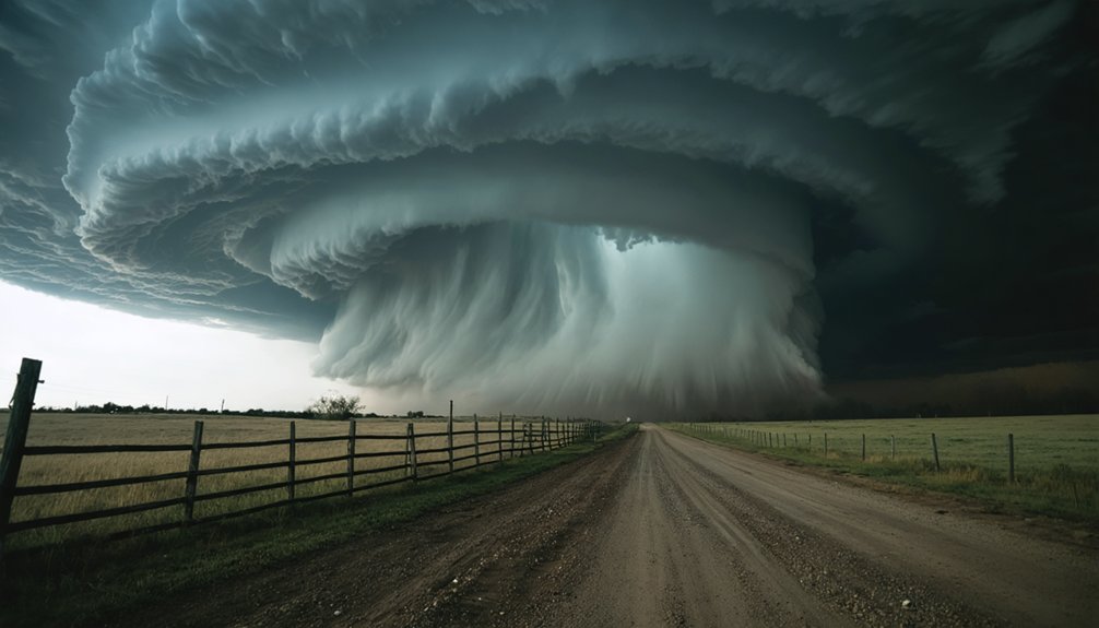
Ground-level visual clues separate a confirmed tornado from a rotating wall cloud or funnel cloud that never completes contact.
Ground-level visual clues are the deciding factor between a confirmed tornado and one that never fully develops.
You must observe rotating debris effects at the surface — dirt, dust, or spray spinning beneath the cloud base — before classifying what you’re seeing as an actual tornado. A condensation funnel alone doesn’t confirm it.
Focus on cloud base identification to establish your reference point. Lower cloud bases correlate with higher touchdown probability, so track that altitude carefully.
If persistent rotation exists at the cloud base but you see zero ground-level debris effects, you’re watching a precursor, not a confirmed tornado.
The moment rotating material lifts from the surface beneath that rotation, you’ve got confirmation.
Document exact time, location, and viewing direction immediately.
Report Your Tornado Location Accurately and Update Often
Once you’ve confirmed a tornado, accurate location reporting becomes your immediate priority. Reference the nearest town to the nearest 1/10 mile using one of 16 compass points. Satellite imagery and atmospheric stability data support your ground-truth reports, so precision matters.
Include these critical elements every time:
- Exact time of observation with your current location clearly separated from the event’s location
- Viewing direction toward the tornado or funnel to help analysts triangulate position
- GPS coordinates or major cross streets for pinpoint accuracy
- Visual details including rotation characteristics, debris presence, and funnel width
Update frequently. Storm movement shifts fast, and stale data misleads emergency responders. Your real-time reports fill gaps that radar alone can’t resolve.
Your reports are vital—stay sharp, stay mobile, and keep transmitting.
Always Have an Escape Route Ready Before the Storm Moves

Before you deploy to any storm position, you must identify at least one emergency escape route. Tornado formation accelerates rapidly, and storm structure can shift direction within minutes, cutting off roads you’d planned to use.
Position yourself southeast of the target storm, but always know which perpendicular road lets you move away from the storm’s forward path quickly.
Mobile spotters must treat escape planning as non-negotiable. Study your map before deployment, not during pursuit.
Identify paved roads running north or south that cross the storm’s expected track at safe angles. Avoid dead-end roads, flooded low-water crossings, and narrow rural paths.
Keep your vehicle pointed in your exit direction whenever possible. If your route becomes compromised, execute your escape immediately—don’t wait for visual confirmation of danger.
Frequently Asked Questions
How Many Miles Apart Should Storms Be for Optimal Tracking Success?
You’ll want at least 30–40 miles of storm separation to maximize tracking accuracy. This spacing gives you the freedom to monitor individual storm behavior, movement, and development without interference from adjacent systems compromising your data.
Why Is Spotting With a Partner Considered Critical for Spotter Safety?
You’re never truly flying solo when storm safety’s on the line. Spotting with a partner’s critical because partner communication gives you extra eyes and ears, catching unexpected threats you’d otherwise miss entirely.
What Radar Colors Indicate a Possible Mesocyclone Rather Than a Confirmed Tornado?
When you’re analyzing radar interpretation, yellow touching light green signals a possible mesocyclone. Color significance matters—these hues suggest rotation, but you’ll need bright reds and greens directly adjacent to confirm you’ve got a tornado.
How Does Cloud Base Altitude Affect the Probability of Tornado Touchdown?
When you observe lower cloud formation, you’re seeing a direct altitude impact on touchdown probability — the closer the cloud base is to the ground, the higher your confirmed tornado risk becomes. Monitor it precisely.
How Many Compass Points Should Be Used When Reporting a Tornado Location?
Use 16 compass points when reporting a tornado’s location. You’ll reference historical tornado patterns, apply storm prediction models, and pinpoint the nearest cultural center to 1/10 mile — ensuring precise, data-driven reports that empower your freedom to track accurately.
References
- https://www.weather.gov/media/mkx/spotters/spotter_do_dont.pdf
- https://www.youtube.com/watch?v=ItwB1laKdF0
- https://www.youtube.com/watch?v=ar1RzrS6YL4
- https://www.youtube.com/watch?v=KvFS8upRANU
- https://www.popularmechanics.com/culture/movies/a6671/tornado-alley-imax-how-to-track-a-tornado/
- https://www.weather.gov/media/ohx/PDF/StormSpotting.pdf
- https://www.weather.gov/oun/stormspotting



