Storm chasing isn’t about thrill-seeking — it’s a structured scientific discipline where you collect ground-truth atmospheric data that radar and satellites can’t capture alone. You’ll reposition dynamically to intercept supercells, validate Doppler radar signatures, and report real-time conditions to the National Weather Service for faster, more accurate warnings. Chasers use mobile Doppler radar, drones, and nowcasting to build multidimensional storm profiles. The science behind every chase decision runs deeper than most realize.
Key Takeaways
- Storm chasers serve as mobile ground-truth observers, reporting real-time hazardous weather data to authorities to enable faster, more accurate public warnings.
- Unlike stationary spotters, chasers dynamically reposition to intercept storms, confirm tornado touchdowns, and enhance severe weather databases through mobile observations.
- Chasers use supercomputer weather models, satellite data, and Doppler radar to analyze storm structure, rotation signatures, and precise movement vectors.
- Tornadoes form from rotating air columns within supercells, though only approximately 30% of supercells produce tornadoes, making accurate targeting essential.
- Advanced tools like mobile Doppler radar and atmospheric drones capture in-situ storm data, filling critical gaps that traditional radar systems cannot address.
What Storm Chasers Actually Do and Who They Help
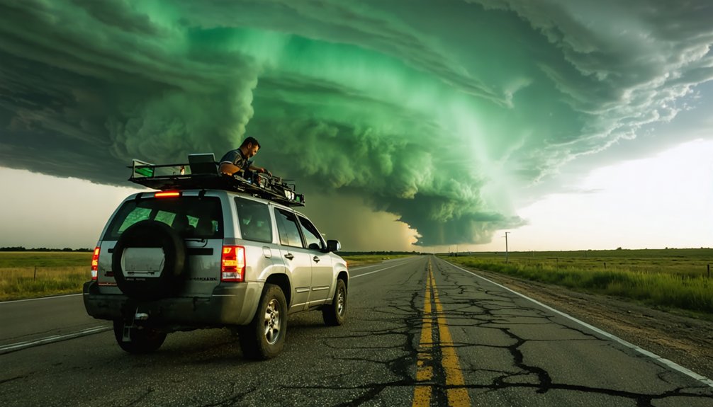
While storm chasing conjures images of thrill-seekers racing toward funnel clouds, it serves a critical operational function: chasers act as mobile ground-truth observers, reporting real-time hazardous weather data directly to authorities who issue life-saving warnings.
Storm chaser motivations vary widely across curiosity, scientific inquiry, and media documentation, yet each role strengthens severe storm databases and forecast reliability. You’ll find that the storm chaser community operates across a spectrum—from volunteers coordinating with agencies like the National Weather Service to professionals embedded in university or government research projects.
Unlike fixed-location spotters, chasers pursue storms dynamically, often becoming the first to confirm tornado touchdowns. This mobile advantage delivers ground-level verification that radar alone can’t provide, directly enabling faster, more accurate warnings that protect lives and communities.
Storm Chasers vs. Storm Spotters: What Sets Them Apart
Both storm chasers and storm spotters report hazardous weather, but their operational structures differ fundamentally.
Storm spotters operate from fixed locations, affiliated with organizations like the Nebraska Amateur Radio Emergency Services or Civil Air Patrol, and report directly to the National Weather Service. You’re looking at a stationary network built on volunteer participation dating back 40 years.
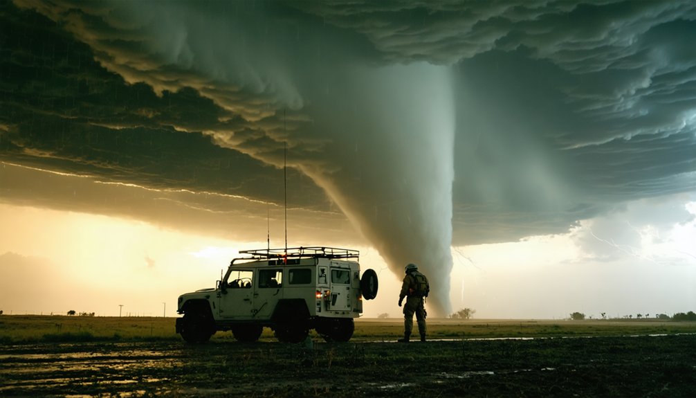
Storm chasers, however, operate dynamically. You’re mobile, repositioning continuously to intercept storms, which makes you the first to confirm tornado touchdowns and trigger town-wide warnings. That mobility generates ground-truth data that fixed spotters simply can’t produce.
Storm chasers stay mobile, repositioning to intercept storms and confirm tornado touchdowns before warnings can reach threatened towns.
Where spotters reinforce forecast reliability from set positions, chasers enhance climatological databases through real-time mobile observations.
Both functions matter, but storm chasers deliver a flexibility that fundamentally expands severe weather intelligence.
How Storm Chasers Forecast and Prepare for a Chase
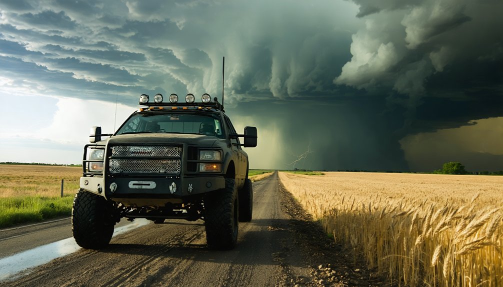
That mobility advantage only holds if you’ve done the forecasting work before you ever leave your driveway. Your preparation techniques determine whether you intercept a supercell or waste 10 hours on an empty highway.
Core forecasting methods you’ll execute:
- Model Analysis – Run supercomputer-generated weather models 24–72 hours ahead to identify atmospheric instability zones.
- Satellite Monitoring – Track real-time cloud formation, storm shape, and moisture boundaries on event day.
- Radar Interpretation – Read storm structure, rotation signatures, and movement vectors before positioning yourself.
- Nowcasting – Continuously update your situational awareness using live radar feeds and trained observer reports during active pursuit.
Each layer sharpens your decision-making, cutting unnecessary risk while maximizing your intercept window.
Precision preparation equals earned freedom in the field.
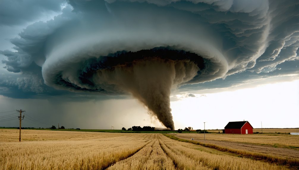
How Tornadoes Form: and Why Chasers Target Supercells
When you’re chasing storms, understanding tornado formation gives you a critical edge: tornadoes develop as rotating air columns that extend from cumulonimbus clouds or supercells to the ground, driven by wind speed changes with altitude that create horizontal spin, which updrafts then tilt vertically into a mesocyclone.
Cold air downdrafts concentrate that rotation further, but you should know that only roughly 30% of supercells actually produce tornadoes.
Supercells remain your primary target because their persistent rotation, detectable via Doppler radar, distinguishes them from ordinary thunderstorms and maximizes your probability of witnessing a tornado event.
Tornado Formation Process
Tornadoes don’t simply drop from the sky—they’re the product of a precise atmospheric chain reaction that storm chasers have spent decades learning to anticipate.
Understanding the tornado lifecycle means decoding specific atmospheric conditions that trigger rotation:
- Wind shear shifts speed and direction with altitude, generating horizontal spin.
- Updrafts from supercell thunderstorms tilt that horizontal rotation vertically, forming a mesocyclone.
- Cold downdrafts concentrate the mesocyclone’s rotation, intensifying the vortex.
- Ground contact occurs in roughly 30% of supercells, producing a confirmed tornado.
You’re fundamentally watching physics execute sequentially.
Radar reveals each structural layer, acting as an X-ray through the storm.
Recognizing these stages lets chasers position accurately—maximizing data collection while maintaining the escape routes that keep them alive.
Supercell Targeting Reasons
Supercells produce roughly 30% of the tornadoes documented in severe weather databases, making them the highest-probability target available to chasers working within tight daily windows.
When you’re allocating limited time and fuel, supercell characteristics like persistent mesocyclones, organized updrafts, and defined wall clouds give you measurable, radar-confirmed indicators that ordinary thunderstorms simply don’t offer.
You’re not guessing—you’re reading storm dynamics through velocity data, rotational signatures, and hook echoes that quantify your odds before committing to an intercept.
Supercells sustain rotation longer than other convective systems, extending your observation window and maximizing data collection per chase.
That structural persistence transforms what could be a random pursuit into a calculated, evidence-based operation, giving you genuine control over where and when you position yourself relative to the storm.
The Radar, Drones, and Tech Storm Chasers Actually Use
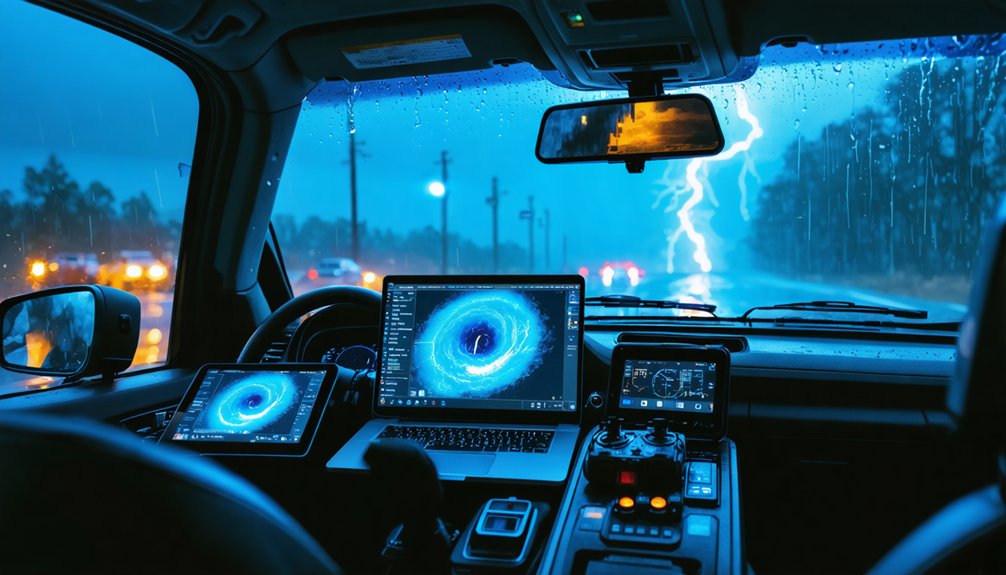
When you look at the tech storm chasers rely on, mobile Doppler radar stands out as the dominant scientific tool since the mid-1990s, giving chasers an X-ray-like view of a storm’s internal structure, rotation, and intensity.
You can supplement that radar data with drone systems like the RAAVEN, which chasers launch 10-15 miles downwind into active thunderstorms to collect precise atmospheric measurements that ground-based instruments can’t capture.
Together, these tools let you build a data-rich picture of storm behavior in real time, turning raw observations into actionable scientific intelligence.
Mobile Doppler Radar Explained
Mobile Doppler radar has dominated storm-chasing science since the mid-1990s, giving chasers something no fixed radar system can deliver: precise, close-range data on a storm’s internal wind structure.
Mobile radar technology lets you intercept storms directly, capturing real-time rotation patterns that distant network radars simply miss.
Here’s what Doppler radar effectiveness actually measures when positioned near a supercell:
- Wind velocity shifts — detecting rotation that signals mesocyclone development
- Precipitation intensity — distinguishing rain, hail, and debris signatures
- Storm structural changes — identifying wall cloud formation and updraft strength
- Tornado confirmation — providing ground-truth data alongside visual observation
Think of it as an X-ray for violent weather.
You’re not guessing at what’s happening inside — you’re reading it directly, making every intercept scientifically meaningful.
Drones And Data Collection
Beyond radar, atmospheric data collection has expanded into vertical airspace that ground-based systems can’t reach.
Drone technology now gives you direct access to thunderstorm environments previously inaccessible without risking human life.
Since 2017, the TORUS project has deployed RAAVEN drones 10-15 miles downwind into active thunderstorms, capturing in-situ measurements that dramatically improve data accuracy.
You’re not relying solely on radar interpretation—you’re pulling real atmospheric readings from inside the storm’s structure.
Rocket launchers and parachute probes further extend your instrumentation reach, deploying sensors directly into tornadoes and remote storm systems.
Each tool targets a specific data gap that radar alone can’t fill.
Combined, these systems build a layered data architecture, giving you multidimensional storm profiles that transform raw observations into actionable scientific intelligence.
Real Risks Every Storm Chaser Faces in the Field
Storm chasing carries life-threatening risks that no amount of preparation can fully eliminate. As a storm chaser, you’re maneuvering through unpredictable environments where weather forecasting challenges can turn a controlled pursuit deadly within minutes.
Storm chaser safety depends on real-time decision-making, not just pre-mission planning.
Here are four critical risks you’ll face:
- Debris projection – Tornadoes launch objects at lethal velocities with minimal warning.
- Flash flooding – Rapidly rising water near storm cells claims more lives than tornadoes annually.
- Blinding conditions – Heavy rain and hail reduce visibility to near zero instantly.
- Route entrapment – Storms can cut off escape paths, leaving you trapped in a dangerous corridor.
Professionals know when retreating isn’t failure—it’s the only rational calculation.
How Storm Chasers Help Meteorologists Issue Faster Warnings
When a tornado touches down, every second between confirmation and public warning determines whether people live or die.
You’re fundamentally functioning as a mobile sensor network that no satellite or fixed radar can replicate.
Storm chasers provide ground-truth data that validates radar signatures, eliminating uncertainty before meteorologists trigger warning systems.
Fixed-location spotters can’t reposition; you can. That mobility lets you confirm rotation, debris signatures, and storm impact in real time, feeding critical observations directly to the National Weather Service.
Studies show confirmed spotter reports accelerate warning issuance measurably, extending lead times that save lives.
You’re not replacing technology—you’re calibrating it.
When your ground-level confirmation aligns with Doppler returns, meteorologists act faster and with greater confidence, converting raw atmospheric data into actionable public alerts.
Frequently Asked Questions
Can Storm Chasing Be Pursued as a Full-Time Professional Career?
You can pursue storm chasing as a full-time career by mastering storm prediction and advanced weather technology. You’ll join university projects, media teams, or government agencies, though you’ll often drive thousands of miles without guaranteed results.
Are There Legal Regulations Governing Where Storm Chasers Can Operate?
As lightning splits the sky, you’ll find no specific legal jurisdictions restricting storm chasers. However, storm chaser ethics demand you respect road laws, emergency zones, and public safety boundaries wherever you’re actively pursuing nature’s fury.
How Do Storm Chasers Financially Support Their Equipment and Travel Costs?
You’re funding your storm chasing through sponsorship opportunities from weather tech companies and media outlets, while crowdfunding platforms let you leverage public support, offsetting costly equipment investments and thousands of miles in annual travel expenditures.
What Physical and Mental Fitness Is Required for Storm Chasing?
With 8-12 hour drives common, you’ll need serious fitness training and mental resilience for storm chasing. Storm preparedness demands sharp decision-making under pressure, sustained focus, and physical endurance to navigate unpredictable, high-stakes environments effectively.
Have Storm Chasers Ever Directly Saved Lives During Active Tornado Events?
Yes, storm chasers have directly saved lives by providing real-time tornado education to communities and triggering emergency response systems. You’d find they confirm tornadoes first, alerting National Weather Service to issue critical warnings before destruction hits populated areas.
References
- https://en.wikipedia.org/wiki/Storm_chasing
- https://science.howstuffworks.com/nature/climate-weather/storms/storm-chaser.htm
- https://research.unl.edu/blog/twisters-draws-from-storm-chasing-science-led-by-nebraska-expert/
- https://www.youtube.com/watch?v=I-iP6_fCVio
- https://rebeccalizemerton.wordpress.com/2018/04/14/storm-chasing-the-science-of-tornadoes/
- https://www.fox.com/watch/clip/fmc-mpqzj8ingd58e6oj/storm-chasing-the-science-and-excitement-behind-the-pursuit
- https://www.youtube.com/watch?v=KDf42_eXz50