When you watch sunset storm clouds ignite the sky, you’re witnessing atmospheric physics at its most dramatic. Rayleigh scattering strips blue wavelengths as sunlight travels its longest atmospheric path, leaving molten reds and burning oranges dominating the spectrum. Multiple cloud layers then amplify these hues — cirrocumulus clouds glow brilliantly while darker stratocumulus bases create stark contrasts below. Mammatus formations act as curved reflectors, intensifying warm tones further. There’s much more behind this chromatic spectacle than meets the eye.
Key Takeaways
- At sunset, Rayleigh scattering strips blue wavelengths from sunlight, leaving vivid reds and oranges dominating storm cloud displays.
- Upper cirrocumulus clouds above 16,500 ft capture direct sunlight, projecting brilliant yellows and reds onto darker lower cloud layers.
- Mammatus clouds amplify sunset colors through multi-directional scattering and curved surfaces that act as natural reflectors for low-angle light.
- Gaps between stratocumulus and cirrocumulus layers create dramatic contrasts, intensifying color saturation across the entire storm system.
- Mountainous regions like New Mexico’s Jemez Mountains enhance contrast and saturation, making timing and location critical for photographing vibrant storm clouds.
Why Sunset Storm Clouds Burst With Color?
When the sun dips below the horizon, the atmosphere acts as a natural color filter, stripping out blue wavelengths and leaving only warm reds and oranges to illuminate the clouds above.
As daylight fades, the sky becomes a filter — bleeding out blue, amplifying red.
You’re witnessing atmospheric conditions at their most dramatic — sunlight traveling a longer path through denser air, scattering shorter wavelengths while reddish hues push through.
Storm clouds amplify this effect considerably. Upper cirrocumulus layers catch brilliant yellows and reds first, then reflect pinkish-purple light downward onto lower stratocumulus edges.
You’ll notice darker cloud bases remain unlit, creating stark contrast against those vivid upper tones.
Color psychology explains why these skies feel so emotionally charged — warm hues trigger urgency and intensity.
Storm clouds don’t just display color; they concentrate it, transforming atmospheric tension into something visually unforgettable.
How Atmosphere Strips Blue Light From Sunset Storm Clouds?
When you look toward a sunset, you’re witnessing sunlight’s full visible spectrum — red, orange, yellow, green, and blue — entering Earth’s atmosphere simultaneously.
The atmosphere actively scatters shorter blue wavelengths away from your line of sight far more efficiently than it scatters longer, warmer wavelengths. By the time sunlight travels its longest atmospheric path at the horizon, the blue is largely stripped away, leaving reddish, orange, and golden hues to dominate what you see.
Sunlight’s Spectral Color Breakdown
As sunlight travels through Earth’s atmosphere, the gas molecules scatter shorter blue wavelengths far more efficiently than longer red and orange wavelengths — a process called Rayleigh scattering.
At sunset, you’re witnessing maximum spectral dispersion: sunlight traverses a dramatically longer atmospheric path, stripping away blue and violet color wavelengths almost entirely. What remains is concentrated reddish-orange light, rich in warm electromagnetic energy.
This filtered spectrum then strikes storm clouds at oblique angles, illuminating their undersides and edges with intense amber, crimson, and gold. The atmosphere fundamentally acts as a natural color filter, eliminating cooler wavelengths while transmitting warmer ones.
You’re not seeing distortion — you’re seeing physics operating with extraordinary precision, transforming ordinary storm clouds into vivid, burning spectacles against the darkening sky.
Atmosphere Filters Blue Light
Sunlight carries the full visible spectrum, but Earth’s atmosphere doesn’t treat every wavelength equally. As sunlight travels through atmospheric layers, molecules scatter shorter blue wavelengths far more aggressively than longer red and orange ones — a process called light scattering.
During midday, this scattering distributes blue light broadly, giving you that familiar blue sky overhead.
At sunset, geometry changes everything. You’re now viewing sunlight traveling a dramatically longer atmospheric path before reaching your eyes. This extended journey intensifies atmospheric filtering, stripping away nearly all remaining blue wavelengths.
What survives that gauntlet? Rich reds, deep oranges, and warm yellows. These wavelengths penetrate where blue cannot.
When storm clouds interrupt that already-filtered light, you witness those surviving warm hues painting turbulent cloud formations in extraordinary, unobstructed color.
Reddish Hues Dominate Sunset
Reddish wavelengths dominate your sunset view precisely because the atmosphere has already done its filtering work. By the time sunlight travels its longest daily path through atmospheric layers, blue wavelengths have scattered away, leaving concentrated reds and oranges to paint your storm clouds.
You’ll notice this cloud color shift most dramatically when light strikes storm cloud formations from below. Those reddish wavelengths bounce off cloud undersides, intensifying sunset patterns across the entire sky canvas.
Storm clouds amplify this effect considerably. Their dense moisture and varied altitudes create multiple reflection surfaces, bouncing reddish light between layers.
Upper cirrocumulus captures brilliant reds while lower stratocumulus edges absorb reflected warmth. You’re witnessing atmospheric filtration rendered visible through cloud architecture — raw physics producing undeniable visual freedom.
How Cloud Layers Mix and Amplify Sunset Storm Cloud Colors?
When sunset light travels its longest atmospheric path, it sheds blue wavelengths and arrives at storm cloud systems as deeply reddened illumination.
As sunlight takes its longest evening journey, the atmosphere strips away blue wavelengths, leaving only smoldering red to reach the waiting clouds.
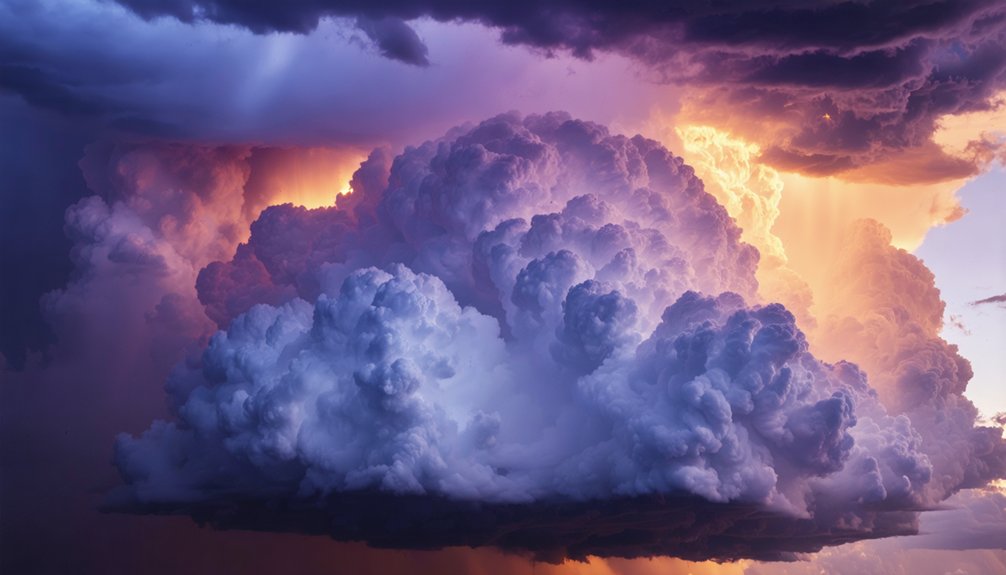
You’ll notice how cloud dynamics create a layered optical exchange: upper cirrocumulus clouds at 16,500–45,000 ft capture brilliant yellows and reds, then project pinkish-purple color reflection downward onto lower stratocumulus edges sitting at 2,000–6,500 ft.
Where gaps open between stratocumulus layers, you’re seeing direct windows into those vivid upper-level hues. Meanwhile, lower stratocumulus clouds remain comparatively dark, receiving only indirect illumination.
This vertical interplay amplifies color intensity across the entire storm system. Each layer processes and redirects wavelengths differently, producing that characteristic multicolored burning sky where red, purple, orange, and pink simultaneously occupy distinct atmospheric altitudes above you.
Why Cirrocumulus Clouds Glow While Stratocumulus Stay Dark?
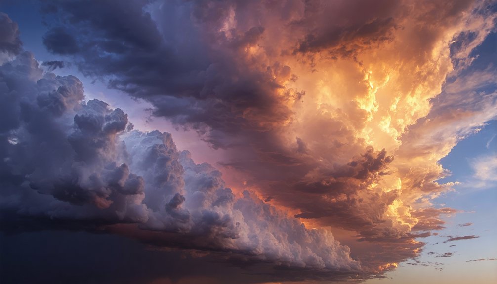
The stark contrast between glowing cirrocumulus and dark stratocumulus comes down to direct versus indirect light exposure.
Cirrocumulus clouds sit at 16,500–45,000 ft, where they intercept reddish sunset light directly through atmospheric windows, producing vivid yellows and reds across their surfaces. You’re witnessing unfiltered solar radiation hitting ice crystals at high altitude.
Stratocumulus clouds, positioned at 2,000–6,500 ft, don’t receive that direct illumination. They’re sheltered beneath the upper layer, relying entirely on cloud reflection from cirrocumulus above for any color at all.
That indirect pinkish-purple light only reaches their edges, leaving their bodies comparatively dark.
This color contrast isn’t random — it’s geometry. Your position as an observer determines how dramatically these layered lighting differences reveal themselves against a stormy sky.
Why Mammatus Clouds Produce the Most Intense Sunset Colors?
When you observe mammatus clouds at sunset, you’re witnessing a unique light-trapping geometry—their pouch-like lobes hang downward, maximizing surface area exposure to the reddish, blue-depleted sunlight that grazes the atmosphere at low angles.
Each lobe acts as a curved reflector, redirecting that concentrated warm light toward your position from multiple angles simultaneously. This multi-directional scattering intensifies the oranges, pinks, and reds far beyond what flat cloud layers can produce, making mammatus formations the most visually dramatic canvases a storm sunset can offer.
Mammatus Cloud Light Dynamics
Mammatus clouds earn their reputation as sunset’s most vivid canvas through a deceptively simple structural advantage: their pouch-like lobes maximize surface area exposure to reddened, low-angle sunlight. Each pendant in the mammatus formation acts as an individual light collector, capturing wavelengths that longer atmospheric pathways have already stripped of blue.
You’re fundamentally watching physics perform geometry.
The irregular cloud texture amplifies this effect dramatically. Unlike flat cloud bases, mammatus lobes create competing shadow zones and illuminated faces simultaneously, producing sharp tonal contrasts you won’t find elsewhere.
Reddish light bounces between adjacent pouches, intensifying warmth through repeated internal reflection. When stratocumulus layers open windows overhead, concentrated yellows and reds strike these surfaces directly.
The result isn’t accidental beauty — it’s structured atmospheric optics delivering maximum chromatic intensity precisely at golden hour.
Intense Hues Explained
Structural geometry alone doesn’t fully account for why mammatus clouds outperform every other formation at sunset — the chemistry of light itself completes the explanation.
At sunset, sunlight travels its longest atmospheric path, stripping blue wavelengths through scattering and delivering concentrated reds and oranges to cloud surfaces. Your color perception registers these wavelengths most intensely against dark storm backdrops, where contrast amplifies saturation.
Mammatus pouches, suspended beneath cumulonimbus anvils, position their curved surfaces at precise angles that maximize reddish light absorption and reflection simultaneously.
Atmospheric effects compound this further — upper cirrocumulus layers redirect pinkish-purple light downward, while lower stratocumulus windows expose vivid yellows and reds beyond.
The result isn’t accidental beauty. It’s physics, geometry, and atmospheric layering converging at the exact moment you’re watching.
How to Spot the Most Colorful Sunset Storm Clouds?
To catch the most colorful sunset storm clouds, you’ll want to look for scenes where multiple cloud layers occupy different altitudes simultaneously.
Position yourself where cirrocumulus clouds sit above 16,500 ft while stratocumulus layers hover between 2,000–6,500 ft. This stacking creates the most rewarding sunset color patterns, as upper clouds capture vivid yellows and reds while their reflected pinkish-purple light tints lower cloud edges.
Watch for gaps, or “windows,” in the stratocumulus layer—these openings expose the brighter upper cirrocumulus clouds beneath.
For storm cloud photography, time your positioning just as the sun approaches the horizon, extending its atmospheric pathlength and stripping away blue wavelengths.
Locations near mountain ranges, like New Mexico’s Jemez Mountains, amplify dramatic contrast between dark storm clouds and warm, saturated hues.
Frequently Asked Questions
How Long Does a Colorful Sunset Storm Cloud Display Typically Last?
You’ll typically witness a colorful sunset storm cloud display lasting 20–40 minutes. Color intensity peaks as cloud formation aligns with low-angle sunlight, so watch actively—you won’t want to miss nature’s fleeting atmospheric masterpiece.
Can Storm Clouds Produce Similar Vibrant Colors During Sunrise?
Yes, you’ll witness storm color variations at sunrise too! As light travels its long atmospheric path, you’ll observe sunrise cloud dynamics painting storm clouds in vibrant reds, purples, and oranges—mirroring sunset’s spectacular display.
Which Locations Worldwide Offer the Best Sunset Storm Cloud Viewing?
Coincidentally, you’ll find the best storm cloud spectacles where atmosphere meets drama: tropical destinations, mountain ranges like New Mexico’s Jemez, coastal viewpoints, and urban skylines like Denver’s — each offering uniquely scattered reddish light painting clouds magnificently.
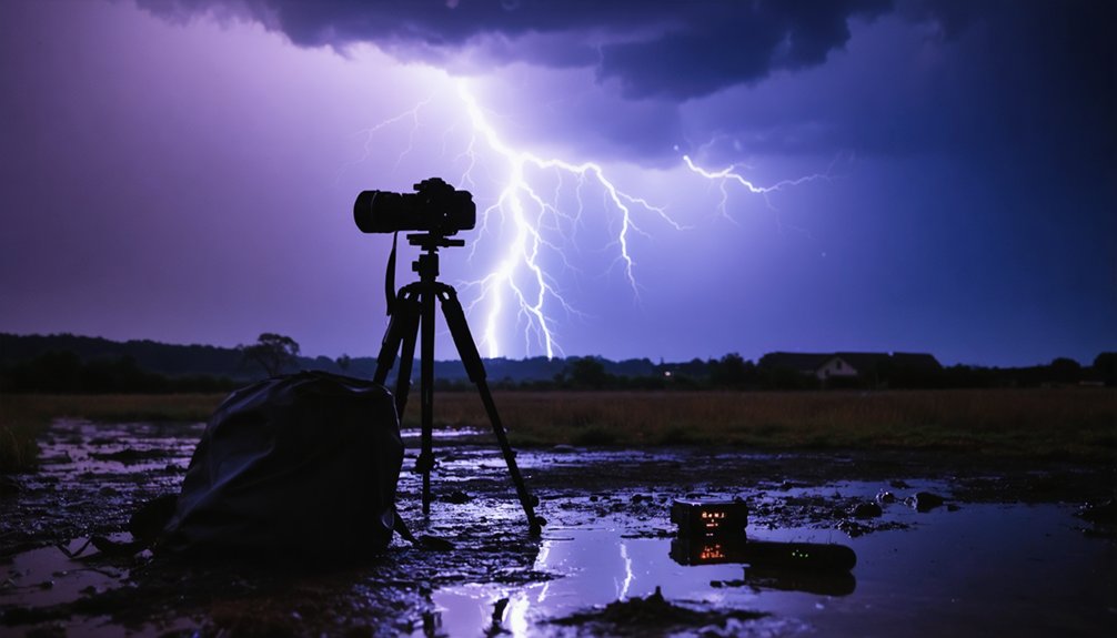
How Do Photographers Best Capture Vivid Sunset Storm Cloud Colors?
You’ll capture vivid sunset storm cloud colors by applying color theory to balance warm reds and purples, while optimizing camera settings—shoot RAW, use manual exposure, and bracket shots to preserve atmospheric light’s dramatic, fleeting intensity.
Do Seasonal Changes Affect the Intensity of Sunset Storm Cloud Colors?
Painting the town red, seasonal variations absolutely affect intensity! You’ll notice summer’s humid atmospheric conditions amplify vivid oranges and reds, while winter’s drier, clearer air mutes storm cloud hues, shifting your sunset palette dramatically.
References
- https://inlightofnature.com/cloud-layers-at-sunset/
- https://stock.adobe.com/search?k=sunset+storm+clouds
- https://stock.adobe.com/search?k=stormy+sunset
- https://www.vecteezy.com/free-photos/sunset-storm
- https://www.istockphoto.com/photos/storm-clouds-sunset
- https://unsplash.com/photos/vibrant-sunset-paints-the-clouds-in-striking-colors–Jykz7ic6n0
- https://www.lemon8-app.com/shelbshares/7259907247860433414?region=us