When you encounter a mesocyclone, you’re facing a rotating air column 2 to 6 miles wide embedded within a severe thunderstorm. It forms when wind shear of at least 46 mph between ground level and 20,000 feet generates horizontal vorticity, which powerful updrafts then tilt into vertical rotation. Angular momentum amplifies that spin to 10⁻² s⁻¹ or greater. Understanding its detection, hazards, and tornado potential reveals just how dangerous this phenomenon truly gets.
Key Takeaways
- A mesocyclone is a rotating air column, 2–6 miles wide, embedded within severe storm systems and classified as a meso-gamma mesoscale vortex.
- It forms when significant wind shear, at least 46 mph, creates horizontal rolls of spinning air in the lower atmosphere.
- Rising thunderstorm updrafts tilt these horizontal rolls into a vertical orientation, converting horizontal vorticity into vertical rotation.
- Angular momentum conservation during upward stretching accelerates the spin, reaching vertical vorticity of 10⁻² s⁻¹ or greater.
- Once established, mesocyclones can persist for hours, generating hazards including tornadoes, large hail, and destructive surface winds.
What Is a Mesocyclone?
A mesocyclone is a rotating column of air classified as a meso-gamma mesoscale vortex, typically measuring 2 to 6 miles (3.2 to 9.7 km) in diameter.
In the Northern Hemisphere, it rotates counter-clockwise, mirroring low-pressure systems.
It’s fundamentally a radar term — radar detection techniques identify it through Doppler velocity signatures showing localized inbound and outbound maxima in close proximity.
You’ll notice it displayed as a yellow solid circle on Doppler velocity products, confirming strong rotation.
Unlike mid-latitude cyclones spanning 900–3,000 miles, a mesocyclone operates at storm scale.
The mesocyclone lifecycle requires rotation persisting across at least two successive radar volume scans, with vertical vorticity reaching 10⁻² s⁻¹ or greater.
This persistence distinguishes a true mesocyclone from ordinary transient rotational features within thunderstorms.
How Does a Mesocyclone Size Up Against Other Storm Systems?
Understanding what a mesocyclone is only tells part of the story — its size relative to other storm systems reveals just how distinct it’s meteorologically.
When you compare mesocyclone size against mid-latitude cyclones, the contrast is striking. A mesocyclone spans just 2–6 miles (3.2–9.7 km) in diameter, while traditional mid-latitude cyclones stretch 900–3,000 miles across. That’s a difference of several orders of magnitude.
This storm comparison matters because mesocyclones operate at the meso-gamma mesoscale — tight, intense, and storm-embedded. You’re looking at a compact rotating structure nested within a single supercell, not a synoptic-scale system dominating a weather map.
Despite its smaller footprint, a mesocyclone concentrates rotational energy efficiently, producing vertical vorticity values reaching 10⁻² s⁻¹ or greater — making it meteorologically powerful relative to its size.
What Atmospheric Conditions Trigger Mesocyclone Formation?
Before a mesocyclone can develop, the atmosphere must satisfy several precise physical requirements — and wind shear tops the list. You’re looking at speed and directional changes of at least 46 mph between ground level and 20,000 feet. That shear generates horizontal vorticity in the lower atmosphere, setting invisible tube-like air rolls into motion.
Buoyancy is equally critical. Warm, rising air drives the convective updraft that tilts those horizontal rolls vertical, directly influencing cloud formation and establishing the rotating column.
Baroclinicity — the collision zone between cold and warm air masses — intensifies the supporting trough structure, sharpening precipitation patterns beneath the developing supercell.
Without these converging conditions operating simultaneously, the atmospheric machinery required to sustain mesocyclogenesis simply won’t engage.
How Speed and Directional Wind Shear Create Horizontal Spin
Wind shear doesn’t just set the stage for mesocyclogenesis — it’s the direct mechanical source of the horizontal spin that makes the entire process possible. When wind speed increases and direction shifts with altitude, the atmosphere develops horizontal shear along invisible layered boundaries.
Wind shear isn’t just a backdrop — it’s the mechanical engine driving the horizontal spin behind mesocyclogenesis.
Picture air moving at 15 mph near the surface while winds 20,000 feet up exceed 60 mph — that differential generates tube-like rolls of horizontally spinning air oriented parallel to the ground.
Both speed shear and directional shear contribute independently to this wind rotation. Speed shear drives the rolling motion through velocity contrast between layers.
Directional shear, where winds veer from southerly to westerly with height, adds curvature to that spin. Together, they produce the horizontal vorticity that a thunderstorm’s updraft will later tilt into vertical rotation.
How a Thunderstorm Updraft Builds a Mesocyclone’s Vertical Spin
Once horizontal wind shear establishes those spinning tube-like rolls in the lower atmosphere, a thunderstorm’s convective updraft tilts them from horizontal to vertical, converting horizontal vorticity into vertical vorticity and initiating column rotation.
As the updraft stretches that rotating column upward, conservation of angular momentum accelerates the spin—the same physics a figure skater uses when pulling in their arms.
You’re now looking at vertical vorticity on the order of 10⁻² s⁻¹ or greater, marking the changeover from disorganized shear to a structured, rotating mesocyclone.
Updraft Tilts Horizontal Rolls
How does invisible atmospheric spinning become a towering column of rotating air? Horizontal wind shear generates tube-like rolls of horizontally spinning air in the lower atmosphere.
When a thunderstorm’s updraft — powered by atmospheric buoyancy — encounters these rolls, it doesn’t simply absorb them. It tilts them.
This tilting mechanism is precise: the convective updraft physically reorients the horizontal rolls from parallel to perpendicular relative to the ground. What was spinning along a horizontal axis now spins along a vertical one. You’re watching horizontal vorticity transform directly into vertical vorticity.
The updraft then stretches this vertical rotation upward, amplifying rotational velocity through vortex tube stretching — the same physics a figure skater uses pulling arms inward. The entire updraft column begins rotating, establishing the mesocyclone‘s foundational structure.
Stretching Amplifies Rotational Velocity
After the updraft tilts horizontal vorticity into the vertical plane, it doesn’t stop working — it stretches that rotation upward, dramatically amplifying rotational velocity in the process. Think of it like a figure skater pulling their arms inward: conservation of angular momentum forces spin to accelerate as the vortex column narrows and extends vertically.
This stretching phase is critical to the mesocyclone lifecycle, pushing vertical vorticity to 10⁻² s⁻¹ or greater. Once rotational velocity reaches approximately 15 meters per second across a 2–10 km diameter column with roughly 3 km of vertical depth, radar detection techniques can confirm a legitimate mesocyclone signature.
Doppler radar identifies paired inbound and outbound velocity maxima, flagging the rotation across successive volume scans and potentially triggering an immediate tornado warning.
Vertical Vorticity Takes Over
The entire mesocyclone formation sequence ultimately hinges on one critical transformation: horizontal vorticity converting into vertical vorticity. Wind shear dynamics generate a horizontal vortex tube spinning parallel to the ground.
Once a thunderstorm’s updraft intersects that tube, it forcibly tilts the rotation from horizontal to vertical. You’re now looking at a column of spinning air oriented perpendicular to the earth’s surface.
This transformation isn’t gradual—it’s mechanically decisive. As vertical vorticity takes over, the mesocyclone’s structure locks into place, reaching measured values at or exceeding 10⁻² s⁻¹. The horizontal vortex effectively ceases to dominate the system.
Vertical spin becomes the controlling dynamic, sustaining rotation through successive radar volume scans and confirming what meteorologists classify as a legitimate, persistent mesocyclone signature.
Where Does a Mesocyclone Sit Inside a Supercell?
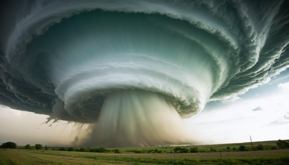
Within a supercell, a mesocyclone typically sits in the storm’s right rear flank, though it can also appear on the eastern flank of a high-precipitation supercell. Understanding mesocyclone dynamics means recognizing that its placement isn’t random—it’s dictated by the storm’s internal airflow structure.
The mesocyclone occupies a zone where the updraft and Rear Flank Downdraft (RFD) converge, creating a tightly organized rotational core.
Storm rotation patterns show that this positioning allows the circulation to persist and intensify, covering an area far larger than any tornado that may develop within it. You’re looking at a circulation spanning 2–6 miles in diameter, embedded within a storm system that can sustain rotation for hours, continuously threatening severe surface winds, large hail, and tornado development.
What Qualifies a Storm as an Official Mesocyclone?
Not every rotating thunderstorm earns the official label of mesocyclone — you need to meet strict detection criteria before it qualifies. The storm’s rotating column must span a diameter of 2–10 km with a vertical depth of at least 3 km.
It must also maintain a minimum rotational velocity of roughly 15 meters per second, and appear in two or more successive radar volume scans.
You can think of these thresholds as a three-part test covering size, intensity, and persistence that must all be satisfied simultaneously.
Official Detection Criteria
Before a storm earns the official label of mesocyclone, it must meet strict criteria across three key dimensions: size, rotation speed, and duration.
Mesocyclone classification requires a storm-scale diameter between 2 and 10 km with a vertical depth of at least 3 km. Rotational velocity must reach a minimum of approximately 15 meters per second.
Duration demands the signature appear in two or more successive radar volume scans, confirming the rotation persists rather than briefly flickers.
Radar signature interpretation centers on identifying closely paired inbound and outbound velocity maxima at the same radar range. Vertical vorticity must register at 10⁻² s⁻¹ or greater.
You’re looking at a system that must sustain rotation for at least 10 minutes before it officially qualifies — no exceptions.
Minimum Rotation Requirements
Qualifying a storm as an official mesocyclone demands more than visible rotation — the numbers must hold up against specific thresholds. You’re looking at a minimum rotational velocity of approximately 15 meters per second, a storm-scale diameter between 2 and 10 kilometers, and a vertical depth of roughly 3 kilometers.
Rotation must also appear across two or more successive radar volume scans, confirming persistence rather than a fleeting signature. Vertical vorticity must reach 10⁻² s⁻¹ or greater.
Mesocyclone evolution from early rotation to full classification depends on consistent data meeting every threshold simultaneously. Sensor calibration plays a critical role here — poorly calibrated Doppler radar can misrepresent velocity values, undermining accurate classification.
Every threshold exists to distinguish genuine mesocyclonic rotation from ordinary storm-scale wind variations.
How Doppler Radar Detects a Mesocyclone Signature
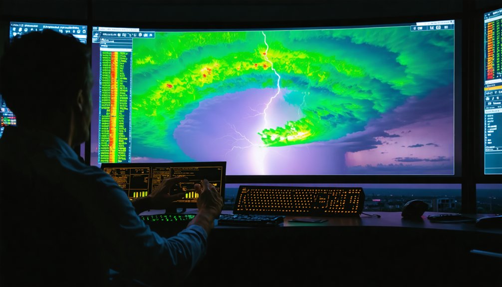
Doppler radar detects a mesocyclone by identifying local inbound and outbound velocity maxima positioned close together at the same range from the radar.
Doppler radar pinpoints mesocyclones by detecting paired inbound and outbound velocity maxima at equal range.
When you examine the radar velocity data, you’re looking for a distinct rotation signature — a couplet where winds move toward and away from the radar in close proximity. This couplet signals organized rotation within the storm.
For official classification, the signature must meet three precise thresholds. The rotational velocity must reach approximately 15 meters per second. The storm-scale diameter must measure between 2–10 km with a vertical depth of roughly 3 km.
Finally, the rotation must appear in two or more successive radar volume scans, confirming persistence. These strict criteria guarantee you’re identifying a genuine, sustained mesocyclone rather than transient atmospheric noise.
Can Every Mesocyclone Produce a Tornado?
Not every mesocyclone you see on radar will produce a tornado, as the rotation must intensify markedly at the surface level through a process involving a descending Rear Flank Downdraft (RFD) that tightens the vortex.
When low-level wind shear is strong enough and the mesocyclone’s rotational velocity surpasses critical thresholds near the ground, conditions become favorable for tornado development within the broader circulation.
Once forecasters detect a confirmed mesocyclone signature meeting those criteria, they’ll issue a tornado warning immediately, even before a tornado touches down.
Mesocyclones Without Tornado Formation
While mesocyclones create the conditions necessary for tornado development, only about 50% of detected mesocyclones actually produce tornadoes. A non-tornadic mesocyclone, or mesocyclone non tornadic event, occurs when atmospheric conditions prevent the rotation from tightening into a surface-reaching vortex.
Insufficient low-level wind shear, weak baroclinicity, or inadequate moisture can all disrupt the process before tornado formation occurs.
Mesocyclone decay also plays a critical role. As the rear flank downdraft wraps around the circulation, it can cut off the warm inflow sustaining rotation. Without that energy source, the mesocyclone weakens before producing a tornado.
You should understand that detecting a mesocyclone on Doppler radar signals danger, but doesn’t guarantee tornado formation. Meteorologists continuously monitor rotational velocity and vertical depth to assess whether conditions will cross that critical threshold.
Conditions Enabling Tornado Development
Though every mesocyclone carries the potential for tornado development, the atmospheric conditions must meet several additional thresholds before that rotation can tighten into a surface-reaching vortex.
Mesocyclone research identifies the Rear Flank Downdraft as a critical mechanism, wrapping cool air around the rotating updraft and intensifying low-level wind shear. You’ll find that surface convergence must strengthen sufficiently to concentrate vertical vorticity beyond 10⁻² s⁻¹.
Mesocyclone history demonstrates that tornadoes typically emerge when rotational velocity surpasses 15 meters per second and the circulation narrows dramatically through vortex stretching. Low lifted condensation levels, strong low-level jet streams, and favorable thermodynamic instability further determine whether rotation reaches the ground.
Without these converging factors, the mesocyclone sustains itself aloft without producing a confirmed tornado.
Tornado Warning Issuance Criteria
Detecting a mesocyclone on Doppler radar doesn’t automatically trigger a tornado warning, because meteorologists apply specific criteria before issuing one. The rotation must appear in two or more successive radar volume scans, confirming mesocyclone longevity rather than a brief, transient signature.
Rotational velocity must reach approximately 15 meters per second, and vertical depth must span roughly 3 kilometers.
Radar detection challenges complicate this process considerably. Beam overshooting at long distances, terrain blockage, and low-topped supercells can obscure critical rotation data, forcing meteorologists to weigh incomplete information carefully.
When a confirmed mesocyclone meets all thresholds — adequate rotation speed, verified depth, and persistent duration — warnings get issued immediately. Not every mesocyclone produces a tornado, but every qualifying signature demands urgent, precise action to protect lives.
Tornadoes, Hail, and Wind: The Hazards a Mesocyclone Produces
When a mesocyclone develops within a supercell, it creates a sustained environment capable of producing multiple simultaneous hazards. Throughout the mesocyclone lifecycle, you’re looking at three primary threats: tornadoes, large hail, and destructive surface winds.
Radar detection techniques reveal that storms carrying persistent mesocyclone signatures frequently produce all three hazards concurrently rather than sequentially. Tornadoes can develop directly within the rotating column, while the storm’s intense updraft suspends hailstones long enough to grow them to dangerous sizes.
Strong surface winds often radiate outward from the Rear Flank Downdraft. The mesocyclone can sustain these conditions for hours, meaning your exposure window isn’t brief.
Understanding these combined hazards lets you make faster, smarter decisions when severe weather threatens your area.
Frequently Asked Questions
Can a Mesocyclone Form Over Water Instead of Land?
Like a spinning top finding its balance on any surface, yes, you can witness mesocyclone formation over water. Water-based vortices develop identically, requiring wind shear exceeding 46 mph and buoyant updrafts, producing waterspouts instead.
How Long Does a Typical Mesocyclone Last Before Dissipating?
You’ll find a mesocyclone lifespan ranges from 10 minutes to several hours. Factors influencing mesocyclone duration include sustained wind shear, atmospheric buoyancy, and updraft strength—all variables you can track independently through Doppler radar data.
Are Mesocyclones More Common During Specific Seasons or Months?
During the 2011 Super Outbreak, you’ll notice mesocyclones peak in spring. Severe weather patterns and tornado precursors surge April–June, when atmospheric instability and wind shear combine most powerfully, giving you the highest mesocyclone frequency.
Can Multiple Mesocyclones Exist Within a Single Thunderstorm Simultaneously?
Yes, you can observe multiple mesocyclones within a single thunderstorm simultaneously. During complex mesocyclone formation cycles, you’ll find successive tornado genesis events as older circulations dissipate and newer rotational structures develop independently within the same supercell.
Have Mesocyclones Been Observed on Other Planets Besides Earth?
You’ll find that extraterrestrial meteorology confirms mesocyclone-like structures exist beyond Earth. Planetary storm systems on Jupiter, particularly the Great Red Spot, exhibit similar rotational dynamics, suggesting you’re witnessing universal atmospheric vortex mechanics across multiple worlds.
References
- https://en.wikipedia.org/wiki/Mesocyclone
- https://skybrary.aero/articles/mesocyclone
- https://www.merriam-webster.com/dictionary/mesocyclone
- https://forecast.weather.gov/glossary.php?word=MESO
- https://www.youtube.com/watch?v=BqlJoseT-tA
- https://www.lpm.org/news/2024-12-14/what-is-a-mesocyclone
- https://www.facebook.com/ametsoc/posts/word-of-the-week-mesocyclone-a-cyclonically-rotating-vortex-around-210-km-in-dia/1114820827352260/
- https://www.faculty.luther.edu/~bernatzr/Courses/Sci123/comet/radar/severe_signatures/navmenu.php_printname_print_low_level_meso.htm_page_1.0.0.htm
- https://simple.wikipedia.org/wiki/Mesocyclone
- https://www.wordreference.com/definition/mesocyclone



