Chasing supercells puts you inside Earth’s most powerful atmospheric engine, where a rotating mesocyclone stretches miles wide and sustains violent winds for hours. You’re reading live radar, watching hook echoes tighten, and making split-second escape decisions as wall clouds drop and rotation intensifies. No two storms behave the same, and every shift in structure demands instant adaptation. It’s raw meteorology in motion — and there’s far more to understand about what makes it work.
Key Takeaways
- Supercells are Earth’s most violent thunderstorms, featuring massive rotating mesocyclones, dramatic anvil formations, and lightning that constantly reveals shifting interior structures.
- No two supercell chases are identical, with each storm presenting unpredictable cloud formations, rapid rotation changes, and evolving tornado potential.
- Storms remain active for 2 to 6 hours, providing extended, multi-hour chase windows filled with continuous radar analysis and strategic repositioning.
- Interpreting real-time radar signatures like hook echoes and velocity couplets, alongside visual cues like wall clouds, demands sharp, high-stakes decision-making.
- Chasing supercells requires constant adaptation to sudden structural changes, escape route planning, and navigating dangerously close to Earth’s most violent winds.
What Exactly Is a Supercell Thunderstorm?
A supercell isn’t your average summer storm—it’s the most organized, most violent thunderstorm classification on Earth, defined by one critical feature: a mesocyclone, a deep, persistently rotating updraft that keeps the storm alive and dangerous for two to six hours.
Understanding storm classification matters before you chase. Supercell history traces back to pioneering meteorologists who recognized these storms behaved differently—sustaining themselves through powerful wind shear rather than collapsing like ordinary convective cells.
Supercells don’t just happen—they’re recognized, classified, and respected by those who studied why they refuse to die.
That rotation changes everything. It fuels massive hail, destructive winds, and the highest tornado production rate of any storm type.
You’re not dealing with a typical weather event when you intercept a supercell. You’re positioning yourself next to an atmospheric engine running at full throttle—structured, relentless, and completely indifferent to your presence.
The Mesocyclone: The Engine Behind a Supercell
What powers the supercell is the mesocyclone—a column of rotating air embedded deep within the storm’s updraft, stretching several miles wide and tens of thousands of feet tall.
Mesocyclone dynamics transform ordinary wind shear into atmospheric rotation that sustains the storm for hours. You’re not watching random chaos; you’re witnessing a structured atmospheric engine operating at full force.
Here’s what drives that rotation:
- Wind shear tilts horizontal air tubes vertically into the updraft
- The updraft stretches and intensifies the rotating column
- Atmospheric rotation tightens, increasing angular momentum
- The mesocyclone anchors the storm’s persistent, organized structure
- Tornado development becomes possible when rotation reaches the surface
Understanding this process changes how you read the sky—and how you chase it.
Why Supercells Produce the Most Violent Tornadoes
Because the mesocyclone runs deep through the storm’s core, supercells don’t just spin at the surface—they sustain rotation through an enormous vertical column for hours. That sustained storm energy is what separates supercells from every other thunderstorm type.
Tornado dynamics within a supercell develop through a tightening, intensifying rotation that ordinary storms simply can’t replicate. Supercells produce over 90% of violent EF4 and EF5 tornadoes—the kind that level everything in their path.
You’re not watching a random atmospheric event; you’re watching a precision engine concentrate atmospheric fury into a focused, lethal column. The mesocyclone’s depth and persistence give the storm time to organize, tighten, and *release*.
That’s why intercepting a supercell means you’re standing closest to Earth’s most violent wind.
How Long Can a Supercell Last?
Unlike ordinary thunderstorms that collapse within an hour, supercells can sustain themselves for two to six hours—sometimes longer. Don’t let supercell myths fool you—these aren’t just big storms that burn out fast. They’re atmospheric engines built for endurance, and that staying power is exactly what makes chasing them so relentless and rewarding.
Here’s what that longevity means for you in the field:
- You’ve got extended windows to intercept and reposition
- Storm legends are born from multi-hour chases, not quick encounters
- Tornado potential shifts repeatedly as the storm evolves
- Structure, hail, and lightning can fire in unpredictable sequences
- Each hour demands fresh radar reads and route decisions
That sustained energy keeps you sharp, locked in, and fully alive out there.
What Does Chasing a Supercell Actually Look Like?
You start the chase by pulling up radar and hunting for hook echoes and velocity couplets that signal rotation deep inside the storm. Once you’ve locked onto a target, you’re constantly repositioning on rural roads, keeping the mesocyclone visible while protecting your escape route.
From there, you watch the structure evolve in real time—wall clouds dropping, inflow bands tightening, and the entire storm reorganizing itself into something that looks almost mechanical in its violence.
Reading The Radar
How do you actually find a supercell before it finds you? You read the radar like a language, and every signal tells a story. Lightning patterns shift, storm temperature gradients sharpen, and the data screams before the clouds even organize.
Watch for these radar signatures:
- Hook echo — the classic comma shape indicating rotation and possible tornado development
- Velocity couplets — opposing wind directions confirming a mesocyclone is spinning
- Reflectivity gradients — tight color transitions revealing intense updraft cores
- Storm-relative motion — isolates rotation independent of overall storm movement
- BWER (Bounded Weak Echo Region) — a vault indicating explosive updraft strength
You’re not guessing out there. You’re intercepting with precision, repositioning in real time, and trusting the data to keep you alive while the storm evolves.
Positioning Near The Storm
Reading radar gets you close — but positioning is where the chase becomes real. You’re constantly calculating distance, road options, and storm motion simultaneously. Too close, and you lose the structure. Too far, and you miss everything.
You want the southeast quadrant — clear of the main precipitation, facing the wall cloud, with an escape route south or east. That’s where atmospheric dynamics reveal themselves fully, where the mesocyclone tightens and rotation becomes visible to the naked eye.
For storm photography, this position is everything. You’re capturing inflow bands curling into the base, lightning threading through the anvil, structure shifting minute by minute. Every decision sharpens your awareness.
You’re not watching weather happen — you’re moving with it, reading it, fully inside the experience.
Watching The Structure Evolve
Once you’re in position, the storm starts talking — and it never stops. Storm dynamics shift fast, and cloud formations transform before your eyes. You’re not watching weather — you’re reading a living system under pressure.
Watch for these structural cues:
- Wall cloud dropping beneath the rain-free base, rotating visibly
- Inflow bands streaming toward the updraft like the storm is inhaling
- Anvil formation spreading downwind as the updraft punches the tropopause
- RFD clear slot wrapping around the mesocyclone — tornado country
- Rapid lowering beneath the wall cloud signals intensification
Every minute reshapes the picture. The structure tightens, tilts, or collapses — and you have to decide what it means in real time. This is where skill meets spectacle.
How to Read Hook Echoes and Velocity Couplets
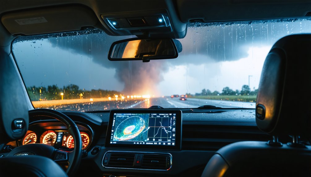
Radar becomes your most critical tool when you’re tracking a supercell, and two signatures will tell you more than anything else on the screen: the hook echo and the velocity couplet.
The hook echo appears when precipitation wraps around the mesocyclone, forming that unmistakable curved appendage on reflectivity. It signals rotation and possible tornado development.
The velocity couplet goes deeper — it shows opposing wind directions in tight proximity, confirming actual rotation within the storm.
Mastering these meteorological patterns separates informed chasers from reckless ones. Storm forecasting sharpens when you can read both signatures simultaneously, triangulating position, intensity, and movement in real time.
Don’t just watch the storm — interrogate the data. Your positioning decisions, your escape routes, and your safety all depend on what that radar screen is telling you.
The Visual Spectacle That Makes Supercells So Cinematic
When you shift your eyes from the radar screen to the sky ahead, nothing prepares you for what a supercell actually looks like. The structure moves, breathes, and transforms in real time. Storm lighting cuts through anvil shadows, painting the entire scene in greens, purples, and deep amber.
Nothing prepares you for a supercell. It moves, breathes, and transforms — alive in greens, purples, and deep amber.
Cloud textures shift from smooth rotation to ragged, churning chaos within minutes.
You’re watching an atmospheric engine running at full power:
- Wall clouds descend with visible rotation
- Inflow bands streak toward the mesocyclone like rails
- Lightning illuminates the interior structure constantly
- Anvil formations spread dramatically across the horizon
- Sunset colors collide with storm shadow for striking contrasts
Every minute delivers a different frame. Your camera can’t keep up, and honestly, neither can your mind.
What It Actually Takes to Chase a Supercell Safely
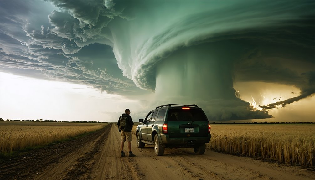
To chase a supercell safely, you’ve got to read radar with confidence, recognizing hook echoes and velocity couplets before the storm makes its next move.
You’re not just watching a screen — you’re translating data into real-time decisions that keep you in the right position without getting trapped.
Always know your escape route, because a supercell that shifts direction doesn’t wait for you to figure one out.
Reading Radar Effectively
Chasing a supercell safely demands more than showing up near a dark sky — you need to read radar with confidence and speed. Weather satellite imagery and atmospheric pressure data sharpen your situational awareness before you even leave the car.
Radar isn’t optional — it’s your lifeline.
Watch for these critical radar signatures:
- Hook echo — signals rotation and possible tornado development
- Velocity couplets — confirm mesocyclone strength and spin intensity
- High reflectivity cores — indicate large hail and intense precipitation
- Inflow notches — show where the storm is aggressively pulling in surface air
- Storm-relative motion — reveals how fast rotation is tightening
Every minute, the picture changes. You’re not just watching weather — you’re interpreting a living system that punishes hesitation and rewards sharp, decisive reads.
Maintaining Safe Escape Routes
Radar keeps you informed, but your escape route keeps you alive. Before you commit to any position—whether you’re optimizing storm photography angles or watching a wall cloud tighten—you need a confirmed exit. Know which roads run perpendicular to the storm’s movement. Supercells typically track northeast, so a southward escape route usually buys you the most time.
Weather safety isn’t passive caution; it’s aggressive planning. Scan your map before the storm forces the decision. Dirt roads flood fast, and hail cores reposition without warning. If your exit disappears, you’re not chasing anymore—you’re surviving.
Keep your vehicle pointed outbound. Never let the storm box you into a dead-end road. Freedom in the field comes from preparation, not luck. Respect the storm, and it rewards you with access.
Why No Two Supercell Chases Feel the Same
Every supercell intercept plays out on its own terms, and that’s what keeps chasers coming back. You’re never reading the same storm twice. Cloud formations shift without warning, lightning storms erupt on unexpected flanks, and rotation intensifies or collapses in minutes. That variability isn’t frustrating — it’s the draw.
Each chase forces you to adapt, read, and react in real time:
- Storm motion and speed change based on atmospheric wind profiles
- Tornado potential rises and falls as the mesocyclone pulses
- Lightning storms alter visibility and positioning windows fast
- Cloud formations like wall clouds and inflow bands evolve uniquely each event
- Road networks either open options or cut them off entirely
You’re chasing something that refuses to repeat itself. That’s freedom.
Frequently Asked Questions
What Is the Best Time of Year to Chase Supercells?
You’ll find peak supercell season runs April through June across Tornado Alley. Track weather patterns aggressively, trust storm predictions, and position yourself on the Plains—that’s where freedom and atmospheric fury collide most powerfully.
Which US States Offer the Highest Supercell Chase Success Rates?
“Go where the action is.” Texas, Oklahoma, and Kansas offer you the highest supercell chase success rates. Pack your storm chasing gear, sharpen your weather forecasting skills, and chase the heart of Tornado Alley fearlessly.
What Camera Gear Do Experienced Storm Chasers Typically Recommend?
You’ll want a weather-sealed DSLR, wide-angle and telephoto lenses, and a sturdy tripod. Master weather prediction techniques for positioning, prioritize storm chase safety, and you’re capturing jaw-dropping supercell shots that’ll fuel your freedom-seeking soul.
How Much Does Joining a Professional Storm Chasing Tour Cost?
Buying your ticket to raw freedom, professional storm chasing tours typically cost $2,500–$4,000 per week. You’ll chase evolving weather patterns while experts handle safety precautions, keeping you close to nature’s most violent, breathtaking spectacle.
Can Beginners Safely Participate in a Guided Supercell Chase Experience?
Yes, you can safely join a guided supercell chase as a beginner! Expert guides handle storm safety, radar reads, and real-time positioning. You’ll just need equipment essentials like sturdy footwear and weather gear — they’ve got everything else covered!
References
- https://backcountryjourneys.com/Trip-Report-Storm-Chasing-Supercells-Tornadoes-June-2025
- https://crazystormchasers.com/why-chase-supercell-storms-beginners-guide/
- https://crazystormchasers.com/why-do-storm-chasers-chase-supercell-storms-in-tornado-alley/
- https://www.youtube.com/watch?v=I6VGSJ3hseY
- https://brandhelps.com/the-science-behind-supercells-why-storm-chasers-follow-them/
- https://www.reddit.com/r/stormchasing/comments/bszk2t/lets_talk_about_positioning_supercell_edition/



