Meteorological outliers matter because they’re the line between accurate intercept positioning and chasing phantom convection. When undetected sensor spikes corrupt real-time radar feeds, you’re maneuvering on statistically compromised coordinates, potentially displacing storm centroid estimates by tens of kilometers. Conversely, legitimate reflectivity anomalies can signal rapid intensification before standard thresholds trigger. Mastering outlier attribution—distinguishing calibration failures from genuine meteorological forcing—keeps your nowcast models clean and your risk assessments operationally sound. Every technique covered ahead sharpens that distinction.
Key Takeaways
- Undetected outliers corrupt real-time data feeds, triggering false storm signatures that misdirect chase trajectories toward non-existent convective targets.
- Statistical outliers can signal violent storm onset, with reflectivity spikes correlating with rapidly intensifying convective cores requiring immediate repositioning.
- Erroneous data can displace storm centroid estimates by tens of kilometers, causing chasers to maneuver using statistically compromised coordinates.
- Sensor failure outliers may suppress legitimate convective signatures, causing chasers to miss critical intercept opportunities during active storm events.
- Real-time outlier detection improves situational awareness by distinguishing genuine meteorological forcing from noise, enhancing nowcast model accuracy during operations.
What Are Outliers in Meteorological Data?

Meteorological outliers are data points that deviate markedly from expected distributional behavior in atmospheric observations, whether measured as temporal anomalies within a single station’s record or spatial anomalies relative to neighboring gauges and grid cells.
You’re dealing with values exceeding robust statistical thresholds—typically 95th or 99th percentiles—that demand rigorous anomaly detection protocols to preserve data integrity. These deviations originate from sensor calibration failures, transmission errors, or genuine extreme weather phenomena, making source attribution critical.
Unresolved outliers distort variance estimates, compromise storm prediction models, and undermine risk assessment frameworks dependent on accurate return-period calculations. Within climate variability analyses, statistically significant anomalies can signal authentic atmospheric extremes or systematic instrumentation drift—distinctions that determine whether your dataset supports defensible scientific conclusions or propagates compounding errors through downstream forecasting systems.
How Undetected Outliers Put Storm Chasers in the Wrong Place?
When undetected outliers corrupt your real-time radar, satellite, or ground-sensor feeds, you’re making intercept decisions based on phantom storm signatures rather than verified meteorological states. This systematically displaces your positioning relative to actual convective targets.
Erroneous spikes in wind, precipitation, or pressure data trigger false alarm thresholds, rerouting your chase trajectory toward null events while genuine mesoscale features develop unmonitored.
Conversely, instrument-damage-induced data suppression masks true rapid intensification signals, causing you to underestimate storm severity and forfeit critical intercept windows entirely.
Misguided Positioning From Faulty Data
Faulty sensor readings, if left undetected, can catastrophically misalign a chaser’s intercept trajectory by feeding erroneous positional cues into nowcasting tools.
When sensor reliability degrades—whether from lightning strikes, hail impacts, or transmission corruption—the resulting outliers propagate through mesoscale analyses, displacing storm centroid estimates by tens of kilometers. You’re then directing toward phantom convection while the actual supercell intensifies elsewhere.
Data validation protocols intercept these corrupted inputs before they contaminate trajectory models.
Without real-time cross-referencing against radar reflectivity and neighboring ground stations, you’re maneuvering on statistically compromised coordinates. Gross wind or precipitation spikes artificially shift storm motion vectors, compressing your decision window and eliminating safe intercept corridors.
Unscreened outliers don’t just degrade forecast precision—they actively reposition you away from the storm’s true translational path.
False Alarms Divert Chase Routes
Undetected outliers don’t just distort your positional data—they manufacture false alarm signatures that redirect entire chase routes toward nonexistent threats.
When sensor calibration fails, erroneous spikes enter your decision frameworks as legitimate convective signatures, corrupting predictive modeling outputs and triggering repositioning toward phantom storm patterns.
Your risk assessment collapses when data integrity isn’t enforced upstream. Anomaly identification protocols exist precisely to intercept these instrumental artifacts before they contaminate forecasting accuracy.
Without rigorous data validation, you’re fundamentally chasing algorithmic ghosts—burning time, fuel, and intercept windows on fabricated mesoscale signatures.
Environmental influences compound the problem; real atmospheric variability masks instrument-generated noise, making false alarms harder to isolate in real-time.
Maintaining clean, validated datasets isn’t procedural bureaucracy—it’s the operational foundation that keeps your chase trajectory aligned with actual severe weather.
Missed Events From Instrument Errors
Instrument errors that go unscreened don’t just introduce noise—they suppress legitimate convective signatures entirely, pulling your intercept framework away from actual severe weather.
When instrument calibration drifts undetected, erroneous low readings replace genuine wind gusts or precipitation intensities, masking the mesoscale signatures you’re actively tracking. Your nowcasting algorithms interpret those suppressed values as quiescent conditions, redirecting your positioning toward meteorologically inactive sectors.
Data validation protocols exist precisely to intercept these corrupted inputs before they propagate through your decision pipeline. Without systematic validation, a malfunctioning rain gauge or anemometer doesn’t just produce noise—it erases the convective signal entirely.
You’ll reposition away from the very storm you’re targeting, losing intercept windows that don’t reopen. Undetected instrument-derived outliers aren’t passive errors; they’re operationally consequential suppressors of real severe-weather intelligence.
How Outliers in Radar and Gauge Data Predict Violent Storm Onset?
Many of the most actionable precursors to violent storm onset emerge as statistical outliers across radar reflectivity fields and rain gauge networks before conventional warning thresholds are breached.
When you’re analyzing pre-storm datasets, reflectivity spikes exceeding the 99th percentile in localized grid cells often signal intensifying convective cores preceding supercell development.
Gauge-detected precipitation anomalies registering as spatial outliers relative to surrounding network stations frequently correlate with mesoscale convergence zones driving explosive cyclogenesis.
Outlier significance here isn’t incidental—it’s diagnostic. You can leverage these deviations as early-warning signatures, distinguishing genuine meteorological forcing from instrumentation noise through cross-validation against dual-polarimetric radar returns.
Integrating real-time anomaly detection into your storm prediction workflow compresses lead times, enabling earlier intercept positioning before violent onset phases fully materialize across the target domain.
How Real-Time Outlier Detection Improves Chaser Safety?
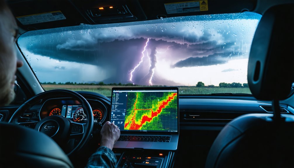
When erroneous sensor spikes go unscreened in real-time data streams, they can trigger false rapid-intensification signals that misposition you relative to an evolving storm’s actual hazard envelope.
Real-time analytics platforms that integrate anomaly classification algorithms distinguish instrument glitches from genuine mesoscale wind-shear surges or precipitation bursts, giving you actionable, uncontaminated situational awareness.
Compromised sensor calibration produces outliers that mimic vortex signatures, and without automated flagging, you’re maneuvering on corrupted inputs.
Maintaining data integrity across radar, surface mesonet, and mobile probe feeds guarantees that your intercept trajectory aligns with verified storm parameters rather than phantom extremes.
Screened datasets also sharpen nowcast model outputs, tightening your probabilistic envelope for dangerous shifts like tornadogenesis onset, so you can reposition or abort with precision rather than reacting to statistical noise.
How to Tell If That Spike Is a Broken Sensor, Not a Real Storm?
When a sensor transmits an anomalous spike, you can distinguish instrument failure from a genuine convective signature by cross-referencing the flagged value against co-located radar reflectivity, neighboring gauge readings, and discharge observations.
You’ll apply real-time outlier detection algorithms—leveraging robust thresholds like the 99th percentile or regression-based predicted values—to isolate implausible extremes that lack spatial coherence with surrounding grid cells.
Recognizing sensor failure signals, such as persistent flat-lining followed by abrupt spikes consistent with lightning or hail damage, lets you reject erroneous data before it contaminates nowcasting models or triggers false severe-weather alerts.
Spotting Sensor Failure Signals
Distinguishing a genuine meteorological spike from a sensor malfunction requires you to cross-examine multiple diagnostic layers simultaneously.
You’ll compare suspect readings against neighboring stations using spatial standardization, checking whether sensor anomalies propagate coherently across adjacent grid points. Genuine convective events exhibit spatial continuity; isolated single-station spikes typically indicate hardware degradation or transmission faults.
Deploy detection techniques like percentile thresholding—flagging values exceeding the 99th percentile—then validate against collocated radar reflectivity and discharge observations.
Temporal persistence matters too: authentic extreme wind gusts or precipitation intensities maintain physically plausible durations, whereas sensor failures produce instantaneous, irrecoverable jumps.
Cross-referencing spectral signatures helps further, since instrument errors generate spurious high-frequency noise inconsistent with real mesoscale dynamics.
Systematic application of these layered diagnostics keeps your dataset uncontaminated and your intercept decisions grounded in verified atmospheric reality.
Cross-Referencing Radar Data
Radar cross-referencing is your most reliable arbitration tool when a ground-based sensor throws a suspect spike.
Compare the gauge’s anomalous value against co-located radar reflectivity and dual-polarization products—ZDR, KDP, and correlation coefficient. If radar returns show no convective signature, no brightband structure, and no hydrometeor classification matching the reported intensity, you’re likely dealing with a sensor fault, not a genuine extreme.
Radar calibration consistency matters here; a poorly calibrated radar introduces its own biases, so verify calibration logs before trusting null returns as definitive.
Data consistency checks across neighboring gauges, disdrometers, and radar QPE fields strengthen your arbitration.
Spatial outliers that lack corroborating radar evidence almost always trace back to instrumentation failures, giving you the confidence to flag and exclude them from your operational dataset.
Real-Time Outlier Detection Methods
Real-time outlier detection demands that you interrogate every anomalous spike against multiple concurrent data streams before attributing it to a physical event.
Anomaly detection via real-time algorithms lets you autonomously screen sensor outputs against robust statistical thresholds—typically 95th or 99th percentile benchmarks—flagging implausible extremes instantly.
Apply this sequential verification protocol:
- Cross-validate the spike against neighboring station readings for spatial consistency.
- Compare flagged values against radar reflectivity and satellite-derived estimates.
- Apply regression-based replacement to predict expected values from correlated variables.
- Assess instrument metadata for recent damage reports from hail, lightning, or wind.
Unscreened gross errors mimic genuine convective signatures, corrupting nowcasting inputs and compromising intercept decisions.
Controlled anomaly detection preserves dataset integrity, ensuring your trajectory forecasts reflect atmospheric reality rather than sensor malfunction.
How Chasers Screen Out Bad Data Before It Causes a Fatal Mistake?
When instrument damage from hail, lightning, or extreme wind forces corrupts sensor output, it generates gross outliers that can masquerade as genuine meteorological extremes. This makes real-time outlier screening a non-negotiable component of storm chaser protocol. You can’t afford compromised forecasting accuracy when storm intensity escalates within minutes.
Effective data validation combines sensor calibration checks, statistical analysis against robust percentile thresholds, and automated anomaly detection algorithms that flag implausible spikes before they corrupt model reliability. Your decision support tools—radar composites, nowcasting platforms, environmental monitoring feeds—all degrade when bad data infiltrates input streams.
Cross-referencing multi-source observations sharpens risk assessment by isolating instrument artifacts from genuine convective signatures. Maintaining clean, validated datasets isn’t bureaucratic caution; it’s operational survival, keeping your intercept trajectory grounded in physical reality rather than sensor malfunction.
How Rainfall Outliers Shape a Storm Chaser’s Flash Flood Risk Calls?

Flash flood risk assessment hinges on spatially coherent rainfall intensities, and a single gauge outlier—whether an implausible spike from sensor malfunction or an unverified extreme—can collapse the reliability of your entire hydrological inference chain.
Corrupted inputs distort rainfall thresholds, destabilizing flash flood predictions before you’ve repositioned. Scrutinize these four critical failure points:
- Spatial outliers misrepresent basin-wide accumulation, skewing runoff estimates.
- Erroneous intensity spikes inflate return-period calculations, triggering false critical thresholds.
- Unscreened gauge extremes bias stochastic rainfall models used for rapid inundation forecasting.
- Corrupted temporal sequences break change-point detection, masking genuine escalation signals.
You can’t afford contaminated data when terrain amplifies convective rainfall into lethal surges.
Robust outlier-screening protocols protect your decision autonomy and operational accuracy simultaneously.
How Chasers Use Historical Outlier Data to Sharpen Tactics?
Historical outlier datasets aren’t just archival curiosities—they’re tactical calibration tools that sharpen your intercept logic and threshold-setting precision.
By analyzing historical patterns of anomalous wind gusts, precipitation spikes, and pressure drops, you refine your decision rules for initiating or aborting chases under rapidly evolving conditions.
Historical outlier patterns sharpen your decision rules for initiating or aborting chases under rapidly evolving atmospheric conditions.
These catalogued extremes let you benchmark current sensor readings against verified events, distinguishing instrument noise from genuine mesoscale signatures. You’ll identify recurrence intervals for specific outlier magnitudes, allowing probabilistic tactical adjustments when a storm’s parameters approach historically significant thresholds.
Cross-referencing outlier sets with radar reflectivity and discharge records validates which extremes correlate with high-impact events versus data artifacts.
This iterative refinement process tightens your intercept margins, reduces false-alarm exposure, and builds a statistically grounded framework for executing precise, risk-calibrated chase operations.
Frequently Asked Questions
Can Outliers in Climate Records Reveal Long-Term Shifts in Storm Behavior?
Yes, you can leverage climate anomalies in long-term records to detect shifts in extreme events. They’ll reveal evolving long-term trends, sharpen storm prediction models, and expose stationarity breakdowns that signal fundamentally changing atmospheric storm behavior patterns.
How Do Outliers Affect Return-Period Estimates Used in Infrastructure Planning?
Unremoved outliers bias your extreme value models, distorting return-period estimates and undermining infrastructure resilience. Their outlier significance skews stochastic exceedance probabilities, causing you to miscalibrate design storms and misallocate resources for flood-control and emergency-management systems.
Which Machine Learning Methods Best Detect Outliers in Data-Scarce Regions?
Like a compass in uncharted territory, you’ll find KPCA, LOF, Feature Bagging, and LSCP excel at anomaly detection in data-scarce regions, leveraging ensemble methods, clustering techniques, geographic information, and rigorous data preprocessing and model evaluation protocols.
How Do Spectral Analysis Methods Respond to Uncontrolled Meteorological Outliers?
When you skip data normalization, uncontrolled outliers corrupt spectral decomposition, injecting spurious peaks that invalidate storm-cycle diagnoses. You’ll compromise noise reduction pipelines and anomaly detection accuracy, distorting frequency-domain signatures critical for identifying legitimate meteorological extremes.
Can Spatial Outliers Across Multiple Gauges Confirm a Genuine Extreme Rainfall Event?
Like Sherlock’s converging clues, you’ll confirm genuine extreme rainfall when spatial correlation across gauges exceeds extreme thresholds, validating rainfall distribution anomalies and boosting gauge reliability—transforming isolated outliers into undeniable, freedom-affirming meteorological truth.
References
- https://crazystormchasers.com/quality-control-in-meteorological-data-analysis-for-storm-chasers/
- https://hess.copernicus.org/preprints/hess-2022-177/hess-2022-177-ATC1.pdf
- https://www.williambrossow.com/wp-content/uploads/2022/03/15588432-Journal-of-Applied-Meteorology-and-Climatology-A-New-Climatology-for-Investigating-Storm-Influences-in-and-on-the-Extratropics.pdf
- https://people.cs.vt.edu/ctlu/Publication/2007/IS-Region-Outlier-press.pdf
- https://journals.utm.my/jurnalteknologi/article/download/22617/8822
- https://pssc.org.ph/wp-content/pssc-archives/The Philippine Statistician/1979/Num 1-2/06_Detecting Outliers in Micrometeorological Time Series.pdf
- https://radli.meteo.be/uploads/media/60ddaac24e3aa/ildcilmc2016-poelmanetal.pdf?v20250829-1211
- https://www.reddit.com/r/stormchasing/comments/lvub71/how_important_are_storm_chasers_in_giving_data_or/
- https://www.sciencedirect.com/science/article/abs/pii/S0022169423003025
- https://www.pbs.org/newshour/science/inside-the-dangerous-and-unpredictable-science-of-storm-chasing


