Real-time storm forecasting tools are essential because they give you the critical lead time needed to evacuate, shelter, or deploy emergency resources before conditions become life-threatening. You’re relying on Doppler radar, geostationary satellites, and AI-powered nowcasting to track storm intensity with updates every 30 seconds. These systems reduce false alarms, strengthen public trust, and synchronize multi-agency response. The deeper you explore these technologies, the clearer their life-saving impact becomes.
Key Takeaways
- Real-time storm forecasting tools provide critical lead time, enabling emergency managers and first responders to execute evacuations and shelter-in-place decisions effectively.
- Doppler radar and phased array technology update storm data every 30 seconds, delivering high-resolution visualization of precipitation and particle velocity.
- AI-powered nowcasting analyzes live sensor data continuously, refining storm intensity estimates and converting feeds into actionable warnings rapidly.
- GIS mapping tools visualize live storm trajectories, enabling dynamic resource deployment and unified situational awareness across multiple emergency response agencies.
- Accurate real-time forecasts significantly reduce false alarm rates, building public trust and strengthening community resilience against severe weather events.
What Makes Real-Time Storm Forecasting Tools Essential?
When severe weather strikes, real-time storm forecasting tools give emergency managers, meteorologists, and first responders the critical lead time they need to act decisively.
You’re dealing with fast-moving threats where predictive analytics and technology integration directly determine storm impact outcomes. Data accessibility through Doppler radar, satellite feeds, and AI-powered nowcasting sharpens risk management decisions before conditions deteriorate.
Predictive analytics and real-time data don’t just track storms — they determine who stays safe when conditions collapse.
These tools strengthen emergency communication by delivering geotargeted alerts that drive community preparedness and public awareness simultaneously.
Response coordination improves when teams access precise storm trajectory data, enabling optimized resource deployment via GIS mapping. Weather literacy increases as accurate forecasts reduce false alarms, building public trust in official warnings.
Ultimately, integrating these systems transforms raw atmospheric data into actionable intelligence that protects lives and property.
The Life-Saving Value of Early Warning Lead Time
Early warning lead time is the single most measurable variable separating survivable severe weather events from catastrophic ones.
When you receive geotargeted alerts minutes earlier, you’re not just gaining time—you’re gaining options. Lead time benefits compound rapidly: each additional minute allows evacuation decisions, shelter-in-place execution, and resource pre-positioning.
Studies confirm warning effectiveness directly correlates with casualty reduction during tornadoes and flash floods.
Real-time forecasting tools leverage Doppler radar, phased array systems, and AI-powered nowcasting to push that lead time window further than traditional methods ever could.
You’re empowered to act before conditions deteriorate, not after. Systems using Common Alerting Protocol deliver precise, location-specific warnings that cut through noise.
That precision preserves lives, protects property, and maintains your autonomy when severe weather threatens.
How Doppler Radar and Satellites Power Live Storm Detection?
Doppler radar and geostationary satellites form the sensing backbone of live storm detection, each filling critical gaps the other can’t cover. Doppler functionality captures precipitation tracking data by measuring particle velocity and intensity, giving you high-resolution storm visualization in near real time.
Phased array radar integration accelerates scan cycles, delivering real time updates every 30 seconds across targeted zones.
Phased array radar cuts scan cycles dramatically, pushing live storm updates to emergency teams every 30 seconds.
Satellite advancements complement this by providing continuous atmospheric analysis across broad coverage areas. Geostationary platforms monitor weather dynamics without interruption, while polar-orbiting satellites contribute sharper resolution for deeper data accuracy.
Together, they map storm structure, cloud formation, and thermal gradients with precision traditional methods can’t match.
This detection technology converts raw atmospheric inputs into actionable intelligence, letting emergency managers track evolving threats and respond before conditions deteriorate.
How AI and Machine Learning Sharpen Storm Predictions?
When you integrate AI-powered nowcasting into real-time storm forecasting, you’re leveraging algorithms that analyze live radar and satellite data to generate precise predictions within immediate hours.
Machine learning models continuously refine high-resolution IoT sensor data, sharpening trajectory insights and improving storm intensity estimates with each new data cycle.
You’ll find these systems can update targeted storm areas as frequently as every 30 seconds, transforming raw atmospheric data into actionable intelligence that outperforms traditional forecasting methods.
AI-Powered Nowcasting Advances
As storm systems evolve within minutes, AI and machine learning algorithms process real-time radar and satellite data far faster than traditional numerical models, giving forecasters a decisive edge in nowcasting.
These nowcasting techniques analyze atmospheric patterns continuously, identifying rotation signatures, precipitation intensity shifts, and storm trajectory changes with remarkable precision. You benefit directly when predictive modeling converts raw sensor feeds into actionable warnings within seconds rather than hours.
Machine learning refines high-resolution IoT weather sensor data, filtering noise and validating readings automatically. Rapid updates targeting specific areas every 30 seconds let you track fast-changing storm cells accurately.
AI-powered systems detect life-threatening conditions earlier, enabling emergency managers to issue geotargeted alerts through Common Alerting Protocol systems, ultimately reducing casualties and minimizing economic losses from severe weather events.
Machine Learning Refines Predictions
Machine learning sharpens storm predictions by continuously ingesting high-resolution radar, satellite, and IoT sensor data, then applying pattern recognition algorithms that identify subtle atmospheric precursors traditional models miss.
Through algorithm optimization and anomaly detection, you get faster, more reliable risk assessment before conditions deteriorate.
Key capabilities driving this precision include:
- Predictive analytics that leverage trend analysis to forecast storm intensity hours ahead
- Data integration pipelines merging multi-source feeds into unified weather modeling frameworks
- Data visualization dashboards translating complex atmospheric variables into actionable decision layers
- Real-time anomaly detection flagging rapid pressure drops or wind shear signatures instantly
These capabilities compress your response window without sacrificing accuracy.
Machine learning doesn’t just refine forecasts—it fundamentally restructures how meteorological intelligence reaches you when it matters most.
How Real-Time Storm Data Directs Emergency Response?
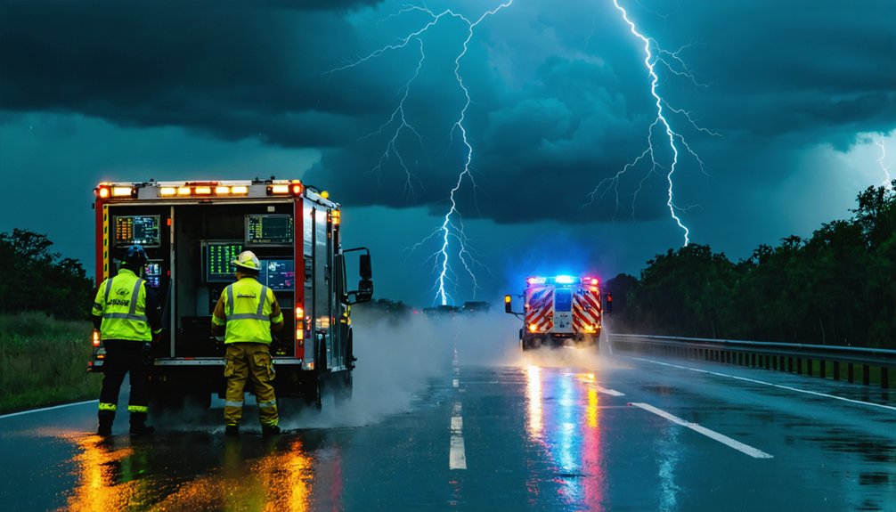
When a severe storm develops, you rely on real-time data streams from Doppler radar, satellites, and IoT sensors to coordinate emergency response across multiple agencies simultaneously.
You can use GIS mapping tools to visualize live storm trajectories, enabling dynamic resource deployment—positioning logistics units, rescue teams, and medical responders precisely where conditions demand.
As storm data updates every 30 seconds, you’re able to continuously recalibrate field operations, rerouting resources and adjusting evacuation corridors based on the storm’s evolving speed and intensity.
Real-Time Data Coordination
Real-time storm data doesn’t just track weather — it actively coordinates emergency response by funneling live atmospheric readings into decision-making pipelines that direct resources, personnel, and public warnings simultaneously.
Through data synchronization across radar networks, satellites, and IoT sensors, you get unified situational awareness that eliminates information gaps between agencies.
Real time collaboration enables:
- GIS-integrated routing that repositions logistics units based on live Doppler feeds
- Geotargeted alerts pushed through Common Alerting Protocol systems to affected zones
- Dynamic resource reallocation triggered by storm trajectory shifts in real time
- Cross-agency data sharing that aligns emergency managers, grid operators, and responders instantly
This synchronized data flow transforms raw atmospheric inputs into coordinated action, minimizing response latency and maximizing the precision of every deployment decision you make.
Dynamic Resource Deployment Strategies
Once live storm data streams into your command infrastructure, it doesn’t just inform — it actively directs where personnel, equipment, and supplies move.
Dynamic logistics depend on continuous situational awareness, letting you reposition assets before conditions deteriorate. Real-time coordination through integrated systems connects field teams, dispatch centers, and logistics units using shared GIS-mapped data layers.
You’re not reacting — you’re executing proactive planning driven by precise storm trajectory modeling.
Adaptive strategies allow resource optimization across shifting threat zones, reducing wasted deployment and closing coverage gaps. Collaborative response frameworks guarantee mutual aid partners receive identical data feeds, eliminating coordination lag.
Risk assessment updates automatically as radar refreshes, giving you actionable decision points every 30 seconds.
Efficient deployment becomes measurable, repeatable, and defensible — because every movement traces back to verified, real-time atmospheric intelligence.
Fewer False Alarms Build Public Trust in Real-Time Forecasts
False alarms erode public confidence, and that erosion translates directly into reduced compliance when genuine severe weather warnings are issued. Real-time forecasting tools combat this by delivering meteorologically verified, high-resolution data that sharpens false alarm reduction rates considerably.
You benefit from systems that prioritize information transparency and precise communication strategies, ensuring warnings reflect actual threat conditions. Community engagement strengthens when public perception shifts toward reliability.
Key trust-building mechanisms include:
- Feedback mechanisms that validate forecast accuracy post-event
- Awareness campaigns educating communities on warning verification protocols
- Geotargeted alerts minimizing unnecessary regional disruptions
- Data-driven transparency publishing false alarm ratios publicly
When you trust the system, you respond. That behavioral compliance is the ultimate metric of effective trust building and successful real-time forecasting integration.
Why Precision Storm Tracking Protects Lives and Property?

When precision storm tracking systems detect a tornado’s rotational signature 20 minutes before touchdown, that lead time is the difference between an ordered evacuation and a casualty report.
Real-time alerts powered by data integration from Doppler radar, satellites, and AI-driven models give you actionable intelligence before conditions become unsurvivable.
Real-time data integration doesn’t just inform—it delivers verified intelligence before survival windows close.
Predictive accuracy transforms raw atmospheric data into targeted evacuation strategies, reducing exposure for vulnerable populations.
Risk assessment tools map storm trajectories against population density, enabling emergency preparedness teams to deploy resources precisely where they’re needed.
Storm safety depends on weather literacy—understanding what alerts mean and acting immediately.
Community resilience strengthens when public awareness campaigns reinforce that real-time data isn’t speculative; it’s operationally verified intelligence.
Precision tracking protects both lives and property by eliminating the deadly gap between warning and response.
Frequently Asked Questions
How Do Real-Time Forecasting Tools Differ From Traditional Weather Prediction Methods?
You’ll find real-time tools surpass traditional methods through continuous data integration from radar, satellites, and AI, dramatically improving predictive accuracy. They process live atmospheric data instantly, giving you actionable storm insights within minutes rather than hours.
What Training Do Emergency Managers Need to Use Real-Time Storm Tools?
You’ll need training requirements covering Doppler radar interpretation, GIS mapping, and AI-powered nowcasting platforms. Master technology integration by practicing dynamic resource allocation using live data streams, ensuring you’re making precise, actionable decisions during severe weather events.
How Are Real-Time Storm Forecasting Tools Funded and Maintained Nationally?
Like a lifeline stretched across the nation, you’re backed by federal funding, private partnerships, and technology investments that sustain data accuracy, ensuring real-time storm forecasting tools remain powerful, reliable, and free from operational gaps.
Can Individuals Access Real-Time Storm Forecasting Data Directly From Home?
You can access real-time storm forecasting data directly from home using platforms like Weather.gov or RadarScope. These tools deliver home accessibility with high data accuracy, empowering you to make independent, informed safety decisions during severe weather events.
How Do Real-Time Storm Tools Perform in Areas With Limited Technology Infrastructure?
In areas with limited connectivity challenges, you’ll rely on alternative data sources like UAVs, crowdsourced inputs, and satellite imaging to maintain storm tracking accuracy, ensuring real-time forecasting remains functional despite constrained technological infrastructure.
References
- https://www.youtube.com/watch?v=BG3qe1Rcki4
- https://www.nssl.noaa.gov/projects/wof/
- https://www.greenmatters.com/weather-and-global-warming/weather-apis-emergency-planning
- https://crazystormchasers.com/real-time-storm-monitoring-technology-trends/
- https://www.youtube.com/watch?v=ECsGC7lMvJU
- https://www.nsf.gov/impacts/doppler
- https://www.youtube.com/watch?v=EDeDdfJp6HQ
- https://link.springer.com/article/10.1007/s12145-008-0010-7
- https://www.rmets.org/metmatters/role-satellites-weather-forecasting
- https://ral.ucar.edu/technologies/forecasting-systems


