You chase supercells because no other storm combines rotating structure, extreme scale, and cinematic light into a single living subject. They can stretch 50 miles wide, persist for hours, and evolve through phases that ordinary thunderstorms never reach. Each one produces a unique configuration of wall clouds, lightning, and color gradients you won’t see twice. If you want to understand what separates a great supercell shot from a breathtaking one, there’s much more to uncover.
Key Takeaways
- Supercells produce dramatic visual features like rotating wall clouds, lightning, and anvil tops, creating extraordinary photographic subjects unlike ordinary storms.
- Their unique lighting effects, including backlit amber anvil clouds and cinematic rain curtains, produce stunning, rarely replicated color contrasts.
- No two supercells are identical, offering photographers a singular, evolving visual experience with each chase.
- Their massive scale and dynamic structural evolution demand skill and patience, making successful captures deeply rewarding for photographers.
- Seasonal variability and unpredictable atmospheric conditions ensure fresh photographic opportunities, fueling continuous pursuit throughout storm season.
What Makes a Supercell Different From a Regular Thunderstorm?
While ordinary thunderstorms build and collapse within an hour, supercells lock into a self-sustaining rotation that can persist for several hours and stretch 50 miles wide. What drives that difference is atmospheric dynamics — specifically, wind shear twists rising air into a vertical column called a mesocyclone, giving the storm its organized spin.
Wind shear transforms rising air into a mesocyclone — the rotational engine that keeps supercells alive for hours.
Standard storms lack that rotational engine, so they dissipate quickly and produce unremarkable cloud formation.
Supercells, by contrast, develop a layered structure: a broad anvil top, a defined updraft base, and a rotating wall cloud beneath. That architecture makes them visually distinct and meteorologically intense.
You’re not just watching rain fall — you’re witnessing a system that generates hail, lightning, damaging winds, and sometimes tornadoes, all within one coherent, evolving storm structure.
Why Supercells Look Like Something From Another World
Because supercells develop such a highly organized internal structure, they produce cloud formations that look nothing like a typical storm. You’re looking at celestial architecture in motion — a rotating mass with a defined updraft base, a striated wall cloud, and a flat anvil top that spreads across the horizon like a spaceship holding position.
The visual result is pure atmospheric wonder. The storm’s symmetry and scale separate it from ordinary weather, and when low light catches the edges, the contrast between illuminated structure and dark core becomes almost surreal.
You’re not just seeing a cloud — you’re watching a living system organize itself in real time. That’s exactly why photographers position themselves deliberately, chasing the angle that captures what most people will never witness firsthand.
The Rare Structure That Makes Every Supercell Unique
When you study a supercell up close, you can see how wind shear, instability, moisture, and lift combine to produce a storm with a clear updraft base, a rotating mesocyclone, and a distinct anvil top — a level of organization most thunderstorms never achieve.
That structure isn’t static; it shifts through visual phases as the storm intensifies, weakens, or reorganizes, giving you a constantly evolving subject to frame.
No two supercells produce the same configuration, so each chase puts you in front of a structure that exists only once.
Organized Storm Structure Explained
Supercells don’t just happen—they build from a precise alignment of wind shear, atmospheric instability, moisture, and lift that most storms never achieve. These atmospheric dynamics work together to produce a mesocyclone, a rotating updraft column that organizes the entire storm around a single, powerful engine.
Unlike ordinary convective cells, supercells develop a structured, layered profile. You’ll notice a clear updraft base pulling moisture upward, flanking bands wrapping around the core, and a flat, spreading anvil top pushed outward by upper-level winds.
These storm cloud formations evolve in real time, shifting shape and intensity as atmospheric conditions fluctuate.
Each phase offers a different visual opportunity. No two supercells produce the same structure, which means every chase puts you in front of something that’s genuinely never existed before.
No Two Supercells Alike
Although supercells follow the same basic atmospheric recipe, no two ever produce an identical result. Wind shear, instability, and moisture combine differently every time, generating distinct light dynamics, storm symmetry, and structural evolution you won’t replicate elsewhere.
Each storm gives you a completely different visual phase to chase:
- A wall cloud that spirals tighter than anything you’ve photographed before
- Light dynamics that shift from copper to deep violet within minutes
- Storm symmetry so precise it looks architecturally designed
- A rotating updraft base that dissolves before you reposition your lens
That uniqueness is exactly why photographers return season after season. You’re not chasing a repeatable shot. You’re pursuing a singular atmospheric event that exists once, transforms fast, and disappears completely on its own terms.
How Supercell Scale and Danger Shape Every Shot
When you’re standing beneath a supercell that stretches 50 miles wide, fitting the full structure into a single frame becomes one of your most immediate technical problems.
You’re constantly weighing positioning against safety, choosing angles that preserve compositional balance without putting you inside the storm’s most dangerous quadrants.
That tension between scale and danger doesn’t just shape where you stand—it drives every exposure decision you make.
Navigating Immense Storm Scale
Scale alone can turn a promising shot into a compromised one. Supercells rank among the most extreme weather phenomena you’ll ever face behind a lens, stretching up to 50 miles wide. Understanding storm dynamics means knowing that fitting the full structure into one frame demands deliberate positioning.
You’ll need to balance these realities fast:
- Distance too close collapses your perspective, burying structure in rain and contrast loss
- Distance too far strips the storm of its raw, imposing presence
- Neighboring rain bands bleed into your frame, killing visual clarity
- Storm movement constantly invalidates your position, forcing real-time adjustments
You’re not just composing an image — you’re negotiating with a living, shifting system. Every decision compounds quickly, and hesitation costs you the shot entirely.
Danger Driving Compositional Decisions
Smart weather forecasting tells you where the storm’s strongest features will develop, letting you intercept the visual structure without gambling your exit route. You’re constantly weighing the shot against the risk — adjusting distance, shifting position, reading the storm’s motion.
That tension sharpens your instincts. You move deliberately, commit quickly, and never let a perfect composition trap you.
Danger strips away hesitation and forces disciplined, precise shooting under real consequences.
How Light and Color Transform Supercells Into Living Portraits
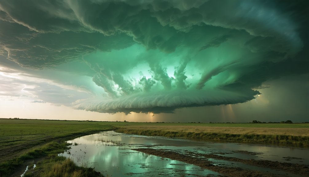
Light transforms a supercell from a meteorological event into something that feels alive. When you’re out there, you’ll notice how color contrast sharpens between the darkened core and the illuminated outer edges. Light diffusion through rain curtains creates a softened, almost cinematic glow that no studio can replicate.
Light doesn’t just illuminate a supercell — it resurrects it, turning meteorology into something that breathes.
Evening conditions push this further. You’re watching the storm absorb sunset gradients, shift tones, and reorganize structure in real time. Here’s what that light actually gives you:
- Backlit anvil clouds glowing amber against a violet sky
- Deep shadow pockets that anchor the storm’s rotation visually
- Warm edges that make the storm feel textured, not flat
- Shifting color phases that mark each stage of the storm’s evolution
You’re not photographing weather. You’re composing a portrait of something breathing.
Why Photographing Supercells Is Harder Than It Looks
That portrait of a living storm is beautiful until you try to fit it in a frame. Supercells can stretch 50 miles wide, so your widest lens still struggles to capture the full structure. You’re constantly repositioning, balancing storm safety against the need for clean sightlines free of rain bands that kill contrast.
Weather forecasting gets you close, but the storm moves and evolves faster than your plan. Light shifts, structure changes, and your window tightens without warning. You’re making split-second decisions about angle, distance, and exposure simultaneously.
Isolation matters enormously. Neighboring precipitation muddies the scene and flattens the drama you came for. The technical demands are real, and the field rewards photographers who combine patience, spatial awareness, and the discipline to move decisively when conditions shift.
How Positioning and Timing Produce the Best Supercell Images
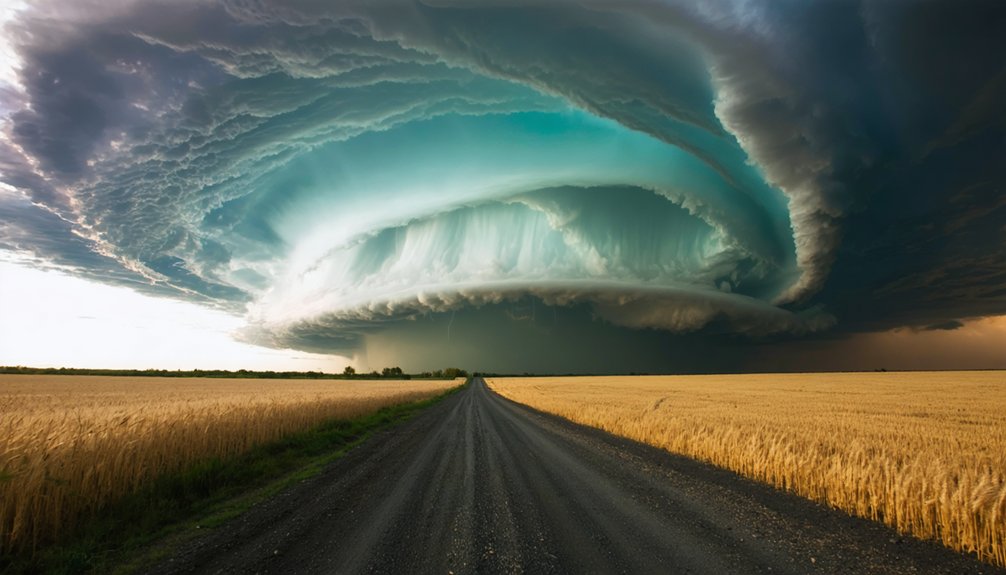
Positioning yourself correctly transforms a chaotic sky into a coherent image. You’ll want to read weather patterns early, staying southeast of the storm to capture its full rotating base without rain blocking your view. Cloud formations shift fast, so every minute of hesitation costs you a critical frame.
Work these positioning principles to maximize impact:
- Stay ahead of the storm’s forward motion to maintain clean sight lines
- Use foreground elements like roads or fields to anchor the storm’s massive scale
- Time your shots during transition light when edges glow against dark cores
- Reposition constantly as cloud formations evolve through distinct structural phases
You’re not waiting for the storm — you’re moving with it, reading its rhythm, and claiming the frame before conditions collapse.
Why Storm Chasers Choose Supercells Over Every Other Storm
When you’ve chased ordinary thunderstorms, you quickly recognize what’s missing — the organized, rotating structure that makes a supercell unlike anything else in the atmosphere. Standard storms lack the layered updraft base, the anvil symmetry, and the sheer scale that defines serious storm photography.
Supercells form under precise atmospheric conditions — wind shear, instability, moisture, and lift — producing weather phenomena that no other storm type replicates. They can stretch 50 miles wide, generate lightning, hail, and tornadoes, and shift visually within minutes.
Supercells demand exact conditions — and in return, they deliver phenomena no other storm can match.
Each storm evolves differently, meaning you’ll never shoot the same subject twice. That rarity, combined with structural complexity and raw power, is exactly why experienced chasers bypass ordinary cells entirely.
Supercells don’t just offer a shot — they offer an encounter with something genuinely extraordinary.
What Keeps Photographers Chasing Supercells Season After Season?
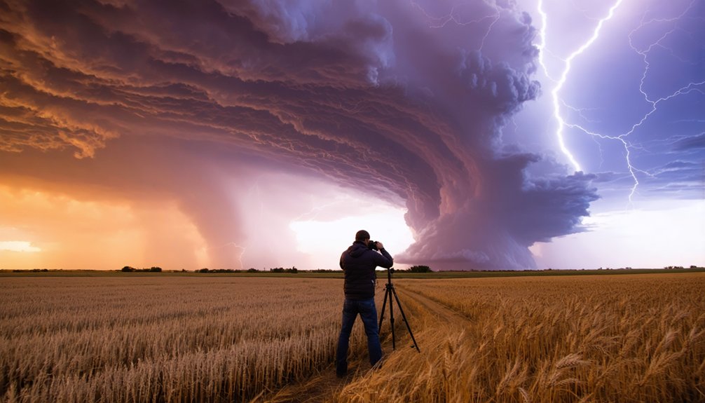
Once you’ve stood beneath a supercell and felt the inflow wind pull toward the updraft base, ordinary storm photography stops being enough. The scale, structure, and raw atmosphere keep pulling you back each season.
What makes storm photography and weather visualization addictive isn’t just the image — it’s what you earn to get it:
- The rotating wall cloud dropping toward open plains with no barriers between you and it
- Lightning threading through a green-tinted hail core at dusk
- A 50-mile-wide storm reorganizing itself while you reposition for a cleaner frame
- Inflow winds shifting as the mesocyclone tightens overhead
Each season delivers different conditions, different light, and different structure. No supercell repeats itself. That unpredictability isn’t frustrating — it’s the reason you load the gear and drive toward the anvil again.
Frequently Asked Questions
What Camera Settings Work Best for Photographing Supercells in Low Light?
Like a night owl hunting clarity, you’ll master low-light camera techniques by setting ISO 800–3200, f/2.8, and 15–30 sec exposures. Make lighting adjustments dynamically as the supercell’s dramatic contrasts shift rapidly around you.
How Do Photographers Stay Safe While Shooting Supercells up Close?
You’ll stay safe during storm chasing by constantly monitoring storm movement, maintaining escape routes, and prioritizing lightning safety by never standing in open fields. Position yourself at a safe distance while still capturing the supercell’s dramatic, evolving structure.
Which Regions of the World Produce the Most Photogenic Supercells Annually?
You’ll find the most photogenic supercells waiting in America’s Great Plains — Tornado Alley’s volatile skies release unrivaled weather phenomena annually. Storm chasers consistently target Kansas, Oklahoma, and Texas, where atmospheric instability and wind shear sculpt the most visually dramatic, structurally perfect supercells worldwide.
How Long Does a Typical Supercell Last Before It Dissipates Completely?
You’ll find a typical supercell lasts two to six hours before it dissipates. Storm formation and weather patterns influence its lifespan, so you’ve got a limited window to chase, position yourself, and capture its evolving, breathtaking structure.
Do Photographers Need Special Permits to Chase Supercells on Private Land?
You don’t need formal permits, but legal considerations demand you secure permission requirements directly from landowners before accessing private land. Respect boundaries, ask ahead, and you’ll chase freely while keeping your adventure both ethical and unrestricted.
References
- https://www.youtube.com/watch?v=ZzunoaqNc7E
- https://www.bbc.com/travel/article/20230727-in-pictures-photos-from-a-us-storm-chaser
- https://www.atlasobscura.com/articles/storm-chaser-photographs
- https://www.popsci.com/story/science/weather-storms-photography/
- https://1x.com/magazine/permalink/8560
- https://www.rmets.org/metmatters/weather-photographer-year-setting-scene-storm-chasing
- https://www.youtube.com/watch?v=-Bk5UQT4Ak4
- https://www.wired.com/story/supercell-thunderstorm-photo-gallery/
- https://www.theguardian.com/artanddesign/2022/jun/24/it-leaves-you-speechless-australian-storm-chaser-captures-americas-monster-skies
- https://www.thisiscolossal.com/2017/05/fractal-a-magnificent-supercell-thunderstorm-timelapse-by-chad-cowan/



