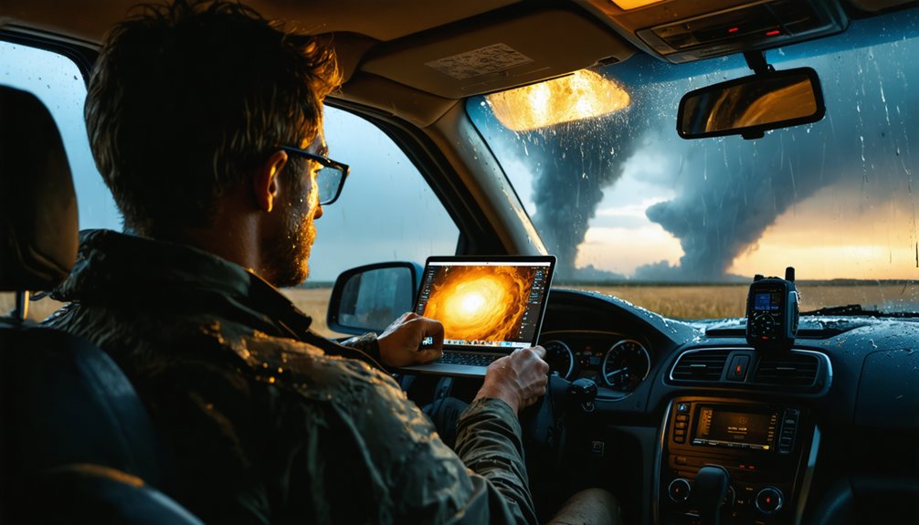
Technology is vital in storm chasing because it’s the only thing standing between you and catastrophic failure. You’re operating within a 20-minute average tornado warning window, and without layered radar systems, GPS mapping, and real-time communication networks, that margin collapses entirely. Mobile Threat Net delivers radar updates every five minutes with 99% reliability, while dual-polarization radar confirms active tornadoes instantly. Every system you deploy directly sharpens your survival odds—and there’s far more to unpack across each essential layer.
Key Takeaways
- Radar systems provide real-time storm tracking, enabling chasers to monitor rapidly shifting conditions and maintain critical situational awareness.
- GPS and mapping tools allow live position plotting and quick routing decisions, especially on rural roads with limited escape routes.
- Real-time communication systems like Mobile Threat Net deliver reliable alerts, ensuring chasers stay connected even in remote areas.
- Drones and autonomous vehicles safely collect data in dangerous environments, improving tornado prediction capabilities without risking human lives.
- AI processes atmospheric data faster than human analysts, enhancing predictive modeling accuracy and extending tornado warning lead times significantly.
Why Do Storm Chasers Depend on Technology to Survive?
Storm chasing isn’t just a high-adrenaline pursuit—it’s a data-intensive operation where technology forms the critical boundary between survivability and catastrophic failure.
You’re maneuvering through violent weather hazards where conditions shift within seconds, making technological awareness non-negotiable.
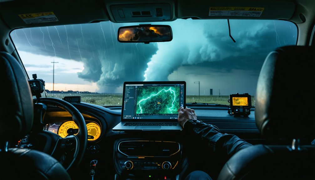
Your survival strategies depend on multi-layered systems working simultaneously. Radar arrays mounted on mobile vehicles capture real-time precipitation and wind data, while GPS mapping software plots live positions against developing tornado tracks.
Survival depends on multi-layered systems—radar capturing live storm data while GPS tracks your position against advancing tornado paths.
Mobile Threat Net delivers radar updates every five minutes with 99% reliability, ensuring you’re never operating on outdated intelligence.
Ground-level instrument arrays monitor pressure, humidity, and wind ahead of approaching storms, giving you actionable data before hazardous conditions arrive.
Without these integrated technologies, you’re fundamentally maneuvering blind inside one of Earth’s most destructive natural phenomena.
How Radar Systems Help Chasers Track Storms in Real Time
Radar systems form the technological backbone of real-time storm tracking, giving you layered situational awareness that no single instrument can provide alone.
Radar evolution has produced two distinct operational tools: long-wavelength radars penetrate deep into storm systems for broad coverage, while short-wavelength radars positioned closer to developing tornadoes deliver high-resolution detection of small-scale phenomena.
You’re not locked into one perspective—you’re pulling data from multiple radar types mounted on mobile vehicles capturing precipitation and wind measurements from various angles simultaneously.
Mobile Threat Net systems ingest live radar updates every five minutes with 99 percent reliability, ensuring your storm detection capabilities remain sharp even in remote areas.
This multi-radar architecture lets you anticipate tornadic development before conditions become unsurvivable, preserving your operational freedom and safety margin.
Why GPS and Mapping Tools Are Non-Negotiable in the Field
When you’re moving at highway speeds toward a rapidly evolving storm system, GPS-based mapping software with live position plotting isn’t a convenience—it’s your primary instrument for surviving the intercept.
GPS integration connects your vehicle’s position directly to live radar overlays, letting you make split-second routing decisions with confidence.
Mapping accuracy becomes critical when you’re traversing rural Tornado Alley roads with limited escape options—outdated cartographic data can trap you in a dangerous position.
Systems with annual road network updates and GIS integration allow you to calculate ideal observation points while maintaining viable exit routes.
Mobile computers with wireless internet access enable dynamic route adjustments as storm tracks shift.
Without precise positioning data, you’re not chasing storms—you’re gambling with your life.
What Do Ground-Level Instrument Arrays Actually Measure?
When you deploy ground-level instrument arrays ahead of an approaching storm, you’re capturing four critical atmospheric parameters simultaneously: wind speed and direction, air pressure, temperature, and humidity.
These measurements establish the pre-storm environmental baseline that radar systems alone can’t provide, giving you precise surface-layer data vital for understanding tornadic development.
You’re fundamentally building a real-time atmospheric profile at ground level, where boundary layer physics directly influence storm intensification and tornado formation.
Atmospheric Conditions Monitored
Ground-level instrument arrays deployed ahead of approaching storms measure four core atmospheric variables: wind speed and direction, barometric pressure, temperature, and relative humidity.
These atmospheric measurements give you a precise snapshot of surface conditions before and during storm passage. Each sensor transmits continuous data streams, letting researchers track rapid pressure drops, sudden wind shifts, and temperature gradients that signal tornado development.
Your data collection network captures these variables simultaneously across multiple stationary points, building a spatial picture of the storm’s ground-level environment.
Barometric pressure readings reveal mesocyclone intensity, while humidity data confirms moisture availability fueling convection. Wind measurements identify dangerous rotational signatures at the surface.
Together, these four variables form the empirical foundation that separates informed storm analysis from guesswork, directly improving warning accuracy and protecting lives.
Ground-Level Data Parameters
Four primary atmospheric variables define what ground-level instrument arrays measure during storm chase operations: wind speed and direction, barometric pressure, air temperature, and relative humidity.
You’re capturing raw environmental data before, during, and after storm passage, creating precise temporal snapshots of atmospheric transformation.
Ground level observations deliver what remote sensing can’t replicate — direct surface contact measurements revealing how storms interact with the boundary layer. Barometric pressure drops signal intensifying rotation. Wind direction shifts expose mesocyclone positioning. Temperature gradients identify cold pool boundaries.
Data accuracy depends entirely on instrument placement and calibration. Arrays deployed ahead of approaching systems record baseline conditions, establishing comparison points when severe weather arrives.
These measurements feed directly into forecast models, helping meteorologists refine warning thresholds and understand tornadic development at its most fundamental level.
How Drones and Autonomous Vehicles Are Changing Storm Chasing?
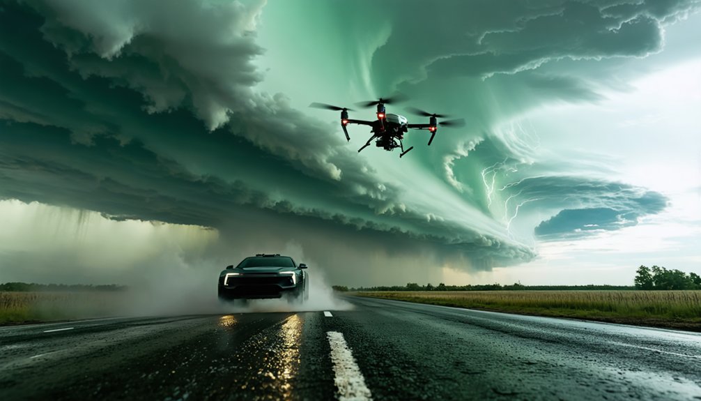
Drones and autonomous vehicles are revolutionizing storm chasing by accessing environments that’d otherwise be lethal or physically impossible for human operators to enter.
Through Drone Innovations and Autonomous Navigation, uncrewed platforms now achieve Storm Penetration into boundary layers where traditional instruments can’t survive. These systems withstand winds exceeding 140 mph and 90-foot waves, enabling Data Collection under Extreme Conditions that’d destroy conventional equipment.
AI Integration empowers these platforms to gather measurements autonomously, capturing internal storm structures and boundary layer physics that dramatically sharpen forecast models.
You’re fundamentally deploying independent scientific instruments directly into the storm’s core, retrieving Weather Insights that no manned vehicle could safely obtain.
This technological freedom expands your observational range exponentially, delivering precision data that strengthens tornado prediction and ultimately saves lives.
How Does Storm Chasing Data Directly Improve Tornado Warnings?
How directly does storm chasing data translate into life-saving tornado warnings? More directly than you might expect. Every instrument reading, radar sweep, and atmospheric measurement collected during active chases feeds into forecast models, sharpening tornado prediction capabilities with measurable precision.
When mobile radars capture high-resolution wind shear data and instrumented pods record ground-level pressure drops, meteorologists gain critical inputs unavailable through standard remote sensing. That data accuracy translates into earlier warning times, giving you and your community more seconds to act.
Historical chase datasets studied over years refine boundary layer physics models, systematically eliminating forecast errors.
Real-time data streams reach analysts nearly as fast as National Weather Service forecasters receive their own feeds, compressing the gap between detection and public warning to its absolute minimum.
How Real-Time Communication Systems Enable Split-Second Field Decisions
When you’re tracking a violent supercell across open terrain, split-second decisions depend entirely on the quality and speed of incoming data. Mobile Threat Net systems deliver real-time alerts with 99% reliability, invigorating radar updates every five minutes directly to your mobile unit.
Split-second decisions define storm chasing survival—and Mobile Threat Net’s 99% reliable real-time alerts keep those decisions razor-sharp.
That communication reliability keeps your situational awareness sharp when storm structure shifts unexpectedly.
Satellite internet systems like DataStorm maintain mobile connectivity across remote regions where cellular infrastructure disappears entirely. Meanwhile, 4G LTE integration handles most domestic operations, pushing data accuracy to near-National Weather Service speeds.
LoRaWAN networks extend low-power communication across rural chase corridors where other systems fail.
These layered communication architectures aren’t optional equipment—they’re your operational efficiency backbone. Without rapid response data streams reaching your vehicle instantly, precise field positioning becomes guesswork, and guesswork gets people killed.
How Does Storm Chase Technology Directly Save Lives?
When you examine storm chase technology’s life-saving impact, two advancements stand out: early warning system improvements and emergency response protocol development.
Data collected from instrumented pods, mobile radar arrays, and autonomous drones feeds directly into forecast models, extending tornado warning lead times and reducing false alarm rates that cause public complacency.
You can trace measurable reductions in storm-related fatalities to these technologies, as historical chase data—analyzed months and years after events—continuously refines the boundary physics models that drive National Weather Service alert systems and evacuation procedures.
Early Warning System Improvements
Storm chase technology directly saves lives by transforming raw atmospheric data into actionable tornado warnings with unprecedented speed and accuracy.
Mobile radar networks and instrumented pods deliver storm prediction capabilities that give you critical minutes to act. Improved data accuracy means fewer false alarms and more reliable evacuation decisions.
- Dual-polarization radar distinguishes rain from debris, confirming active tornadoes within seconds.
- Mobile Threat Net systems push radar updates every 5 minutes, keeping emergency managers ahead of storm movement.
- Instrumented pods capture ground-level pressure drops and wind signatures impossible to detect remotely.
- Historical chase data refines forecast models continuously, extending warning lead times from minutes to nearly 20 minutes on average.
Each technological advancement directly translates into preserved human freedom—specifically, your freedom to escape danger.
Emergency Response Protocol Advancement
Beyond improving warning times, storm chase technology directly shapes how emergency managers deploy resources and coordinate evacuations. Real-time data streams from mobile radar units and instrumented pods feed directly into emergency simulations, letting responders model tornado trajectories before touchdown occurs.
You’re fundamentally working with live atmospheric intelligence rather than historical approximations.
Protocol evaluation becomes measurable when chase vehicles transmit ground-truth data confirming or contradicting existing evacuation models. If a tornado’s boundary layer physics behaves unexpectedly, emergency managers adjust resource positioning immediately.
LoRaWAN networks and satellite-connected DOW vehicles guarantee this critical data reaches coordination centers even where cellular infrastructure fails.
Storm chase research gathered over decades continuously refines these protocols, eliminating procedural weaknesses that cost lives during previous events and strengthening response frameworks before the next major system develops.
What Role Is AI Playing in Storm Chasing and Forecasting?
As storm chasing technology advances, AI’s role has shifted from a supplementary tool to a core data-gathering and forecasting asset. Machine learning algorithms process atmospheric insights faster than any human analyst, enabling predictive modeling that sharpens your risk assessment capabilities considerably.
AI advancements now drive:
AI advancements now drive smarter, faster storm intelligence—transforming raw atmospheric chaos into precise, actionable data for every chase.
- Automated analysis of multi-radar datasets, identifying rotation signatures within seconds.
- Storm simulations that model tornadic development using real-time data integration from drones and instrumented pods.
- Boundary layer mapping where AI-powered uncrewed vehicles capture physics previously inaccessible to manned platforms.
- Predictive modeling refinement that continuously trains on historical chase data, tightening forecast accuracy with each storm cycle.
You’re no longer guessing. AI delivers precise, actionable intelligence before conditions become unsurvivable.
What’s Next for Storm Chasing Technology?
The next frontier of storm chasing technology builds directly on AI’s predictive gains, pushing instrumentation, connectivity, and autonomous systems toward capabilities that’ll redefine what data you can extract from a tornadic environment.
Future Innovations include LoRaWAN-networked instrument pods, higher-resolution dual-polarization radars, and expanded drone fleets penetrating boundary layers that manned vehicles can’t safely reach.
Uncrewed platforms already surviving 140-mph winds and 90-foot waves signal where autonomous capability is heading.
Enhanced Safety follows directly — as autonomous systems absorb the highest-risk data collection roles, you reduce human exposure without sacrificing observational precision.
Real-time satellite connectivity will push data transmission speeds closer to instantaneous, giving you field intelligence nearly indistinguishable from what National Weather Service forecasters receive, fundamentally sharpening tornado warning lead times.
Frequently Asked Questions
What Types of Weather Balloons Are Used During Active Storm Chasing Missions?
During active storm chasing missions, you’ll deploy weather balloon types that ascend through storm systems, using data collection methods to measure temperature variations and atmospheric conditions, giving you critical insights into tornadic development and boundary layer physics.
How Do Storm Chasers Coordinate With National Weather Service Forecasters During Events?
With 99% reliability, you’re sharing real-time communication and data streams nearly as fast as forecasters receive them, enabling seamless coordination through Mobile Threat Net systems that push live radar updates and weather nowcasting intelligence every five minutes.
What Training Do Storm Chasers Need Before Operating Advanced Meteorological Equipment?
You’ll need advanced meteorology training covering atmospheric physics, radar interpretation, and data analysis, plus hands-on equipment handling skills for operating radar systems, instrumented pods, drones, and GPS navigation tools before independently deploying in active storm environments.
How Are Lorawan Networks Specifically Deployed in Rural Tornado-Prone Regions?
You deploy LoRaWAN deployment infrastructure by positioning low-power nodes across rural weather monitoring zones, creating cellular-independent networks that transmit storm data over long ranges, giving you reliable, decentralized communication freedom when chasing tornadoes through remote Tornado Alley regions.
What Happens to Collected Storm Data After It Reaches Central Analysis Servers?
Once data hits central servers, you’re releasing an unstoppable force of server analysis and data processing — meteorologists refine forecast models, sharpen warning systems, improve boundary physics, and transform raw storm measurements into life-saving emergency response protocols and evacuation procedures.
References
- https://www.preventionweb.net/news/what-do-storm-chasers-really-do-two-tornado-scientists-take-us-inside-chase-and-tools-studying
- http://theweatherprediction.com/technology_weather/storm_chase_technology.html
- https://www.stormtours.com/information/storm-chasing-technology/
- https://www.youtube.com/watch?v=BksUUYTQuso
- https://makezine.com/article/science/storm-chasers-real-twister-tech/


