You can’t afford to rely on outdated information when a storm’s structure shifts within minutes. Top remote storm monitoring tools give you real-time radar, live GPS integration, and customizable alerts that verify conditions through sensor data, cutting false alarms and response lag. They layer radar, satellite, and forecast models simultaneously, so you’re always working from accurate, current intelligence. Stick around to discover exactly which tools and strategies keep you safest in the field.
Key Takeaways
- Top tools integrate radar, satellite, and forecast data simultaneously, providing comprehensive storm analysis and reducing critical coverage gaps during severe weather events.
- Real-time NEXRAD radar updates every few minutes, detecting rapid storm reorganizations before conditions become life-threatening.
- GPS and radar integration enables precise storm proximity calculations, supporting data-driven movement decisions and maintaining essential safety buffers.
- Customizable alerts filtered by threat type and severity eliminate generalized forecast lag, enabling immediate, targeted responses to dangerous conditions.
- Broader applications support emergency management, evacuation coordination, and operational planning, ensuring effective responses across various weather-dependent operations.
What Is Remote Storm Monitoring?
Remote storm monitoring lets you track severe weather systems—tornadoes, hurricanes, thunderstorms, and tropical systems—using real-time radar, satellite imagery, and forecast data without being physically present near the storm. You access live velocity data, storm motion updates, and warning alerts from any location, giving you operational control without geographic constraints.
Data integration pulls radar, satellite, and forecast layers into a single workflow, letting you analyze storm structure and make faster decisions. You’re not dependent on delayed broadcasts or generalized forecasts.
Historical patterns add critical context, allowing you to compare current storm behavior against past systems and identify likely evolution. This combination of live feeds and archived data gives you a precise, independent picture of developing threats—on your terms, from wherever you’re operating.
Why Real-Time Radar Data Saves Lives in the Field
When you’re working in the field, storms can reorganize within minutes, and real-time radar gives you the velocity and reflectivity data you need to detect those shifts before they become lethal.
You use live positioning data to place yourself relative to a storm’s motion vector, keeping you out of high-risk zones like hail cores and dangerous inflow regions.
Timely alerts tied to that radar feed cut your exposure by compressing the gap between storm development and your decision to reposition or retreat.
Radar Detects Rapid Changes
Storms don’t announce their worst moments in advance—they escalate in minutes, and delayed data can put you in the wrong place at the wrong time. Real-time radar gives you direct visibility into storm dynamics as they shift—rotation strengthening, cells merging, or hail cores expanding without warning.
NEXRAD-based platforms update every few minutes, delivering velocity and reflectivity data accurate enough to detect structural changes before conditions become life-threatening. That data accuracy isn’t a convenience—it’s what separates informed positioning from dangerous guesswork.
When a supercell reorganizes or a storm’s forward motion accelerates, you need current information, not a generalized forecast from an hour ago. Live radar keeps you calibrated to what’s actually happening, giving you the freedom to move with precision and confidence.
Live Data Guides Positioning
Knowing where you’re relative to a storm’s most dangerous features—hail cores, inflow bands, rotation—depends entirely on the quality and recency of your data. Stale radar loops or delayed feeds create positioning errors that cost you options.
Live data closes that gap. When you’re tracking a supercell’s forward flank or watching a mesocyclone tighten, real-time velocity scans and reflectivity updates let you make precise storm positioning decisions—not guesses.
GPS-integrated platforms overlay your location directly against current storm structure, sharpening hazard identification before threats escalate. You’re not reacting to where the storm was three minutes ago; you’re responding to where it’s now.
That distinction separates controlled field operations from dangerous exposure. Live data doesn’t just inform your position—it protects it.
Alerts Reduce Field Exposure
Real-time alerts don’t just notify you—they compress your reaction window before conditions deteriorate. When a weather sensor detects rapid rotation or pressure drops, that signal moves through data integration pipelines and reaches you in seconds, not minutes. That gap matters. A 90-second warning lead time can mean the difference between a safe repositioning and a dangerous intercept decision.
You’re not reacting to a forecast—you’re responding to live, sensor-verified conditions. Platforms that pull from NEXRAD velocity scans and surface observation networks give you layered confirmation before you commit to a route.
Customizable alert thresholds let you filter noise and focus on the specific threats—wind shear, hail probability, or tornado signatures—that directly affect your exposure. Fewer surprises mean better decisions under pressure.
Top Remote Storm Monitoring Tools Compared
When choosing a remote storm monitoring tool, you’ll want to evaluate options based on radar resolution, alert customization, GPS integration, and data latency.
The leading platforms—including RadarScope, Weather Underground, and National Hurricane Center tools—each offer distinct feature sets that suit different operational needs.
Breaking down these differences across core functions helps you match the right tool to your specific field requirements.
Leading Tools Evaluated
Choosing the right storm monitoring tool depends on what phase of operations you’re supporting—whether that’s live field tracking, pre-event planning, or post-storm documentation. Each platform delivers distinct capabilities, so matching the tool to your operational need is critical.
RadarScope leads in high-resolution NEXRAD data and velocity analysis, making it the strongest option for real-time storm visualization and field positioning.
Spotter Network integrates GPS tracking with live reporting, useful for coordinated deployments.
Weather.com and Weather Underground provide accessible overlays for broader hazard prediction across multiple threat types.
The National Hurricane Center remains the authoritative source for tropical systems.
For post-event analysis, platforms offering time-stamped radar archives deliver structured documentation.
You’ll get the most operational value by running complementary tools simultaneously rather than relying on a single source.
Feature Comparison Breakdown
Each tool covered above handles a distinct slice of the monitoring workflow, but a side-by-side feature comparison makes it easier to identify gaps in your current setup and decide where to add capability.
When evaluating storm tracking platforms, prioritize these core differentiators:
- Radar resolution and velocity data – NEXRAD-based tools outperform basic radar apps for real-time cell analysis.
- Data integration depth – Stronger platforms pull radar, satellite, and model output into a single workflow.
- Alert customization – Granular controls let you filter by threat type, region, and severity threshold.
- Mobile performance – Field use demands low-latency rendering under poor connectivity.
Match each tool’s strengths against your operational role.
A gap in data integration or storm tracking coverage signals where your current stack needs reinforcement.
How Live Alerts Cut Your Response Time During Severe Weather
Severe weather moves fast, and every second between a warning and your response determines whether you’re in a safe position or a dangerous one. Live alerts from authoritative sources like the National Weather Service deliver location-based notifications the moment conditions escalate, eliminating lag from generalized forecasts. You’re not waiting—you’re acting on real-time data tied to your exact coordinates.
Customizable alerts let you filter by specific threats: tornado warnings, surge risk, or damaging wind thresholds. Weather analytics platforms reinforce this by integrating historical patterns, helping you benchmark current storm behavior against comparable events. That context sharpens your decision-making.
When alerts trigger, you already understand the storm’s likely trajectory. Faster notification combined with precise data means you control your response window instead of reacting after conditions deteriorate.
Which Forecast Platforms Are Built for Storm Chasers?
Storm chasing demands forecast platforms that go beyond consumer weather apps—you need tools built around model-based visualization, storm morphology analysis, and pre-chase route planning.
The right platforms give you layered data integration across radar, satellite, and model output simultaneously.
Look for platforms offering:
- High-resolution model overlays for identifying convective initiation zones
- Storm cell tracking with motion vectors and intensity trends
- Historical analysis tools for comparing similar atmospheric setups
- Multi-source data integration combining NWS output, surface obs, and upper-air data
These capabilities let you plan routes before deployment and adjust positioning as storms evolve. You’re not guessing—you’re working from structured, real-time intelligence.
Platforms built specifically for severe-weather operations remove the gap between raw atmospheric data and actionable field decisions.
How GPS and Radar Work Together for Remote Storm Monitoring
When you combine GPS positioning with live radar data, you get a two-layer situational awareness system that maps storm location relative to your exact coordinates in real time. Integration techniques overlay your GPS track directly onto NEXRAD radar returns, letting you calculate your distance from hail cores, velocity couplets, and dangerous inflow regions with precision.
Data synchronization guarantees your position and radar frames update simultaneously, eliminating lag that could misrepresent storm proximity. You’re not guessing your exposure—you’re reading it numerically.
Tools like RadarScope execute this integration natively, rendering your coordinates against high-resolution base reflectivity and storm-relative velocity layers. That fusion lets you make movement decisions based on hard spatial data rather than visual estimation, keeping you operationally mobile while maintaining a measurable buffer from high-risk storm sectors.
Plan Smarter Routes Before and During Storms
Knowing your position relative to a storm is only half the operational equation—what you do with that data determines your exposure. Smart route planning means layering forecast models, radar trends, and storm motion vectors before you move.
Knowing your position is only half the equation—what you do with that data determines your exposure.
Data accuracy directly shapes every decision you’ll make in the field.
Use integrated tools to plan around:
- Hail core positions updated in real time
- Flash flood corridors identified through precipitation overlays
- Storm motion vectors projecting future cell locations
- Inflow and outflow boundaries that shift your risk profile instantly
Your safety protocols shouldn’t rely on static pre-mission plans. Conditions evolve fast, and your routing strategy must evolve with them.
Tools that combine live radar with mapping keep you ahead of the storm—not reacting to it.
How to Avoid Hail Cores and Flash Flood Zones With Live Data
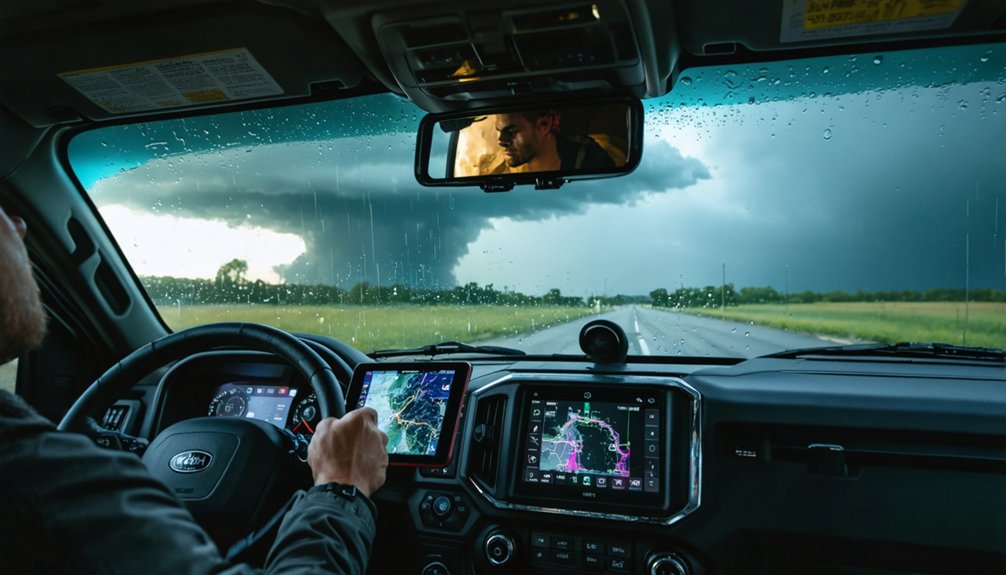
Hail cores and flash flood zones aren’t static targets—they shift with storm motion, and live radar data is your primary tool for staying clear of both.
For hail prevention, monitor reflectivity gradients above 55 dBZ and cross-reference with velocity data to track core movement in real time. Tools like RadarScope give you the resolution needed to identify exact core positioning relative to your location.
For flood zone avoidance, layer rainfall accumulation estimates over terrain maps to flag low-lying drainages before water builds. GPS integration keeps your position updated against shifting hazard boundaries.
You’re not guessing—you’re making data-driven decisions with current information. Combining radar, storm motion vectors, and mapping tools gives you the positional clarity to move freely without putting yourself inside either hazard.
Remote Storm Monitoring Beyond Storm Chasing
Storm monitoring tools extend well beyond storm chasing—emergency managers, field crews, and weather operations teams rely on the same radar, satellite, and alert platforms to coordinate faster decisions during active events. When you’re operating in the field, integrated storm data gives you the situational clarity needed for accurate risk assessment without depending on delayed briefings.
These platforms support a range of operational roles:
- Emergency management teams track hazard zones and coordinate evacuations
- Field deployment crews monitor storm movement relative to work sites
- Weather operations use live feeds for real-time forecast adjustments
- Remote analysts review historical and current storm data for pattern comparison
You’re not locked into one use case—these tools give you the flexibility to act on precise, live intelligence across any weather-dependent operation.
Frequently Asked Questions
Can Remote Storm Monitoring Tools Work Without a Cellular or Internet Connection?
Most remote storm monitoring tools require connectivity, but some offer offline functionality for cached data access. You’ll need to plan ahead, ensuring data synchronization occurs before losing signal so you’re not flying blind in the field.
How Much Do Professional-Grade Storm Monitoring Subscriptions Typically Cost per Year?
You’ll spend a small fortune — or around $100–$400/year — on professional-grade subscriptions. Tools offering advanced storm tracking and real-time weather alerts, like RadarScope Pro, typically run $10–$30 monthly, giving you complete meteorological freedom.
Are Storm Monitoring Tools Legally Required for Certified Storm Spotters or Emergency Teams?
Storm monitoring tools aren’t legally required for certified storm spotters or emergency teams. However, legal compliance and certification requirements often recommend them, as you’ll find authorized training programs strongly encourage their use for accurate, real-time field operations.
How Long Is Historical Storm Data Stored Within Remote Monitoring Platforms?
Storm data retention varies by platform, but you’ll typically access historical data spanning months to years. Check each tool’s historical data access policies, as storage limits depend on subscription tiers and provider infrastructure choices.
Can Multiple Team Members Share Live Storm Data Simultaneously Across Different Devices?
Yes, despite connectivity concerns, you can share live storm data simultaneously across multiple devices. Modern platforms support real-time collaboration and multi-device sharing, letting your entire team access identical radar, alerts, and storm movement data instantly.
References
- https://www.reddit.com/r/stormchasing/comments/1qa9hh6/what_radar_app_do_storm_chasers_usually_use/
- https://www.facebook.com/groups/6926972223/posts/10162109950822224/
- https://teamrubiconusa.org/news-and-stories/best-hurricane-tracking-apps-and-tools/
- https://www.facebook.com/groups/695179457720378/posts/1753927905178856/
- https://crazystormchasers.com/best-storm-tracking-tools-for-storm-chasers/
- https://worldmetrics.org/best/weather-monitoring-software/
- https://crazystormchasers.com/real-time-storm-monitoring-software-options/
- https://www.youtube.com/watch?v=RE9GemgDryQ
- https://storm-cast.org/