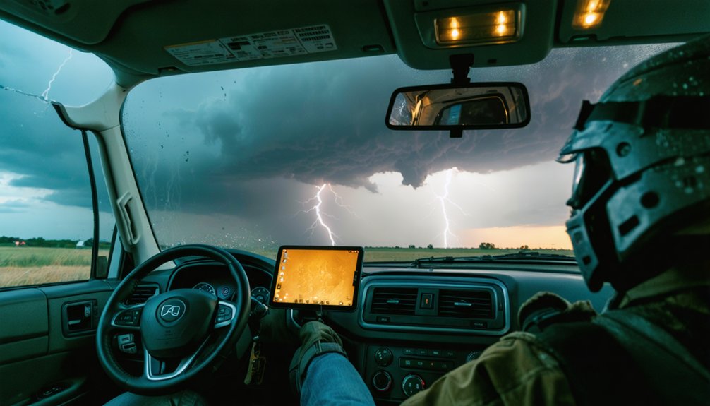
For storm chasing communication, you’ll need a layered setup covering satellite, radio, and cellular gaps. The Garmin inReach Mini 2 and Zoleo provide satellite-based SOS and two-way messaging beyond cell range. GMRS radios like the Midland MXT575 handle multi-vehicle coordination, while a Baofeng UV-5R covers SkyWarn frequencies with an FCC license. Pair these with NOAA weather radios and radar apps like RadarScope for real-time alerts. There’s considerably more to selecting, powering, and integrating each device effectively.
Key Takeaways
- Garmin inReach Mini 2 (~$300) provides global satellite coverage, two-way messaging, SOS triggering, and GPS sharing via the Iridium network.
- Satellite communicators like Zoleo (~$200) operate independently of cellular towers, ensuring reliable communication in remote areas like the Oklahoma Panhandle.
- Two-way radios like Midland MXT575 and Baofeng UV-5R enable multi-vehicle coordination and SkyWarn compatibility during severe weather operations.
- NOAA Weather Radios, such as the Midland ER310, deliver real-time NWS alerts with solar and hand-crank charging for off-grid use.
- Radar apps like RadarScope provide real-time storm tracking, dual-polarization data, and offline caching for reliable situational awareness in poor connectivity zones.
Storm Chaser Communication Gear: What You Actually Need
Whether you’re coordinating with a chase team or calling for emergency rescue, your communication gear can determine whether you make it home. Storm chasing demands layered communication systems — no single device covers every failure point.
In storm chasing, your communication gear doesn’t just connect you — it brings you home.
You’ll need satellite connectivity for remote areas beyond cellular range, two-way radios for real-time team coordination, and NOAA weather radios for authoritative alert reception. Each device serves a distinct operational role.
Emergency preparedness means building redundancy before you deploy, not improvising when systems fail in the field. Carry backup power for every critical device.
Equipment maintenance is non-negotiable. Test your gear before each chase, inspect antennas, verify subscriptions, and confirm battery capacity. Functional equipment doesn’t fail you mid-pursuit — neglected equipment does.
Choose your tools deliberately and maintain them rigorously.
Garmin inReach Mini 2 for Storm Chasers
Satellite connectivity sits at the top of every serious storm chaser’s gear list, and the Garmin inReach Mini 2 delivers that capability in a package small enough to clip to a chest harness or tuck into a vest pocket.
At roughly $300, it provides global satellite coverage through the Iridium network, keeping you operational when cellular infrastructure fails completely.
Key operational advantages include:
- Two-way messaging with contacts and emergency communication services
- SOS triggering with live rescue coordination tracking
- GPS location sharing at customizable intervals
- MapShare tracking pages visible to your team remotely
You’re not tethered to cell towers or regional networks. When you’re repositioning ahead of a violent supercell in a communication dead zone, the Mini 2 keeps you connected and extractable.
Best Two-Way Radios for Severe Weather Conditions
Two-way radios fill a critical gap in storm chasing communications that satellite devices can’t cover: rapid, real-time voice coordination with nearby chasers, spotters, and emergency personnel. When you’re repositioning ahead of a rotating wall cloud, you need instant voice contact, not a 30-second satellite message delay.
For severe weather operations, the Midland MXT575 MicroMobile delivers professional dual-band performance under harsh conditions. The Midland GXT1000 extends GMRS range effectively for coordinating multi-vehicle teams.
If you’re licensed, the Baofeng UV-5R enables SkyWarn spotter network access for roughly $25.
Prioritize antenna placement on your vehicle’s roof centerline to maximize signal propagation across flat terrain. Battery longevity directly impacts operational continuity during extended chase days, so carry spare power sources and verify charge levels before deployment.
HAM Radio Licensing and Storm Chasing: What the Rules Require
Upgrading from FRS/GMRS to HAM radio grants considerably more capability for storm chasing operations, but it comes with a legal requirement: you must hold a valid FCC amateur radio license before transmitting on amateur frequencies.
Ham radio licensing involves three tiered exams—Technician, General, and Extra—each expanding your operational privileges. Storm chasing regulations don’t restrict licensed operators from SkyWarn participation; they actually encourage it.
To stay compliant and operationally ready:
- Pass the Technician exam to access VHF/UHF SkyWarn frequencies
- Register with your local SKYWARN program after licensing
- Program your radio with designated NWS spotter frequencies
- Renew your FCC license every ten years without lapse
Non-compliance means illegal transmission—a federal violation that undermines your credibility and exposes you to significant penalties.
NOAA Weather Radios Every Storm Chaser Should Carry
When you’re operating in an area with degraded cellular infrastructure, a programmable NOAA weather radio gives you direct, real-time alerts straight from the National Weather Service without depending on any third-party network.
You can’t always count on your phone to receive warnings when towers are overwhelmed or damaged, so a dedicated receiver like the Midland ER310 keeps you connected to critical safety updates regardless of network conditions.
Its hand-crank and solar charging mechanisms mean you’ll maintain functionality even when your vehicle’s power supply or external battery banks are exhausted.
Real-Time Alert Benefits
NOAA weather radios give storm chasers direct access to National Weather Service alerts before cellular networks degrade or fail entirely. Programmable receivers deliver county-specific warnings, keeping your communication protocols sharp and your emergency preparedness ahead of rapidly evolving conditions.
Real-time alerts provide four distinct operational advantages:
- Instant warning reception before tower congestion blocks cellular data
- County-specific targeting filters irrelevant alerts from adjacent zones
- Continuous broadcast monitoring eliminates dependence on app refresh cycles
- Offline functionality maintains alert reception when internet infrastructure collapses
Digital weather radios supporting both analogue and digital signals perform reliably across Plains regions where coverage gaps frequently appear. You maintain situational awareness independently, without surrendering control to network availability.
That operational independence separates prepared chasers from those caught reacting too late.
Manual Charging Features
Real-time alerts lose their value the moment your radio’s battery dies mid-chase. That’s why manual charging features aren’t optional — they’re essential. The Midland ER310 integrates both hand-crank manual charging and solar power collection, giving you two independent energy sources when you’re operating far outside grid access.
You can crank the handle to generate immediate reserve power or position the unit in direct sunlight for passive solar power accumulation between deployments. Neither method requires infrastructure, towers, or external dependency.
The ER310 also outputs USB power, letting you redirect stored charge toward your phone or secondary devices. When you’re chasing in isolated terrain, this self-sufficient charging architecture keeps your entire communication chain functional — regardless of how long you’re operating off-grid.
Best Satellite Phones for Remote Storm Chasing Areas
When you’re chasing storms across remote Plains corridors where cellular towers don’t exist, satellite phones become your only reliable communication lifeline.
Devices like the Garmin inReach Messenger Plus and inReach Mini 2 deliver two-way messaging and SOS capability at price points between $300 and $350.
While subscription-flexible options like the Zoleo Satellite Communicator offer budget-conscious alternatives near $200.
You’ll need to evaluate coverage networks, subscription costs, and device durability to select the satellite communicator that best fits your operational requirements.
Why Satellite Phones Matter
Storm chasing frequently takes you deep into rural and remote terrain where cellular infrastructure simply doesn’t exist. When you’re tracking a supercell across the Oklahoma Panhandle or pursuing tornadoes through the Nebraska Sandhills, satellite phones become your lifeline. Signal reliability isn’t optional — it’s operational.
Satellite phones provide four critical advantages for independent chasers:
- Coverage independence — you’re not bound by carrier towers
- Satellite encryption — your communications stay secure in contested airspace
- Signal reliability — consistent uplinks regardless of ground infrastructure damage
- Emergency SOS capability — direct rescue coordination when situations deteriorate fast
Cellular networks frequently collapse during severe weather events, leaving you disconnected precisely when coordination matters most. A satellite phone eliminates that vulnerability, keeping you operationally autonomous across any terrain you choose to pursue.
Top Satellite Phone Options
Knowing why satellite phones matter only gets you so far — you also need to know which units actually perform under field conditions. Three options stand out for storm chasers prioritizing satellite durability and signal reliability.
The Garmin inReach Messenger Plus (~$350) delivers two-way messaging and SOS capability with proven network redundancy across the Iridium constellation. It’s compact enough for rapid deployment during active chases.
The Garmin inReach Mini 2 (~$300) offers a lighter footprint without sacrificing backcountry connectivity — ideal when you’re running minimal gear.
The Zoleo Satellite Communicator (~$200) gives you flexible subscription tiers, reducing operational costs during off-season months.
Each device runs on satellite infrastructure independent of cellular towers, keeping you connected precisely when terrestrial networks collapse under severe weather pressure.
Choosing Your Satellite Phone
Choosing the right satellite phone comes down to three operational variables: network coverage, form factor, and subscription flexibility. Satellite integration with your existing gear stack determines operational efficiency in the field.
Device durability under extreme weather conditions isn’t optional—it’s mandatory.
Evaluate your selection using these four criteria:
- Network coverage – Confirm Iridium or Globalstar constellation compatibility for your chase regions
- Device durability – Verify MIL-STD-810 ratings for rain, shock, and temperature extremes
- Subscription flexibility – Match monthly data allowances to your transmission requirements
- Satellite integration – Guarantee compatibility with RadarScope, weather apps, and SOS protocols
You’re operating beyond cellular infrastructure. Your satellite phone isn’t a backup—it’s your primary communication lifeline when conditions deteriorate fastest and cellular towers fail completely.
Mobile Hotspots vs. Cellular Boosters: Which One Wins?
When you’re chasing storms in remote terrain, two tools dominate connectivity: mobile hotspots and cellular boosters. Each serves a distinct purpose, and understanding the difference keeps you operational when conditions deteriorate fast.
Mobile hotspots, like Starlink Mini, deliver independent satellite integration, functioning where zero cell towers exist. They’re self-contained but demand significant power, making battery longevity a critical planning factor during extended deployments.
Cellular boosters, like WeBoost Drive Reach Overland, amplify existing weak signals rather than generate new ones. They consume less power but fail completely in true dead zones.
Speedify software bridges both tools, bonding multiple connections for optimized real-time radar access. Your terrain dictates your choice — boosters handle fringe coverage efficiently, while hotspots guarantee connectivity where cellular infrastructure simply doesn’t reach.
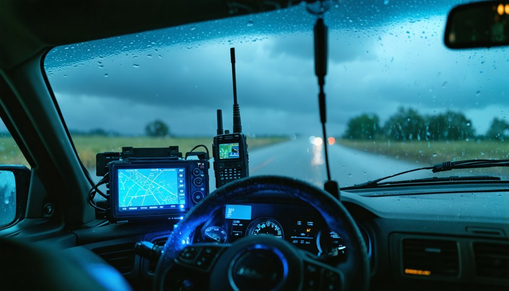
Connectivity keeps you online, but navigation keeps you alive. When you’re repositioning ahead of a rotating wall cloud, GPS accuracy determines whether you escape or intercept incorrectly. Dedicated GPS units outperform smartphones under heavy processing loads.
Prioritize these navigation tools:
- Dedicated GPS units — maintain function independent of cellular signal degradation
- GRLevel2/Analyst shape files — overlay county boundaries directly onto road networks
- Navigation apps like RadarScope — integrate radar data with real-time positioning
- County boundary maps — identify watch and warning zones standard road maps omit
You need layered navigation, not a single point of failure. Combining dedicated hardware with software-based navigation apps gives you redundancy when roads dead-end and storms accelerate unexpectedly.
Radar Apps Storm Chasers Use for Real-Time Tracking
When storm chasing, you’ll rely on radar apps like RadarScope and RadarOmega to track storm movement and analyze structural features in real time. These platforms give you access to dual-pol radar data, velocity scans, and storm-relative motion overlays that raw NWS feeds can’t match in usability.
You can monitor rotation signatures, hook echoes, and mesocyclone development directly from your mobile device, keeping your situational awareness sharp as conditions evolve.
Top Radar Apps Used
Real-time radar data is the backbone of effective storm chasing, and the apps you choose directly impact your situational awareness in the field. Each platform offers distinct technical advantages worth evaluating:
- RadarScope – Delivers professional-grade dual-pol radar data with satellite encryption protocols securing your transmitted positioning data.
- RadarOmega – Provides advanced meteorological analysis tools, including data compression algorithms that optimize bandwidth usage in low-connectivity environments.
- GRLevel3 – Supports custom shapefiles for precise county boundary overlays, enhancing navigational accuracy during active pursuit.
- MyRadar – Offers lightweight storm tracking with rapid refresh rates suited for quick situational assessments.
You’ll want apps that balance data richness with transmission efficiency, especially when cellular coverage degrades and every kilobyte of radar data counts.
Real-Time Storm Tracking
Storm chasers rely on radar apps to maintain continuous situational awareness as supercells evolve rapidly in the field. You’ll need platforms that integrate weather pattern analysis with live radar feeds, giving you the edge when rotation tightens unexpectedly.
RadarScope delivers dual-pol data and velocity products that let you identify mesocyclone signatures before visual confirmation becomes possible.
RadarOmega extends that capability by incorporating storm prediction models, helping you anticipate track shifts and intensity changes with greater precision.
You’re not just watching storms — you’re interpreting constantly shifting atmospheric data to make split-second positioning decisions.
Pairing these apps with a reliable mobile hotspot or Starlink Mini ensures your radar stream stays uninterrupted across coverage gaps.
Real-time data transmission isn’t optional; it’s the foundation of every safe, successful intercept.
Key App Data Features
Radar apps separate functional chasers from dangerous ones by delivering layered meteorological data you can act on immediately. RadarScope and RadarOmega give you professional-grade tools without institutional gatekeeping.
Key features you need active in the field:
- Dual-polarization radar — identifies debris signatures, hail cores, and rotation with precision
- Storm-relative velocity — isolates mesocyclone structure independent of storm motion
- Satellite security overlays — integrates satellite imagery with radar for all-encompassing situational awareness
- Emergency protocols integration — syncs NWS warnings directly into your display for immediate threat recognition
These aren’t convenience features — they’re operational necessities. When you’re repositioning ahead of a cyclic supercell, delayed or incomplete data costs you options.
Choose apps that update continuously, cache offline, and don’t collapse under poor connectivity.
Powering Your Storm Chasing Gear in the Field
Keeping your devices powered in the field is as critical as the communication gear itself. You can’t afford downtime when you’re tracking a tornado-warned supercell. Portable power banks give you a reliable backup for phones, hotspots, and GPS units without depending on your vehicle’s alternator. High-capacity banks in the 20,000–30,000mAh range handle extended deployments effectively.
Solar panel integration extends your operational window during daylight chases, feeding charge into your banks while you’re stationary or repositioning. Pair foldable 100W panels with a quality charge controller for efficient energy capture.
Your vehicle’s 12V outlets and USB-C power delivery ports should also supplement your setup. Redundancy across charging sources keeps every critical device—satellite communicators, weather radios, and dash cameras—fully operational throughout your chase.
Frequently Asked Questions
Can Storm Chasers Legally Operate on Emergency Service Radio Frequencies?
You can’t legally operate on emergency service frequencies without authorization. Use satellite phones or licensed HAM bands instead. Morse code proficiency grants additional HAM privileges, giving you legitimate, interference-free communication channels that respect operational freedom responsibly.
How Do Storm Chasers Coordinate Communication With Local Law Enforcement Agencies?
Like a relay race, you coordinate with law enforcement through SkyWarn networks and police scanners. Satellite messaging keeps you connected remotely, while signal boosters strengthen cellular links, ensuring you’re transmitting critical storm data to agencies efficiently.
What Communication Devices Work Best Inside a Reinforced Storm Chasing Vehicle?
You’ll want satellite messaging devices like the Garmin inReach, emergency beacons like ACR ResQLink, a NOAA weather radio, and HAM radio installed inside your reinforced vehicle for redundant, reliable communication when cellular networks inevitably fail.
Are There Communication Protocols Storm Chasers Must Follow During Active Tornadoes?
When the funnel drops, every second counts—you must activate satellite messaging for team coordination and trigger emergency beacons if incapacitated. Follow SkyWarn protocols, maintain radio discipline, and transmit precise GPS coordinates to your chase network immediately.
How Do Storm Chasing Teams Maintain Communication When Separated by Great Distances?
When separated by vast distances, you’ll rely on satellite phones for real-time voice coordination and emergency radios for NOAA updates. These tools maintain critical team connectivity across remote terrain where cellular infrastructure completely fails you.
References
- https://crazystormchasers.com/communication-devices-for-storm-chasers/
- http://www.ndtornado.com/primary/equipment.htm
- https://stormtrack.org/threads/recommended-chaser-equipment-list.23013/
- https://store.sirui.com/blogs/guides/essential-equipment-for-storm-chasing-guide-for-2025
- https://www.youtube.com/watch?v=Sr2lz72ZYwM
- https://policeradioencryption.com/learn/storm-chaser-gear-guide
- https://midlandusa.com/blogs/blog/how-to-use-two-way-radios-while-storm-chasing
- https://prepare.blog/blog/emergency-communication-staying-connected-when-it-counts/
- https://www.reddit.com/r/stormchasing/comments/1d17gg7/does_anyone_know_what_type_of_radios_the_chasers/
- https://gearjunkie.com/technology/best-walkie-talkies