If you’re chasing hurricanes, your survival depends on disciplined pre-chase planning, redundant communication systems, and mapped escape routes above inundation zones. You’ll need to monitor NHC surge forecasts every six hours, since storm surge causes nearly 50% of U.S. tropical cyclone fatalities. Practice timed radar glances no longer than 20 seconds, maintain defensive driving protocols, and prioritize emergency responder access at all times. The best practices outlined ahead will sharpen every operational decision you make in the field.
Key Takeaways
- Pre-chase planning should include mapping three escape routes, checking vehicle integrity, and consulting SPC forecasts before entering any risk zone.
- Carry redundant communication devices, including a NOAA weather radio, satellite communicator, and backup phone, to maintain contact during network failures.
- Practice defensive driving by obeying speed limits, avoiding overpasses, and limiting radar glances to 20-second intervals for sustained situational awareness.
- Avoid flooded roads and debris zones; monitor NHC surge forecasts and reduce speed below 20 mph near hazardous obstacles.
- Ensure emergency responders have unobstructed access, use social media responsibly, and educate communities about storm risks and preparedness measures.
Pre-Chase Planning Every Hurricane Chaser Must Complete Before Deploying
Before you deploy, consult the Storm Prediction Center website for the latest weather outlooks and cross-reference multiple radar data sources to avoid locking onto a single storm interpretation.
Hurricane forecasting demands analytical precision, so identify the boundaries of the severe risk area rather than targeting the zone’s center.
Map at least three escape routes away from the projected storm path to preserve your operational freedom and safety.
Map three escape routes minimum—operational freedom and survival depend on never letting a storm dictate your only option.
Chaser collaboration strengthens situational awareness, so coordinate with fellow chasers to synthesize radar analyses before committing to a target.
Check your vehicle’s mechanical components, fluid levels, and tire integrity before departing.
These pre-chase protocols aren’t bureaucratic formalities—they’re data-driven decisions that determine whether you operate effectively or become a liability in a high-stakes, rapidly evolving meteorological environment.
Safety Gear Hurricane Chasers Must Carry for Every Operation
When you’re gearing up for a hurricane chase operation, you must pack three core safety categories into your vehicle: essential communication device kits, emergency supply packs, and high-visibility warning equipment.
Your communication kit should include a fully charged prepaid backup phone and a NOAA weather radio capable of receiving real-time warnings independent of cellular infrastructure, which frequently fails during major storm events.
You’ll also need to mount rear-facing high-intensity warning lights on your vehicle and stock a verified emergency supply pack containing non-perishables, water reserves, medical supplies, and backup power sources rated for multi-day field operations.
Essential Communication Device Kits
Three core communication devices form the backbone of any responsible hurricane chasing operation, and failing to carry all three simultaneously creates dangerous gaps in situational awareness.
Your communication strategies must prioritize device reliability across redundant systems so no single failure silences your operation.
- NOAA Weather Radio — receives real-time warnings independent of cellular infrastructure
- Prepaid backup cell phone — fully charged, stored separately from your primary device
- Satellite communicator — maintains two-way messaging when towers fail during landfall
- VHF/UHF handheld radio — enables direct coordination with emergency responders on dedicated frequencies
Each device covers a distinct failure point.
You’re not carrying redundancies for comfort — you’re building a layered system that keeps you informed, mobile, and operationally independent when conditions deteriorate fastest.
Vehicle Emergency Supply Packs
Every vehicle emergency supply pack you carry must address five distinct survival categories: nutrition, hydration, communication backup, medical response, and thermal protection. Non-perishable food, sealed water reserves, a prepaid cell phone, a first aid kit, and heating packs satisfy each category respectively.
Supply organization isn’t optional — it’s operational discipline. Label every compartment, rotate perishables monthly, and audit supplies before each deployment. Disorganized kits cost critical seconds during emergencies.
Integrate vehicle maintenance checks into your pre-chase protocol. Verify fluid levels, tire pressure, and battery charge before departing, since mechanical failure during active hurricane conditions eliminates your escape options entirely.
Your kit should function independently of external infrastructure. Assume cellular networks collapse, fuel stations close, and roads flood. Pack accordingly, audit ruthlessly, and treat every supply decision as a survival calculation.
High-Visibility Warning Equipment
Your supply pack keeps you alive inside the vehicle — high-visibility warning equipment keeps you alive outside it and signals your presence to every other driver operating in degraded visibility conditions.
Deploy these four critical visibility enhancements during every operation:
- High visibility vests — ANSI Class 3-rated minimum, worn immediately upon exiting the vehicle.
- Warning lights — rear-mounted amber strobes cycling at 75+ flashes per minute, visible at 500 feet.
- Reflective signage — retroreflective panels mounted on the vehicle’s exterior, rated for 1,000-foot detection range.
- Emergency flares and beacon signals — chemical flares lasting 30 minutes minimum, supplemented by electronic beacon signals for extended operations.
These aren’t optional accessories.
Degraded visibility conditions during hurricane operations eliminate driver reaction time — your equipment compensates where human perception fails.
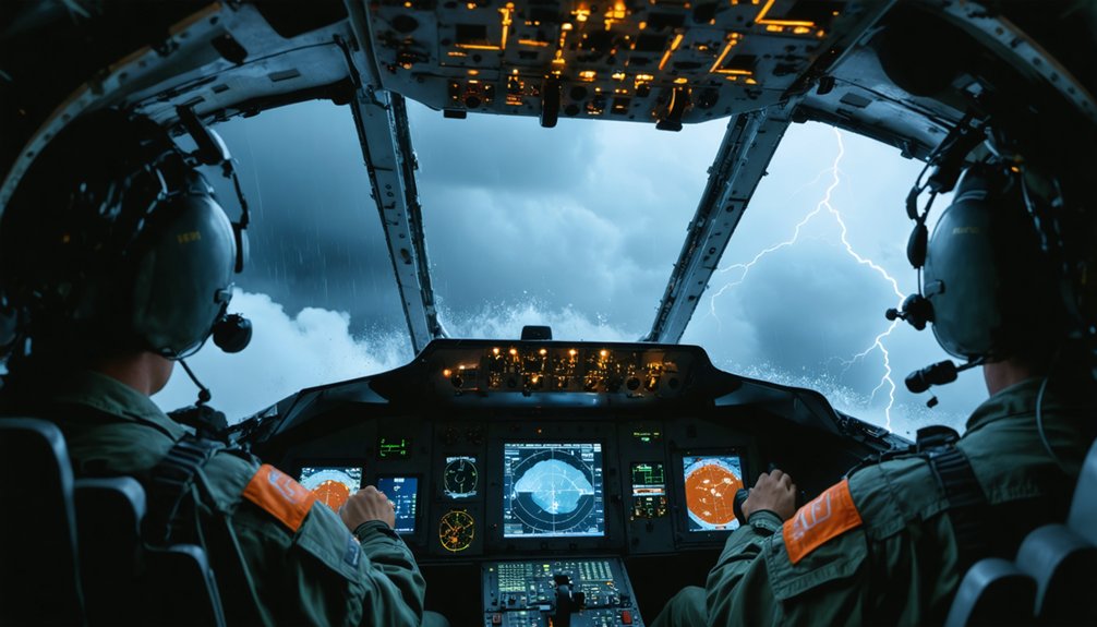
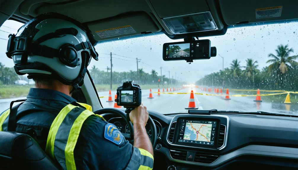
How to Read Hurricane Radar Without Losing Situational Awareness
Radar interpretation is one of the most cognitively demanding tasks you’ll perform during a hurricane chase, and it’s easy to let the screen consume your full attention at the cost of real-world awareness.
Mastering hurricane radar basics means synthesizing velocity, reflectivity, and storm-relative motion data simultaneously rather than fixating on a single layer. Set timed glance intervals—no longer than 20 seconds on radar before scanning your physical environment.
Cross-reference multiple data sources to avoid misreading a single feed’s latency errors. Situational awareness techniques demand you track wind shifts, debris patterns, and surrounding traffic concurrently with your radar analysis.
Never let digital data override direct observation. Your eyes on the storm provide ground-truth information no radar feed can fully replicate—stay disciplined, stay mobile, stay aware.
Escape Routes to Map Before Moving Into a Hurricane’s Path
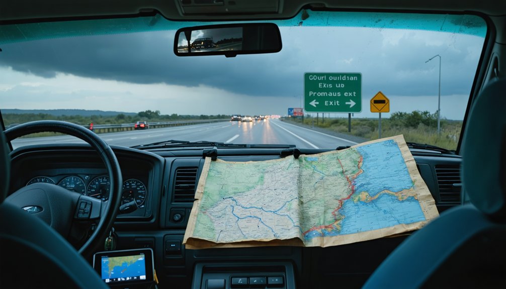
Before you commit to any intercept position, map at least three distinct escape routes that diverge away from the storm’s projected path and potential highway blockages.
Effective evacuation planning keeps your options open when storm tracking data shifts unexpectedly.
Solid evacuation planning preserves your flexibility when storm tracking data changes course without warning.
- Identify boundary exits — target routes at the storm’s edge, not its core, to preserve mobility.
- Cross-reference live radar — validate each route against current storm tracking models before moving.
- Flag alternate highways — note secondary roads in case primary corridors become flooded or congested.
- Set trigger points — define specific conditions, such as wind thresholds or surge warnings, that automatically activate your evacuation planning protocol.
Pre-mapping these routes eliminates hesitation, preserves reaction time, and guarantees you’re never boxed in by a rapidly intensifying system.
Defensive Driving Rules That Protect Chasers and the Public
Once you’re in the field, defensive driving isn’t optional — it’s the operational framework that keeps both you and the public alive. Obey speed limits, wear your seat belt, and maintain safe following distances — storm behavior shifts faster than most drivers anticipate, demanding immediate reaction capacity.
Driver awareness means keeping your eyes off radar screens long enough to monitor surrounding traffic and evolving road conditions simultaneously.
Never stop under overpasses; wind acceleration through confined spaces creates lethal projectile corridors. Yield immediately to emergency vehicles — their access directly determines civilian survival outcomes.
Avoid flooded roadways where depth is unverifiable; vehicle submersion risk rises exponentially in standing water. Pull completely off roadways when repositioning, and activate rear warning lights to signal your presence, protecting both responders and the public moving through the impact zone.
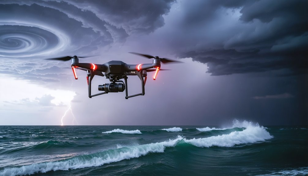
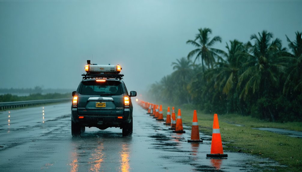
Flooding, Storm Surge, and Debris Hazards That Kill Hurricane Chasers
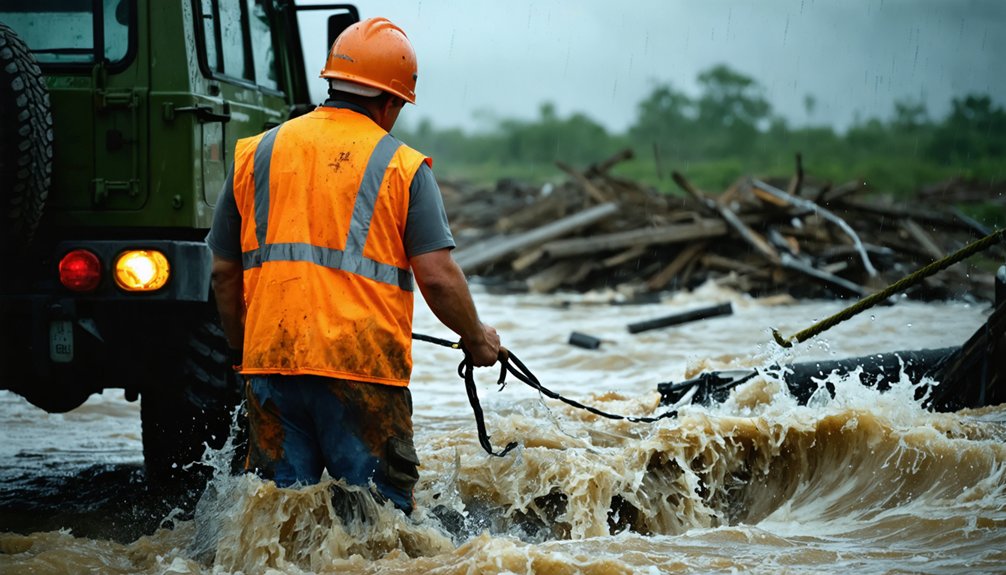
When storm surge advances inland faster than most vehicles can retreat, you must pre-identify elevation-based escape routes that rise above the projected inundation zone before you ever position near the coast.
You can’t safely navigate a debris field where wind-driven projectiles, downed power lines, and structural wreckage block roadways without real-time aerial or ground reconnaissance confirming passage is viable.
Never drive through standing floodwater, as just 12 inches of moving water can sweep away a standard vehicle and 2 feet can carry away an SUV or truck.
Storm Surge Escape Routes
Storm surge is the deadliest component of a hurricane, responsible for nearly half of all U.S. tropical cyclone fatalities, and it moves faster than most chasers anticipate. Your evacuation plans must account for storm surge inundation maps, not just wind radii.
- Pre-position inland: Identify elevation benchmarks above projected surge levels before landfall.
- Map multiple escape routes: A single coastal road becomes a death trap when surge cuts off access simultaneously from both directions.
- Monitor NHC surge forecasts: The Potential Storm Surge Flooding Map updates every six hours—check it.
- Set hard departure triggers: Define a specific surge height threshold or timeframe before landfall that forces immediate withdrawal, eliminating hesitation.
Your freedom to chase ends permanently if storm surge overtakes your vehicle.
Debris fields generated by hurricane-force winds transform familiar roadways into obstacle courses that disable vehicles and trap chasers within the storm’s kill zone.
Effective debris field navigation demands hazard recognition skills that operate faster than your instincts normally allow. Projectiles exceeding 100 mph embed into asphalt, creating tire-shredding obstacles invisible beneath standing water.
You’ll encounter downed power lines carrying lethal voltage alongside structural collapse zones where secondary failures remain imminent. Data from NOAA post-storm surveys consistently show vehicle disablement within debris corridors accounts for a disproportionate share of chaser fatalities.
Maintaining a pre-mapped exit corridor, reducing speed below 20 mph in active debris zones, and continuously scanning 360 degrees preserves your operational freedom while preventing entrapment.
Never assume cleared pavement equals safe passage.
Floodwater Depth Dangers
Floodwater conceals its lethality beneath a deceptively calm surface, and that deception kills hurricane chasers who underestimate its physics.
Floodwater visibility dangers intensify when murky surge water masks road edges, drop-offs, and submerged debris risks beneath an unreadable surface.
- Six inches of moving water knocks an adult down; twelve inches carries a vehicle off-road.
- Submerged debris including rebar, downed lines, and displaced vehicles destroys tires and punctures undercarriages instantly.
- Storm surge advances faster than most chasers anticipate, cutting off retreat routes within minutes.
- Never attempt to gauge depth visually—turbid floodwater obscures both bottom composition and current velocity entirely.
Avoid driving through flooded areas where depth is uncertain.
Your vehicle becomes a trap, not a refuge, the moment water breaches the door threshold.
How to Reposition Safely as a Hurricane’s Landfall Point Shifts
When a hurricane’s projected landfall point shifts, you’ll need to reposition quickly while synthesizing live radar, satellite imagery, and multiple model analyses to refine your target. Track the hurricane eye’s movement continuously, cross-referencing at least three data sources to avoid single-source interpretation errors.
Your landfall tactics must account for shifting storm surge zones, evolving wind field asymmetry, and updated NHC advisories.
Map alternate escape routes before executing any repositioning maneuver, identifying road segments vulnerable to flooding or storm debris. Avoid committing to a fixed location until model consensus tightens.
As you reposition, maintain legal driving speeds, yield to emergency vehicles, and never cut ahead of active storm response corridors. Flexibility, disciplined data synthesis, and pre-planned route options keep you operationally effective without compromising your safety or obstructing public emergency access.
When Retreating Is the Only Decision That Keeps You Alive
When wind speeds exceed your vehicle’s safe operational threshold or storm surge projections indicate rapid inundation of your current corridor, you must treat those data points as non-negotiable retreat signals.
You’ve already mapped at least three escape routes before deployment, so activate one immediately rather than reassessing under deteriorating conditions.
Your survival depends on executing a pre-planned withdrawal before the storm’s forward speed and landfall shift close off viable road networks entirely.
Recognizing Critical Retreat Signals
Recognizing when to retreat isn’t a judgment call you make slowly — it’s a protocol you execute the moment specific thresholds are crossed. Your storm observation techniques must include pre-defined critical retreat signals that trigger immediate action, not debate.
- Tornado bearing down directly — abandon repositioning; move perpendicular to the storm’s path immediately.
- Hail initiation — stop driving; protect the vehicle and occupants before windshield compromise occurs.
- Flooded roadways ahead — never assess depth by driving through; reverse and reroute without hesitation.
- Lightning strikes within one mile — evacuate the vehicle and seek hard-structure shelter instantly.
Each signal represents a data point your situational awareness must process in real time.
You own your decisions — execute them with precision before conditions eliminate your options entirely.
Escape Routes Save Lives
Escape routes aren’t a contingency — they’re a pre-mission requirement you build into your chase plan before the vehicle ever leaves the driveway.
Effective route planning demands you map three independent evacuation corridors during weather forecasting analysis, targeting storm boundaries rather than centers. Cross-reference road conditions, bridge load limits, and flood-prone corridors before committing.
Risk assessment isn’t optional — it’s operational. During storm evacuation, maintain emergency communication with coordinated chasers using redundant channels: NOAA radio, cellular backup, and prepaid devices.
Chaser coordination prevents multiple units from simultaneously blocking identical escape corridors, protecting both operators and public awareness of emergency vehicle access.
Travel safety depends entirely on pre-calculated exit geometry. When conditions deteriorate beyond defined thresholds, execute your retreat immediately — your pre-built route is the only decision that keeps you alive.
How to Minimize Civilian Disruption While Chasing a Hurricane
Minimizing civilian disruption during a hurricane chase demands deliberate route selection and adherence to ethical conduct protocols.
You’re operating in populated corridors where every decision directly impacts civilian safety and emergency response efficiency. Ethical considerations aren’t optional—they’re operational requirements.
- Avoid SPC risk zone centers—target boundary edges to reduce congestion in high-traffic evacuation corridors.
- Never cut in front of active storm paths where emergency responders need unrestricted access to affected populations.
- Deploy rear-mounted warning lights or emergency blinkers when stopping near roadways to alert approaching civilian traffic.
- Retreat after sunset unless operationally mandated, eliminating unnecessary nighttime hazards for local residents.
You preserve both your operational integrity and public trust by executing these protocols with precision and consistency.
The Ethical Rules Every Hurricane Chaser Must Follow in the Field
Beyond managing civilian disruption, you’re bound by a strict ethical framework that governs every operational decision in the field.
Ethical considerations demand that you never cut in front of dangerous storms, ensuring emergency responders maintain unobstructed access to affected civilian zones. You must retreat from active areas after sunset unless legally mandated otherwise.
Storm behavior is unpredictable, so you’re responsible for synthesizing multiple radar sources rather than relying on a single data interpretation.
Avoid unimproved dirt roads that compromise environmental integrity and contribute to infrastructure degradation. Use rear-mounted warning lights when stopped near roadways to signal your presence clearly.
Your autonomy as a chaser doesn’t override public safety obligations. Every decision you make must balance operational freedom against measurable, data-supported risk to surrounding communities.
Frequently Asked Questions
What Legal Permits Do Hurricane Chasers Need Before Operating Professionally?
You’ll find no universal permit requirements for hurricane chasing, but you must assess legal liabilities tied to local ordinances, media credentials, and state-specific road access laws before you professionally operate in affected zones.
How Do Hurricane Chasers Coordinate Directly With Local Emergency Management Agencies?
You’ll want to “sync up” with local agencies through established communication protocols, sharing your real-time data sharing feeds directly with emergency coordinators, ensuring your observational intelligence enhances their response capabilities while keeping affected communities safer during active operations.
What Insurance Coverage Do Professional Hurricane Chasers Typically Carry for Operations?
You’ll typically carry liability coverage protecting against third-party damages and equipment insurance securing cameras, radar units, and vehicles. Policies vary by operational scope, but you’re analyzing risk-to-asset ratios to guarantee financial continuity during high-exposure meteorological data collection missions.
How Do Chasers Handle Media Obligations Without Compromising Their Personal Safety?
You prioritize safety protocols before fulfilling media obligations—transmit data remotely, schedule briefings post-storm, and you’ll maintain media ethics without compromising positioning. Never let broadcast deadlines override your radar monitoring or hazard avoidance decisions.
What Mental Health Resources Exist Specifically for Storm Chasers After Traumatic Events?
You’ll find trauma support through organizations like SAMHSA and storm chaser communities offering peer counseling. Adopt coping strategies such as debriefing sessions, psychological first aid protocols, and data-driven stress assessments to maintain your mental resilience after traumatic events.
References
- https://www.youtube.com/watch?v=nxPSFg2R8YY
- https://www.flame.org/~cdoswell/chasesums/Chase_safety.html
- https://www.youtube.com/watch?v=6otZLjSZvPU&vl=en
- https://www.livingskytours.com/storm-chasing-101/
- https://stormchaser.com/Storm-Chasing-Safety.pdf
- https://midweststormchasers.org/safety-tips/
- https://www.weathercentertx.com/weather-101-different-types-of-weather/storm-chasing-101/
- https://www.rd.com/article/how-to-survive-a-hurricane/
- https://www.reddit.com/r/stormchasing/comments/1ds937c/hurricane_chasing_tips_and_tricks/
- http://www.stormeyes.org/tornado/chasing/FAQ/