For effective storm spotting, you’ll need a reliable vehicle, portable weather instruments, and solid communication gear. Carry a portable weather station, anemometer, hail ruler, and calibrated rain gauge for precise field measurements. Use radar apps like RadarScope or RadarOmega alongside real-time visual observations, since radar carries a several-minute delay. A dual-band amateur radio with at least 50 watts keeps you coordinated with local NWS networks. Keep scrolling to get the full equipment breakdown.
Key Takeaways
- A reliable, well-maintained vehicle with offline maps, escape routes, and emergency supplies is the foundation of effective storm spotting.
- Portable weather instruments, including anemometers, rain gauges, and hail rulers, enable accurate, measurable field data collection.
- Radar apps like RadarScope and RadarOmega provide high-resolution storm data, though direct visual observation remains critical.
- A dual-band amateur radio with at least 50 watts ensures reliable communication and coordinated reporting with NWS and spotters.
- Submitting geo-tagged, timestamped reports through Spotter Network or Skywarn with precise measurements improves NWS warning operations.
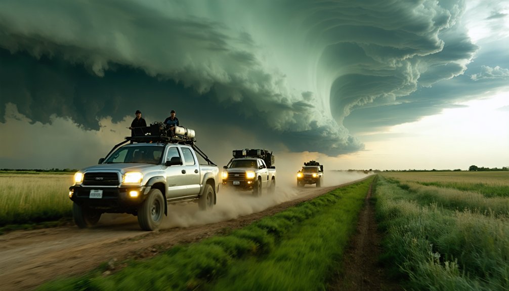
Storm Chasing Vehicle Setup Every Spotter Needs First
Your vehicle is the single most critical piece of equipment in your storm-spotting kit, and every other tool depends on it functioning reliably when conditions deteriorate fast.
Storm safety begins with disciplined vehicle maintenance—inspect tires, brakes, wipers, and fluids before every deployment. Visibility enhancements like rain-repellent window treatments directly improve situational awareness during heavy precipitation events.
Smart chase planning means pre-loading offline maps, identifying chase routes with viable escape options, and reviewing storm forecasting data before you leave.
Keep emergency supplies secured and accessible: first-aid kit, flashlight, and basic recovery tools. Vehicle modifications such as exterior lighting improve roadside safety during low-visibility stops.
Storm gear and safety protocols mean nothing if your platform fails. Treat your vehicle as infrastructure, because during active operations, it absolutely is.
Portable Weather Instruments Every Storm Spotter Should Carry
Once your vehicle’s operational foundation is solid, the next layer of field readiness comes from the instruments you carry inside it. A portable weather station gives you real-time wind speed, temperature, humidity, and pressure readings you can log independently of any network.
Portable anemometer benefits include rapid deployment for spot wind measurements and accurate gust documentation during fast-moving events. For precipitation, rainfall measurement techniques range from a simple calibrated rain gauge to portable tipping-bucket units that timestamp accumulation rates automatically.
Portable anemometers deploy fast for precise wind and gust data, while tipping-bucket gauges automatically timestamp every rainfall accumulation rate.
Carry a dedicated hail ruler to report stone diameter with precision rather than estimation. A voice recorder or timestamped mobile app ties every reading to a specific moment.
These tools let you report with accuracy, speed, and credibility when it counts most.
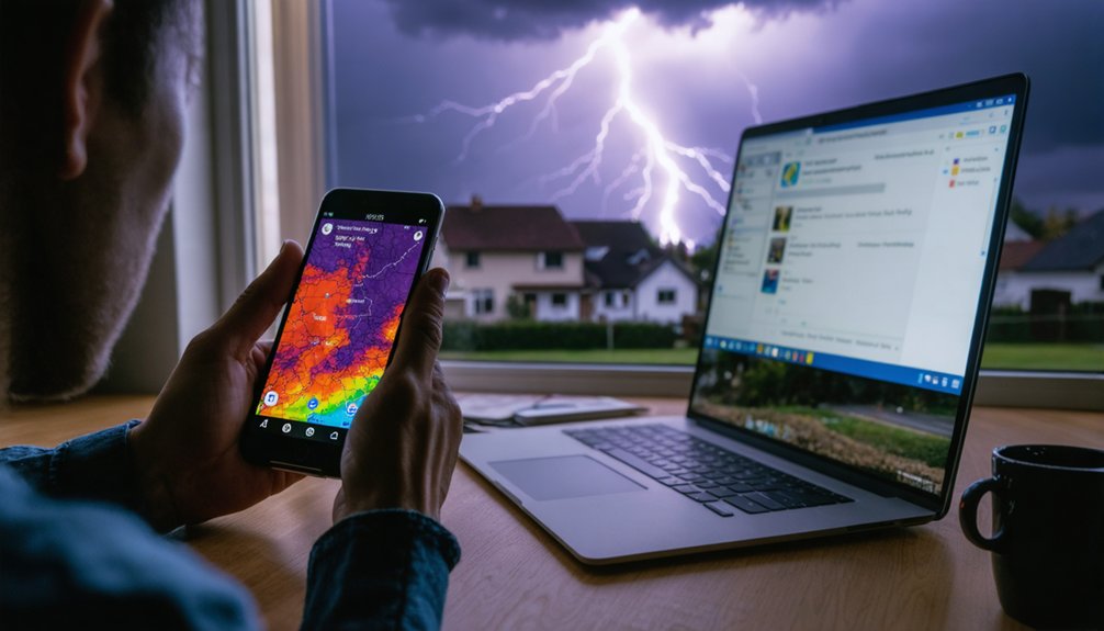
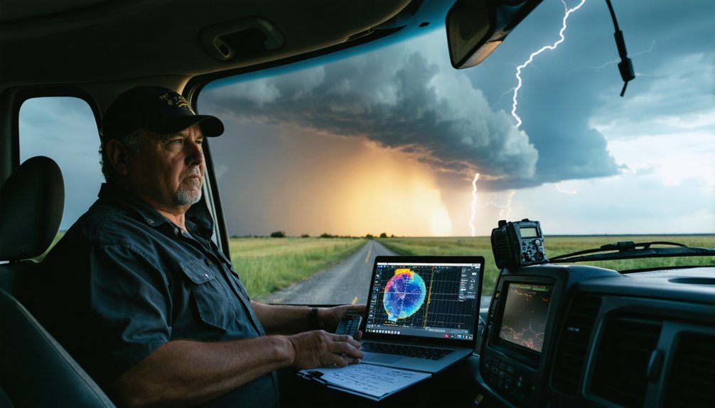
Best Radar Apps Trained Spotters Actually Use
Knowing which radar application sits open on your screen can determine whether you’re reading a storm correctly or chasing outdated data.
RadarScope remains the top choice among trained spotters, consistently earning strong user feedback for its high-resolution base data and dual-pol product access.
RadarOmega suits spotters who push public-facing updates while tracking storm motion simultaneously.
For Windows-based operations with vehicle internet, GRLevel3 delivers serious customization through radar app comparisons that favor flexibility and raw data control.
Regardless of your platform, remember that every radar product carries a several-minute update delay. Your direct visual observations always carry more real-time accuracy than any screen.
Choose your app based on the products you need, eliminate clutter, and never let radar replace what your eyes confirm directly.
When you’re chasing in rural terrain, a reliable GPS navigation system gives you real-time road-network awareness so you can calculate escape routes and reposition quickly as storm motion shifts.
You’ll want offline map access loaded before you leave cell coverage, since rural areas often drop data connectivity at the worst possible moments.
Pairing a dedicated GPS unit or a cached offline map app with your live radar feed keeps your situational awareness intact even when cellular signals fail.
Reliable GPS guidance isn’t optional gear for storm spotters—it’s a core safety tool that directly affects your ability to intercept, reposition, and escape. GPS accuracy matters when you’re traversing rural road networks with split-second decisions.
Prioritize units or apps with offline capabilities, since cellular coverage fails in remote target areas. Real-time updates and traffic avoidance features help you maintain clear escape routes when a storm accelerates unexpectedly.
Route optimization keeps your positioning efficient without unnecessary exposure. Terrain awareness prevents you from driving into low-water crossings or dead-end paths during heavy rain.
Choose platforms with user-friendly interfaces so you’re not fumbling through menus mid-chase. Confirm battery longevity before deployment, and always maintain emergency routing options as a fallback when your primary path becomes compromised.
Offline Map Access Benefits
Offline map access eliminates your dependency on cellular infrastructure at the exact moment rural networks are most likely to fail.
When you’re deep in marginal coverage zones, a cached tile-set keeps your position locked and your route options visible without a single data packet. The offline map benefits compound quickly in storm environments where towers lose power, bandwidth saturates, or you’re simply too far out for reliable signal.
Rural navigation demands that your map layer loads instantly, not after a three-second handshake with a remote server. Apps like Gaia GPS or Maps.me let you pre-download regional datasets before you leave your origin point.
You stay mobile, you stay oriented, and you never sacrifice a positioning advantage because a carrier failed during the critical intercept window.
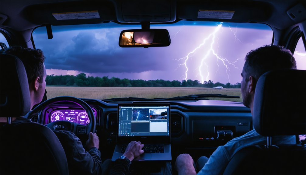
Communication Gear Storm Spotters Use for Reporting
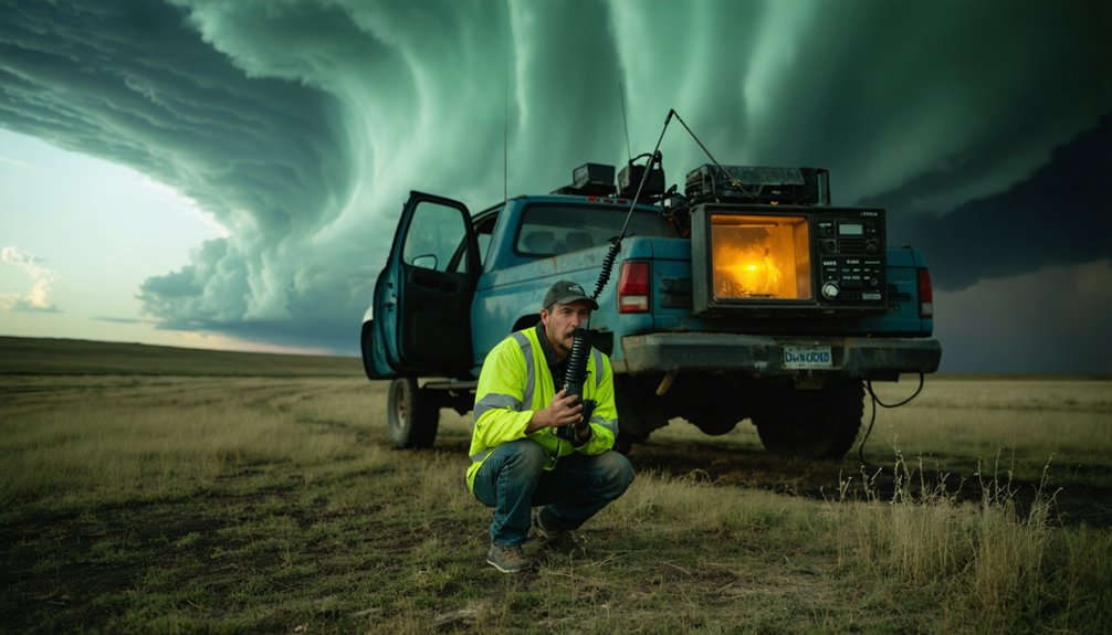
Staying connected in the field isn’t optional — it’s what separates a useful spotter from an isolated one.
You’ll need a dual-band amateur radio with at least 50 watts on the VHF side for strong signal reliability across rural terrain. Master communication protocols and network etiquette before keying up on active weather nets — unnecessary transmissions compromise coordination strategies during critical operations.
Use emergency frequencies only when situations demand them. Submit reports through Spotter Network or Skywarn to maximize report accuracy and guarantee your observations reach the National Weather Service directly.
A mobile hotspot keeps real-time updates flowing when cellular towers are strained.
Prioritize equipment maintenance — dead batteries and corroded connectors kill your ability to contribute when conditions escalate fastest.
Camera and Documentation Equipment Worth Carrying
Reporting what you see is only half the job — documenting it with precision is the other half.
Choose camera types matched to field conditions: mirrorless or DSLR bodies handle variable lighting conditions better than smartphones when capturing cloud structures and storm features. Use image stabilization via a tripod or vehicle mount to prevent blur during high-wind shoots.
Prioritize video quality settings of at least 1080p/60fps for capturing damage assessments and rotation. Apply basic documentation techniques — timestamp every file, log GPS coordinates, and shoot RAW format for photo editing flexibility.
Maintain your equipment with weather seals, lens cloths, and protective cases to prevent moisture damage. Clean sensors regularly and check battery reserves before every deployment.
How to Submit Storm Reports and Get Data to the NWS
Once you’ve documented a severe weather event, getting that data to the National Weather Service quickly and accurately is what makes your field work count.
You can submit reports through Spotter Network, tie into your local NWS office’s Skywarn program, or transmit observations over amateur radio nets using a dual-band radio with sufficient output power.
Each channel serves a distinct operational role, so understanding how they work together lets you push time-sensitive data to the right people without duplication or delay.
Spotter Network Report Submission
When a severe weather event unfolds, getting your observations into official channels quickly is what makes spotter data actionable for National Weather Service forecasters. Spotter Network lets you submit geo-tagged reports directly from the field, feeding real-time data into NWS warning workflows and public-facing spotter maps.
Follow established reporting protocols precisely. Include event type, time, location coordinates, and measured values where possible. Data accuracy depends on your inputs, so avoid estimating when direct measurement is achievable.
Log hail diameter in inches, wind damage indicators by structure type, and precipitation intensity against a calibrated gauge.
Your Spotter Network account ties reports to your trained-spotter credentials, which increases report credibility with NWS personnel. Activate location services, keep the app updated, and submit reports the moment conditions are confirmed rather than after the event passes.
Working With Local NWS
Direct coordination with your local NWS office turns isolated field observations into operationally useful severe weather data.
Local NWS collaboration strengthens forecast accuracy and warning decisions when you submit structured, timely reports. Effective communication means delivering precise location, time, and measurement data without unnecessary narrative.
Use these channels and practices to maximize your reporting impact:
- Register with your local NWS office through official Skywarn training
- Submit reports via Spotter Network for automatic NWS ingestion
- Call your local NWS directly during active warnings for high-priority events
- Include GPS coordinates, measurement values, and UTC timestamps in every report
- Monitor your regional weather net frequency using a dual-band amateur radio
Your ground-truth data fills radar gaps and directly supports warning operations when seconds matter.
Radio Nets and Coordination
Radio nets form the operational backbone of coordinated spotter reporting, letting you push real-time observations directly into NWS warning workflows when cellular data fails or delays matter.
Radio communication through dual-band amateur radio keeps you integrated into net operations even when cellular infrastructure collapses under severe conditions. A vehicle-mounted 50-watt VHF radio strengthens your coordination strategies, ensuring information dissemination reaches net control without signal drop.
Spotter networks like Skywarn structure effective reporting through standardized emergency protocols, so your observations arrive formatted and actionable. Net control stations relay real time alerts upward to NWS offices, compressing your report-to-warning timeline.
Active participation creates networking opportunities that sharpen your field awareness. Regular training updates through local nets reinforce observation standards, keeping your reporting technically precise and operationally relevant every chase season.
Frequently Asked Questions
What Training Is Required Before Using Professional Storm Spotting Equipment?
You’ll need official Skywarn storm spotting certifications from your local NWS office. Supplement that with advanced meteorology courses via MetEd. These programs sharpen your severe-storm recognition, wind-speed estimation, and precise, data-driven reporting skills before deploying professional equipment.
How Do Spotters Stay Safe When Storms Change Direction Unexpectedly?
Like a chess player anticipating moves, you’ll rely on storm tracking apps and pre-planned escape routes. You’ve got to maintain safety protocols, monitor radar updates continuously, and always keep multiple exit options ready when conditions shift unpredictably.
Can Beginners Use the Same Equipment as Experienced Storm Spotters?
Yes, you can use the same equipment for storm spotting basics, as equipment accessibility isn’t restricted by experience. Start with RadarScope, a handheld anemometer, GPS, and a notebook—then build proficiency through official NWS spotter training.
What Clothing and Footwear Do Storm Spotters Wear in the Field?
Comfortable indoors, dangerous outdoors — you’ll need protective storm gear suited to shifting weather conditions. Wear weather-resistant, layered clothing and waterproof, sturdy footwear to handle rain-wrapped events, hail impacts, and unpredictable terrain safely during active field operations.
How Much Does a Complete Storm Spotter Equipment Setup Typically Cost?
Your complete setup’s cost breakdown ranges from $500 to $5,000+, covering essential accessories like radar apps, dual-band radio, GPS, portable weather station, camera, and vehicle safety gear depending on your chosen equipment tier.
References
- https://www.acurite.com/blogs/who-uses-acurite/how-acurite-helps-storm-spotters-track-storms
- https://www.facebook.com/groups/382818555149437/posts/25293492156988732/
- https://www.benholcomb.com/storm-chasing/equipment/
- https://www.reddit.com/r/stormchasing/comments/1ccqg2e/storm_chasing_as_a_hobby_what_equipment_do_i_use/
- https://www.jpole-antenna.com/2014/03/18/severe-weather-storm-spotter-equipment/
- https://www.youtube.com/watch?v=Sr2lz72ZYwM
- https://www.youtube.com/watch?v=PacB9kb1okM
- http://www.caps.ou.edu/~kbrews/spothelp.html
- https://www.weather.gov/media/bis/Weather_Spotter_Field_Guide.pdf
- https://stormtrack.org/threads/equipment-for-the-newbie.32134/