Hailstorms drive 50–80% of severe convective storm claims annually, yet traditional weather records and regional averages leave your portfolios dangerously mispriced. You can’t rely on coarse historical data when individual storms now exceed $1 billion in damage. Modern hail assessment combines satellite imagery, Doppler radar, lab-tested hailstone data, and property-level risk models to deliver defensible underwriting and faster claims resolution. Keep going to see exactly how these tools work together.
Key Takeaways
- Hailstorms generate 50–80% of severe convective storm claims annually, making accurate risk assessment essential for sound insurance underwriting decisions.
- Satellite and radar technology now deliver property-level hail data, replacing subjective storm reports and coarse regional averages used in traditional assessments.
- Property-level models integrate roof age, material, geometry, and verified storm history to quantify structural vulnerability and future loss severity potential.
- Forensic weather reports provide legally defensible, site-specific documentation of hail size and intensity, supporting claim validation and dispute resolution.
- Precision analytics enable insurers to segment portfolios by actual hail exposure, achieving tighter loss ratios and eliminating cross-subsidization across policyholders.
Why Hailstorms Cost the Insurance Industry More Than Hurricanes
While hurricanes dominate headlines, hailstorms quietly drain more from the insurance industry’s bottom line with striking consistency.
Hailstorm economics reveal a sobering reality: hail drives 50–80% of severe convective storm claims annually, and U.S. insured losses from these storms surpassed $50 billion in 2023 alone. Individual hailstorms can exceed $1 billion in damage.
Hail drives up to 80% of severe convective storm claims — quietly costing the industry billions every year.
By contrast, since 2010, only three hurricane seasons have crossed that same $50 billion threshold.
You’re dealing with a peril that strikes broadly, repeatedly, and without the concentrated media attention that typically mobilizes industry response.
Building insurance resilience against hail requires recognizing it as the dominant loss driver it truly is.
Frequency, geographic spread, and structural impact make hailstorms a persistent financial threat that demands precise, data-driven risk strategies.
Why Old Hail Data Leaves Insurers Exposed at the Property Level
The gap between where hail falls and what insurers actually know about it is wider than most risk professionals recognize.
Traditional hail risk assessment relied on storm frequency, seasonal patterns, and historical weather records—none of which resolve to the property level. These old data pitfalls leave you pricing exposure based on regional averages rather than actual structural vulnerability.
Storm reports are subjective and geographically uneven. Weather station data contains critical temporal and spatial gaps. High-altitude radar detection doesn’t confirm ground impact, since hailstones melt or drift noticeably before reaching a structure.
Without property-specific data, you’re fundamentally flying blind on property vulnerability assessments. Coarse-scale inputs produce unreliable underwriting decisions, misallocated reserves, and claims surprises that erode profitability—risks you can’t afford to carry forward.
How Satellite and Radar Technology Are Transforming Hail Detection
Satellite and radar technology have fundamentally closed the detection gap that traditional hail assessment methods couldn’t bridge. You now have access to tools that deliver property-level precision previously impossible with coarse historical records.
Satellite innovation combines geostationary and low Earth orbit data to identify:
- Hail event length, width, duration, and intensity
- Storm movement speed and directional trajectory
- Ground-impact probability, distinguishing high-altitude detection from actual surface strikes
Radar advancements complement satellite data by providing near-real-time frequency and severity monitoring across the United States.
NASA-developed methodologies and machine learning algorithms further refine damage assessments by analyzing historical pattern data.
Together, these technologies give you independent, verifiable, property-specific hail records—freeing you from subjective storm reports and geographic data gaps that previously undermined accurate underwriting and claims decisions.
Why Lab-Tested Hailstone Data Makes Damage Models More Accurate
Beyond remote sensing, ground truth data anchors your damage models in physical reality. When researchers collect, measure, weigh, and crush nearly 10,000 hailstones across multiple storm events, they’re building empirical baselines that remote sensors can’t replicate alone.
Lab-tested hailstone characteristics—size distribution, density, and impact force—feed directly into damage prediction algorithms, quantifying how specific stone properties translate to structural failure thresholds. Without this physical calibration, your models rely on atmospheric proxies rather than verified impact mechanics.
Without physical calibration, your damage models rely on atmospheric proxies rather than verified impact mechanics.
Regional variation matters here. Hailstone characteristics differ across storm environments, meaning localized laboratory data sharpens radar verification and improves testing protocols for building materials.
You’ll get more defensible loss estimates when your damage prediction framework integrates measured physical properties alongside satellite and radar inputs.
How Property-Level Hail Risk Assessment Models Are Built
Physical hailstone data gives your damage algorithms empirical grounding, but translating that granularity into actionable underwriting requires scaling from the laboratory to the individual property.
Property-specific modeling integrates three core data streams:
- Recent hail experience — verified strike history at the parcel level using radar and satellite confirmation
- Structural vulnerability — roof age, material type, and geometry mapped against documented hailstone impact thresholds
- Future loss severity potential — regional storm simulations spanning synthetic event sets to quantify tail-risk exposure
This layered approach drives meaningful risk differentiation across portfolios, moving you beyond zip-code proxies toward defensible, property-level conclusions.
Ground-truth field data calibrates each model layer, ensuring your outputs reflect actual environmental conditions rather than theoretical weather estimates alone.
The Best Hail Assessment Tools for Insurance Professionals
When it comes to evaluating hail damage at the property level, you’ll find that platforms like HailTrace, StormGeo, and AccuWeather deliver advanced analytics, interactive mapping, and real-time data updates that accelerate claims decisions and sharpen underwriting accuracy.
These tools cross-verify hail data from multiple sources—including radar and satellite imagery—to meet industry-standard precision requirements while giving you a defensible, site-specific damage record.
For high-stakes disputes or complex claims, forensic weather consulting services complement these platforms by producing detailed meteorological analyses and written reports that document exact site conditions during a storm event.
Leading Hail Assessment Platforms
Selecting the right hail assessment platform directly affects how quickly and accurately you process claims, price risk, and respond to storm events.
Three platforms lead the industry in delivering actionable, property-level intelligence:
- HailTrace – Provides granular hailstone characteristics data, including size and intensity mapping tied to specific coordinates.
- StormGeo – Delivers real-time storm tracking with damage pattern overlays, enabling precise pre- and post-event analysis.
- AccuWeather for Business – Integrates historical storm records with predictive modeling for proactive risk positioning.
Each platform cross-verifies radar, satellite, and ground-truth data to eliminate ambiguity in damage pattern attribution.
You’ll process claims faster, underwrite more accurately, and allocate field resources efficiently—without depending on outdated, coarse-scale weather reports that obscure property-level exposure.
Real-Time Data Capabilities
Real-time data capabilities separate reactive claims handling from proactive storm response. When you’re operating with live hail tracking, you’re not waiting on delayed reports — you’re positioning resources before losses accumulate.
Real-time monitoring tools pull radar feeds, satellite inputs, and ground-truth verification simultaneously, giving you a composite picture of active storm conditions as they develop.
Data integration is what transforms raw atmospheric information into actionable intelligence. Platforms that consolidate multi-source inputs — including Doppler radar, storm path modeling, and property-level exposure data — let you assess damage potential with precision before field teams deploy.
You gain the freedom to prioritize high-severity zones, allocate adjusters efficiently, and initiate contact with policyholders faster. That operational speed directly compresses claim cycle times and reduces overall loss adjustment expenses.
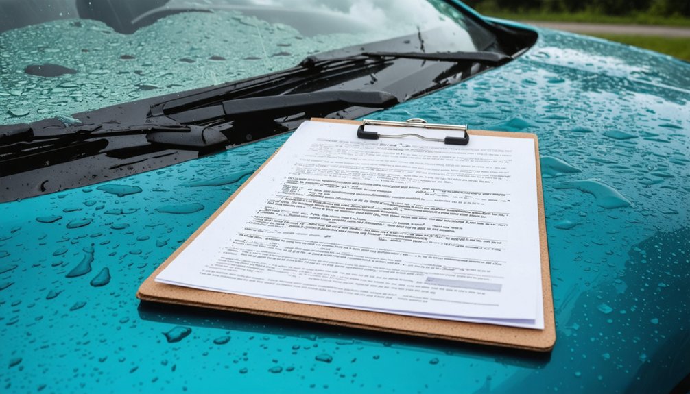
Forensic Weather Consulting Services
Where real-time tools track what’s happening now, forensic weather consulting services reconstruct what happened — and that distinction carries significant weight in contested claims.
These services deliver site-specific meteorological analyses using forensic analysis and weather modeling to establish precise storm conditions at a defined location and time.
You get documented evidence that holds up under scrutiny, including:
- Written reports detailing verified hail size, intensity, and duration at the property level
- 10-year hail history reports for individual U.S. properties
- Forensic storm reports confirming accurate site conditions during specific weather events
This isn’t generalized data — it’s defensible, property-specific documentation.
When claim disputes arise, forensic consulting gives you the evidentiary foundation to resolve them accurately, efficiently, and on your terms.
How Forensic Weather Reports Strengthen Claims and Disputes
When standard weather data falls short in disputed claims, forensic weather consulting services fill the gap with site-specific meteorological analyses that document precise atmospheric conditions at a given property during a specific storm event.
Standard weather data doesn’t always tell the full story—forensic meteorological analysis fills the gap with site-specific precision.
You’ll gain defensible, written documentation that withstands legal and regulatory scrutiny. Forensic methodologies integrate radar data, surface observations, storm reports, and satellite imagery to reconstruct actual hail characteristics—size, intensity, duration, and trajectory—at your specific location.
Report accuracy depends on cross-referencing multiple independent data sources, eliminating assumptions that weaken standard assessments. These reports directly support claim validation, dispute resolution, and litigation by replacing subjective estimates with quantified meteorological evidence.
When you’re facing a contested claim, forensic weather reports give you the precise, verifiable documentation needed to assert or defend a position confidently.
How Hail Data Cuts Claims Cycle Time and Sharpens Underwriting
When you integrate property-specific hail data into your claims workflow, you compress cycle time by enabling adjusters to access verified storm parameters—size, intensity, and ground-level impact—before the first inspection call.
Advanced analytics let you move from event detection to damage estimation in near-real-time, replacing manual verification steps with satellite- and radar-confirmed data streams.
On the underwriting side, you can apply granular risk differentiation at the individual property level, moving beyond broad regional approximations to set premiums that accurately reflect each structure’s actual hail exposure history and vulnerability profile.
Accelerating Claims Through Data
Every hour that passes after a hailstorm without actionable damage data costs insurers money and erodes policyholder trust.
Data integration between satellite imagery, radar verification, and property-level risk models enables claims automation that compresses settlement timelines dramatically.
Prioritize these operational advantages:
- Faster damage detection — Near-real-time hail outbreak monitoring identifies affected properties within hours, not days.
- Reduced field dependency — Verified remote sensing data eliminates unnecessary physical inspections, cutting operational costs directly.
- Precise loss estimation — Property-specific vulnerability data produces accurate reserve calculations before adjusters deploy.
You’re no longer reliant on delayed storm reports or fragmented weather station records.
When your data pipeline connects detection to decision-making seamlessly, you control claim cycle speed, reduce leakage, and deliver faster payments — strengthening policyholder relationships without sacrificing accuracy.
Precision Underwriting With Analytics
Hail data doesn’t just accelerate claims — it reshapes how you price risk before a single storm forms. Precision analytics give you property-level insight into hail frequency, intensity, and structural vulnerability, replacing broad regional assumptions with granular, actionable intelligence.
You’re no longer underwriting a ZIP code — you’re underwriting a specific roof, age, and material profile against documented storm history. This specificity strengthens your underwriting strategies in measurable ways.
You can segment portfolios by actual exposure, adjust premiums to reflect verified risk differentials, and eliminate cross-subsidization between low- and high-hazard properties. Integrated data combining satellite detection, radar verification, and historical loss patterns lets you quantify tail risk with precision.
The result: tighter loss ratios, defensible pricing decisions, and a competitive edge built on evidence rather than estimation.
Frequently Asked Questions
Can Homeowners Access Hail History Reports for Their Own Properties?
Yes, you can access 10-year hail history reports for your property through specialized verification services. These tools empower you with precise, data-driven property assessments, giving you full visibility into your site’s hail exposure history.
How Many Hailstones Have Researchers Physically Collected and Tested so Far?
You’ve got nearly 10,000 hailstones collected through rigorous research methodologies. Teams have physically measured, weighed, and crushed each one, enabling precise hail size documentation and impact analysis—giving you reliable, ground-truth data for truly independent risk assessment.
Do Hailstorms Cause More Annual Insured Losses Than Hurricanes Historically?
Like David vs. Goliath, hail punches above its weight — you’ll find hail damage drives 50-80% of severe convective storm insurance claims annually, often outpacing hurricane-related losses in most years.
Can Artificial Intelligence Predict Future Hail Damage Before Storms Occur?
Yes, AI can enhance hail prediction by analyzing historical data patterns before storms occur. You’ll benefit from machine learning’s ability to improve storm forecasting accuracy, helping you anticipate damage, accelerate claims response, and make data-driven underwriting decisions independently.
How Far Can Hailstones Travel Horizontally Before Reaching the Ground?
Like Odysseus’s long journey home, hailstone trajectory can carry stones miles from formation. You’ll find impact factors like wind shear and storm height determine how far hailstones travel before reaching the ground.
References
- https://capeanalytics.com/resources/hail-risk-insurers-storm-report/
- https://www.nasa.gov/centers-and-facilities/langley/nasa-takes-an-insured-look-at-hailstorm-risk/
- https://descartesunderwriting.com/insights/understanding-hail-risk
- https://hailstorm.ie/hail-damage-assessment-tools-reallife-case-studies-of-userfriendliness/
- https://www.verisk.com/solutions/catastrophe-risk-solutions/natural-hazard-risk-response/hail-severe-thunderstorm/
- https://ibhs.org/hail/hailstones/
- https://www.weather.gov/enterprise/fs-hail-3c
- https://climatemonitoring.info/wp-content/uploads/2022/06/UseCase_Hail-risk-assessment-using-space-borne-remote-sensing-and-reanalyses.pdf


