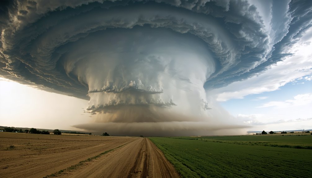
Rising temperatures systematically reshape the atmospheric physics driving severe storm formation. Warmer surface air rises more aggressively, boosting CAPE values and strengthening updrafts. Each 1°C increase adds roughly 7% more atmospheric moisture, accelerating condensation and releasing additional latent heat that intensifies storms further. NASA data confirms 21% more extreme storms per 1°C of ocean warming. However, competing forces like upper-tropospheric warming and shifting wind shear add complexity — and the full picture reveals far more than surface-level warming alone.
Key Takeaways
- Warmer surface air rises more aggressively, strengthening updrafts and increasing atmospheric instability, measured by higher CAPE values.
- Every 1°C of warming adds roughly 7% more atmospheric moisture, intensifying rainfall and raising flash flood risks.
- Rising temperatures concentrate storm energy into fewer but more powerful storms, with projected intensity increases of 1–10%.
- Upper-tropospheric warming can suppress storm formation by altering vertical wind shear, despite favorable surface conditions.
- Urban heat islands amplify local convection, pushing storm cells higher and contributing to more severe localized storms.
What Makes a Thunderstorm Severe in the First Place?
Before a storm earns the label “severe,” it must meet a specific meteorological threshold: producing hail at least 1 inch in diameter, wind gusts of 58 mph or greater, or a tornado.
To hit those benchmarks, a thunderstorm needs three core ingredients: moisture, unstable rising air, and lift.
Add strong vertical wind shear, and you’ve created conditions capable of spawning rotating supercells.
Hail formation depends on powerful updrafts that suspend ice particles long enough for repeated freezing cycles.
Lightning frequency signals updraft strength — more frequent strikes often indicate a more energetic, unstable storm core.
High CAPE values quantify that instability, measuring how aggressively air parcels accelerate upward.
When you understand these dynamics, you can see exactly why warming temperatures don’t just tweak storm behavior — they restructure the atmospheric conditions that define it.
How Rising Temperatures Fuel Stronger Convection
Once those ingredients are in place, temperature becomes the accelerant. Warmer surface air rises more aggressively, strengthening convective updrafts and fundamentally altering cloud dynamics.
Temperature is the accelerant—warmer air rises harder, reshaping cloud dynamics from the ground up.
That upward motion pulls in more moisture, and since the atmosphere holds roughly 7% more water vapor per 1°C of warming, you’re feeding storms a richer fuel supply.
That extra moisture doesn’t just sit there—it releases latent heat as it condenses, driving updrafts even harder. The result shifts precipitation patterns toward more intense, concentrated downpours rather than steady, moderate rainfall.
Higher CAPE values, which the IPCC links with high confidence to warming in the tropics and subtropics, confirm this trajectory. You’re not just seeing warmer days—you’re watching the atmospheric engine recalibrate toward greater convective intensity.
Why Does CAPE Matter for Severe Storm Formation?
CAPE—Convective Available Potential Energy—measures how much energy a rising air parcel can extract from its environment, and that number directly determines a storm’s potential violence. When CAPE values climb, updrafts accelerate, stretching the atmosphere vertically and creating conditions that intensify cloud rotation and drive explosive lightning strikes.
The IPCC reports high confidence that CAPE increases with global warming across the tropics and subtropics, meaning the atmospheric fuel available for deep convection is actively expanding. Higher CAPE doesn’t guarantee a tornado, but it raises the probability ceiling for what storms can achieve.
Combined with strong vertical wind shear, elevated CAPE creates environments where supercells organize efficiently. You’re fundamentally watching the atmosphere load a weapon—and warmer temperatures keep tightening the spring.
Why Warmer Air Holds More Moisture: and Why That Matters?
When air warms by just 1°C, it can hold approximately 7% more water vapor — a relationship governed by the Clausius-Clapeyron equation.
That extra moisture doesn’t just sit idle; it drives stronger evaporation from Earth’s surface, loading the atmosphere with latent heat energy that fuels deeper, more explosive convection.
As a result, you’re looking at a direct pipeline from warming temperatures to heavier rainfall rates and a sharply elevated risk of flash flooding in severe storm events.
Moisture Capacity Increases With Heat
As temperatures rise, the atmosphere’s capacity to hold water vapor increases by roughly 7% for every 1°C of warming — a relationship governed by the Clausius-Clapeyron equation.
These moisture dynamics directly amplify storm energy, since water vapor releases latent heat during condensation, accelerating convection.
You can think of it this way: every degree of warming effectively loads the atmosphere with more storm fuel.
Temperature thresholds matter here — once surface warming pushes evaporation rates higher, moisture availability compounds rapidly.
For every 1.1°C gained, atmospheric water vapor rises approximately 8%.
That extra moisture doesn’t just make storms wetter; it intensifies their development cycle.
More latent heat drives stronger updrafts, increasing the potential for severe convective events, heavier rainfall, and greater flash flood risk.
Evaporation Fuels Storm Energy
Evaporation is the engine behind atmospheric moisture loading — and it accelerates with every degree of surface warming. As surface temperatures rise, water molecules gain enough kinetic energy to convert into vapor faster, feeding the atmosphere with additional fuel.
That extra vapor doesn’t just sit idle — it drives cloud formation by releasing latent heat during condensation, which intensifies convective updrafts and amplifies storm energy.
You need to understand the temperature thresholds involved here. NASA’s data shows extreme storm activity spikes when ocean surfaces exceed 28°C. At that point, evaporation rates surge, moisture availability increases sharply, and storm systems can tap into substantially greater energy reserves.
Each additional 1°C of warming adds roughly 7% more atmospheric water vapor — a measurable, compounding advantage for severe storm development.
Heavy Rainfall Risks Rise
That additional atmospheric moisture doesn’t stop at fueling storms — it directly determines how much rain those storms can drop. For every 1°C of warming, the atmosphere holds roughly 7–8% more water vapor. That surplus feeds directly into cloud microphysics, accelerating droplet coalescence and intensifying precipitation rates within storm cells.
Storm tracking data confirms this shift isn’t theoretical. NASA found that extreme storm frequency could rise by as much as 60% by century’s end under continued warming. The IPCC reports high confidence that maximum rain rates in severe convective storms are already increasing across regions like the USA.
You’re not just facing more storms — you’re facing storms engineered by warmer conditions to dump considerably more water, faster, compressing your window to respond.
Why Storms Are Dumping More Rain Than Ever Before
When the atmosphere warms by just 1°C, it can hold roughly 7–8% more water vapor — and that extra moisture goes directly into storms. This moisture buildup accelerates convection, as warmer, wetter air rises faster and releases more latent heat energy, intensifying precipitation rates.
Every 1°C of warming loads the atmosphere with 7–8% more moisture — fuel that storms convert into heavier, more intense rainfall.
Temperature gradients between the surface and upper atmosphere sharpen storm dynamics further. The IPCC confirms with high confidence that average and maximum rain rates in severe convective storms are increasing across regions like the USA.
NASA’s data reinforces this, showing 21% more extreme storms form per 1°C of ocean warming.
You’re not imagining it — storms are genuinely delivering heavier downpours. The physics are straightforward: more heat means more evaporation, more vapor, and ultimately more water crashing down in less time.
Do Warmer Temperatures Actually Create More Storms?
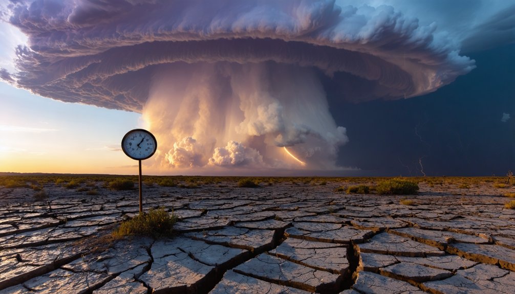
When you examine the data, the relationship between warming and storm frequency isn’t straightforward—total tropical cyclone counts may stay flat or even decline, yet the strongest storms grow more intense.
Warmer air drives stronger convection by supplying more latent heat energy, raising CAPE and making severe storm environments more favorable, particularly in the tropics and subtropics.
You’re also dealing with competing atmospheric forces, since upper-tropospheric warming and shifts in vertical wind shear can suppress storm formation even as surface conditions become more favorable.
Storm Frequency Versus Intensity
Does a warmer climate mean more storms? Not necessarily. The data reveals a critical distinction between storm frequency and storm intensity — and that difference matters.
NOAA and NASA both confirm that total tropical cyclone counts may stay flat or even decline. What changes is the destructive capacity per storm.
You’re looking at projected intensity increases of 1% to 10% under a 2°C warming scenario, alongside a rising proportion of Category 4 and 5 storms.
Warmer temperatures reshape cloud dynamics, concentrating energy into fewer but more powerful systems. Lightning patterns may shift regionally as CAPE increases drive deeper convection in targeted zones.
The takeaway: climate change isn’t simply manufacturing more storms — it’s engineering stronger ones, with heavier rainfall and greater destructive potential per event.
Warmer Air Fuels Convection
Warmer air doesn’t automatically generate more storms — but it does stack the atmospheric deck in their favor. When surface temperatures rise, you get stronger temperature gradients between the ground and upper atmosphere, accelerating convective updrafts. That vertical instability is what cloud dynamics depend on to build towering cumulonimbus systems.
Here’s the data: for every 1°C of warming, the atmosphere holds roughly 7% more water vapor. That additional moisture amplifies latent heat release, feeding convection more aggressively.
CAPE — convective available potential energy — increases with warming across the tropics and subtropics, according to IPCC findings.
You’re not guaranteed more storms, but when conditions align — moisture, lift, and shear all present — the resulting storms carry significantly greater energy potential than they’d in a cooler atmosphere.
Competing Climate Effects
Climate change doesn’t simply flip a switch and produce more storms — the relationship is far more competitive and nuanced. Warmer sea surfaces and rising air temperatures supply more energy and moisture, yet higher upper-tropospheric warming simultaneously alters cloud dynamics and vertical wind shear in ways that can suppress storm development.
Aerosol effects further complicate the picture, influencing cloud microphysics and precipitation efficiency unpredictably. The IPCC confirms that severe storm responses vary considerably by region because temperature, moisture, and shear interact differently across locations.
Some climate-driven changes favor intensification; others actively resist it. What you’re left with isn’t necessarily more storms — it’s stronger peak storms producing heavier rainfall, while total storm frequency may remain stable or even decline.
How Hurricanes Are Getting Stronger Even If They’re Not More Frequent
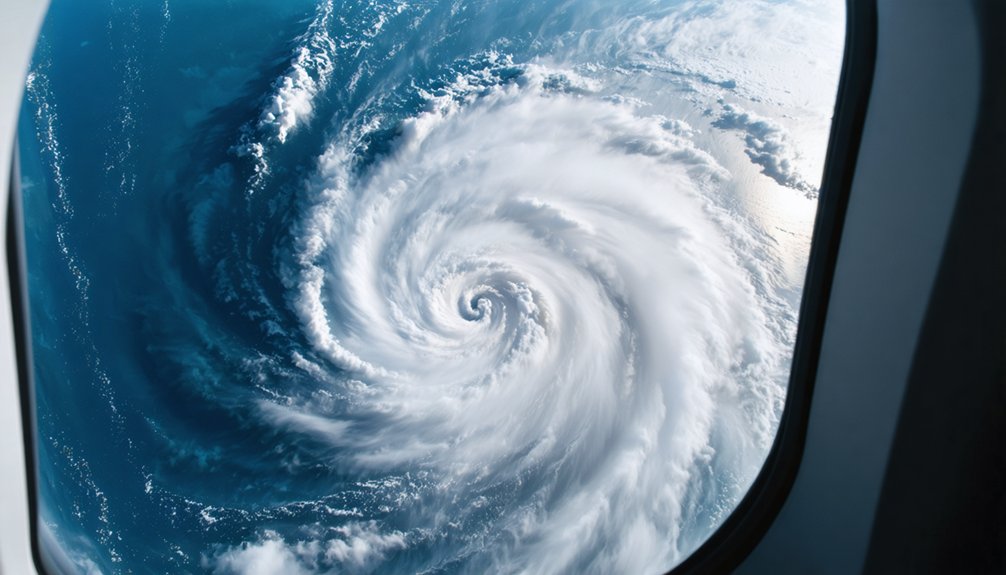
Although hurricanes may not be forming more often, the ones that do form are packing a harder punch. Climate data confirms that warming drives intensity, not necessarily frequency. Here’s what you need to track:
Hurricanes aren’t forming more often — they’re just hitting harder. Warming drives intensity, and that changes everything.
- Intensity climbs 1%–10% for every 2°C of warming, altering cloud dynamics and dramatically increasing destructive potential per storm.
- Category 4 and 5 storms are increasing in proportion, meaning you’re facing fewer weak storms and more catastrophic ones.
- Lightning frequency and rainfall rates surge inside stronger storms, with coastal flood risk rising alongside peak wind speeds.
NOAA and NASA both confirm total hurricane counts may stay flat or drop. What changes is the ceiling — the strongest storms keep getting stronger, and that’s what threatens your safety and infrastructure.
How Climate Change Is Making U.S. Storm Conditions More Dangerous
Across the United States, storm conditions are shifting in measurable ways that directly raise your risk. The IPCC reports high confidence that CAPE increases with warming, particularly amplifying instability across storm-prone regions.
Average and maximum rain rates in severe convective storms are rising. Urban heat intensifies this further — cities trap warmth, destabilizing the lower atmosphere and accelerating convective triggering.
Aerosol impacts add complexity; industrial particulates alter cloud microphysics, affecting droplet size and precipitation efficiency.
Meanwhile, a warming atmosphere holds roughly 7% more moisture per 1°C rise, directly fueling heavier downpours and flash flooding.
You’re not facing the same storm environment your parents did. The atmospheric deck is reshuffling, concentrating destructive potential into fewer but markedly more intense events.
Why Wind Shear and Instability Drive Future Tornado Risk
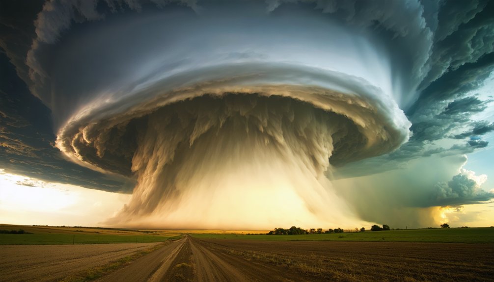
Tornadoes don’t form from heat alone — they require the precise co-occurrence of large CAPE and strong vertical wind shear. Climate change directly influences both variables, reshaping tornado risk across shifting atmospheric conditions.
Here’s what the data shows:
- Instability rises — The IPCC confirms with high confidence that CAPE increases in a warming climate, particularly across the tropics and subtropics, fueling deeper, more explosive convection.
- Wind shear remains critical — Without strong vertical wind shear, even highly unstable air won’t generate tornadic rotation.
- Competing forces create uncertainty — Warming upper-tropospheric temperatures can suppress wind shear, partially offsetting instability gains.
You’re steering a system where two atmospheric forces — instability and wind shear — don’t always move in the same direction under warming conditions.
Which Regions Face the Biggest Shift in Severe Storm Conditions
When you examine which regions face the greatest shifts in severe storm conditions, the tropics and subtropics stand out immediately. The IPCC reports high confidence that CAPE increases with global warming across both zones, directly amplifying deep convection potential.
You’ll also find that the USA faces measurable rainfall intensity shifts, with the IPCC confirming high confidence that average and maximum rain rates in severe convective storms are already rising.
These two regional patterns — tropical CAPE growth and American rainfall intensification — represent the clearest, most data-supported signals of climate-driven storm change currently available.
Tropical and Subtropical Hotspots
The tropics and subtropics are already facing the sharpest shifts in severe storm conditions, and the data backs that up. The IPCC confirms with high confidence that CAPE is rising in these regions, directly fueling deeper convection and more volatile cloud dynamics. Aerosol impacts further complicate storm behavior by altering precipitation efficiency and updraft strength. Here’s what you need to track:
- CAPE increases in the tropics and subtropics signal stronger updrafts and more explosive storm development.
- NASA data shows 21% more extreme storms form per 1°C rise in ocean surface temperatures.
- Rain rates are climbing, raising flash flood risk across vulnerable low-latitude regions.
You’re watching a measurable, data-confirmed acceleration in storm-favorable conditions concentrated exactly where they’re hardest to absorb.
USA Rainfall Intensity Shifts
Shifting focus from tropical and subtropical hotspots to the continental United States, you’re looking at a region where the IPCC confirms with high confidence that average and maximum rain rates from severe convective storms are already climbing.
Urban heat amplifies this trend by intensifying local convection, pushing storm cells toward greater vertical development and heavier precipitation output.
Aerosol impact adds another layer of complexity—particulates alter droplet formation, potentially suppressing or intensifying rainfall depending on concentration and storm type.
Higher CAPE values drive stronger updrafts, pulling more moisture upward and converting it into intense downpours.
You’re facing a compounding system where warmer air, modified urban landscapes, and shifting aerosol loads collectively push rainfall intensity beyond historical baselines, demanding infrastructure and emergency planning frameworks built for conditions that no longer reflect current atmospheric realities.
Frequently Asked Questions
Can Severe Storms Become More Dangerous at Night Due to Warming Temperatures?
Like a furnace that never cools, yes, you’ll find nighttime intensification grows more likely as warming keeps temperatures above critical temperature thresholds, sustaining CAPE and moisture that fuel dangerous severe storms even after sunset.
How Do Urban Heat Islands Influence Local Severe Storm Development?
Urban heat islands intensify local storms by warming surface air, boosting convection and moisture. You’ll find they create unstable atmospheric conditions that can trigger stronger updrafts, heavier rainfall, and more frequent severe weather events in your city.
Are Storm Seasons Getting Longer as Global Temperatures Continue to Rise?
Yes, you’re watching storm seasons stretch like a horizon that never ends. Rising temps fuel atmospheric instability and climate feedbacks, extending active periods. CAPE increases with warming, giving convective storms more runway to develop longer each year.
How Does Warming Affect the Speed at Which Storms Move Across Land?
Warming doesn’t directly drive storm translation speed, but it’s reshaping storm dynamics you’d notice. Storm intensification and wind acceleration increase, while some research suggests slower-moving storms could dump heavier rainfall, amplifying flood risks considerably.
Can Warmer Temperatures Cause Multiple Severe Storm Systems to Merge Together?
Yes, you’re entering “atmospheric cooperation” territory—warmer air can encourage storm clustering by lowering temperature thresholds for convection, letting multiple systems tap shared moisture and instability pools, ultimately merging into larger, more intense storm complexes.
References
- https://www.nssl.noaa.gov/education/svrwx101/thunderstorms/
- https://scied.ucar.edu/learning-zone/climate-change-impacts/climate-severe-storms
- https://www.weather.gov/source/zhu/ZHU_Training_Page/thunderstorm_stuff/Thunderstorms/thunderstorms.htm
- https://en.wikipedia.org/wiki/Thunderstorm
- https://www.rmets.org/metmatters/how-does-climate-change-affect-thunderstorms
- https://www.ipcc.ch/report/ar6/wg1/chapter/chapter-11/
- https://www.bbc.com/news/articles/cz913gxlw3jo
- https://www.gfdl.noaa.gov/global-warming-and-hurricanes/
- https://science.nasa.gov/earth/climate-change/warming-seas-may-increase-frequency-of-extreme-storms/
- https://science.nasa.gov/earth/climate-change/a-force-of-nature-hurricanes-in-a-changing-climate/