Topography directly shapes your risk calculations during a chase. Surface roughness disrupts low-level rotation, while steep gradients intensify updrafts by enhancing moisture flux. Forested ridgelines create frictional drag that produces erratic tornado tracks, and low-lying areas flood rapidly, turning escape routes into death traps. Hills and tree lines slash your visibility, forcing split-second repositioning decisions. Master terrain mapping with tools like ArcGIS and you’ll start anticipating dangers before they materialize.
Key Takeaways
- Terrain features like ridgelines and forests block storm visibility, making accurate risk assessment and safe positioning significantly more difficult.
- Surface roughness and steep gradients alter tornado intensity and track, increasing unpredictability during risk calculations.
- Low-lying areas accumulate water rapidly, while hilly roads increase hydroplaning risks, demanding constant route reassessment.
- High-resolution terrain mapping tools like ArcGIS integrate elevation and radar data, improving real-time storm chasing risk intelligence.
- Orographic lifting zones, where terrain forces air upward, can intensify storms unexpectedly, requiring chasers to adjust positioning strategies.
How Terrain Changes Tornado Behavior During a Chase
When you’re chasing a tornado across varied terrain, the ground beneath it isn’t passive—it’s actively reshaping the storm’s behavior. Terrain influence operates at multiple scales: surface roughness disrupts low-level rotation, while slope orientation alters near-surface wind shear, directly modulating tornado intensity.
Steep orographic gradients can enhance moisture flux, feeding stronger updrafts and amplifying circulation. Conversely, forested ridgelines introduce frictional drag that destabilizes rotational symmetry, producing erratic, looping tracks that defeat standard risk prediction models.
You can’t rely on historical flat-terrain chase protocols here. Microscale topographic features—ravines, ridges, valley corridors—create localized damage path variability that confounds real-time intensity assessments.
Understanding how terrain reshapes vortex dynamics isn’t optional; it’s a tactical necessity for accurate positioning and survivable exit strategies.
Road Hazards Topography Creates for Storm Chasers
Topography doesn’t just reshape tornado behavior—it turns the road network itself into a hazard matrix. In hilly or forested terrain, hydroplaning risks spike as water channels along road surfaces with nowhere to drain efficiently.
You’re operating on roads where stopping distances increase dramatically, and road visibility drops due to rain curtains, blowing debris, and dense tree lines obstructing sightlines.
Slick roads contribute to approximately six storm-chasing deaths annually—a statistic you can’t afford to ignore.
Downed power lines and tornado debris compound navigation complexity in areas with underdeveloped road networks. Low-lying areas accumulate water rapidly, creating sudden hydroplaning risks even at moderate speeds.
You must pre-map exit routes using high-resolution terrain data, ensuring you’re never locked into a single compromised corridor when conditions deteriorate fast.
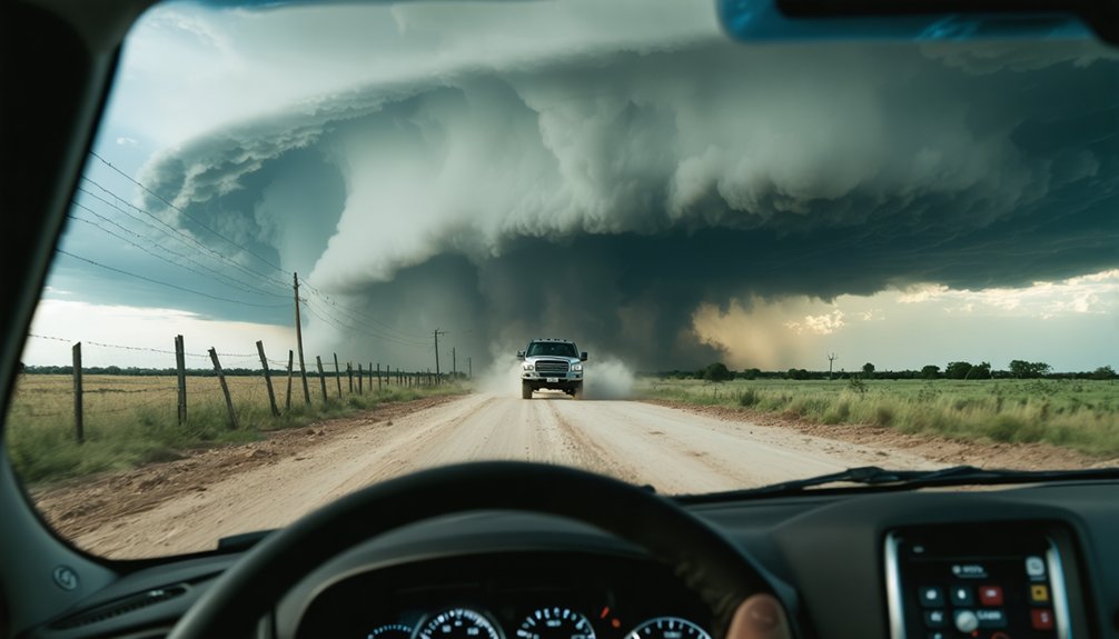
Why Hills and Forests Kill Your Visibility Mid-Chase
Hills and forests strip away your situational awareness faster than almost any other terrain feature you’ll encounter mid-chase. Elevated ridgelines block low-level storm structure, preventing you from tracking wall cloud position or identifying a bear’s cage before you’re already inside it.
Forest obstacles compound visibility challenges by fragmenting your sightlines into narrow corridors, eliminating the wide-angle assessment you need for accurate escape route planning.
Heavy precipitation in forested terrain intensifies the problem. Rain-borne dust and hail fog reduce contrast, making rotating curtains nearly indistinguishable from standard precipitation. You lose critical seconds determining storm movement direction.
Research confirms that microscale topographic features directly increase damage path variability, meaning your risk calculations become unreliable precisely when accuracy matters most. Know your terrain before committing to a position.
How Chasers Use Terrain Maps to Spot Danger Zones
Terrain maps transform raw elevation data into actionable risk intelligence before you commit to a chase position.
Load ArcGIS or QGIS with real-time radar overlays and historical storm tracks to execute precise terrain mapping that identifies orographic lifting zones where storms intensify rapidly. You’re cross-referencing elevation gradients against moisture corridors, flagging ridgelines that accelerate wind shear and valleys that funnel debris unpredictably.
Pinpointing danger zones means analyzing slope angles where hydroplaning risks spike and road networks that dead-end in low-lying flood-prone areas.
High-resolution topographic data reveals elevation breaks critical for flash flood prediction, while mobile GPS apps deliver custom overlays mid-chase.
You’re not guessing—you’re operating from spatial analysis that converts complex terrain variables into calculated positioning decisions that protect your escape routes.
Driving through complex terrain demands real-time decisiveness, not reactive guessing. You’ll rely on sharp driving techniques and precise navigation tools to stay ahead of dynamic conditions.
- Use ArcGIS or QGIS overlays to cross-reference real-time radar with elevation data, identifying intensification zones before you’re inside them.
- Reduce speed on wet, hilly roads—hydroplaning kills chasers more reliably than tornadoes do.
- Position your vehicle to the storm’s right flank, maintaining clear sightlines and viable escape routes.
- Monitor mobile GPS apps with custom terrain overlays to anticipate road limitations, debris fields, and low-lying flood zones.
Forested ridgelines and valley corridors don’t just block your view—they actively reshape storm paths.
Navigate with topographic awareness, not assumptions, and you’ll retain the freedom to move fast when it counts.
Frequently Asked Questions
How Does Topography Affect Storm Surge Risks in Coastal Chasing Zones?
You’ll face amplified storm surge risks where coastal elevation drops sharply, as wind angles directly correlate with surge height. Without adequate flood barriers, you’re traversing data-confirmed danger zones demanding precise topographic analysis before every coastal chase.
What Geospatial Software Do Professional Storm Chasers Rely on Most?
You’ll rely most on ArcGIS and QGIS — proven through testing — for storm tracking, data visualization, and mapping tools. They integrate satellite imagery, predictive modeling, and historical analysis, empowering you to navigate terrain-based risks independently and precisely.
How Do Microscale Terrain Features Influence Tornado Damage Path Variability?
Microscale terrain features directly alter tornado damage paths by disrupting wind patterns through elevation changes. You’ll find vegetation impact, microclimate effects, and terrain variability create unpredictable shifts, making precise tornado damage assessments considerably harder to model accurately.
Can Orographic Lifting Significantly Strengthen a Tornado’s Parent Supercell Storm?
Like a bellows feeding a forge, orographic lifting fuels your supercell’s tornado dynamics — yes, it can greatly strengthen storm structure by boosting moisture availability on steep slopes, intensifying updrafts and escalating overall storm development.
How Does Remote Sensing Technology Improve Flash Flooding Risk Assessments?
Remote sensing acquires high-resolution elevation data that you’ll integrate into flood modeling systems, pinpointing flash flood-prone zones with precision. It’s empowering you to make data-driven decisions, identify vulnerable terrain, and navigate storm chasing risks confidently and freely.
References
- https://journals.ametsoc.org/view/journals/wcas/9/3/wcas-d-16-0038_1.pdf
- https://stormtrack.org/threads/topography-and-tornadogenesis.14295/
- https://repository.library.noaa.gov/view/noaa/20438/noaa_20438_DS1.pdf
- https://inside.nssl.noaa.gov/vsecommunity/understanding-the-role-of-terrain-and-surface-roughness-on-severe-storm-and-tornado-behavior/
- https://proceedings.esri.com/library/userconf/proc08/papers/papers/pap_1396.pdf
- https://ascelibrary.org/doi/10.1061/9780784480618.023
- https://bpb-us-w2.wpmucdn.com/wp.towson.edu/dist/d/1041/files/2021/09/25_Wagner-et-al.-2021-MWR.pdf
- https://crazystormchasers.com/geospatial-analysis-for-precise-risk-assessment-in-storm-chasing/
- https://onlinelibrary.wiley.com/doi/full/10.1002/esp.4062
- https://www.atms.unca.edu/cgodfrey/courses/swfex/pdf/ChasingSafety.pdf