Mastering storm chasing drone techniques means you’ll need more than piloting skills—you must understand supercell structure, select weather-resistant airframes, and comply with FAA Part 107 regulations before launching. Target organized low-level rotation on the storm’s clear, less-precipitating flank, and always monitor for TFRs issued during emergency operations. Establish firm withdrawal thresholds to avoid violent wind shear, hail, and unpredictable RFD surges near tornado cores. This guide breaks down everything you need to operate safely and effectively.
Key Takeaways
- Target storms with organized low-level rotation, positioning drones on the clear, less-precipitating flank for optimal visual access and safety.
- Use carbon fiber airframes with weather-resistant electronics and sensor redundancy to withstand turbulent, moisture-heavy storm environments.
- Avoid penetrating precipitation cores; collect layered atmospheric data from the inflow region while establishing clear withdrawal thresholds beforehand.
- Monitor RFD surges, violent wind shear, and rapid pressure drops that can instantly destabilize drone flight near tornado cores.
- Comply with FAA Part 107 regulations, monitor real-time TFRs via NOTAMs and B4UFLY, and carry your Remote Pilot Certificate always.
What Makes a Supercell Worth Chasing With a Drone?
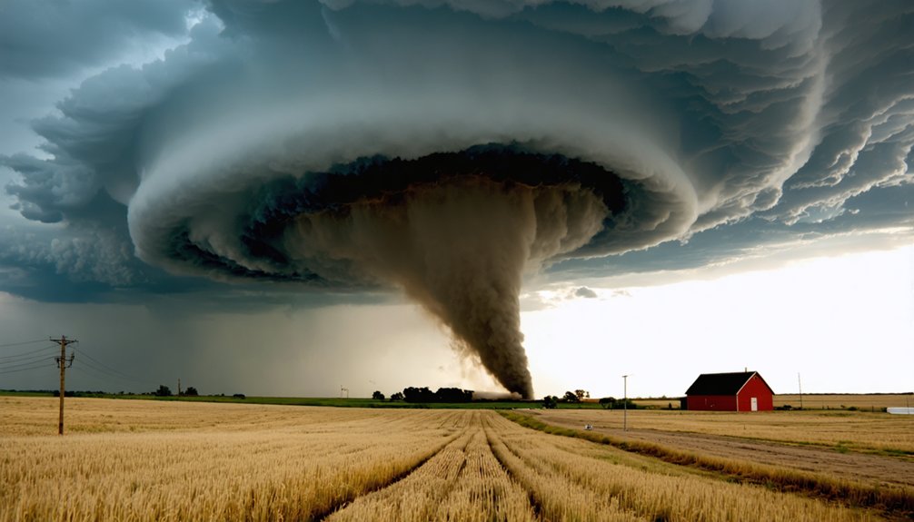
Not every supercell justifies the risk and logistics of deploying a drone. You need to evaluate supercell characteristics before committing to a launch. Target storms that show organized low-level rotation, a defined wall cloud, and clear visual access on the less-precipitating flank.
Strong moisture convergence and sustained wind shear increase tornado probability, making the mission scientifically and operationally worthwhile.
High wind shear and moisture convergence signal elevated tornado potential—conditions that make the mission worth every calculated risk.
Drone advantages become significant when ground-level visibility fails. Aerial positioning lets you observe storm structure above precipitation curtains, revealing rotation and inflow patterns invisible from the road.
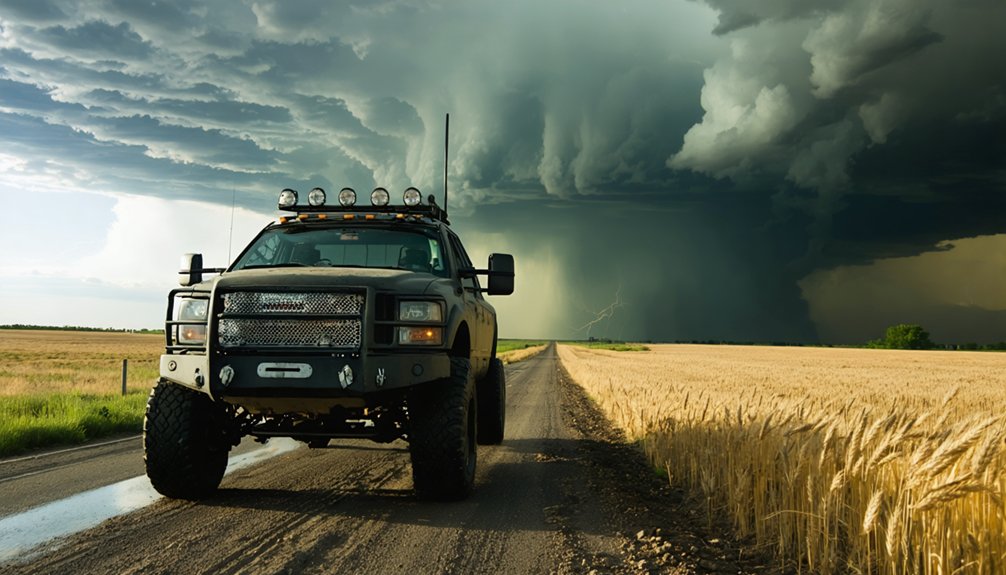
Prioritize supercells with slower storm motion, accessible road networks, and defined escape routes. Fast-moving or rain-wrapped storms reduce your operational window and elevate risk.
Choose your target deliberately—your drone, your data, and your safety depend on that discipline.
What Storm Chasers Learned From the TORUS Drone Project
Selecting the right supercell is only part of the equation—knowing what to do with your drone once you’re airborne separates useful data collection from expensive footage.
The 2019 TORUS findings confirmed that drones can measure temperature, pressure, humidity, and wind speed inside active supercells with meaningful scientific precision. These drone insights reshaped how researchers model tornado development and inflow dynamics at low levels.
You’ll want to position your platform where it captures data within the inflow region without penetrating precipitation cores. TORUS operators prioritized sensor redundancy, stable airframes, and real-time telemetry to maintain situational awareness as storm structure shifted rapidly.
Apply those same principles. Collect layered atmospheric data, track storm motion continuously, and establish clear withdrawal thresholds before launch.
Freedom in the field comes from disciplined pre-mission planning, not improvisation.
Choose the Right Storm Chasing Drone for Severe Weather
When selecting a drone for severe weather operations, you’ll need to prioritize airframe stability above nearly every other specification, since turbulent inflow, gust fronts, and erratic wind shear can overwhelm lighter, less rigid platforms within seconds.
You should also confirm that your electronics carry adequate weather resistance, as moisture infiltration from heavy rain or hail can degrade sensors, interrupt telemetry, and force premature recovery at the worst possible moment.
Treating these two criteria as non-negotiable filters will immediately narrow your platform choices to designs built for performance under genuine atmospheric stress rather than controlled conditions.
Prioritizing Airframe Stability
Airframe stability isn’t a preference in storm chasing—it’s a hard operational requirement. When you’re operating near a supercell, inflow winds, gust fronts, and turbulent downdrafts don’t give you margin for a structurally weak platform.
Your drone’s airframe materials directly determine how it responds under load. Carbon fiber composites offer the best strength-to-weight ratio, resisting flex and torsional stress during sudden wind events.
Avoid platforms built primarily from lightweight plastics—they’ll lose rigidity when it matters most. Before deploying in severe weather, conduct formal stability testing across multiple wind speeds and directions.
Document how your airframe behaves under lateral stress and rapid directional changes. That data tells you where your operational limits actually are, not where you assume they are.
Weather-Resistant Electronics Matter
Even if your airframe holds up under gust loads, unprotected electronics will fail first in heavy rain or hail exposure.
Drone durability means nothing if moisture penetrates your ESCs, flight controller, or receiver. You’ll want conformal coatings applied to circuit boards, sealed connectors, and waterproof camera housings rated for actual precipitation contact.
Electronic protection isn’t optional in severe weather operations—it’s a prerequisite.
Corrosion builds fast when salt-laden inflow air combines with rain saturation. Gaskets around motor bells and battery compartments reduce ingress points considerably.
You should also verify that your telemetry and video transmission systems maintain signal integrity under wet conditions, since dropouts during critical storm positioning can cost you both footage and safe egress timing.
Prioritize protection before launch, not after damage occurs.
How to Read Storm Structure Before You Launch
Understanding storm structure before you launch isn’t optional—it’s the foundation of every safe and effective drone mission near severe weather. You need to read storm cloud dynamics before your rotors ever spin. Identify the wall cloud, precipitation curtains, and inflow bands first. Inflow patterns tell you where the storm is drawing surface moisture—that’s your positioning cue, not just a visual reference.
Watch how the cloud base evolves. A rotating, lowering base signals increasing mesocyclone intensity and shrinking safe launch windows.
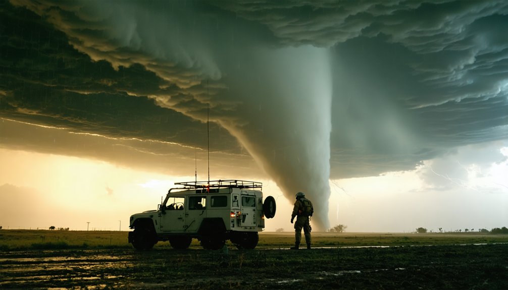
Position yourself on the clear, less-precipitating flank for visual access and escape route integrity. Track storm motion against your planned flight corridor. If structure deteriorates faster than your retrieval window allows, you don’t launch.
Discipline here protects both your equipment and your operational future.
How to Position Your Storm Chasing Drone for Clean Footage
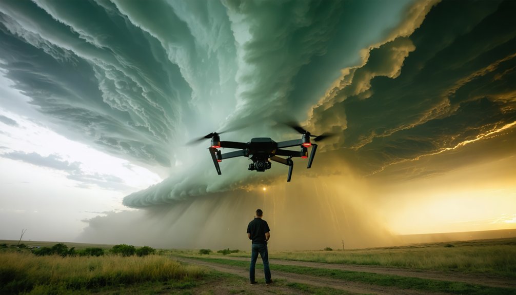
Once you’ve read the storm’s structure and committed to a launch, your next variable is positioning—and it determines whether you get clean, usable footage or a compromised shot obscured by precipitation and turbulence.
For clean footage, place yourself on the storm’s forward flank or clear southern edge, where visual access is strongest and precipitation interference is minimal.
Drone positioning should keep your airframe away from the RFD corridor, which delivers turbulent, unpredictable winds close to the tornado core. Maintain lateral distance that lets you frame wall cloud development without entering heavy rain curtains.
Track storm motion continuously—supercells move fast, and your launch window can close within minutes.
Disciplined drone positioning isn’t restrictive; it’s what gives you operational freedom to capture footage that’s actually worth keeping.
Storm Chasing Drone Hazards Near Tornado Cores
Flying near a tornado core exposes your drone to a set of hazards that compound quickly and leave almost no margin for correction.
Understanding tornado dynamics isn’t optional — it’s what keeps your aircraft airborne and your mission intact.
You’re contending with:
- Violent wind shear that can flip or tumble your drone within seconds
- Rapid pressure drops that destabilize flight systems and corrupt telemetry
- Hail and heavy precipitation that destroy electronics and strip motor performance
- Unpredictable RFD surges that push lethal gusts far outside the visible core
Drone safety here demands real-time situational awareness, not hesitation.
You must read storm motion, trust your positioning data, and commit to withdrawal before conditions overwhelm your platform.
Freedom in storm chasing comes from discipline, not recklessness.
Know the Rules Before You Launch Near a Storm
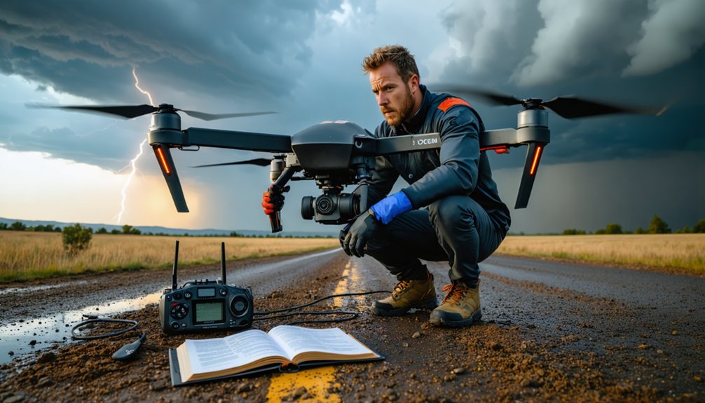
Before you launch a drone near a severe weather event, you must confirm compliance with FAA airspace regulations, particularly Part 107, which governs remote pilot certification, flight altitude limits, and visual line-of-sight requirements.
When emergency operations activate in a storm-affected area, temporary flight restrictions (TFRs) can be issued with little notice, and violating one carries serious legal and safety consequences.
You should monitor NOTAMs and tools like the FAA’s B4UFLY app in real time, since TFR boundaries can shift as storm response operations evolve on the ground.
FAA Airspace Compliance Rules
Whether you’re chasing your first supercell or your fiftieth, FAA airspace compliance isn’t optional—it’s a hard operational requirement that shapes every launch decision you make near a severe weather event.
Drone regulations and airspace classification directly determine where, when, and how you fly.
Before launching, verify these non-negotiables:
- Check your airspace classification—Class B, C, D, or E restrictions apply regardless of storm urgency.
- Obtain LAANC authorization before entering controlled airspace near airports or active emergency corridors.
- Monitor TFRs in real time—temporary flight restrictions can activate rapidly during disaster declarations.
- Carry your Remote Pilot Certificate—enforcement doesn’t pause for weather chaos.
Your freedom to operate depends entirely on your discipline to comply.
Ignorance of drone regulations won’t protect your equipment, your license, or your data.
Emergency Operation Zone Restrictions
FAA airspace compliance sets your baseline authority to fly, but emergency operation zone restrictions can strip that authority entirely—often with little warning and no appeal process during active severe weather events.
When emergency management agencies activate Temporary Flight Restrictions (TFRs), your Part 107 certification becomes irrelevant until the restriction lifts. Emergency protocols override standard operating permissions automatically.
You’re responsible for monitoring NOTAMs in real time—ignorance isn’t a legal defense. Safety measures during active TFRs include immediate grounding, equipment securing, and repositioning outside the restricted boundary.
Violating an emergency TFR exposes you to certificate suspension, civil penalties, and criminal liability. Cross-reference FAA’s real-time TFR map, your local emergency management scanner, and weather service bulletins simultaneously.
Protecting your operational freedom long-term means respecting temporary restrictions now.
Frequently Asked Questions
How Do Storm Chasers Coordinate Drone Flights With Other Chase Teams Nearby?
You’ll coordinate drone communication strategies through shared radio frequencies and real-time GPS tracking apps. Chase team collaboration requires you to establish clear airspace zones, broadcast launch intentions, and maintain active communication to prevent conflicts during rapidly evolving storm conditions.
Can Drones Be Insured Specifically for Storm Chasing and Severe Weather Damage?
Coincidentally, just as storms test your limits, so does coverage—you can secure drone insurance policies that specifically cover storm damage, though you’ll need specialized aviation insurers who understand severe weather operational risks and equipment exposure.
What Editing Software Do Storm Chasers Use for Drone Storm Footage?
You’ll find DaVinci Resolve and Adobe Premiere Pro dominate storm footage workflows. Apply drone stabilization techniques in post, and use color grading to highlight weather pattern analysis, revealing storm structure with technical precision and creative freedom.
How Long Does It Typically Take to Become a Professional Storm Chasing Pilot?
Like forging steel, your training duration spans 2–4 years. You’ll need pilot certification, meteorology knowledge, and field experience to turn raw skill into professional storm chasing competence — freedom earned through disciplined, methodical preparation.
Do Storm Chasing Drone Operators Work With Local Emergency Management Agencies?
Yes, you’ll often coordinate with local emergency management agencies, following collaboration protocols to share real-time aerial data. You’d establish emergency communication channels, ensuring your drone operations complement—not hinder—their response efforts during active severe weather events.
References
- https://www.facebook.com/JasonRWeingart/videos/drones-are-an-absolute-game-changer-for-storm-chasingthey-allow-us-to-get-angle/4258320514496331/
- https://www.youtube.com/watch?v=yAg5IwjBNfk
- https://www.youtube.com/watch?v=8BT8_rPKAVU
- https://nebraskapublicmedia.org/es/news/news-articles/chasing-severe-weather-with-drones-takes-off/
- https://www.colorado.edu/iriss/torus
- https://phantompilots.com/threads/going-up-near-storm-fronts-tornadoes-etc.151110/
- https://mediahub.unl.edu/media/9673
- https://www.ksn.com/weather/weather-stories/severe-weather-preparedness-researchers-push-boundaries-with-first‑ever-drone-tornado-intercept/
- https://www.facebook.com/groups/severeweatherphoto/posts/3268012710031863/
- https://www.reddit.com/r/amateurradio/comments/1oz8iot/offtopic_storm_chasers_use_fpv_drone_to_fly/