Real-time storm alerts aren’t optional when you’re chasing—they’re what keep you ahead of a storm instead of reacting to it. You need layered data: SPC outlooks for target selection, NWS warnings for verified positional threats, and rapid-refresh radar for mesoscale changes happening in minutes. Stale data means you’re making decisions on a storm that no longer exists. Stack your sources correctly, and every intercept becomes a calculated move rather than a gamble—and there’s a precise method for building that stack.
Key Takeaways
- Start with SPC’s Day 1 Convective Outlook before departure to identify categorical risk zones and significant tornado probabilities.
- Use rapid-updating radar with sub-2-minute refresh rates; tools like WeatherPower consolidate warnings, lightning, and outlook overlays for mesoscale accuracy.
- Build a three-layer alert stack: official NWS warnings, radar/mesoanalysis, and live chase streams to eliminate situational blind spots.
- Trust NWS warning geometries over crowd-sourced reports; cross-reference warning polygons with GPS to determine repositioning or abort decisions.
- Seconds matter when VIL spikes or velocity couplets appear; immediate repositioning is mandatory when storm dynamics threaten safety or escape routes.
What You Miss Without Real-Time Storm Alerts on a Chase Day
Without real-time storm alerts, you’re operating on stale data during a chase day when conditions can shift within minutes. Missing a tornado warning update or a sudden mesocyclone intensification report compromises your risk assessment, putting you inside a danger corridor you didn’t account for.
Stale data during a storm chase isn’t just inconvenient — it’s how chasers end up inside corridors they never planned for.
Storm chasing ethics demand situational awareness, and that requires live NWS warnings, rapid-updating radar, and current SPC products running simultaneously.
Delayed data means you’re reacting instead of anticipating. A hail core expands fast. A storm’s motion vector can shift 20 degrees in under ten minutes.
Without push notifications and live mesoanalysis, you lose the decision window needed to reposition safely. That gap between old data and ground truth is where serious miscalculations happen.
Start Every Chase Day With SPC Outlooks
Before you pull out of the driveway, SPC’s Day 1 Convective Outlook should already be open on your screen. Storm prediction starts here, not at initiation. The outlook gives you categorical risk zones, percentage hatching for significant tornadoes, and the reasoning behind the setup — all derived from atmospheric modeling run overnight and updated through the morning.
Cross-reference the Day 1 against the Day 2 to gauge how confidence has trended. If the SPC upgraded a moderate risk from a slight overnight, that shift matters. It tells you the models are converging on a more aggressive solution.
Pin your primary target zone before mesoanalysis and soundings are available. The outlook defines your geographic boundaries. Everything else — radar, CAPE, helicity — narrows your position within them.
NWS Warnings vs. Crowd-Sourced Reports: What to Trust
When you’re mid-chase and reports start flooding in from social media, scanner feeds, and spotter networks, you need a clear hierarchy: NWS warnings sit at the top. These products are issued from operational forecast systems backed by meteorological modeling, Doppler analysis, and verified atmospheric data — not eyewitness interpretation alone.
Crowd-sourced reports can arrive faster, but they’re unverified and inconsistently described. A spotter calling “large rotation” doesn’t carry the same operational weight as a tornado warning polygon derived from historical storm patterns and live radar interrogation.
Crowd-sourced reports arrive fast — but fast and verified are not the same thing.
Use spotter reports as supplementary context, not decision triggers.
Your route changes and intercept decisions should confirm against NWS warning geometry first. When warnings and crowd reports conflict, trust the modeled, verified layer. It’s the one built on science, not signal strength.
Which Radar Tools Give You Street-Level Storm Alerts?
NWS warnings anchor your decision-making, but they don’t show you the hail core advancing toward your intersection or the inflow notch tightening two miles out. For street-level storm chase logistics, you need rapid-updating radar with sub-kilometer resolution.
Texas Storm Chasers delivers rapid-revitalizing radar overlaid on street grids, letting you reposition before a debris field crosses your route. WeatherPower integrates live NWS warnings, lightning strikes, and SPC outlook overlays in one interface, compressing your scan time during fast-moving outbreaks.
Weather forecast accuracy degrades quickly at the mesoscale, so prioritize tools refreshing every two to three minutes. Pair dual-pol reflectivity with velocity data to distinguish rotation from precipitation cores.
Street-level granularity isn’t a luxury—it’s the difference between a clean intercept and a compromised escape route.
Read CAPE, Helicity, and Soundings on the Fly
When you’re actively chasing, you need to scan CAPE and helicity values fast—MUCAPE above 2,000 J/kg paired with 0–3 km SRH exceeding 300 m²/s² signals a high-shear, high-instability environment capable of producing significant tornadoes.
Pull up the latest sounding for your target area and check the hodograph shape, boundary-layer dewpoints, and LCL height to confirm whether the atmosphere supports supercell organization.
A low Lifted Index combined with a curved hodograph and moisture depth extending through 850 mb tells you conditions are primed, letting you prioritize intercept positioning before convection fully matures.
Identifying Instability And Shear
Before convection fires, you’ll want to pull three numbers fast: CAPE, storm-relative helicity (SRH), and the Lifted Index (LI). These three metrics quantify atmospheric instability and wind shear simultaneously, giving you a rapid environmental snapshot.
Target CAPE values above 2,000 J/kg for significant severe potential.
SRH exceeding 150 m²/s² in the 0–1 km layer signals dangerous low-level wind shear favorable for tornadogenesis.
A negative LI below −6 confirms deep instability.
Cross-reference these against the latest skew-T sounding to verify moisture depth and shear vectors through the full column.
When CAPE is marginal but SRH is elevated, supercell organization remains possible.
Don’t chase single parameters in isolation — the interaction between instability and shear drives storm mode and ultimate threat potential.
Interpreting Sounding Profiles Quickly
A skew-T log-P diagram compresses the entire atmospheric column into one chart, so you’ll want to scan it in a fixed sequence rather than free-form. Start at the surface: check dewpoint depression and mixing ratio for moisture depth.
Move upward to locate the LCL, LFC, and EL, which bracket your CAPE area. A wide red parcel envelope signals explosive instability.
For soundings interpretation, note how quickly the environmental lapse rate steepens above 700 mb. Then shift focus to the hodograph for shear profiles—a large, curved loop indicates strong directional and speed shear favorable for supercell rotation.
Measure storm-relative helicity directly from the hodograph’s 0–3 km segment. Values exceeding 300 m²/s² demand immediate attention.
Cross-reference these parameters against hourly mesoanalysis before committing to an intercept route.
Live Chase Streams That Confirm What Radar Can’t
When radar signatures turn ambiguous—rotation indicated but no confirmed funnel, or a hook echo obscured by range folding—live chase streams give you direct visual confirmation of wall clouds, dust whirls, and rope-out stages that radar alone can’t resolve.
Platforms like Severe Studios and LiveStormChasing broadcast radar-verified feeds, letting you cross-reference what you’re seeing on the tilt scan against real-time ground truth from a chaser already on the storm.
You should treat these streams as a parallel data layer, not a backup option, because structural changes in a supercell often appear on camera seconds before they register as a meaningful radar update.
Visual Storm Structure Verification
Radar excels at detecting precipitation structure and rotational couplets, but it can’t confirm what’s actually happening at ground level—that’s where live chase streams fill the gap. Visual feeds let you independently verify storm morphology and cloud dynamics that radar signatures only imply.
Three critical structure events streams confirm when radar can’t:
- Wall cloud formation – confirms sustained, organized low-level rotation beneath a mesocyclone before a tornado warning clears.
- Inflow band development – visible striations indicate explosive instability and active moisture convergence feeding the updraft.
- Tornado condensation funnel – radar may show a strong couplet, but ground-level video verifies actual touchdown and debris signature.
Cross-referencing stream visuals against your radar layer sharpens intercept timing and keeps your decisions grounded in verified, real-time ground truth.
Radar Gap Live Confirmation
Even the highest-resolution radar has structural blind spots—beam overshooting, range folding, and ground clutter suppression can mask low-level features that determine whether a storm is producing or about to produce a tornado.
When radar goes ambiguous, live chase streams close the gap. Platforms like Severe Studios and LiveStormChasing deliver ground-truth visual confirmation—wall clouds, dust whirls, and inflow banding that radar simply can’t resolve at distance.
You’re not guessing; you’re executing data fusion, layering radar signatures against real-time chase footage to build a complete operational picture. That integration sharpens your storm tracking precision, letting you make intercept decisions based on verified structure rather than interpolated returns.
In fast-moving situations, that confirmation window is narrow—don’t operate without it.
Build Your Real-Time Storm Alert Stack
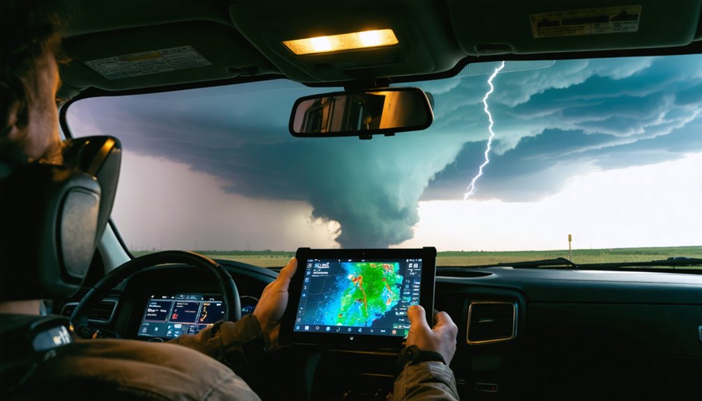
Building an effective real-time storm alert stack means layering complementary data sources so no single feed becomes a blind spot. Your stack should integrate official warnings, radar, and live visual confirmation into one coherent workflow.
Weather modeling gives you the strategic edge before initiation; your storm chase gear keeps you mobile and connected when conditions shift fast.
Prioritize these three layers:
- Official alerts – SPC outlooks and NWS warnings anchor every intercept decision with authoritative, operationally verified data.
- Radar and mesoanalysis – CAPE, Helicity, MUCAPE, and Lifted Index updates track storm environment changes in real time.
- Live chase streams – Radar-valid visual feeds confirm structure, wall clouds, and tornado formation when radar signatures lag behind reality.
No single source wins alone. Stack them deliberately.
Reposition or Abort: Acting on Alerts During an Active Chase
When an NWS warning drops or a radar loop shows unexpected storm motion, you’ve got seconds—not minutes—to decide whether to reposition or abort. Cross-reference the warning polygon against your GPS position immediately.
When warnings drop, seconds matter. Cross-reference your position instantly—hesitation is not a strategy.
If the storm’s forward motion has accelerated or the hook echo is tightening toward your road grid, repositioning isn’t optional—it’s mandatory.
Storm chasing ethics demand you never block evacuation routes or delay your exit to grab footage. Safety protocols require a pre-designated abort route confirmed before intercept, not during it.
Watch for rapid VIL spikes and velocity couplet tightening—both signal dangerous escalation.
If your exit corridor is compromised, abort without hesitation. No intercept is worth a blocked escape route.
Your alert stack exists to keep you mobile, not stationary.
Frequently Asked Questions
How Do Storm Chasers Receive Alerts in Areas With Poor Cell Coverage?
When cell coverage fails, you’ll rely on satellite communication devices like Garmin inReach for two-way messaging and emergency radios to receive NWS SAME-encoded alerts, ensuring you’ve got real-time warning data regardless of your remote location.
Are Paid Storm Alert Subscriptions Worth the Cost for Amateur Chasers?
For amateur chasers, paid subscriptions aren’t always necessary. Free NWS warnings, SPC outlooks, and radar apps deliver solid storm alert accuracy. Evaluate subscription affordability against your chase frequency before you’re committing real money to premium features.
What Alert Tools Work Best for Nighttime Storm Chasing Conditions?
When darkness narrows your horizon, lean on storm prediction tools like SPC mesoanalysis, radar velocity scans, and lightning strike data. Weather visualization layers—especially reflectivity and rotation—keep you situationally sharp, giving you the freedom to chase safely and decisively.
Can International Storm Chasers Access Us-Based Real-Time Alert Systems?
Yes, you can access U.S.-based systems globally. NWS, SPC outlooks, and radar platforms offer international compatibility with no regional restrictions, giving you full global access to real-time warnings, CAPE data, and live chase streams.
How Do Storm Chasers Manage Alert Fatigue During Extended Outbreak Days?
Like a seasoned pilot ignoring routine turbulence bumps, you combat storm fatigue by mastering alert prioritization—filtering SPC tornado warnings above generic severe thunderstorm alerts, muting lower-tier advisories, and focusing your radar attention on confirmed tornadic supercells only.
References
- https://stormcenter.app/
- https://www.severestudios.com/livechase
- https://livestormchasing.com/
- https://texasstormchasers.com/radar/
- https://michiganstormchasers.com/
- https://play.google.com/store/apps/details?id=co.median.android.pkmqnq&hl=en_ZA
- https://play.google.com/store/apps/details?id=weatherradar.livemaps.free&hl=en_US
- https://www.weather.gov/ddc/chaser
- https://www.severestudios.com/



