Storm chasers pursue waterspouts because you can’t get the data you need from radar or satellites alone. These marine vortices operate at spatial scales too small for remote sensing to resolve, so chasers capture high-resolution imagery of funnel diameter, rotation, and surface contact points directly. That visual data feeds storm models, sharpens tornado formation research, and improves marine warning systems. Keep exploring to see exactly what this field research uncovers.
Key Takeaways
- Storm chasers collect high-resolution visual data on funnel structure, rotation, and surface contact that radar and satellites cannot fully resolve.
- Field observations help distinguish fair-weather waterspouts from tornadic variants, improving classification accuracy and reducing misclassification in climatological datasets.
- Waterspouts’ rapid formation and dissipation make them ideal case studies for understanding vortex dynamics and early-stage tornado development.
- Documented wind intensities and threat factors improve marine warning systems, providing tighter lead times for coastal communities and vessel operators.
- GPS-stamped imagery and synchronized video enhance storm modeling, forecast skill, and validation of severe weather prediction frameworks.
What Makes Waterspouts Worth Chasing for Scientists?
Because radar and satellites can’t fully resolve the small structural scales relevant to funnel shape and surface interaction, scientists rely on direct field observation to fill those gaps. When you chase waterspouts, you’re capturing meteorological phenomena at resolutions that remote sensing simply can’t match.
Visual documentation gives researchers measurable data on funnel diameter, rotation features, curvature, and surface contact points. You’re also helping distinguish fair-weather waterspouts from tornadic ones, reducing costly misclassification in storm databases. That distinction directly sharpens forecasting accuracy and warning skill.
Your collected photos, videos, and synchronized location data feed into storm models, support tornadogenesis research, and strengthen climatological records. Field evidence you gather can enter university or government programs, translating raw observation into refined storm behavior simulations used by the broader scientific community.
What Data Can Storm Chasers Actually Collect in the Field?
When you’re in the field chasing waterspouts, the data you collect spans visual, positional, and temporal dimensions that remote sensors can’t replicate at the same resolution. Your camera captures funnel diameter, curvature, and rotation features with precision that radar simply can’t achieve at small structural scales.
Field-chasing waterspouts yields visual, positional, and temporal data that remote sensors simply cannot match.
Aerial photography, when available, adds overhead perspective that reveals spray ring formation and surface interactions between the rotating column and the water below.
GPS coordinates paired with timestamps let researchers reconstruct storm movement and structure. Video synchronized with radar data creates layered records useful for storm modeling.
You can also distinguish fair-weather waterspouts from tornadic ones visually, reducing misclassification in severe storm databases.
Every field-collected record strengthens forecasting models and fills gaps that remote sensing leaves behind.
What High-Resolution Imagery Reveals About Waterspout Structure
High-resolution imagery reveals structural detail that radar and satellite can’t resolve at the scale waterspouts operate. When you’re in the field capturing close-range footage, you’re documenting funnel dynamics that distant sensors miss entirely—diameter measurements, curvature shifts, and rotation features that define a waterspout’s behavior at any given moment.
Your imagery can distinguish fair-weather waterspouts from tornadic ones, cutting misclassification rates that weaken storm databases. You’ll also capture spray rings at the surface contact point, which indicate wind intensity more reliably than remote data alone.
Structural variations between waterspouts become measurable when you compare synchronized video against radar overlays. That combination lets researchers reconstruct storm geometry with precision, feeding more accurate inputs into simulation models and ultimately sharpening forecast skill across coastal and marine environments.
What Waterspouts Teach Us About Tornado Formation
Structural data from waterspout imagery feeds directly into tornadogenesis research, where the same formation mechanics—temperature gradients, wind shear, and moisture thresholds—drive both marine and land-based rotation.
When you analyze high-resolution waterspout documentation, you’re effectively examining tornado mechanics in a controlled, observable environment. Waterspouts form faster and dissipate more predictably than land tornadoes, giving researchers cleaner vortex dynamics data across shorter observation windows.
Field-collected measurements of funnel diameter, rotation rates, and surface contact signatures translate directly into model inputs that refine tornadogenesis simulations.
You’re also building comparative case studies—waterspout behavior under specific atmospheric conditions mirrors early-stage tornado development, helping scientists isolate which variables trigger intensification.
That cross-environment comparison strengthens forecasting frameworks and expands the empirical foundation researchers need to predict rotational storm behavior accurately.
Why Waterspouts Are a Serious and Underestimated Marine Hazard
If you’re operating a vessel or low-flying aircraft near coastal waters, you’re facing a hazard that most mariners consistently underestimate.
Waterspouts can generate winds exceeding 100 mph and produce waves capable of capsizing small watercraft within seconds of contact.
You won’t find these events well-represented in marine safety statistics, partly because waterspout encounters rarely get formally reported, leaving their true frequency and destructive potential hidden from the datasets that inform warning protocols.
Underestimated Dangers At Sea
Although waterspouts are often dismissed as minor spectacles, they’re recognized in marine safety research as serious hazards capable of threatening watercraft, aircraft, and personnel operating in coastal and open-water environments. When you’re steering open water, a waterspout’s rotating column can generate destructive winds, disrupt marine navigation, and overwhelm vessel safety protocols before crews can respond.
Strongier systems produce spray rings and surface turbulence that destabilize smaller craft rapidly. Unlike land-based tornadoes, waterspouts frequently form with minimal warning, compressing your evasion window considerably. Movement tracking data helps researchers estimate safe escape routes, but unpredictable path shifts remain a documented risk.
Field observations from storm chasers directly support efforts to translate real-world evidence into actionable coastal warnings, strengthening both public safety messaging and marine operational planning.
Threat To Marine Safety
Waterspouts pose a more serious marine hazard than public perception typically reflects, and field research consistently supports that conclusion. If you’re steering coastal zones, you can’t afford to dismiss them as spectacles.
Stronger systems threaten marine navigation directly, generating destructive winds, erratic movement, and dangerous spray rings. Coastal erosion compounds shoreline vulnerability when waterspout-associated surge interacts with unstable coastal margins.
Field documentation helps you understand three critical threat factors:
- Rotation intensity — visual confirmation distinguishes tornadic waterspouts from fair-weather variants, preventing dangerous misclassification.
- Movement tracking — chaser data estimates evasion windows for vessels caught in proximity.
- Surface contact evidence — spray ring documentation signals wind strength thresholds that radar alone can’t resolve.
Your safety depends on accurate data, not assumptions.
How Waterspout Research Strengthens Forecasting and Warning Systems
Research into waterspout behavior directly strengthens forecasting and warning systems by feeding field-collected data into the storm databases that meteorologists rely on for climatological analysis. When you document waterspouts in the field, you’re contributing to data validation efforts that correct remote-sensing misinterpretations and sharpen meteorological patterns identified across storm seasons.
High-resolution imagery confirms funnel characteristics, spray ring formation, and surface contact points that radar can’t fully resolve. That ground-truth evidence gets incorporated into simulation models, improving how forecasters reconstruct storm behavior and predict future events.
Stronger databases mean more precise public safety messaging, giving coastal communities and marine operators actionable warnings with tighter lead times. Your observations don’t just serve scientific curiosity—they directly translate into forecasting improvements that protect lives and vessels operating in waterspout-prone regions.
How Chasers Fill Critical Gaps in Severe Weather Databases
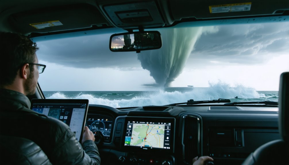
When you submit spotter reports during an active waterspout event, you’re feeding real-time ground truth directly into warning operations that radar alone can’t fully support.
Your photos and videos, once filed with the National Weather Service or research portals, become structured entries in severe storm databases used for climatology and model validation.
These chaser-generated records fill observational gaps that remote-sensing systems routinely leave behind, particularly at the small spatial scales where waterspout structure and behavior matter most.
Spotters Report Real-Time Data
How do warning systems stay accurate when radar can’t resolve every storm at the scale that matters? You fill that gap. When you’re positioned near a waterspout tracking cloud formations and shifting weather patterns, your real-time spotter reports deliver ground-truth data that remote sensors simply can’t match.
Here’s what your reports directly support:
- Warning accuracy — Your observations confirm or correct radar interpretations before warnings reach the public.
- Database integrity — Submitted photos and videos strengthen severe storm records used in operational climatology.
- NWS coordination — Real-time reports feed directly into National Weather Service warning operations during active events.
You’re not just watching. You’re functioning as a precision instrument in a distributed observational network, one that keeps forecasting systems honest and public safety messaging grounded in verified field evidence.
Chasers Submit Visual Records
Real-time spotter reports keep warning systems calibrated, but the data you submit after an event carries equal scientific weight. When you contribute aerial photography and synchronized video to the National Weather Service or university research portals, you’re filling gaps that radar simply can’t resolve.
High-resolution imagery documents funnel diameter, rotation features, and surface interaction with precision no distant sensor can match. Your footage can distinguish fair-weather waterspouts from tornadic variants, reducing misclassification in severe storm databases.
Researchers then integrate your location-stamped records with radar returns to reconstruct storm structure computationally. Every submission strengthens climatological datasets, sharpens forecast models, and improves public safety messaging.
You’re not just witnessing extreme weather—you’re producing documented evidence that directly advances storm science.
Why Waterspouts Remain One of Storm Chasing’s Most Valuable Targets
Because waterspouts operate at spatial scales that radar and satellites can’t fully resolve, storm chasers remain one of the most effective tools for capturing high-resolution structural data on funnel diameter, rotation features, and surface contact dynamics.
Aerial perspectives combined with ground-level documentation let you assess environmental impacts across multiple observation layers simultaneously.
Three reasons waterspouts stay scientifically irreplaceable:
- Classification precision — Visual records distinguish fair-weather waterspouts from tornadic variants, directly reducing database misclassification rates.
- Model refinement — Chaser-collected imagery feeds storm simulations, sharpening formation mechanism analysis tied to wind shear and moisture gradients.
- Hazard quantification — Surface spray ring documentation links visual markers to wind intensity estimates, strengthening marine safety warnings.
You’re not just observing weather — you’re generating data that radar simply can’t independently produce.
Frequently Asked Questions
Do Storm Chasers Need Special Permits to Pursue Waterspouts Legally?
You don’t typically need formal legal permissions for waterspout safety pursuits on public waters, but you’ll want to check local maritime regulations, as jurisdictional nuances occasionally require navigational compliance before you engage atmospheric phenomena.
How Do Chasers Safely Position Themselves Near Active Waterspouts on Water?
You’ll maintain safe distances by continuously tracking the waterspout’s movement vector, using real-time weather monitoring to anticipate path shifts, and applying strict boat safety protocols—keeping your vessel positioned for rapid evasion if the funnel redirects unexpectedly.
Are Storm Chasers Ever Compensated for Waterspout Data They Collect?
Over 80% of chasers volunteer unpaid. You’ll rarely receive direct compensation for waterspout safety data, though storm chase ethics support submitting footage to the NWS or universities, occasionally earning gear sponsorships or research credits.
What Equipment Do Storm Chasers Typically Use When Documenting Waterspouts?
When you’re in the field, you’ll rely on weather radar, high-speed cameras, GPS trackers, and video equipment to capture precise funnel measurements, rotation features, and surface contact data that satellites can’t fully resolve.
Can Amateur Storm Chasers Contribute Meaningfully to Professional Waterspout Research?
Yes, you can meaningfully advance professional research through amateur contributions—your waterspout observation data, photos, and synchronized video fill critical gaps in severe storm databases, strengthen forecasting models, and deliver ground-truth evidence that remote sensors can’t independently resolve.
References
- https://en.wikipedia.org/wiki/Storm_chasing
- https://crazystormchasers.com/why-are-waterspout-photos-vital-for-chasers/
- https://en.wikipedia.org/wiki/Waterspout
- https://crazystormchasers.com/the-science-behind-chasing-waterspouts/
- https://hull-repository.worktribe.com/preview/4415817/Hunter_ Nicolle – Storm Chasing in Contemporary American Society and Culture.pdf
- https://digital.library.txst.edu/items/99736918-39e0-4f0f-b5dc-3354bde2f32d
- https://repository.library.noaa.gov/view/noaa/17641/noaa_17641_DS1.pdf
- http://www.stormeyes.org/tornado/chasing/FAQ/
- https://es.wikipedia.org/wiki/Caza_de_tormentas
- https://www.pbs.org/newshour/science/inside-the-dangerous-and-unpredictable-science-of-storm-chasing



