Chasing storms in rough terrain rewires every decision you make, from target selection to escape planning. Elevation changes disrupt wind shear, valleys funnel inflow unpredictably, and ridgelines block both radar and sightlines. You’ll rely heavily on visual cues like wall clouds, clear slots, and inflow tails when technology falls short. Your vehicle, gear, and route choices must account for flooded dirt tracks and canyon entrapment risks. Master these variables, and every rough-terrain chase becomes far more calculated.
Key Takeaways
- Elevation changes disrupt wind shear and moisture delivery, making topographic maps essential for selecting optimal storm targets in rough terrain.
- Visual cues like wall clouds and clear slots become critical when hills and ridgelines block low-level radar coverage.
- Pre-plan multiple paved escape routes, marking chokepoints prone to flooding before entering canyon or rough terrain environments.
- Avoid dirt roads during precipitation, as saturated soil can trap vehicles; prioritize paved routes with multiple escape corridors.
- Continuously cross-reference radar velocity couplets with visual indicators to enable timely repositioning before terrain becomes a barrier.
Understand Why Rough Terrain Rewires Every Chase Decision
Terrain shapes every decision you make on a chase, from your initial target selection to your last-minute escape routes. Elevation changes disrupt wind shear profiles, alter moisture content delivery, and force storms to behave unpredictably compared to flat-country setups you’re accustomed to reading.
Valleys funnel inflow while ridgelines block your sightlines, stripping away the visual advantage you’d normally rely on near a supercell. A road network that looks adequate on paper can collapse into impassable dirt tracks the moment precipitation hits.
You must study topographic maps alongside meteorological data before committing to any target. Terrain isn’t background information — it’s an active variable that directly determines whether you chase effectively or get trapped.
Read Wall Clouds and Clear Slots When Hills Block Your Radar View
When hilly terrain cuts off your radar feed, you’ll need to rely on direct visual cues to assess storm structure and rotation.
A wall cloud drops noticeably below the rain-free cloud base, rotates persistently, and often pulls in ragged inflow bands that signal strong low-level wind convergence.
Once you spot a clear slot—a dry, wrapping intrusion of descending air cutting into the wall cloud’s western or southwestern edge—you’re watching the rear flank downdraft surge forward, a reliable precursor to tornado development.
Identifying Wall Cloud Features
Hills and ridgelines can mask low-level radar coverage, forcing you to rely on visual cues alone to assess tornado potential. Wall cloud identification becomes critical when terrain blocks your beam angles.
Watch for these key tornado development indicators:
- Persistent lowering beneath the rain-free base, rotating cyclonically and lasting longer than ten minutes
- Clear slot appearance on the wall cloud’s rear flank, signaling dry air wrapping around the mesocyclone
- Rapid upward motion visible as scud racing into the lowering, confirming strong inflow
- Ragged, turbulent edges rather than smooth cloud bases, indicating intense surface convergence
These visual signatures replace missing radar data. Maintain a southerly or easterly position to keep the wall cloud visible against contrast-rich skies.
Clear Slots Signal Danger
Clear slots cut through the cloud base behind the wall cloud as dry air from the rear flank downdraft wraps cyclonically around the mesocyclone, and you need to recognize this signature immediately.
This clearing represents a critical phase in storm structure evolution, signaling that tornado development is imminent or already occurring.
In rough terrain, radar limitations prevent you from detecting low-level rotation accurately, making visual identification your primary tool. Hills and ridgelines mask beam penetration below 3,000 feet, so you can’t rely solely on velocity data.
When you spot that distinctive clearing wrapping around the wall cloud, reposition immediately. The rear flank downdraft following that clear slot accelerates rapidly, and your escape window narrows fast.
Trust your eyes when radar fails you.
Plan Terrain-Specific Escape Routes Before the Storm Arrives
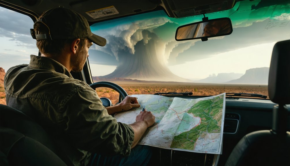
Before you arrive at your target area, study the local terrain and road network to identify potential escape routes in every direction. Wind damage and storm surge can cut off roads instantly, eliminating options you assumed were safe.
Plan your exits before conditions deteriorate:
- Mark paved routes only — wet dirt roads will sink your vehicle axle-deep, trapping you completely.
- Identify single-bridge chokepoints — one flooded crossing eliminates an entire escape corridor.
- Note terrain elevation changes — low-lying areas concentrate storm surge and flash flooding rapidly.
- Pre-load multiple map sources — no single navigation app covers every rural road accurately.
You can’t reclaim freedom of movement once a rotating wall cloud blocks your path. Plan now, move early.
Gear Your Vehicle and Kit for Unpaved, High-Terrain Conditions
Before you head into high-terrain chase country, confirm your vehicle runs on well-maintained tires with solid tread, carries multiple map data sources, and holds a first-aid kit, weather radio, and microcassette recorder.
You’ll want binoculars and a compass to track distant storm features and orient your camera position relative to the cell’s movement.
Avoid dirt and unpaved roads entirely when precipitation is present, since wet ground can swallow your axles and kill your escape options fast.
Essential Vehicle Preparation Tips
Although storm chasing rarely demands off-road capability, your vehicle must handle sudden encounters with compromised pavement, flooded low-water crossings, and debris-strewn rural routes. Upholding storm chasing ethics means you’re prepared without becoming a liability to others. Solid storm photography techniques also depend on a stable, reliable platform.
- Inspect tires for tread depth and pressure before every chase — wet pavement and gravel demand maximum grip.
- Check brakes and suspension to handle abrupt stops and uneven terrain without compromising control.
- Carry emergency supplies including a first-aid kit, tow strap, and jumper cables for self-recovery.
- Avoid dirt roads entirely when precipitation threatens — saturated soil immobilizes even four-wheel-drive vehicles instantly.
Your vehicle’s reliability directly determines your freedom to reposition safely and decisively.
Must-Have Terrain Navigation Gear
Reliable navigation gear separates chasers who reposition decisively from those who get trapped by deteriorating road conditions. You’ll need multiple map data sources—dedicated GPS units, downloaded offline maps, and a physical road atlas—because cell signals fail precisely when you need them most.
Cross-reference SPC mesoanalysis tools against your position continuously. A compass helps you determine camera direction relative to storm position, particularly when storm surge obscures visual landmarks near flooded terrain.
Binoculars extend your situational awareness beyond radar range, letting you identify escape routes before conditions force your hand.
Prioritize lightning safety by tracking cloud-to-ground strike proximity. If strikes land within one mile, you’re repositioning immediately, not consulting gear.
Your navigation setup must enable fast, confident decisions—freedom on dangerous roads depends entirely on preparation made before you leave home.
Avoiding Dangerous Road Conditions
Wet dirt roads will swallow your vehicle to the axles faster than any storm threatens your timeline—four-wheel drive won’t save you once traction disappears beneath standing water or saturated soil. Storm surge flooding and lightning strikes compound road hazards instantly, turning marginal routes into traps.
Prioritize these road discipline rules:
- Avoid all unpaved roads when precipitation begins—saturated soil collapses without warning.
- Never cross rising water—six inches moves a person; twelve inches floats most vehicles.
- Retreat before conditions deteriorate—early repositioning preserves your escape routes and freedom of movement.
- Scout single-bridge access points beforehand—one flooded crossing eliminates your entire exit strategy.
Your vehicle stays your greatest asset only while it remains mobile. Protect that mobility aggressively.
Avoid the Roads That Trap Chasers in Rough Country
Dirt roads can end your chase before the storm even develops. Once precipitation hits, wet dirt turns into axle-deep mud that’ll swallow your vehicle regardless of whether you’re running 4×4. You lose your escape route, your positioning advantage, and potentially your safety.
Cross-reference your road network against satellite interpretation of storm movement before committing to any path. If a supercell shifts unexpectedly, a dirt road becomes a trap with no exit. Single-bridge routes present the same problem—one flooded crossing eliminates your options entirely.
Lightning safety also demands attention here. A stalled vehicle on an open dirt road during an active electrical storm puts you in serious danger. Stick to paved roads, maintain multiple escape corridors, and study your terrain thoroughly before you ever leave your starting position.
Position Around Supercells Without Getting Boxed In by Canyons

Canyon terrain introduces a different category of trap than muddy roads—one where paved surfaces and solid footing won’t save you if the topography cuts off your lateral movement. During storm formation, supercells can shift track quickly, turning a solid observation point into a dead end. You need positional freedom before the storm forces your hand.
- Scout exits first — Identify two lateral escape routes before committing to any canyon road.
- Monitor storm motion continuously — A rightward-moving supercell closes off southern exits faster than most chasers anticipate.
- Respect lightning safety margins — Canyon walls funnel cloud-to-ground strikes unpredictably, eliminating safe standing positions.
- Reposition early — Waiting for visual confirmation inside a canyon removes every option except retreat through deteriorating conditions.
Spot Inflow Tails and Rotation When Ridgelines Cut Your Sightlines
Ridgelines that block your forward sightlines don’t eliminate your ability to read storm structure—they just force you to work with partial information and compensate through other indicators.
Inflow tails remain visible even when the main updraft base sits behind elevated terrain. Watch for low-level scud racing horizontally toward the storm’s hidden core—that convergent motion confirms strong moisture ingestion regardless of what you can’t see.
Rotation indicators become equally critical here. Listen for an abrupt wind direction shift or sudden pressure drop, both signaling mesocyclone intensification behind the ridge.
Cross-reference radar velocity couplets on your mobile device against what you’re observing visually. If inflow accelerates and your radar shows a tightening couplet, reposition immediately.
Don’t let terrain lull you into a static observation point.
Frequently Asked Questions
How Does Chaser Convergence Worsen Danger in Narrow Mountain Corridors?
Chaser convergence clogs mountain pass narrow corridors, stripping you of escape routes, blocking repositioning, and trapping you when storms shift suddenly. You’ll lose freedom fast—plan your exits before others crowd in.
Which CAMS Models Perform Best When Forecasting Storms Over Elevated Terrain?
You’ll find HRRR and NAM3K perform best over elevated terrain. They’re your go-to CAMs for resolving complex mountain airflow. Pair their data with camera stability and lens sensitivity adjustments when documenting rapidly evolving, terrain-influenced convective signatures.
How Do You Submit Storm Reports When Cellular Service Fails in Remote Areas?
When cellular fails, you’ll rely on satellite reporting devices like Garmin inReach for emergency communication. Transmit storm reports directly to NWS via SpotterNetwork integration, ensuring your location, time, and damage observations reach forecasters without cellular dependency.
Does Lightning Risk Increase When Chasers Are Positioned on Exposed Ridgelines?
Yes, you’re at considerably higher lightning safety risk on ridgelines due to elevated exposure. You become the tallest conductor, attracting strikes. Reposition immediately to lower terrain when cloud-to-ground lightning’s striking within one mile.
How Do SPC Outlook Risk Levels Account for Terrain-Driven Storm Behavior Differences?
SPC outlook risk levels don’t explicitly factor terrain-induced wind patterns or elevation impact into their categorical assessments. You’ll need to independently analyze how local topography modifies storm behavior beyond what standardized outlooks communicate.
References
- https://www.youtube.com/watch?v=6otZLjSZvPU
- https://www.youtube.com/watch?v=0QL0aVmZGi4
- https://www.flame.org/~cdoswell/chasesums/Chase_safety.html
- https://www.accuweather.com/en/weather-blogs/weathermatrix/how-to-chase-storms-in-your-local-area/66392
- http://www.stormeyes.org/tornado/chasing/FAQ/
- https://www.wiu.edu/SevereWeather/images/presentations/How_to_Effectively_Storm_Chase.pdf
- https://www.weathercentertx.com/weather-101-different-types-of-weather/storm-chasing-101/



