Climate change has shifted Tornado Alley roughly 400 to 500 miles eastward over the past four decades. Warmer Gulf of Mexico waters are increasing atmospheric moisture and raising convective available potential energy, while altered jet stream behavior redirects cold polar air deeper into the Southeast. Traditional Great Plains activity is declining as Arkansas, Mississippi, and surrounding states emerge as primary tornado zones. There’s much more to uncover about what’s driving this dangerous transformation.
Key Takeaways
- Warmer Gulf of Mexico waters increase atmospheric moisture and instability, fueling tornado-producing storms further east than traditionally observed.
- Tornado Alley’s center has shifted approximately 400–500 miles eastward over four decades, with Arkansas and Mississippi becoming primary tornado zones.
- Altered jet stream behavior redirects moisture patterns eastward, allowing cold polar air to penetrate deeper into southeastern states.
- Enhanced moisture gradients strengthen wind shear, expanding the area where tornado-producing supercell storms can develop beyond the Great Plains.
- Climate-driven shifts have created preparedness gaps in Dixie Alley, where fewer shelters and weaker building codes increase vulnerability.
What Is Tornado Alley and Where Has It Traditionally Been?
Tornado Alley is a loosely defined region spanning the central United States where atmospheric conditions historically produce the highest concentration of tornadoes in the world.
Tornado Alley spans the central United States, where atmospheric conditions produce the world’s highest concentration of tornadoes.
Traditionally, it encompasses Texas, Oklahoma, Kansas, Nebraska, and South Dakota — states where warm Gulf moisture collides with cool, dry Arctic air along a volatile atmospheric boundary.
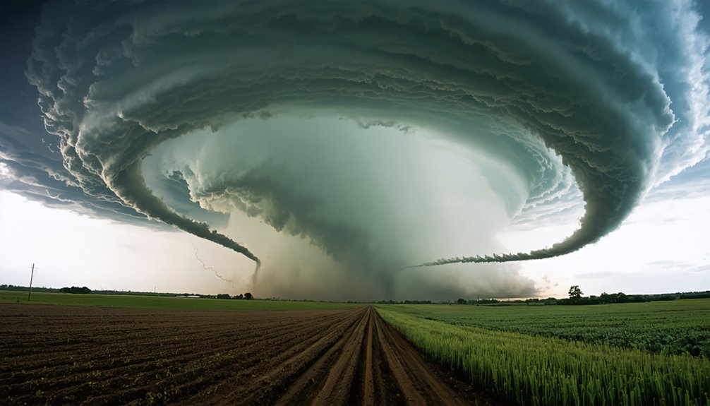
Tornado history in these plains states spans decades of documented outbreaks, with peak activity occurring between March and June. The flat terrain accelerates wind shear, enabling supercell thunderstorm formation.
Climate effects, however, are now challenging this long-established geographic definition. Over the past four decades, atmospheric data confirms measurable shifts in tornado frequency across traditional zones.
You’re witnessing a transformation where the region’s boundaries are no longer fixed — they’re actively migrating eastward under warming conditions.
How Far East Has Tornado Alley Actually Shifted?
Over the past four decades, you can trace Tornado Alley‘s center of activity shifting approximately 400 to 500 miles eastward, a migration confirmed by 40 years of tornado report data.
You’ll find that traditional hotspots in Texas, Oklahoma, and Kansas are recording modest declines in tornado frequency, while new activity centers have emerged across Arkansas, Louisiana, Mississippi, Alabama, Tennessee, Kentucky, and Illinois.
Discriminant analysis confirms this shift is statistically significant, placing Arkansas and Mississippi at the core of the new primary tornado-producing region.
Measuring The Eastward Migration
Research spanning four decades of tornado reports reveals that the activity center has migrated approximately 400 to 500 miles eastward, shifting the primary threat zone from the traditional Great Plains hotspots of Texas, Oklahoma, and Kansas toward the Mississippi Valley and Southeast.
Discriminant analysis confirms this shift is statistically significant, not random variation.
You can track climate impacts directly through tornado frequency data: Texas, Oklahoma, and Kansas show modest declines, while Arkansas, Mississippi, Alabama, Tennessee, and Kentucky register sharp increases.
Comparing warm versus cold years demonstrates that shifts in relative warm centers couple with measurable low-pressure and tornado activity displacement eastward.
This 40-year dataset establishes a clear, data-supported migration pattern that redefines where the nation’s most concentrated severe weather threat now exists.
New Tornado Activity Centers
The epicenter of U.S. tornado activity has shifted definitively eastward — not by a modest margin, but by 400 to 500 miles.
Tornado trends now point toward entirely new regional impacts you need to understand:
- Arkansas sits at the center of the emerging activity zone, recording markedly higher tornado occurrences than historical averages.
- Mississippi and Alabama are experiencing sharply increased frequency, replacing traditional Plains hotspots.
- Tennessee and Kentucky now rank among the most active states for large, multi-twister outbreak events.
- Illinois has entered the threat corridor, extending the danger zone northward into previously lower-risk territory.
Meanwhile, Texas, Oklahoma, and Kansas show modest but measurable declines.
The data’s clear — you’re watching a fundamental redistribution of America’s most destructive atmospheric phenomenon in real time.
Why Climate Change Is Pushing Tornado Activity Eastward
When you examine the atmospheric mechanics behind this eastward migration, two primary drivers stand out: warmer Gulf of Mexico waters and altered jet stream behavior.
The warming Gulf pumps increased moisture and instability into the Mid-South region, creating the low-level humid air that supercells require to form.
Simultaneously, climate-driven jet stream disruptions are shifting atmospheric moisture patterns that once concentrated storm activity over the Great Plains, redirecting that energy toward the Mississippi Valley and Southeast.
Gulf Moisture Fueling Storms
As Gulf of Mexico waters warm under rising global temperatures, they’re pumping significantly greater volumes of moisture and atmospheric instability into the Mid-South region, fundamentally altering where supercells form and intensify.
Gulf moisture now fuels storm intensity across four critical mechanisms:
- Warmer sea surfaces transfer greater latent heat energy into low-level airflow.
- Increased atmospheric moisture raises convective available potential energy (CAPE).
- Enhanced moisture gradients strengthen wind shear, a core supercell ingredient.
- Elevated instability expands the geographic zone where tornado-producing storms can develop.
You’re now seeing the direct consequence: traditional Plains states lose their atmospheric advantage while Arkansas, Mississippi, and Tennessee gain it.
The data confirms warmer Gulf conditions aren’t a minor variable—they’re actively redrawing severe weather boundaries across the entire southeastern United States.
Jet Stream Pattern Changes
Gulf moisture sets the fuel, but altered jet stream behavior determines where that fuel ignites. Climate change is reshaping jet stream dynamics, pushing the atmospheric boundary where cold polar air meets warm Gulf moisture progressively eastward.
You’re witnessing a fundamental reorganization of atmospheric interactions that once reliably positioned severe weather over Kansas and Oklahoma.
As the Arctic warms faster than the tropics, the jet stream weakens and meanders more erratically. This erratic behavior allows cold, dry upper-level air to penetrate deeper into the Southeast, colliding with Gulf-sourced warmth over Mississippi, Arkansas, and Tennessee.
The resulting wind shear creates ideal supercell conditions in areas historically unprepared for such threats. These aren’t random fluctuations — they’re statistically confirmed shifts backed by four decades of tornado-report data.
How Gulf of Mexico Warming Is Fueling New Tornado Zones
The warming Gulf of Mexico has become a primary engine driving tornado activity into new geographic zones. Gulf warming is directly reshaping tornado patterns across the Mid-South by injecting unprecedented moisture and instability into atmospheric systems.
The Gulf of Mexico isn’t just warming — it’s actively rewriting the rules of tornado risk across the American South.
Here’s how climate impact is altering supercell dynamics:
- Warmer Gulf waters pump elevated moisture levels into Arkansas, Mississippi, and Alabama.
- Increased low-level humidity creates unstable air masses that collide with cool, dry upper-level currents.
- This collision fuels supercell dynamics, generating rotation-favorable conditions across previously low-risk regions.
- Atmospheric data confirms tornado patterns have shifted 400-500 miles eastward over four decades.
You’re now living in a reality where traditional Tornado Alley boundaries no longer define your actual risk exposure.
How Altered Jet Streams Are Changing Tornado Season Patterns
When you examine how climate change is reshaping tornado season, the jet stream‘s altered behavior stands out as a primary driver, pushing moisture corridors eastward and away from traditional Plains corridors.
You’ll find that these jet stream disruptions are stretching and fragmenting the typical March-through-May storm window, introducing severe weather risk into months and regions that historically saw minimal activity.
This redirection of Gulf moisture flow, now channeled more aggressively toward the Mississippi Valley and Southeast, is fundamentally rewiring where and when tornado-producing supercells form.
Jet Stream Pattern Changes
Altered jet stream patterns are reshaping not just where tornadoes form, but when they form, effectively scrambling the traditional spring-focused tornado season.
Jet stream dynamics now deliver severe weather threats across expanded timeframes, driven by measurable atmospheric shifts:
- Extended seasons — Tornado activity increasingly spans fall and winter months, breaking historical spring-dominant patterns.
- Eastward displacement — Shifting jet stream positioning redirects storm-producing energy toward the Mississippi Valley and Southeast.
- Moisture amplification — Altered flow patterns draw warmer Gulf moisture deeper inland, intensifying supercell conditions.
- Unstable interactions — Cool, dry upper-level air collides more frequently with warm low-level flow in new geographic zones.
You’re no longer dealing with a predictable seasonal window.
Climate-driven atmospheric shifts have fundamentally restructured when and where severe tornado threats materialize.
Shifting Seasonal Storm Windows
Jet stream repositioning has fractured the traditionally predictable spring tornado season, redistributing severe weather risk across months that historically recorded minimal activity.
You’re now facing shifting storm windows that extend tornado threats well into autumn and compress traditional peak periods unpredictably.
Atmospheric data confirms warmer Gulf moisture combined with altered upper-level flow patterns is generating supercell-favorable conditions outside March-through-May boundaries.
The seasonal impacts are measurable: significant tornado outbreaks are increasingly documented in November and December across Dixie Alley states.
Discriminant analysis of 40 years of tornado reports demonstrates that warming conditions don’t just relocate tornado geography—they restructure timing.
You can no longer rely on historically predictable seasonal calendars for preparedness planning, as climate-driven atmospheric changes continue dismantling conventional severe weather forecasting frameworks.
Moisture Flow Redirection Effects
The jet stream’s repositioning is fundamentally redirecting Gulf moisture flow, channeling warm, humid low-level air into atmospheric corridors that historically received far less instability.
These moisture dynamics are reshaping where supercells develop and intensify.
Here’s what’s driving the atmospheric instability eastward:
- Warmer Gulf waters are injecting elevated moisture content into Mid-South air masses.
- Altered jet stream positioning creates favorable wind shear over Arkansas, Mississippi, and Alabama.
- Drier desert air advancing eastward suppresses traditional Plains storm formation zones.
- Low-level Gulf flow combines with upper-level cool air precisely over densely populated southeastern corridors.
You’re now living in a period where the atmospheric mechanics that once defined Oklahoma and Texas are actively reconstructing themselves 400-500 miles east.
What Four Decades of Tornado Data Reveals About the Shift

Four decades of tornado reports have confirmed what climate scientists suspected: the primary tornado-producing region in the United States has migrated approximately 400 to 500 miles eastward.
Discriminant analysis of atmospheric changes across this period reveals a statistically significant geographic shift, moving the core threat zone from the Great Plains toward the Mississippi Valley and Southeast.
You can see this clearly in the tornado frequency data: Texas, Oklahoma, and Kansas show modest declines, while Arkansas, Mississippi, Alabama, and Tennessee record sharp increases compared to historical averages.
Warm versus cold year comparisons confirm that shifts in relative warm centers directly couple with low-pressure systems and tornado activity migration.
The numbers aren’t ambiguous—they’re pointing definitively east, demanding that preparedness strategies and risk assessments reflect this measurable, data-confirmed reality.
What Is Dixie Alley and Why Is It So Dangerous?
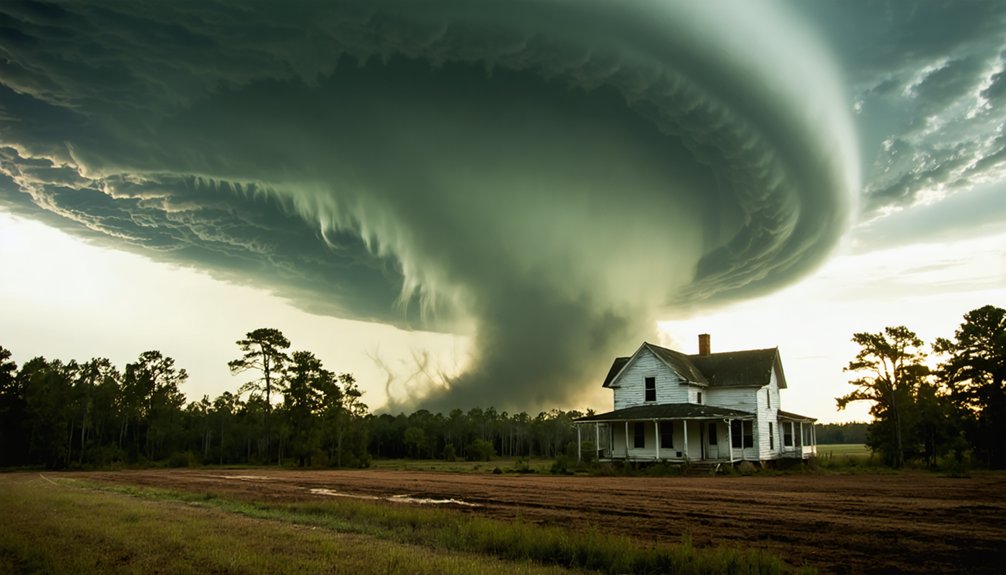
As tornado activity shifts eastward, a distinct severe weather corridor has emerged that scientists now call “Dixie Alley”—a region centered on Mississippi, Alabama, western Tennessee, and Arkansas that’s producing some of the most violent tornado outbreaks in recorded history.
Understanding Dixie Alley dangers requires recognizing four critical factors:
- Dense population concentration increases casualty potential dramatically compared to rural Great Plains zones.
- Limited tornado preparedness infrastructure leaves communities more vulnerable than traditional Tornado Alley counterparts.
- Multi-tornado outbreak systems are definitively shifting eastward into this corridor.
- Arkansas now sits at the geographic center, experiencing notably elevated tornado frequency versus historical averages.
You’re facing a region where warmer Gulf moisture, altered jet streams, and population density converge—creating conditions that could triple disaster potential compared to traditional tornado zones.
Which States Face the Highest Tornado Risk in Dixie Alley Today?
Within Dixie Alley’s emerging threat corridor, five states now carry the highest measurable tornado risk: Alabama, Tennessee, Kentucky, Mississippi, and Arkansas.
Scientists confirm that tornado outbreaks are shifting definitively eastward into these regions, where population density amplifies disaster potential threefold compared to traditional Great Plains zones.
Tornado outbreaks are shifting east, where dense populations amplify disaster potential threefold compared to traditional Great Plains zones.
Arkansas now sits at the geographic center of this new activity corridor, while Alabama and Tennessee record the highest outbreak frequencies.
Mississippi faces compounding risks from warmer Gulf moisture fueling supercell formation directly overhead.
Your tornado preparedness strategy must account for this data-confirmed reality. Unlike the rural Plains, Dixie Alley’s dense urban infrastructure creates cascading vulnerabilities when systems strike.
Atmospheric data spanning 40 years confirms this eastward migration isn’t temporary — it’s a statistically significant, climate-driven restructuring of where America’s most violent tornadoes now strike.
Why the Southeast Is Less Prepared Than the Great Plains
The Great Plains built its tornado culture over generations — storm shelters, warning sirens, and community drills are embedded into daily life across Kansas, Oklahoma, and Texas.
The Southeast hasn’t had that luxury. Southeast preparedness lags considerably behind, and urban expansion is accelerating the risk.
Here’s what you’re up against in the new tornado zone:
- Fewer residential storm shelters per capita than Plains states
- Denser urban expansion means faster-spreading destruction paths
- Heavily forested terrain blocks visual tornado detection
- Nighttime tornado frequency in Dixie Alley reduces warning response time
These aren’t abstract vulnerabilities — they’re measurable gaps.
When a supercell targets Memphis or Birmingham, the infrastructure simply isn’t calibrated for it the way Wichita’s is.
That disparity costs lives.
Where Scientists Expect the Most Tornado Activity in the Future?
Preparedness gaps matter most where tornado risk is heading next. Scientists project the mid-South, Ozark plateau, and lower Ohio Valley will become the dominant severe tornado zones. Future simulations place the highest-risk corridor east of Interstate 35, directly targeting states like Arkansas, Mississippi, Tennessee, and Kentucky.
Future tornado trends point toward environments where warm Gulf moisture increasingly collides with cool upper-level air across densely populated landscapes. Southeastern vulnerabilities amplify the threat — limited storm shelters, weaker building codes, and lower public awareness create compounding risks that the rural Great Plains never faced at this scale.
You’re looking at a region where atmospheric conditions are becoming structurally favorable for supercell development, and where infrastructure hasn’t caught up to the accelerating climatological reality driving tornadoes eastward.
Frequently Asked Questions
How Does Urban Sprawl Increase Tornado Fatalities in Newly Affected Regions?
Urban sprawl drives higher fatalities because you’re concentrating population density in tornado-prone zones lacking preparedness infrastructure. Rapid urban development outpaces warning systems, leaving you vulnerable as tornadoes strike densely populated southeastern areas previously unaccustomed to frequent severe storm activity.
What Time of Year Do Tornadoes Most Frequently Strike Dixie Alley?
While it’s not limited to one season, you’ll find Dixie Alley’s peak tornado threat runs November through April, defying traditional spring patterns. Seasonal trends show winter outbreaks uniquely define this corridor, demanding your year-round preparedness.
Can Tornado Shelters and Safe Rooms Reduce Deaths in Southeastern States?
Yes, tornado shelters and safe rooms can greatly reduce deaths. You’ll find shelter effectiveness increases when you prioritize community preparedness, especially as Dixie Alley’s dense, less-prepared populations face escalating tornado risks demanding immediate, individual protective action.
How Do Nighttime Tornadoes in the Southeast Increase Danger for Residents?
Nighttime tornadoes kill 2.5x more people. You can’t rely on tornado visibility after dark, so your nighttime preparedness must include weather alerts, since sleeping residents often don’t detect dangerous storms approaching until it’s tragically too late.
What Economic Costs Result From Tornadoes Shifting Into Densely Populated Areas?
You’ll face exponentially higher economic impact as tornadoes strike areas with greater population density — property damage, infrastructure loss, and recovery costs can triple compared to rural Great Plains regions, straining local governments and private resources considerably.
References
- https://corescholar.libraries.wright.edu/biw/vol8/iss1/6/
- https://abcnews.com/US/tornado-alley-shifting-due-climate-change-scientists-explain/story?id=98347077
- https://stormwireusa.com/tornado-alley-shifts-eastward-climate-change-alters-severe-weather-patterns-2026/
- https://kentuckylantern.com/2025/05/19/traditional-tornado-alley-shifts-eastward-as-climate-changes-says-meteorologist-studying-trend/
- https://www.scientificamerican.com/article/watch-out-tornado-alley-is-migrating-eastward/
- https://www.osti.gov/pages/servlets/purl/1853125
- https://tucson.com/weather/tornadoes-climate-change-and-why-dixie-is-the-new-tornado-alley/article_0e8953d3-5209-5ecf-85df-8dd3a927f079.html
- https://www.cbsnews.com/news/tornado-alley-may-be-moving-to-southeast-climate-change-noaa-national-severe-storms-laboratory-oklahoma-study/
- https://www.bbc.co.uk/future/article/20230616-how-tornado-alley-is-changing
- https://www.nationalgeographic.com/environment/article/tornado-alley-shift-east