To chase supercells successfully, you’ll need solid atmospheric knowledge before you ever hit the road. Evaluate CAPE values between 2,000–4,000 J/kg, confirm wind shear exceeds 40 knots, and verify surface dewpoints above 55°F. Position yourself southeast of the mesocyclone, update radar every 2–3 minutes, and always maintain paved escape routes perpendicular to storm motion. Avoid core punching, watch for rain-wrapped tornadoes, and start with low-topped supercells to sharpen your skills—everything covered ahead will make you a more capable, safer chaser.
Key Takeaways
- Take free storm spotter courses via MetEd or local NWS to build foundational knowledge before attempting live supercell chasing.
- Evaluate CAPE values between 2,000–4,000 J/kg and confirm wind shear exceeds 40 knots before chasing.
- Position southeast of the mesocyclone, staying 1–2 miles from circulation for visibility and safe escape options.
- Update radar every 2–3 minutes, tracking rotational velocity, hook echo development, and storm motion vectors simultaneously.
- Pre-identify at least two paved escape routes perpendicular to storm movement, prioritizing south or southeast directions.
Take a Storm Spotter Course Before You Chase
Before you ever position yourself near a supercell, take a storm spotter course. These programs, offered free through MetEd or your local NWS office, teach you to interpret weather forecasts, recognize dangerous storm structures, and make sound decisions under pressure.
Storm safety isn’t instinct — it’s trained knowledge.
You’ll learn to identify mesocyclone signatures, understand radar data, and recognize when conditions shift from manageable to life-threatening. That foundation directly influences every positioning and escape route decision you’ll make in the field.
Experienced chasers like Skip Talbot emphasize starting with education before chasing live storms. You can’t exercise real freedom in the field if you don’t understand what you’re facing.
Take the course, build the skillset, then chase with confidence and competence.
Why CAPE Values and Wind Shear Determine Everything
When you’re evaluating whether a storm will organize into a supercell, two atmospheric parameters cut through all other variables: CAPE and wind shear.
CAPE quantifies available instability — target values between 2,000 and 4,000 J/kg confirm sufficient energy for explosive updraft development. Below that threshold, atmospheric dynamics won’t support sustained supercell organization.
Wind shear determines rotation. You need directional and speed shear exceeding 40 knots through the storm’s depth. Wind variability across multiple atmospheric layers creates the horizontal vorticity that tilts into vertical rotation, producing a mesocyclone.
Without adequate shear, even high-CAPE environments generate disorganized convection rather than structured supercells.
Pull your Skew-T log-P diagrams before committing to a chase. Verify surface dewpoints above 55°F alongside these parameters.
When all three align, supercell potential becomes actionable intelligence, not speculation.
Check These Atmospheric Conditions Before Every Chase
Every chase day demands a systematic atmospheric review before you commit resources or position yourself in the field. Pull surface observation charts and upper-air data first. Confirm CAPE values between 2,000–4,000 J/kg, because atmospheric stability within that range signals sufficient convective energy for supercell development.
Verify surface dewpoints stay above 55°F and check wind shear exceeding 40 knots aloft.
Load your Skew-T log-P diagram and examine instability profiles carefully. Cloud formation patterns visible on satellite imagery will confirm whether the atmosphere is actualizing what the models projected. If the cap’s too strong or moisture is lagging, don’t force the chase.
You own your decisions out there. Disciplined pre-chase analysis keeps those decisions grounded in data, not wishful thinking.
Position Southeast of the Mesocyclone for the Best View
Positioning southeast of the mesocyclone puts you inside the inflow region, where clean, rain-free air delivers unobstructed sightlines to the wall cloud and any developing tornado. Understanding mesocyclone dynamics helps you exploit this sweet spot effectively.
Storm inflow pulls surface air toward the updraft base, keeping precipitation away from your viewing angle and giving you clear visual access to rotation.
Stay one to two miles from the circulation minimum. Any closer and you’re compromising your escape window.
Watch the rear flank downdraft closely — it wraps around the mesocyclone’s southwest quadrant and can push damaging winds toward your position with little warning.
Keep a perpendicular escape route southward and never let the RFD cut off your path.
Your positioning discipline directly determines both your visibility and your survival margin.
How Do You Stay Clear of the RFD?
Staying clear of the rear flank downdraft starts with understanding where it lives — southwest of the mesocyclone, wrapping cyclonically around the circulation’s back edge. The RFD hazards are real: violent, descending winds capable of flipping vehicles and eliminating escape options instantly.
You’ll identify it by watching for clearing skies behind the wall cloud combined with a sudden, gusty shift in surface winds.
Your positioning southeast of the mesocyclone naturally keeps you ahead of it, but don’t grow complacent. Wind shear within the RFD can intensify rapidly, pushing damaging gusts further east than anticipated.
Watch your inflow carefully — if it weakens or reverses direction, the RFD is encroaching. Reposition immediately by driving south, keeping perpendicular to storm motion until you’ve reestablished clean inflow.
Plan Your Storm Chasing Escape Routes Before the Storm Moves
Before a storm closes in, you must identify escape routes that run perpendicular to the storm’s motion, typically heading south or southeast.
Never rely on a single corridor—if conditions deteriorate faster than expected, a blocked or flooded road can cut off your only exit.
Map at least two viable escape routes in advance, and confirm they’re paved, passable, and positioned to keep you ahead of the mesocyclone’s track.
Perpendicular Escape Route Priority
When chasing supercells, you must plan your escape routes before the storm demands them. Prioritize roads running perpendicular to storm motion — typically heading south or southeast — so you’re never caught retreating parallel to a dangerous forward flank.
Wind shear intensifies rapidly near the mesocyclone, meaning storm proximity shrinks your decision window faster than you’d expect.
Keep a paved perpendicular road accessible behind your vehicle at all times. If your only option runs parallel to storm movement, reposition immediately. Dirt roads become impassable in rain-soaked conditions, cutting off your exit entirely.
Always identify at least two perpendicular escape corridors before committing to a chase position. Conditions shift fast, and a single blocked route can trap you within a storm’s most destructive path.
Multiple Route Backup Planning
Effective storm chasers map backup escape routes before committing to any chase position — not after conditions deteriorate. Before deployment, cross-reference satellite analysis with atmospheric modeling to anticipate storm motion shifts and identify road network vulnerabilities along your intended chase corridor.
You should pre-load at least two to three alternative exit paths into your GPS, prioritizing paved routes running south or southeast. If your primary escape becomes compromised by rapid storm acceleration or a new meso development, you’ll execute your backup without hesitation or improvisation.
Study county road grids the night before. Dead ends, river crossings, and unpaved sections eliminate options fast under pressure.
Freedom in the field comes from preparation — knowing you’ve built redundancy into your plan before the storm ever forces your hand.
Use Live Radar to Stay Ahead During a Storm Chase
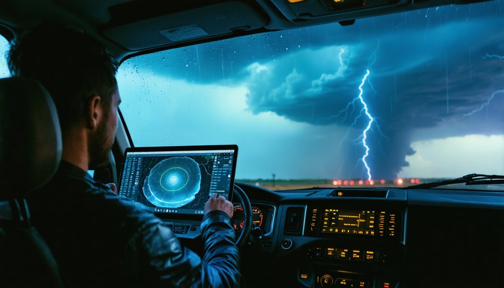
When chasing a supercell, you’ll need a live radar app with mesocyclone interpretation capabilities to track rotation in real time and anticipate the storm’s next move.
Update your positioning frequently by calculating the storm’s speed and heading, ensuring you’re never caught off-guard by a rapid directional shift.
Don’t fixate on the screen, though—cross-reference your radar data with what you’re physically observing to maintain full situational awareness.
Real-Time Mesocyclone Tracking
Staying ahead of a supercell demands that you treat live radar as your primary navigational tool, not a secondary reference. Apps like RadarScope deliver real-time mesocyclone dynamics, letting you monitor rotational velocity, hook echo development, and storm motion vectors simultaneously.
You’ll track atmospheric coupling between low-level jet streams and surface boundaries, identifying where instability intensifies and rotation tightens.
Update your radar every two to three minutes. Storm motion shifts quickly, and delayed data creates dangerous positioning errors.
Cross-reference velocity scans with reflectivity returns to distinguish genuine mesocyclone signatures from precipitation clutter. Note the storm’s forward speed and heading, then calculate your positioning window accordingly.
Never let radar fixation pull your eyes from the physical storm. Radar confirms what you’re seeing—it doesn’t replace direct observation.
Updating Storm Position Frequently
Supercells evolve faster than most chasers anticipate, so you’ll need to refresh your radar position every two to three minutes to avoid falling behind storm motion. Atmospheric shear accelerates storm drift unpredictably, forcing you to recalculate positioning windows continuously.
Cross-reference your GPS location against the mesocyclone’s tracked heading to maintain an ideal intercept angle. Use live radar apps with velocity overlays to distinguish precipitation core shifts from actual circulation movement.
Prioritize these three updates each radar refresh cycle:
- Recalculate storm drift speed and heading
- Confirm your escape route remains perpendicular to storm motion
- Verify mesocyclone distance stays within your one-to-two-mile safety threshold
Falling behind storm motion eliminates your options fast—stay disciplined, stay current.
Avoid Core Punching Supercells
Core punching—driving through a supercell’s main precipitation core—is one of the most dangerous mistakes you can make during a chase. Heavy rain, hail, and zero visibility compromise your ability to read storm structure and react to rapidly changing conditions. Precipitation shielding masks rotation, leaving you blind to a tornado’s actual position until it’s too late to escape.
Core punching blinds you to rotation and steals your escape window before you ever see the danger coming.
Stay southeast of the mesocyclone within the inflow region, where visibility remains clear and escape routes stay open.
If you’re caught behind the core, RFD winds and debris dramatically reduce your options. Reserve core punching strictly for situations where a north escape route is critically necessary—not for convenience or impatience.
Protecting your positioning discipline protects your life. Never sacrifice situational awareness for a closer look.
Spot the Warning Signs of a Rain-Wrapped Tornado
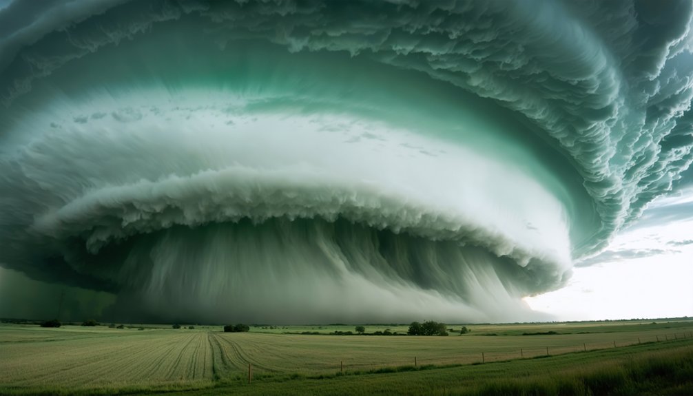
Rain-wrapped tornadoes are among the most lethal hazards in storm chasing because they hide inside precipitation curtains that obscure rotation entirely. You can’t rely on visual confirmation alone when chasing high-precipitation supercells.
Instead, recognize these critical tornado signs before committing to a position:
- Radar indicates a tight rotational couplet embedded within heavy precipitation cores.
- You hear a persistent roar or freight-train sound without visible funnel confirmation.
- Debris clouds appear at ground level despite zero visible condensation funnel.
When you detect rain-wrapped conditions, retreat immediately rather than holding position. Maintain your escape route perpendicular to storm motion, and never assume reduced radar rotation means reduced danger.
Rain-wrapped tornadoes kill chasers who underestimate concealed circulation. Your freedom to chase another day depends on disciplined, data-driven decision-making.
Chase Low-Topped Supercells First to Build Core Skills
Building discipline in low-risk environments prepares you for the high-stakes decisions that rain-wrapped and high-precipitation supercells demand. Low topped storms offer a controlled setting where you can develop core management skills without the visual obstructions and violent outputs of classic supercells.
These storms typically produce shallower updrafts, slower rotation, and more manageable precipitation cores, giving you time to study mesocyclone structure and practice radar correlation against physical storm features.
You’ll refine your escape route execution, positioning relative to the RFD, and real-time decision-making under moderate pressure.
Start by chasing storms with tops below 30,000 feet in regions with strong road networks. Treat each chase as a training evolution, logging positioning errors and radar misreads. That discipline compounds directly into safer, smarter execution when conditions escalate.
Frequently Asked Questions
What Legal Permits Are Required for Storm Chasing in Different States?
No universal permit requirements exist, and state regulations don’t specifically govern storm chasing. You’re free to chase legally by respecting private property, following traffic laws, and avoiding road obstruction across all states.
How Do Experienced Chasers Coordinate With Local Emergency Management Agencies?
You’ll coordinate through SKYWARN networks, sharing real-time storm data with local NWS offices. Integrate emergency response coordination into your chase plan and apply risk management strategies by reporting hazardous conditions directly to emergency managers via established communication protocols.
What Insurance Coverage Do Professional Storm Chasers Typically Carry?
70% of professionals carry specialized insurance policies. You’ll need liability coverage plus extensive vehicle protection. Confirm your plan covers storm-related damage, equipment loss, and medical emergencies—don’t chase without verifying every policy detail beforehand.
Can Storm Chasing Footage Be Legally Sold to News Organizations?
Yes, you can legally sell storm footage to news organizations. Secure your chasing rights agreements upfront, negotiate storm footage licensing terms directly, and retain copyright ownership to maximize your freedom and profit from every captured event.
What Communication Equipment Do Storm Chasers Use to Contact Authorities?
Ever wonder how chasers stay connected? You’ll use radio communication via HAM or NOAA weather radio and mobile apps like Spotter Network to relay real-time storm data directly to local authorities and emergency management teams.
References
- https://www.reddit.com/r/stormchasing/comments/1ooimws/does_anyone_have_tips_for_a_storm_chasing/
- https://www.youtube.com/watch?v=nxPSFg2R8YY
- https://www.livingskytours.com/storm-chasing-101/
- https://crazystormchasers.com/storm-chasing-beginners-guide-supercells/
- https://stormtrack.org/threads/best-way-to-approach-a-storm-supercell.12165/
- https://www.youtube.com/watch?v=6otZLjSZvPU&vl=en
- https://www.youtube.com/watch?v=KcATU3Rc8tM
- https://crazystormchasers.com/chasing-supercell-storms-solo-vs-in-a-group/



