Professional storm chasers rely on a layered communication stack to stay connected in hostile, infrastructure-sparse environments. You’ll need cellular signal boosters with external antennas, satellite links like Starlink, and ham radios operating on VHF/UHF bands as your backbone. GMRS/FRS handhelds and CB radios provide inter-vehicle backup, while NOAA weather radios and ruggedized mobile data terminals running RadarScope or RadarOmega keep your situational awareness sharp. There’s considerably more to building a resilient, field-ready system that won’t fail you when conditions deteriorate fast.
Key Takeaways
- Cellular signal boosters amplify weak signals and pair with external antennas to maintain reliable voice and data connections in remote storm-chasing environments.
- Satellite communications like Starlink and satellite phones ensure connectivity when terrestrial infrastructure is absent, damaged, or overwhelmed during severe weather events.
- Ham radios on VHF/UHF bands, GMRS/FRS handhelds, and CB radios eliminate infrastructure dependency and enable direct inter-vehicle communication.
- NOAA weather radios with SAME filtering and GPS-enabled scanners like the Uniden SDS100 deliver automatic, unfiltered, location-based severe weather alerts.
- Ruggedized mobile data terminals running RadarScope or RadarOmega integrate GPS, live radar, and mapping software for real-time storm tracking and escape routing.
Why Communication Fails Storm Chasers in the Field
Storm chasing pushes communication infrastructure to its limits, and understanding why it fails is the first step to building a reliable system. You’re operating in environments where towers are sparse, terrain is unpredictable, and severe weather actively degrades signal propagation.
Interference issues compound the problem — lightning generates broadband electromagnetic noise that disrupts both cellular and radio frequencies simultaneously. Power limitations create a second vulnerability; mobile devices drain rapidly under continuous transmit cycles, GPS polling, and radar data streaming.
Cellular networks in rural Plains regions lack redundancy, meaning a single overloaded or damaged tower eliminates your connection entirely. When you’re intercepting a storm miles from infrastructure, these failure points aren’t hypothetical — they’re guaranteed.
Recognizing each weakness lets you engineer redundancy into your communication setup before you deploy.
Cellular Signal Boosters Every Storm Chaser Should Carry
When cellular infrastructure fails you in the field, a quality signal booster becomes your first line of defense against losing connectivity entirely. Cell tower limitations in rural chase corridors create dangerous data gaps, leaving you blind to rapidly evolving radar signatures.
The WeBoost Drive Reach Overland effectively functions as a miniature cell tower, amplifying weak signals into reliable voice and data connections. Pair it with external antennas to combat signal interference from terrain features and atmospheric conditions that regularly degrade transmission quality.
For Plains operations specifically, prioritize carriers supporting dual-band analog and digital frequencies, since digital coverage frequently collapses in remote areas.
Your mobile hotspot then leverages the boosted signal to deliver real-time weather data precisely when deteriorating conditions demand immediate, accurate situational awareness.
When to Rely on Satellite Phones and Starlink for Storm Chasing
Even the best cellular boosters hit a hard ceiling when terrestrial infrastructure simply doesn’t exist—that’s where satellite communication takes over. Satellite reliability becomes non-negotiable when you’re operating beyond all signal limitations of conventional networks.
Deploy satellite solutions when:
- Cellular towers are destroyed by severe weather or simply absent in remote Plains sectors
- Starlink dishes deliver high-speed internet where boosters can’t compensate for zero terrestrial coverage
- Satellite phones maintain voice and emergency connectivity during complete network failures
- Real-time weather data transmission requires uninterrupted bandwidth regardless of ground infrastructure
- Safety-critical communications with Skywarn networks demand backup systems you fully control
You can’t predict when infrastructure collapses. Carrying both a satellite phone and Starlink ensures you’re never operationally blind during the most dangerous chase scenarios.
Two-Way Radios That Keep Your Storm Chasing Team Connected
Satellite and cellular systems both share a critical vulnerability: they depend on infrastructure you don’t control. Two-way radios eliminate that dependency entirely. Ham radio operators leverage 2-meter VHF and 70 cm UHF bands for direct vehicle-to-vehicle coordination and Skywarn spotter network integration.
Ham radio’s 2-meter VHF and UHF bands keep chase teams coordinated when cellular infrastructure inevitably fails.
GMRS/FRS handhelds provide inexpensive inter-vehicle backup when primary systems fail. CB radios deliver real-time trucker reports on hail cores and road hazards ahead.
Optimize antenna placement on your chase vehicle for maximum line-of-sight range—roof-mounted configurations outperform magnetic bases considerably. Always maintain battery backup capacity for every radio unit; power failures during tornado intercepts aren’t hypothetical.
Unlike cellular networks, your radios function independently of towers, servers, or corporate infrastructure, keeping your team coordinated especially when conditions deteriorate fastest.
Weather Radios and Scanners Storm Chasers Use for Live Alerts
Two-way radios keep your team coordinated, but they won’t relay official National Weather Service alerts automatically—that’s where dedicated weather radios and scanners fill a distinct operational gap.
Mastering weather radio protocols and consistent scanner maintenance gives you unfiltered, real-time intelligence independent of any carrier network.
- Uniden SDS100: Top scanner choice with built-in GPS for automatic county-based frequency switching
- NOAA Weather Radios with SAME filtering: Cheapest, most programmable option for targeted county alerts
- Middleware WR400: Purpose-built for storm chasers demanding reliable dedicated alerts
- Scanner maintenance: Regularly update firmware and frequency databases to prevent missed transmissions
- Weather radio protocols: Program SAME codes precisely to filter irrelevant alerts and reduce noise
These tools operate independently, giving you sovereign access to critical alerts without relying on third-party infrastructure.
GPS Devices Storm Chasers Use to Track Position and Plan Escapes
Weather radios deliver alerts, but they won’t tell you where you’re or how to get out—that’s where dedicated GPS devices become operationally critical. When you’re repositioning ahead of a wedge tornado, you need real-time coordinate data, not guesswork.
GPS navigation units give you precise positional awareness, enabling you to map escape routes dynamically as storm motion shifts. Paired with satellite communication infrastructure, modern GPS systems cross-reference your location against storm trajectory data, letting you make calculated decisions fast.
The Uniden SDS100‘s integrated GPS automatically switches scanner frequencies as you cross county lines, eliminating manual reprogramming during high-stress intercepts. Ruggedized mobile data terminals extend this capability further, overlaying live radar onto topographic maps so you’re always running calculated exits—never improvised ones.
Storm Chasing Apps and Mobile Data Terminals Worth Running
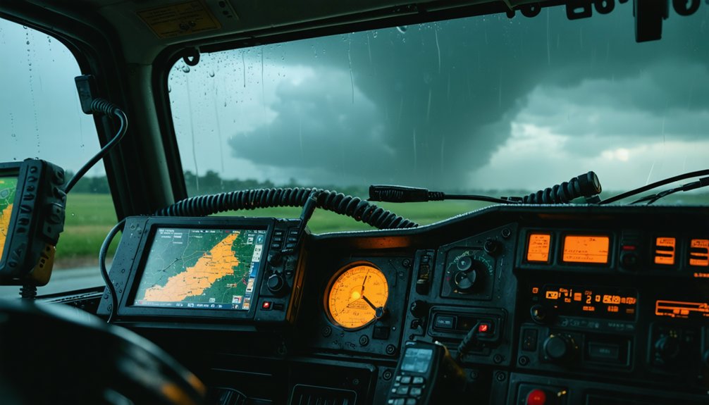
When it comes to radar applications, you’ll find RadarScope and RadarOmega dominating storm chasers’ devices, with each offering distinct overlays and data layers critical for real-time storm analysis.
If you’re running a mobile data terminal, you need a ruggedized computer or tablet loaded with advanced mapping software that pulls live radar feeds via cellular or satellite internet.
These systems let you track storm movement, identify escape routes, and push field observations directly to meteorologists as conditions evolve.
RadarScope Versus RadarOmega
Among storm chasers, RadarScope and RadarOmega stand out as the two dominant radar applications, each offering distinct capabilities that’ll influence which one you’ll run in the field. Both deliver professional-grade radar imaging, but they differ in key areas:
- RadarScope leads in dual-pol data visualization and offers clean, precise storm-relative velocity rendering.
- RadarOmega excels in multi-panel overlays, giving you simultaneous radar imaging across multiple tilt angles.
RadarOmega’s interface supports faster comparative analysis during rapidly evolving supercells.
RadarScope’s reliability and signal redundancy make it the more stable platform during high-demand severe weather events.
Running both apps simultaneously maximizes your signal redundancy and eliminates blind spots in data interpretation.
Most experienced chasers run both, treating them as complementary tools rather than competitors.
Mobile Data Terminal Essentials
Beyond the radar apps themselves, the hardware and software ecosystem you build around them determines how effectively you’ll process and act on incoming data. Ruggedized mobile data terminals resist vibration, dust, and moisture — critical factors when equipment durability separates functional gear from expensive debris.
You’ll want a purpose-built tablet or hardened laptop running advanced mapping software alongside real-time radar overlays.
Mount your terminal where signal interference from the vehicle’s electrical systems won’t degrade your cellular or satellite data feeds. Proper cable routing and shielded connections minimize that risk.
Pair your terminal with a cellular booster and backup satellite connection to maintain uninterrupted data throughput during rapid storm repositioning.
Your terminal isn’t optional equipment — it’s your operational nerve center, integrating GPS positioning, radar feeds, and escape route mapping simultaneously.
Real-Time Storm Tracking
Storm chasing apps have evolved into mission-critical tools that directly influence your tactical decisions in the field. They process live storm data and integrate seamlessly with communication protocols across your device ecosystem.
Key platforms and terminals worth running:
- RadarScope – Industry-standard iOS/Android app delivering professional-grade radar overlays
- RadarOmega – Preferred for detailed mesoscale analysis and storm-relative velocity data
- Mobile Data Terminals – Ruggedized computers running advanced mapping software with real-time radar integration
- Cellular/Satellite Hybrid Connectivity – Ensures uninterrupted storm data transmission when terrestrial networks degrade
- GPS-Integrated Mapping – Plots escape routes dynamically as storm evolution accelerates
You’ll need redundant data pipelines feeding these platforms simultaneously. A single communication protocol failure shouldn’t compromise your situational awareness when a tornado’s track shifts unexpectedly.
How to Build Your Storm Chasing Communication Stack
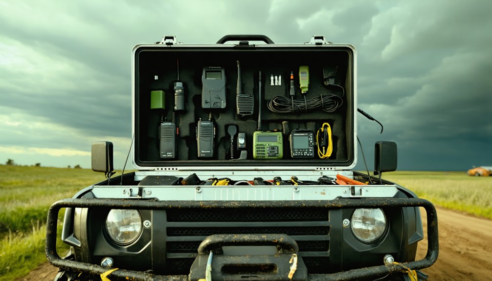
Building an effective storm chasing communication stack requires layering redundant systems so that if one fails, another picks up the slack. Start with a cellular booster like the WeBoost Drive Reach Overland, then add a Starlink satellite dish for areas where signal interference degrades cellular performance.
Redundant systems save lives—layer cellular boosters and satellite connectivity so no single failure leaves you dark in the field.
Layer two-way VHF/UHF ham radios for direct inter-vehicle coordination independent of any network infrastructure. Mount a NOAA weather radio with SAME filtering for NWS alerts requiring zero internet dependency.
Run RadarScope or RadarOmega on a ruggedized mobile data terminal, feeding data through whichever connection remains active. Each system compensates for another’s failure point.
You’re not over-engineering—you’re eliminating single points of failure that could compromise your safety or positioning when it matters most.
Frequently Asked Questions
How Do Storm Chasers Legally Operate Ham Radios Across Multiple States?
You’ll operate ham radios across multiple states legally by holding a single FCC amateur radio license—it’s federally issued, so radio licensing and legal regulations apply nationwide, granting you unrestricted freedom to communicate anywhere in the U.S.
What Communication Devices Work Best During a Tornado’s Electromagnetic Interference?
Like a lighthouse cutting through fog, your best allies against electromagnetic interference are two-way radios and satellite devices—they’ll deliver signal resilience when tornadoes cripple cellular networks, keeping you connected and free to chase safely.
How Much Does a Complete Storm Chaser Communication Setup Typically Cost?
You’ll typically invest $2,000–$10,000 for a complete setup prioritizing storm safety and equipment durability. It’ll include cellular boosters, satellite devices, two-way radios, weather scanners, and GPS units—you’re building operational independence against nature’s most extreme conditions.
Can Storm Chasers Communicate Directly With National Weather Service Meteorologists?
Yes, you can communicate directly with NWS meteorologists through Skywarn/Canwarn spotter networks via VHF ham radio. These emergency protocols enhance storm chaser safety by transmitting real-time ground-truth observations, enabling meteorologists to issue more accurate, timely severe weather warnings.
What Communication Training Do Professional Storm Chasers Complete Before Chasing?
Imagine earning your ham radio license before your first chase — you’ll master storm chasing protocols, emergency communication procedures, and Skywarn spotter certification, giving you the freedom to operate independently and communicate effectively with meteorologists and fellow chasers.
References
- https://www.youtube.com/watch?v=Sr2lz72ZYwM
- https://crazystormchasers.com/communication-devices-for-storm-chasers/
- https://www.youtube.com/watch?v=AswKDts1i0o
- https://en.wikipedia.org/wiki/Storm_chasing
- https://policeradioencryption.com/learn/storm-chaser-gear-guide
- http://www.ndtornado.com/primary/equipment.htm