Before intercepting severe thunderstorms, you’ll need airtight preparation across every system. Check tire pressure, brake fluid, and battery health before departure. Pack satellite phones, first aid kits, and high-lumen flashlights for field emergencies. Map three evacuation routes, identify flash flood zones, and pre-program radio channels with local authorities. Disable cruise control, extend your following distance, and never underestimate storm cell behavior. Master these fundamentals, and the full picture of safe intercept strategy gets even sharper ahead.
Key Takeaways
- Check tire pressure, brake fluid, and run engine diagnostics before departure to ensure your vehicle performs reliably in severe conditions.
- Deploy dual-frequency radar and satellite imagery tools to track storm cells, wind shear patterns, and cloud top temperatures in real time.
- Map at least three evacuation routes beforehand, marking primary, secondary, and tertiary exits while identifying flash flood zones and road surfaces.
- Maintain extended following distances, disable cruise control, and avoid hard braking to prevent hydroplaning on debris-covered or flooded roads.
- Carry satellite phones, pre-programmed two-way radios, and VHF handhelds to sustain communication when cellular networks become unreliable.
Prep Your Vehicle Before the Thunderstorm Arrives
Before you chase a single storm cell, your vehicle needs to be mission-ready. Start with tire pressure checks across all four wheels — wet roads demand peak grip, and under-inflated tires will betray you at the worst moment.
Run full engine diagnostics covering oil viscosity, cooling system integrity, and battery health to prevent mechanical failures during extended pursuits. Verify your fuel levels and brake fluid reservoirs, because high-speed evasive maneuvers require reliable stopping power.
Your engine doesn’t get a second chance mid-pursuit — diagnose everything before the storm does it for you.
Install reinforced roof racks to secure radar equipment and communication gear against violent wind loads. Your vehicle isn’t just transportation — it’s your mobile command center and your escape route.
Treat pre-chase preparation with the same intensity you’ll bring to intercepting the storm itself.
What Safety Gear Should Every Storm Chaser Carry?
Once your vehicle’s mechanically squared away, your safety kit becomes the next line of defense between you and a bad outcome in the field. Pack a multi-tone first aid kit loaded with tourniquets, antiseptics, and bandages — trauma happens fast, and you won’t have time to improvise.
Supplement it with high-lumen LED flashlights and spare batteries for zero-visibility situations.
Your emergency tools loadout should include a versatile multi-tool with pliers, screwdrivers, and wire cutters for rapid field repairs.
Don’t overlook sustenance — carry energy bars, dried fruits, and sealed water reserves for multi-day operations.
When cellular networks collapse under storm damage, a satellite phone keeps you connected.
Every item you pack should earn its weight by serving a direct, functional purpose.
How to Interpret Storm Cell Behavior Before Intercept
Understanding storm cell behavior separates a clean intercept from a dangerous miscalculation.
You’re reading a living system, and radar interpretation isn’t optional — it’s survival. Master storm cell dynamics before you commit to any intercept position.
A storm doesn’t wait for you to catch up — read it fluently or don’t read it at all.
Watch for these critical indicators:
- Rotation signatures — A tight, persistent couplet on dual-polarimetric radar signals mesocyclone development and potential tornado genesis.
- Storm motion vectors — Track the cell’s forward speed and directional drift to calculate intercept angles without boxing yourself in.
- Hook echo morphology — A deepening hook indicates strong inflow and rear-flank downdraft intensification, meaning your positioning window is narrowing fast.
You’ve got the data — trust it.
Hesitation kills clean intercepts. Move decisively, stay updraft-adjacent, and always keep an escape route open.
Master Real-Time Thunderstorm Data Tools on the Road
Reading storm cells accurately sets the stage, but acting on that data in real time is where your intercept lives or dies. Deploy dual-frequency radar technology to track storm cell velocity, rotation, and precipitation intensity simultaneously.
You’ll want satellite imagery running parallel, giving you wind shear patterns and cloud top temperatures for broader atmospheric context.
Keep two-way radio channels open with local authorities and fellow chasers — coordinated updates can redirect your storm tracking route within seconds. When cellular networks collapse under storm damage, your satellite phone becomes mission-critical. Never rely on a single communication layer.
Tune weather radio receivers to NOAA frequencies for official tornado alerts and severe warnings. Redundant systems aren’t overkill — they’re survival architecture.
Real-time data mastery separates calculated pursuit from reckless exposure.
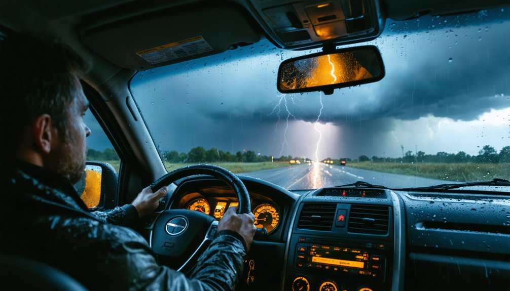
How to Drive Safely in Severe Thunderstorm Conditions?
When storm conditions deteriorate around you, your driving technique becomes as critical as your radar setup. Applying sharp storm driving techniques keeps you mobile and alive when the atmosphere turns violent.
- Cut your speed immediately on flooded or debris-covered roads to maintain traction and preserve vehicle stability tips your chassis depends on during evasive maneuvers.
- Extend your following distance to six to eight seconds minimum, giving you reaction time when visibility collapses inside a squall line.
- Kill the cruise control and manually manage throttle input, preventing unexpected acceleration when grip fluctuates across wet pavement.
Avoid hard braking and sharp steering inputs that trigger hydroplaning.
Keep headlights on low beam with hazard flashers active so other drivers see you through the murk.
Where to Park When a Thunderstorm Closes In
Parking decisions can make or break your safety margin once a thunderstorm closes in fast. Choose ideal parking locations on elevated ground, clear of trees, power lines, and light poles that can snap and crush your rig without warning.
Position your vehicle close to reinforced concrete or steel structures to exploit natural wind deflection.
Your storm shelter options narrow quickly once rotation develops overhead. Never park under highway overpasses—wind accelerates violently through those gaps, turning debris into projectiles.
If a solid building isn’t reachable, a carwash or commercial awning beats open exposure. Abandon your vehicle only when immediate entry into a substantial structure is guaranteed.
Own your escape plan before conditions deteriorate, because hesitation under a rotating wall cloud costs lives.
When Should You Abort a Thunderstorm Intercept?
You’ll know it’s time to abort when storm behavior shifts from predictable to erratic — rapidly tightening rotation, sudden debris lofting, or a roar that drowns out your radio all signal that your safety margin is collapsing fast.
When those signs hit, you execute your pre-planned escape route immediately, moving perpendicular to the storm’s forward track rather than racing it head-on.
Keep your speed controlled, your headlights on, and your eyes off the storm — because hesitation during an emergency retreat is the difference between a close call and a catastrophe.
Recognizing Escalating Danger Signs
Even the most seasoned storm chasers must recognize when a developing intercept shifts from calculated risk to unacceptable danger. Monitoring storm intensity indicators and atmospheric pressure changes gives you critical seconds to react decisively.
Watch for these escalating danger signs:
- Rapid pressure drops exceeding 5 millibars within minutes — this signals explosive storm intensification, indicating imminent tornado development or violent wind shear.
- Debris clouds appearing at ground level — visible rotation carrying material means a tornado has already touched down closer than your radar suggests.
- Complete communication blackout — losing radio contact with fellow chasers or authorities eliminates your situational awareness entirely.
When any of these thresholds trigger, you abort immediately.
No data point, photograph, or intercept opportunity justifies compromising your escape window. Execute your predetermined evacuation route without hesitation.
Executing Safe Emergency Retreats
When the storm shifts from target to threat, you’ve got one priority: get out clean. Execute your storm retreat strategies before the situation locks you in—don’t wait for confirmation that you’re trapped.
Trigger your abort when rotation tightens unexpectedly, escape routes flood, or debris begins crossing your path. Activate emergency signal protocols immediately: broadcast your position on established two-way radio channels, notify fellow chasers, and alert local authorities to your retreat vector.
Drive perpendicular to the storm’s forward motion—never outrun it head-on. Maintain reduced speeds on debris-covered roads, keep headlights and hazard flashers active, and avoid overpasses entirely.
Your pre-identified evacuation routes aren’t suggestions—they’re lifelines. A clean retreat today means another intercept tomorrow.
Plan Your Thunderstorm Evacuation Routes Before You Need Them
Before a single dark cloud appears on the horizon, map out at least three separate evacuation routes from your chase area. Solid evacuation planning separates disciplined chasers from reckless ones. Route assessment demands ruthless honesty about road conditions, bridge load limits, and flood-prone corridors.
- Mark primary, secondary, and tertiary exits on physical county maps before deployment—never rely solely on GPS during a communications blackout.
- Identify elevation changes along each route to avoid flash flood zones that can cut off escape corridors within minutes.
- Confirm road surface types—dirt and gravel roads become impassable mud traps under heavy rainfall, eliminating your freedom to maneuver quickly.
Pre-planned routes give you decisive, immediate action when conditions deteriorate faster than any forecast predicted.
How to Stay in Contact When Cell Networks Go Down?
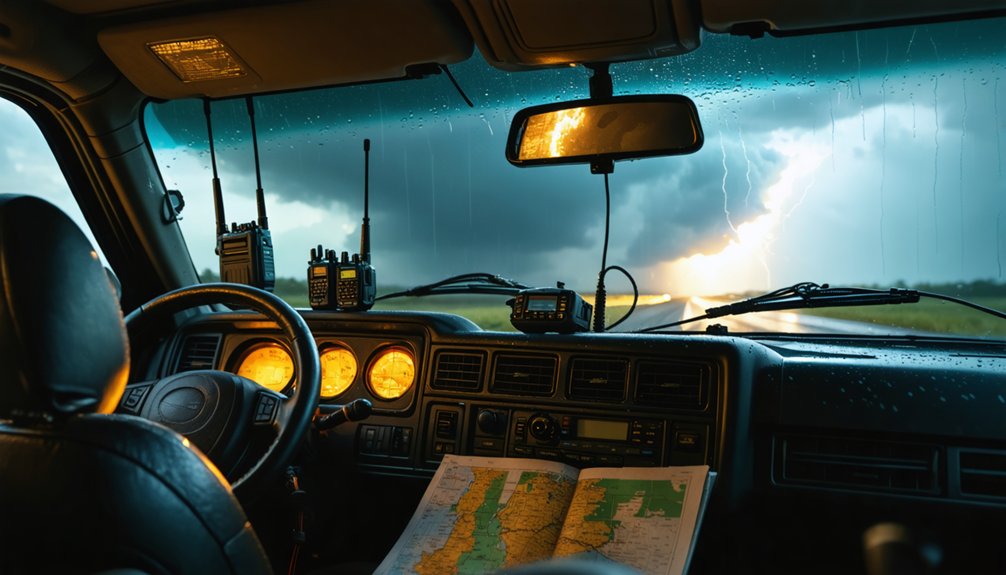
Cell networks collapse fast when a major storm tears through a region, and you can’t afford to lose contact with fellow chasers or emergency services at that critical moment.
Deploy satellite phones immediately as your primary emergency communication strategies shift away from cellular dependency. These devices maintain signal integrity independent of terrestrial infrastructure, keeping you connected when towers fail.
Tune your weather radio receiver to NOAA frequencies for official tornado alerts and storm tracking updates.
Establish two-way radio channels with local authorities and chase partners before entering the target zone, ensuring coordinated situational awareness throughout interception.
Carry backup signal devices like handheld VHF radios as redundant layers of communication. Pre-program all channels, frequencies, and contact protocols before departure, so you’re executing decisions rather than troubleshooting equipment when conditions deteriorate rapidly.
How to Safeguard Your Equipment and Vehicle During a Thunderstorm Chase?
Protecting your gear and vehicle during a thunderstorm chase demands deliberate preparation before you ever approach the target zone. Equipment protection and vehicle maintenance aren’t optional—they’re your operational foundation.
- Secure your radar and communication gear inside heavy-duty roof racks and reinforced cargo boxes, preventing vibration damage across rough, debris-scattered roads.
- Execute pre-chase vehicle maintenance checks covering tire pressure, brake fluid, battery health, and engine diagnostics—mechanical failures in active storm corridors eliminate your escape options entirely.
- Park strategically on elevated ground, distanced from trees, power lines, and overpasses where wind acceleration and debris impact create maximum damage risk.
You’re operating in hostile atmospheric territory. Every unsecured cable, under-inflated tire, or neglected brake line becomes a critical liability when conditions deteriorate rapidly around you.
Frequently Asked Questions
What Legal Permits Are Required for Storm Chasing on Private Property?
You’ll need written landowner permission for property access, as no universal storm chasing permits exist. Always address legal considerations by securing trespass waivers beforehand, respecting boundaries, and consulting local ordinances to chase freely and responsibly.
How Do Storm Chasers Handle Mental Stress After Witnessing Severe Tornado Destruction?
You’ll build emotional resilience by debriefing with fellow chasers, documenting trauma responses through structured journals, and seeking professional counseling. Acknowledge what you’ve witnessed, process it actively, and you’ll maintain sharp mental clarity for future intercepts.
Are There Specific Age Restrictions for Participating in Professional Storm Chasing Activities?
You’ll find that most professional storm chasing organizations enforce strict age limitations, typically requiring participants to be 18 or older. If you’re younger, you’ll need parental consent and direct adult supervision throughout every active chase operation.
How Do Storm Chasers Coordinate With News Media Outlets During Active Chase Operations?
You’ll coordinate storm tracking data with media partnerships by sharing real-time radar feeds, live video streams, and two-way radio updates directly with news outlets, ensuring they’ve got accurate, timely severe weather coverage during your active chase operations.
What Training Certifications Are Recommended Before Attempting Solo Thunderstorm Intercept Missions?
You’ll need storm forecasting credentials like Spotter Network certification and SKYWARN training before solo missions. Master vehicle safety protocols through NWS courses, ensuring you’re competent in meteorological analysis, navigation, and emergency response before chasing independently.
References
- https://www.wheelerchevy.com/blogs/6529/10-tips-for-protecting-your-car-during-a-tornado
- https://www.edmunds.com/car-safety/driving-safely-in-sudden-extreme-conditions.html
- https://www.weather.gov/media/pah/Skywarn/SafetyForMobileSpotters.pdf
- https://crazystormchasers.com/intercepting-severe-thunderstorms-in-rural-areas/
- https://www.chubb.com/us-en/individuals-families/resources/how-to-protect-your-car-during-severe-weather.html
- https://www.nyc.gov/site/em/ready/thunderstorms.page
- https://www.mas.law/blog/2026/may/what-to-do-when-a-storm-hits-while-driving/
- https://www.mass.gov/info-details/thunderstorm-and-lightning-safety-tips
- https://raleighnc.gov/transportation/services/ready-raleigh-guide-emergency-preparedness/preparing-your-car-severe
- https://www.wnins.com/blog/stormdriving.html


