Storm chasers intercept severe thunderstorms to collect ground-truth data that remote sensors simply can’t capture. You’ll find them deploying mobile Doppler radar to reconstruct three-dimensional wind structures, measuring surface pressure drops tied to tornadogenesis, and validating numerical weather prediction models in real time. Their work directly sharpens National Weather Service alerts, giving communities critical preparation time. The science behind what they measure, how they position themselves, and why they keep returning each season runs deeper than most realize.
Key Takeaways
- Storm chasers collect ground-truth data unavailable through remote sensors, including vortex pressure drops and three-dimensional wind structures near tornadoes.
- The physics of tornadogenesis remains partially understood, making close-range measurements essential for advancing scientific knowledge of tornado formation.
- Chasers validate numerical weather prediction models using real-world data, helping the National Weather Service issue faster, more accurate severe weather alerts.
- A deep passion for atmospheric physics, combined with the challenge of directly measuring tornado dynamics, drives personal motivation to chase.
- Ground-truth observational data continuously refines forecasting algorithms, strengthening community preparedness and safety across severe weather-vulnerable regions.
What Storm Chasers Are Actually Trying to Learn
When storm chasers deploy into the field, they’re gathering ground-truth data that remote sensors simply can’t capture. Mobile Doppler radar units measure three-dimensional wind structures, while surface instruments record pressure drops tied to tornado formation and storm dynamics.
You’re looking at real-time atmospheric conditions that validate numerical weather prediction models, sharpening forecast accuracy and extending warning lead times.
Real-time atmospheric data validates weather prediction models, sharpening forecast accuracy and extending life-saving warning lead times.
Visual documentation adds another analytical layer. High-resolution imagery of wall clouds and funnel clouds reveals meteorological phenomena that radar alone can’t fully resolve.
Your data analysis of inflow boundaries, rear-flank downdraft temperatures, and wind shear profiles directly refines chasing techniques and safety strategies.
Beyond instrumentation, personal experiences observing updraft structures and environmental impacts of severe storms build a qualitative understanding no satellite pass ever delivers.
How Storm Chasers Choose Where to Intercept?
Choosing where to intercept a storm isn’t guesswork—it’s a structured, data-driven process that starts the night before chase day. You’ll pull Storm Prediction Center outlooks, analyze wind shear profiles, and identify dryline positions to narrow your target selection to a specific region.
On chase day, you’re monitoring satellite loops for towering cumulus development and radar returns for intensifying cells.
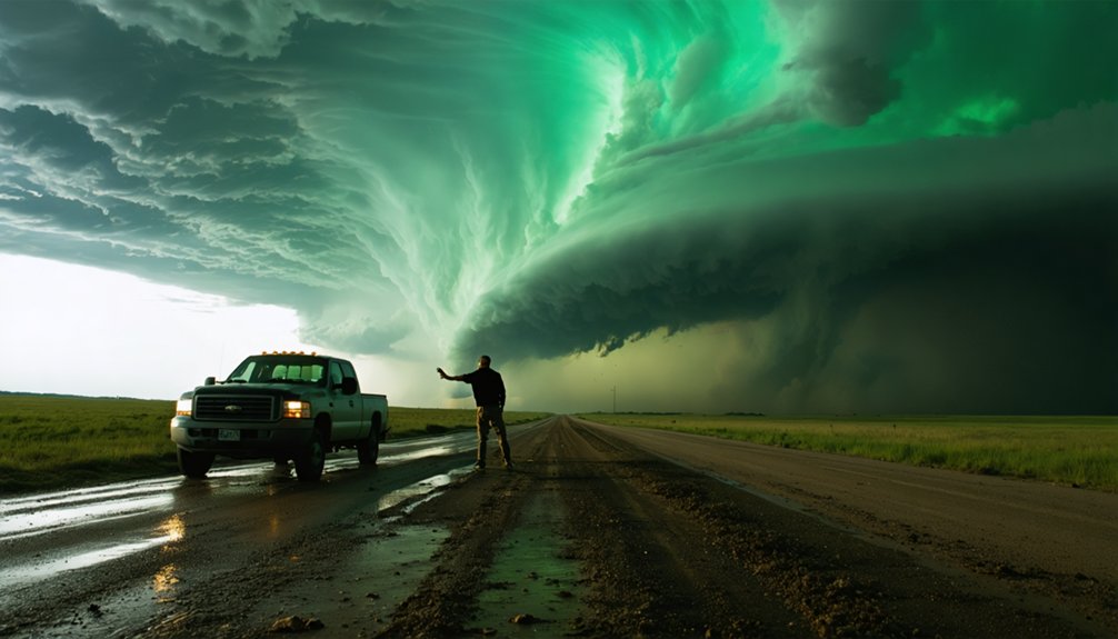
Once you’ve identified a candidate storm, storm positioning becomes critical. You’ll aim for a southeast location relative to the storm’s forward motion, placing yourself 2–5 km ahead and to the right of the anticipated wall cloud path.
That angle keeps you clear of the hail core while maximizing visual access to the mesocyclone. Every positioning decision balances observational value against escape route availability.
What Do Storm Chasers Actually Measure?
Once you’re in position, the data collection begins in earnest. Storm chasers deploy precise measurement techniques targeting specific atmospheric variables that reveal critical storm dynamics.
Here’s what you’re actually capturing:
- Wind speed and pressure — Surface-level readings inside vortices that remote sensors simply can’t reach
- Temperature gradients — Thermal variations across rear-flank downdrafts that expose the physics driving tornadogenesis
- Inflow conditions — Environmental parameters feeding the storm’s rotating updraft base
Mobile Doppler radar units simultaneously reconstruct three-dimensional wind structures, giving you a complete picture no satellite can match.
Every data point you collect validates numerical weather prediction models, directly sharpening forecast accuracy.
You’re not just watching severe weather unfold — you’re generating irreplaceable ground-truth measurements that improve warning lead times for communities in harm’s way.
How Do Storm Chasers Capture What They See?
When you’re in the field, you’ll rely on high-resolution DSLR cameras and 4K video rigs mounted on tripods or vehicle brackets to document wall clouds, funnel formation, and mesocyclone structure in real time.
You’ll pair that visual capture with onboard data loggers recording GPS coordinates, atmospheric pressure, temperature, and wind velocity at precise timestamps.
These synchronized streams of visual and numerical data let you cross-reference what you see with what your instruments measure, producing a verifiable record of storm behavior.
Camera Equipment Used
Storm chasers rely on a precise arsenal of camera equipment to document the rapid, often fleeting dynamics of severe weather. Your camera types, lens choices, and stabilization tools directly determine the quality of data you’ll capture under extreme weather conditions.
Three critical equipment priorities define successful documentation:
- Camera types and video settings — Use mirrorless or DSLR bodies capable of high-frame-rate shooting to excel at capturing motion within rotating wall clouds.
- Lens choices — Wide-angle lenses between 14–24mm maximize storm structure coverage across turbulent skies.
- Stabilization tools — Gimbal stabilizers counteract vehicle vibration, keeping footage analytically usable.
You’ll also need to master photography techniques that compensate for rapidly shifting lighting equipment demands, since storm contrast levels change within seconds.
Real-Time Data Recording
Beyond capturing visual footage, you’ll need integrated data recording systems that timestamp and synchronize multiple instrument streams simultaneously.
Real time tracking demands that your GPS coordinates, barometric pressure readings, temperature gradients, and wind velocity measurements all log to a central data acquisition unit without lag.
You’ll configure your systems to record at intervals tight enough to detect rapid pressure drops indicating vortex intensification.
Data accuracy depends on calibrated sensors cross-referenced against mobile Doppler radar returns, eliminating instrument drift that corrupts analysis.
Your onboard laptop runs specialized software that overlays field measurements against Storm Prediction Center model outputs, flagging discrepancies instantly.
Every logged parameter builds a synchronized dataset scientists later use to refine tornadogenesis models, transforming your raw field observations into actionable meteorological intelligence.
What Keeps Chasers Hunting Tornadoes Year After Year?
Once you witness a tornado’s brief, violent existence, the compulsion to find another takes hold fast.
You’ll spend hours tracking storms for mere minutes of active vortex contact, investing serious money in equipment, fuel, and time to close the gap between forecast and intercept.
That pursuit—measured in data points, positioning calculations, and seasonal chase logs—keeps you returning to Tornado Alley year after year.
The Relentless Tornado Pursuit
For many chasers, the relentless return to Tornado Alley each spring isn’t simply about witnessing a dramatic event—it’s driven by a convergence of scientific necessity, personal challenge, and the raw difficulty of the intercept itself.
Tornadoes last minutes, forcing you to spend hours analyzing storm behavior and positioning precisely.
Three factors keep chasers returning:
- Tornado dynamics demand direct measurement—ground-based wind data remains unobtainable remotely.
- Intercept difficulty creates personal challenge, requiring accurate target selection from Storm Prediction Center outlooks.
- Scientific gaps persist, pushing researchers to refine numerical weather prediction models through real-world validation.
You’re not chasing spectacle alone—you’re chasing answers.
Each failed intercept sharpens your forecasting instincts, while each successful one delivers irreplaceable data that improves warning lead times for entire communities.
Personal Passion Fuels Chasers
Passion, not profit, anchors most chasers to Tornado Alley season after season.
You’re not collecting a paycheck when you spend hours repositioning across Kansas backroads chasing a storm that lasts minutes. Instead, personal fulfillment drives the investment of time, fuel, and equipment.
Weather fascination runs deep — you’re drawn to the atmospheric physics behind rotating supercells, the visual complexity of wall clouds, and the raw power of vortex formation. That pull doesn’t diminish after one intercept; it intensifies.
Tracking a tornado against a fixed reference point, confirming your positioning calculations worked, delivers measurable satisfaction rooted in skill, not luck.
You’re exercising freedom — choosing your own targets, running your own data, and operating independently within nature’s most dynamic laboratory.
Chasing Storms Year-Round
Season after season, you return because the data gap never closes. Each storm season exposes new variables—pressure anomalies, inflow shifts, rear-flank downdraft signatures—that previous intercepts couldn’t fully capture.
Your chasing strategies sharpen yearly because the atmosphere keeps introducing conditions no model perfectly predicts.
Three critical reasons you keep hunting:
- Model validation gaps persist, demanding fresh observational data to refine numerical forecasting algorithms.
- Tornadogenesis physics remain incompletely understood, requiring repeated close-range measurements of vortex pressure drops and wind shear profiles.
- Warning lead times still need improvement, and your ground-truth data directly contributes to that advancement.
You’re not chasing nostalgia—you’re filling scientific voids that remote sensors can’t reach. The atmosphere doesn’t repeat itself, and neither does your opportunity to measure it.
How Storm Chasing Makes Communities Safer?
Storm chasing directly improves community safety by feeding real-world observational data into the warning systems that protect lives.
When chasers deploy mobile Doppler radar and measure inflow conditions near active supercells, they’re generating ground-truth data that refines the algorithms forecasters rely on. That refinement translates directly into longer warning lead times, giving you and your community more time to act.
Close-up observations of rear-flank downdraft dynamics and visual tornado signatures help the National Weather Service issue faster, more accurate alerts.
Better data means stronger community preparedness and sharper safety awareness across vulnerable regions. You’re not just watching storms get chased — you’re benefiting from a system continuously improved by the real-world measurements those chasers collect while positioned kilometers from a rotating wall cloud.
Frequently Asked Questions
How Much Does a Typical Storm Chasing Expedition Cost per Trip?
You’ll typically spend $500–$1,500 per trip on fuel, equipment, and lodging. Smart budget planning keeps your trip expenses manageable, letting you chase freely without financial strain derailing your storm intercept missions.
Are Storm Chasers Required to Have Any Formal Meteorology Certifications?
You don’t need formal certification requirements to chase storms. However, meteorology training sharpens your data interpretation skills, improves strategic positioning decisions, and enhances your ability to analyze wind shear, drylines, and supercell dynamics effectively.
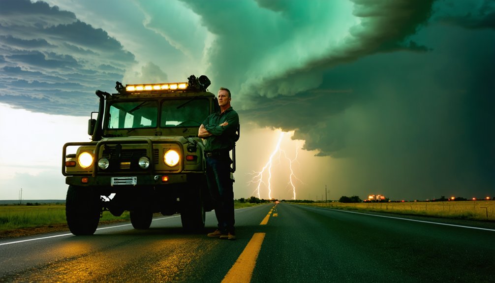
What Types of Vehicles Do Storm Chasers Typically Use During Pursuits?
You’ll typically use reinforced SUVs or trucks as chaser vehicles, with equipment modifications like mounted Doppler radar, GPS arrays, and strengthened chassis systems that let you collect precise storm data while maintaining mobility and personal freedom.
How Do Storm Chasers Coordinate With Local Emergency Management Officials?
You’ll “sync up” with local agencies through structured communication strategies and emergency protocols, sharing real-time positioning data, storm observations, and hazard reports that actively enhance situational awareness and help officials coordinate faster, more accurate public safety responses.
What Insurance Coverage Do Professional Storm Chasers Typically Carry?
You’ll typically carry liability coverage and conduct thorough risk assessment before each chase. Policies usually include vehicle, equipment, and personal injury protection, since you’re operating in high-risk environments where standard auto insurance won’t adequately cover storm-related damages.
References
- http://www.stormeyes.org/tornado/chasing/FAQ/
- https://en.wikipedia.org/wiki/Storm_chasing
- https://www.rmets.org/metmatters/weather-photographer-year-setting-scene-storm-chasing
- https://journals.ametsoc.org/view/journals/wefo/14/4/1520-0434_1999_014_0558_ahossi_2_0_co_2.xml
- https://science.howstuffworks.com/nature/climate-weather/storms/storm-chaser2.htm
- https://www.chriskridler.com/skydiary/kids/stormchasing/
- https://www.youtube.com/watch?v=Bdsi3rQay3g
- https://www.pbs.org/newshour/science/inside-the-dangerous-and-unpredictable-science-of-storm-chasing
- https://www.thehindu.com/life-and-style/kolkata-cloud-chasers-the-group-that-chases-cyclones-thunderstorms-and-lightning-across-bengal/article71131732.ece
- https://www.papertrell.com/apps/preview/The-Handy-Weather-Answer-Book/Handy Answer book/Who-are-storm-chasers/001137016/content/SC/52cb004a82fad14abfa5c2e0_default.html


