Doppler radar gives you real-time wind velocity data by measuring frequency shifts in returned microwave pulses. You can spot velocity couplets exceeding 50–90 knots before a tornado visually forms, identify hook echoes indicating rotating updrafts, and confirm active tornadoes through debris signatures with correlation coefficients below 0.80. Dual-polarization systems separate debris from precipitation even in darkness. Every scan keeps you one step ahead—and there’s far more precision packed into each data return than most chasers ever use.
Key Takeaways
- Doppler radar detects velocity couplets and hook echoes, identifying rotation before a visible funnel forms, giving storm chasers critical early warnings.
- Low correlation coefficient readings below 0.80 confirm lofted debris, verifying active tornadoes even without visual contact in rain or darkness.
- Continuous real-time updates reveal storm speed, heading, and structural changes, helping chasers anticipate behavior shifts and select safe intercept points.
- Phased-array systems scan the atmosphere in under 60 seconds, enabling rapid response to fast-evolving tornadic developments.
- Mobile Doppler radar fills low-altitude coverage gaps missed by fixed systems, providing close-range data essential for comprehensive storm analysis.
What Does Doppler Radar Actually Do?
Doppler radar works by transmitting microwave pulses toward a storm and measuring the frequency shift in the returned signal — a phenomenon known as the Doppler effect. When precipitation moves toward the radar, the returned frequency increases. When it moves away, frequency decreases. That shift translates directly into wind velocity data you can act on.
Doppler radar doesn’t guess — it measures frequency shifts in real time and turns them into wind velocity data you can act on.
Proper radar calibration guarantees those velocity readings remain accurate, so you’re not making life-or-death decisions based on distorted numbers.
Signal attenuation becomes a factor when heavy precipitation absorbs or scatters the microwave energy, weakening the returned signal and potentially masking dangerous storm features behind a rain core. Understanding these limitations keeps you from trusting flawed data.
Doppler radar gives you measurable, real-time storm intelligence — but only when you know how to read it correctly.
How Doppler Radar Detects Rotation Before a Tornado Forms
When Doppler radar transmits microwave pulses into a storm, it measures the frequency shift of the energy reflected back by precipitation. This allows it to directly calculate wind speed and direction relative to the radar beam.
You can use this velocity data to identify a velocity couplet—adjacent regions of strong inbound and outbound winds—which signals rotation within a developing mesocyclone.
Detecting this signature before a tornado touches down gives you a critical lead-time advantage that no visual observation alone can provide.
Velocity Couplets Signal Rotation
Before a tornado ever touches the ground, Doppler radar can already be flagging its likely development through a signature called a velocity couplet. This occurs when adjacent radar pixels display opposing velocities — one moving toward the radar, the other moving away — indicating strong rotational wind shear within a storm’s mesocyclone.
You’re reading storm data in real time, and a tightly packed couplet tells you rotation is intensifying. The closer those opposing velocities are spatially, the stronger the shear. Proper radar calibration ensures these velocity measurements remain accurate, so you’re not chasing bad data into a dangerous position.
Identifying a velocity couplet early gives you a critical time advantage — often minutes before a tornado becomes visible — letting you reposition safely while maintaining your intercept.
Frequency Shifts Reveal Wind
How does a radar system detect invisible wind motion kilometers inside a thunderstorm? It measures frequency shifts. When microwave pulses strike precipitation moving toward the radar, returned frequencies increase. Movement away lowers them. That shift, the Doppler effect, translates directly into wind velocity data.
You’re not guessing at storm structure—you’re reading it through quantified frequency changes updated every few minutes. Proper radar calibration ensures those velocity measurements stay accurate, so you’re not chasing corrupted data into a dangerous intercept position.
When winds on opposite sides of a mesocyclone show strong inbound and outbound velocities simultaneously, rotation is confirmed before any visible funnel forms. That early confirmation gives you positioning options, escape route decisions, and timing advantages that no standard weather application can replicate.
Reading Velocity Couplets and Hook Echoes in Real Time
When you pull up velocity data on your radar display, you’re scanning for a couplet—a tightly paired zone of strong inbound and outbound velocities indicating rotation within the storm.
The tighter and more intense the couplet, the stronger the wind shear, and the higher the probability of tornadic development.
Simultaneously, you watch the reflectivity scan for a hook echo, the characteristic appendage wrapping around the storm’s southern or southwestern flank that signals a rotating updraft drawing in precipitation.
Identifying Velocity Couplet Signatures
Reading velocity couplets in real time is one of the most critical skills you’ll develop as a storm chaser. A velocity couplet appears when adjacent radar pixels show opposing wind directions — one moving toward the radar, the other moving away. That contrast signals rotation within the storm environment.
You’re looking for tight, well-defined couplets with significant speed differentials, typically exceeding 50–90 knots in tornadic supercells. Weak or diffuse couplets may indicate developing rotation rather than confirmed tornadogenesis.
Radar calibration matters here. Miscalibrated data can distort velocity readings, causing you to misinterpret rotation strength or position. Always cross-reference with reflectivity and dual-polarization products before committing to an intercept position.
Accurate couplet identification gives you actionable intelligence — keeping your decisions fast, precise, and independent.
Hook Echo Visual Interpretation
Once you’ve confirmed a velocity couplet, shift your focus to the storm’s reflectivity display and locate the hook echo — a curved appendage extending from the southern or southwestern flank of a supercell’s main precipitation core.
This hook forms as rotating winds wrap precipitation around the mesocyclone. A well-defined hook, particularly one with a bounded weak echo region at its tip, strongly suggests tornadic potential.
Proper radar calibration guarantees reflectivity values are accurate, preventing misidentification of rain-wrapped debris as standard precipitation.
Cross-reference the hook’s position against velocity data through deliberate data integration — alignment between strong rotation and a distinct hook echo markedly raises your confidence in tornadic development.
Tighten your intercept geometry immediately, and prioritize a southern approach to maintain a clear escape route.
The Role of Debris Balls in Confirming an Active Tornado
A debris ball is one of the most conclusive radar signatures you can identify when confirming an active tornado on the ground. It appears as a concentrated region of high reflectivity, typically 50–65 dBZ, co-located with a velocity couplet and a sharp drop in correlation coefficient (CC) values, often below 0.80.
That CC drop tells you the radar’s detecting lofted debris, not uniform precipitation.
That drop in correlation coefficient means the radar is seeing lofted debris, not rain.
Debris balls form when an active tornado lifts vegetation, soil, and structural material into the mesocyclone. Among tornado signatures, this combination of high reflectivity and low CC gives you ground-truth confirmation that a tornado is producing damage. You don’t need visual contact.
Dual-polarization radar delivers that confirmation in real time, letting you make sharper, faster decisions without compromising your safety or position.
Why Dual-Polarization Doppler Radar Changed Storm Chasing Forever
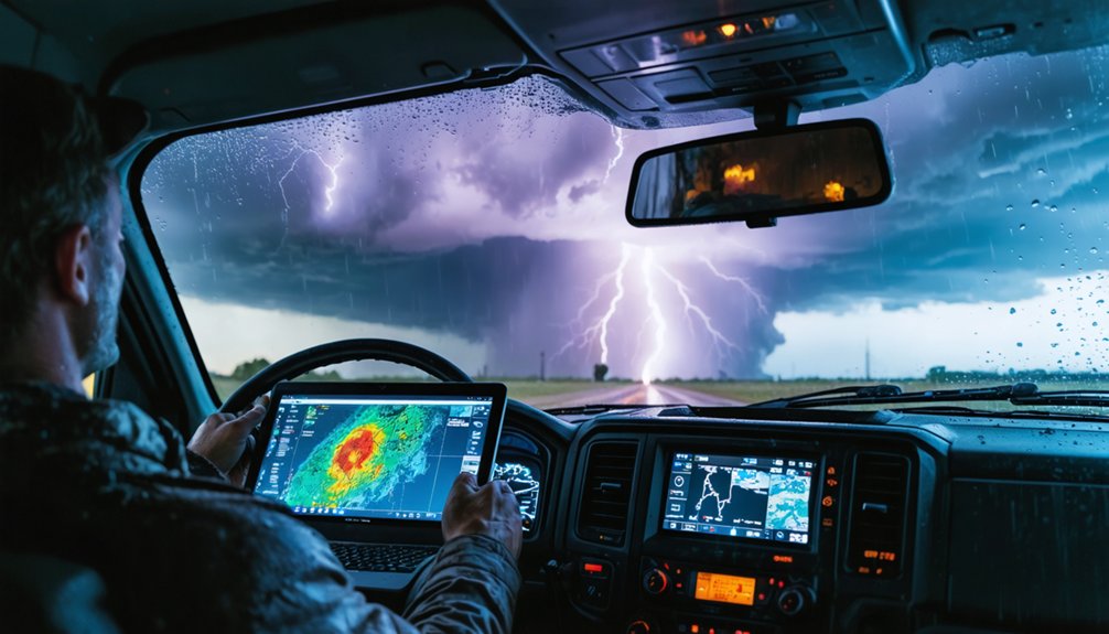
When dual-polarization Doppler radar entered operational use, it fundamentally changed how you interpret storm data by transmitting pulses on both horizontal and vertical axes simultaneously.
That dual-axis capability lets you distinguish debris fields from precipitation by analyzing correlation coefficient values, which drop sharply when irregular objects like wood fragments and insulation contaminate the radar beam.
You’re no longer guessing whether a tornado has touched down — dual-pol data confirms active debris lofting with measurable precision, removing ambiguity from one of storm chasing’s most critical decisions.
Debris Detection Transformed Chasing
Before dual-polarization Doppler radar became operational across the United States in the early 2010s, chasers couldn’t confirm an active tornado was lofting debris without a direct visual. Now, the correlation coefficient product reveals debris balls in real time, even through rain-wrapped storms or darkness.
Dual-pol transformed debris detection by giving you:
- Low CC values (typically below 0.80) confirming non-meteorological particles aloft
- Debris ball signatures collocated with velocity couplets, confirming active tornadoes independent of storm surge interference
- Differential reflectivity anomalies distinguishing tumbling debris from uniform precipitation
- Climate impact awareness, helping researchers link debris field intensity to broader environmental conditions affecting tornado behavior
You’re no longer guessing. Radar data confirms tornado ground contact before you commit to an intercept position.
Dual-Pol Confirms Severe Weather
Dual-polarization Doppler radar didn’t just refine severe-weather analysis—it redefined what chasers can confirm before committing to an intercept.
By transmitting pulses horizontally and vertically, dual-pol systems generate correlation coefficient, differential reflectivity, and specific differential phase data. You’re no longer guessing whether that high-reflectivity core contains hail, heavy rain, or lofted debris—you’re reading quantifiable signatures.
Proper radar calibration guarantees those signatures remain accurate under varying atmospheric conditions, so your data interpretation isn’t compromised when it matters most.
Debris balls confirm active tornadoes even when visual contact is impossible due to rain-wrapped circulation or low visibility. That confirmation lets you make precise intercept or retreat decisions backed by physical evidence rather than assumption.
Dual-pol essentially converted radar from a tracking tool into a storm-content verification system.
Can Doppler Radar See a Tornado Through Rain and Darkness?
- Velocity couplets reveal rotation inside rain curtains before any funnel becomes visible.
- Correlation coefficient drops confirm debris lofted by a tornado obscured within precipitation.
- Hook echo geometry persists through darkness, giving you structural data independent of sunlight.
- Dual-pol discrimination separates biological returns and ground clutter from genuine storm signatures.
These tools let you track a dangerous storm without ever needing to see it directly, keeping your decision-making grounded in data rather than guesswork.
How Storm Chasers Use Doppler Radar to Track Storm Movement
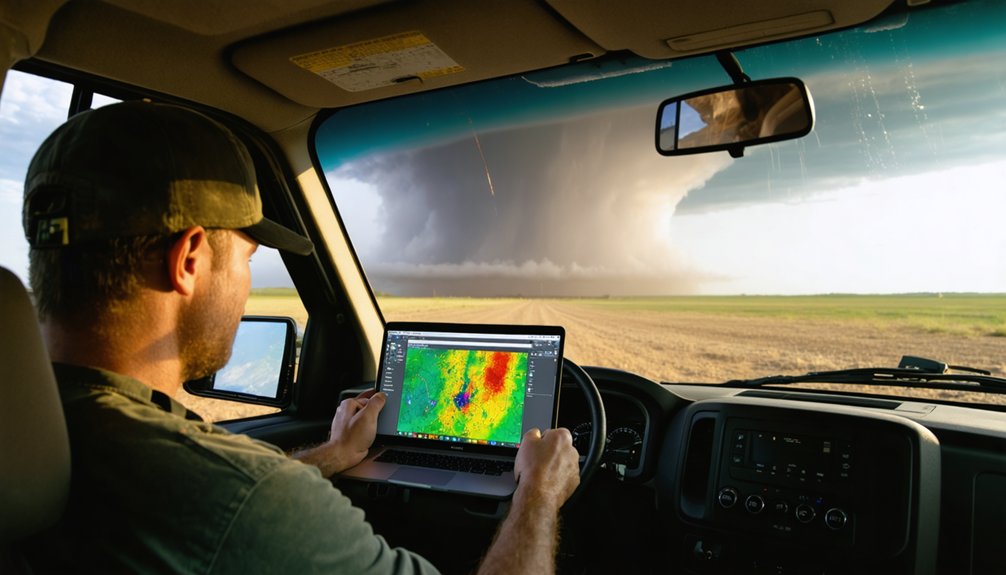
Tracking a storm in real time means interpreting continuous radar updates to stay ahead of rapid directional and intensity changes. You’re pulling storm speed, heading, and movement trends directly from velocity and reflectivity data, then adjusting your route as conditions evolve.
Doppler radar lets you analyze storm structure—identifying whether a supercell is strengthening, collapsing, or deviating from its forecast path. You factor in environmental factors like wind shear and atmospheric instability to anticipate behavioral shifts before they occur.
Rapid refreshes give you actionable data to select intercept points and avoid entering a hail core or the wrong storm quadrant. Mobile radar extends this capability into areas where fixed systems miss low-altitude rotation, keeping your positioning precise and your decisions grounded in real data.
How Faster Radar Scans Improve Split-Second Chase Decisions
When a storm intensifies or shifts track in under a minute, your radar’s update rate determines whether you react in time or get caught in a dangerous position. Phased-array systems can complete full atmospheric scans in under 60 seconds, giving you actionable data before conditions deteriorate.
Faster scans directly improve your decision-making by delivering:
- Rapid mesovortex tracking — detect rotation tightening before touchdown occurs
- Real-time data visualization — clearer storm structure updates reduce misreads during fast-moving intercepts
- Wind shear monitoring — identify sudden shear increases tied to tornadic development
- Radar calibration accuracy — properly calibrated systems maintain data integrity at high scan rates, preventing false signatures
Every second of delay between storm change and your decision costs positioning advantage. Faster radar closes that gap.
How Mobile Doppler Radar Fills Critical Coverage Gaps
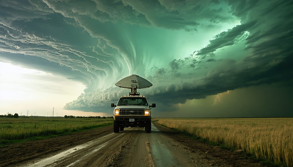
Fixed radar networks leave 3 critical blind spots that mobile Doppler systems are built to address: low-altitude beam overshoot, sparse coverage in rural tornado-prone regions, and delayed deployment to rapidly evolving targets.
When you’re operating in Tornado Alley, fixed beams often overshoot near-surface rotation entirely, missing the most dangerous storm-level data. Mobile platforms like DOW systems close that gap by collecting low-altitude measurements that stationary networks can’t reach.
Proper radar calibration guarantees the data you’re pulling in real time is accurate enough to feed reliable storm modeling, giving you precise structural analysis at close range. You gain the freedom to reposition quickly, matching the storm’s movement and capturing evolving signatures before fixed infrastructure even registers the threat.
What Doppler Radar Still Cannot Tell Storm Chasers
Despite its critical role in storm chasing, Doppler radar carries hard limitations you can’t afford to overlook. Radar limitations directly affect data accuracy, and understanding them keeps you alive in the field.
Doppler radar has hard limitations. Know them before you chase — they directly affect your survival in the field.
Doppler radar won’t tell you:
- Exact tornado location on the ground — rotation signatures indicate potential, not confirmed touchdowns.
- Near-surface wind fields — fixed radar beams overshoot low-altitude activity, leaving critical blind spots beneath 1,000 feet.
- Precise debris composition — dual-pol products distinguish debris fields broadly but can’t identify specific hazards within them.
- Real-time visual storm structure — radar shows data snapshots, not continuous live imagery, creating decision gaps during rapid intensification.
You must combine radar intelligence with direct visual observation, spotter networks, and sound situational judgment to compensate for these hard gaps.
Frequently Asked Questions
How Much Does Professional Doppler Radar Equipment Typically Cost Storm Chasers?
Like buying a tank, professional Doppler radar’s cost analysis runs $50,000–$500,000+. You’ll invest heavily in equipment durability, but you’re securing your freedom to chase storms with precision, real-time data, and unmatched situational awareness.
Do Storm Chasers Need Special Licenses to Operate Mobile Doppler Radar Systems?
You don’t need special licenses to operate mobile Doppler radar systems, but you’re responsible for radar calibration and meeting FCC frequency regulations. License requirements vary based on transmission power and spectrum use.
How Do Storm Chasers Share Real-Time Doppler Radar Data With Each Other?
You’ll share real-time Doppler radar data through apps like RadarScope, GRLevel3, and GPS-linked platforms. Data sharing protocols guarantee radar accuracy stays consistent across chase teams, letting you coordinate intercepts, adjust routes, and communicate storm signatures instantly.
What Training Do Storm Chasers Need to Interpret Doppler Radar Accurately?
Sure, just wing it—storm interpretation’s totally instinctive! Actually, you’ll need formal meteorology coursework, hands-on radar calibration practice, velocity couplet analysis training, and dual-polarization product study to accurately read rotation signatures and make life-saving, independent chase decisions.
Has Doppler Radar Ever Directly Saved a Storm Chaser’s Life in the Field?
Yes, radar accuracy has directly saved chasers’ lives—you’ve relied on real-time velocity couplets and storm prediction data to escape sudden tornado paths, avoiding dangerous intercept positions before conditions turned lethal in the field.
References
- https://www.youtube.com/watch?v=G2upCSLvmks
- https://crazystormchasers.com/what-makes-doppler-radar-crucial-for-storm-chasers/
- https://www.youtube.com/watch?v=q4fwYUScwOM
- https://crazystormchasers.com/enhancing-storm-chaser-protection-with-doppler-radar-advancements/
- https://crazystormchasers.com/how-does-doppler-radar-help-storm-chasers/
- https://en.wikipedia.org/wiki/Storm_chasing
- https://crazystormchasers.com/what-technology-aids-storm-chasers-in-real-time-monitoring/
- https://www.youtube.com/watch?v=7hR3bFVvUGg
- https://www.youtube.com/watch?v=3lF416dpiDI
- https://www.cbc.ca/news/world/how-the-weather-info-that-storm-chasers-use-can-keep-you-safe-1.1354921



