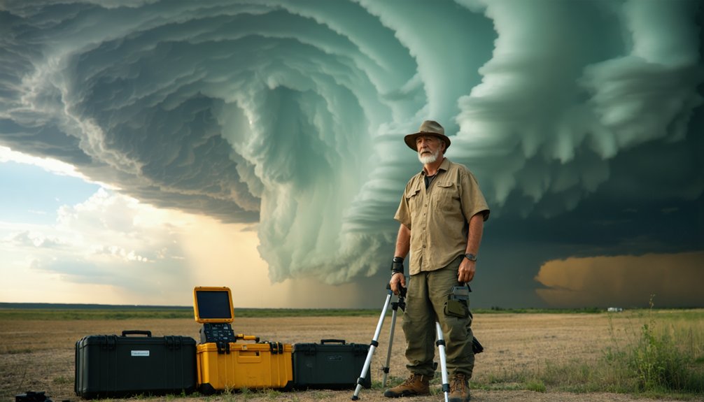
Storm chasing isn’t what Hollywood shows you. You’re watching dramatized pursuits that replace hours of methodical radar analysis, instability index reviews, and wind shear profiling with reckless high-speed chases. Real chasers reposition constantly, log extensive mileage, and often never see a tornado. Standard vehicles fail catastrophically in extreme winds, while purpose-built units use engineered geometry to survive. Understanding the real science, ethics, and data-driven decisions behind storm chasing completely transforms how you’ll interpret what’s actually happening out there.
Key Takeaways
- Real storm chasing involves hours of data analysis, repositioning, and waiting, not the reckless high-speed pursuits depicted in Hollywood films.
- Rain-wrapped and wedge tornadoes often look nothing like classic funnel shapes, making visual identification extremely difficult without radar support.
- Standard vehicles catastrophically fail in extreme winds, unlike purpose-built units like TIV2 and Dominator, which are engineered for survival.
- Tornado behavior frequently defies forecasts, with paths that curve, stall, or bifurcate, making perfect positioning nearly impossible.
- Responsible storm chasers prioritize scientific data collection and community safety, contributing directly to improved tornado forecasting and warning systems.
What Storm Chasing Really Looks Like on a Typical Chase Day
Most people picture storm chasing as a continuous high-speed pursuit of a tornado, but the reality involves far more waiting, routing, and data analysis than dramatic intercepts.
Chase preparation dominates your day before you ever see a storm. You’re analyzing instability indices, wind shear profiles, and storm mode forecasts to select the most viable target area.
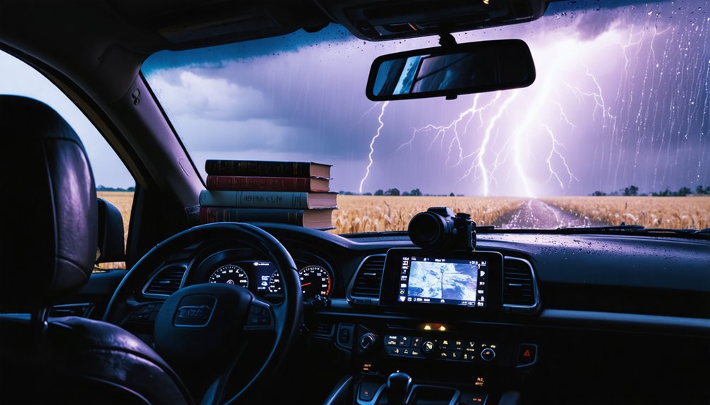
Once you’re mobile, storm monitoring becomes your primary operational focus. You’re tracking radar returns, surface observations, and mesoscale boundaries in real time while repositioning across road networks.
Most chase days end without a tornado sighting. You’ll log hundreds of miles traversing terrain, adjusting targets, and managing timing windows.
Successful chasing rewards disciplined analysis and flexible decision-making, not reckless speed. The data drives every move you make.
The Biggest Storm Chasing Myths the Media Gets Wrong
If you’ve watched Hollywood’s take on storm chasing, you’ve likely absorbed a distorted picture where chasers race directly into tornadoes in ordinary vehicles while the funnel obligingly appears in clear view.
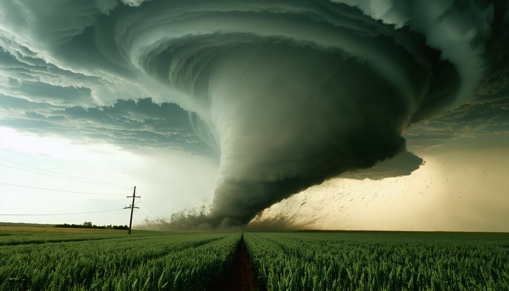
In reality, tornadoes are frequently rain-wrapped, poorly defined, or obscured by terrain and darkness, making clean visual contact far less common than films suggest.
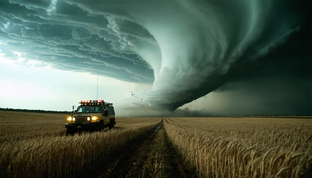
MythBusters data further dismantled the vehicle myth, demonstrating that a standard passenger car loses structural integrity at 160 mph winds, while purpose-built armored vehicles like the TIV2 and Dominator resisted significant movement—proving survival depends on engineering and situational awareness, not just vehicle mass.
Hollywood Versus Real Chasing
When Hollywood portrayals depict storm chasing, they compress hours of radar analysis, repositioning, and target evaluation into seconds of reckless acceleration toward a visible funnel.
Real life experiences look nothing like that. You’re studying instability indices, wind shear profiles, and road network access before you ever move toward a developing supercell.
Misleading dramatizations strip away the ethical considerations and safety protocols that define responsible chasing.
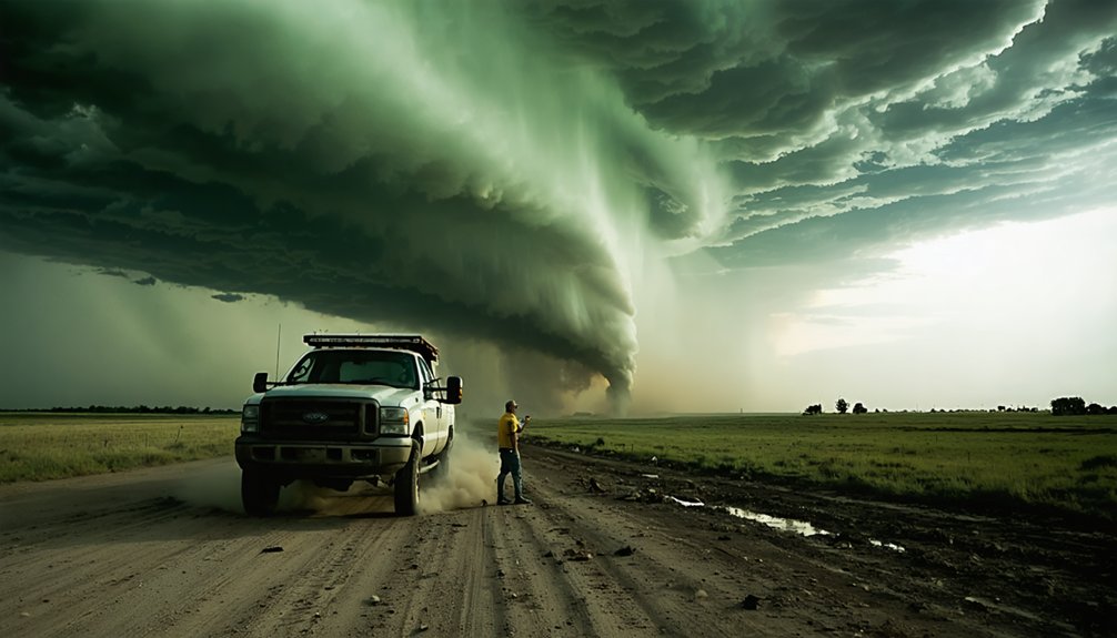
Chaser motivations typically center on documentation, forecasting research, and understanding weather phenomena, not spectacle. Community impacts matter too. Ethical chasers actively avoid blocking rural roads or interfering with emergency response.
Chasing challenges, including rain-wrapped circulations, erratic tornado paths, and rapidly shifting storm modes, demand calculated decision-making.
Hollywood removes that complexity entirely, leaving audiences with a distorted understanding of what disciplined, data-driven field work actually requires.
Tornado Visibility Common Misconceptions
Why do so many people picture tornadoes as the classic narrow, clearly defined funnel descending from a dark cloud? Media reinforces tornado myths by showcasing only photogenic events.
Real storm tracking reveals far more complex visibility challenges:
- Rain-wrapped tornadoes hide circulation entirely within precipitation cores, making tornado shapes impossible to identify visually.
- Wedge tornadoes appear as broad, dark walls rather than recognizable funnels, distorting cloud formations recognition.
- Terrain and darkness severely compromise weather patterns assessment, eliminating photographic opportunities entirely.
- Rapidly shifting tracks demand constant safety precautions, since tornadoes don’t travel predictably straight.
You can’t rely on visual confirmation alone. Radar data drives accurate storm tracking decisions.
Understanding these realities separates dangerous complacency from informed, independent situational awareness that keeps you genuinely free to operate safely in the field.
Vehicle Safety And Myths
Although Hollywood loves the image of a regular pickup truck parking directly in a tornado’s path while its occupants walk away unscathed, MythBusters’ controlled wind tests exposed just how dangerously wrong that assumption is.
At 160 mph, a standard passenger car lost its hood and shifted dramatically. At 250 mph, the results were catastrophic for conventional vehicles.
Purpose-built units like TIV2 and Dominator, engineered with strict safety protocols and rigorous vehicle maintenance standards, resisted those same forces effectively. Your survival depends on design specifications, not sheer weight.
Storm readiness means understanding your vehicle’s structural limits before deployment. Maintaining active chaser communication also guarantees you’re repositioning before conditions exceed your equipment’s tolerance.
Freedom in the field comes from disciplined preparation, not reckless assumptions borrowed from fictional storm-chasing narratives.
Radar, Shear, and Instability: How Chasers Target Storm Days
Targeting a productive storm chase day begins long before anyone gets behind the wheel—it starts with a systematic analysis of atmospheric data that determines whether conditions can support organized, tornadic convection.
Your chase strategies live or die by four critical variables in target selection:
- Instability assessment — CAPE values indicate available energy for storm development
- Wind shear — Directional and speed changes drive storm dynamics and rotation potential
- Radar analysis — Real-time reflectivity and velocity data refine your positioning
- Weather patterns — Synoptic boundaries define where storm forecasting efforts should concentrate
You’re not guessing—you’re synthesizing models, soundings, and surface observations into a calculated decision.
Disciplined instability assessment separates productive chases from wasted mileage.
Why Tornadoes Are Far Less Predictable Than You Think
Even the most disciplined target selection can’t guarantee a productive outcome once a tornado forms, because tornado behavior routinely defies even well-constrained forecasts. Tornado unpredictability factors include rapid intensification cycles, abrupt directional shifts, and rain-wrapping that conceals circulation entirely.
You might position perfectly based on mesocycle data, then watch the tornado accelerate northeast instead of east, cutting off your escape route.
Tornado path variability compounds this challenge. Tracks can curve, stall, or bifurcate, and damage widths fluctuate considerably within a single event.
Darkness and terrain further reduce your ability to assess storm motion accurately. Tornadoes don’t follow linear logic, and no radar algorithm currently eliminates that uncertainty.
Successful chasers don’t bet on prediction alone—they build flexible routing margins that preserve your ability to reposition when the storm rewrites its own script.
Can a Vehicle Actually Survive a Tornado?
If you’ve ever wondered whether a vehicle can actually withstand tornado-force winds, real-world testing offers concrete answers.
MythBusters subjected both standard passenger cars and purpose-built armored vehicles—including the TIV2 and Dominator—to simulated winds of 160 mph and 250 mph, revealing that a conventional car lost its hood and shifted substantially under those conditions.
What the data makes clear is that survival depends not on a vehicle’s raw weight, but on its structural design, low profile, and anchoring capability.
Real-World Vehicle Testing
Whether a vehicle can survive a tornado isn’t just speculation—MythBusters tested it directly using jet-engine wind simulation at 160 mph and 250 mph.
Chase vehicle performance varies dramatically depending on design:
- A standard passenger car lost its hood and shifted considerably at 160 mph.
- At 250 mph, standard vehicles showed catastrophic vulnerability.
- Purpose-built units like TIV2 and Dominator demonstrated strong armored vehicle effectiveness, resisting movement and structural damage.
- Occupants inside purpose-built vehicles would likely have survived both test scenarios.
These results confirm that survival isn’t about weight alone—it’s about engineering, anchoring systems, and situational awareness.
You can’t assume any standard vehicle offers meaningful protection. Purpose-built design separates survivable outcomes from catastrophic ones when extreme wind forces are involved.
Design Over Simple Weight
The MythBusters data makes one thing clear: raw mass doesn’t determine whether a vehicle survives extreme wind forces—engineering does. A heavier standard passenger car failed structurally well before purpose-built armored vehicles showed meaningful displacement. That gap reflects design efficiency, not simply added weight.
TIV2 and Dominator achieved vehicle resilience through low profiles, reinforced frames, and deployable ground anchors—features that redirect aerodynamic forces rather than absorb them passively. You can’t replicate that performance by driving a heavier stock SUV into a violent circulation.
What protects occupants is deliberate structural planning: geometry, anchoring systems, and materials chosen for specific wind-load conditions.
Understanding this distinction matters if you’re evaluating real-world storm-chasing risk rather than relying on assumptions built from entertainment media.
Why Serious Chasers Chase for Science, Not Spectacle
While storm chasing grabs headlines through dramatic footage of violent tornadoes, most serious chasers aren’t out there for the thrill—they’re collecting field data that ground-based radar and satellites can’t fully capture.
Scientific motivation drives their decisions, and ethical considerations shape how they operate in the field.
Here’s what separates data-driven chasers from spectacle-seekers:
- They deploy surface weather instruments directly within storm environments.
- They document mesocyclone structure to improve tornado genesis models.
- They relay real-time observations to National Weather Service forecasters.
- They avoid damage zones to protect responders and residents.
You’ll find that responsible chasers treat every deployment as a research opportunity, not entertainment.
Their work directly refines the forecasting tools that protect your community during severe weather outbreaks.
Why Late-Forming Supercells Reward Patience Over Perfect Forecasts
Storm chasing rarely unfolds on schedule, and late-forming supercells illustrate why rigid forecast adherence can cost you the best observation opportunities of the day. Atmospheric instability often peaks hours after initial model projections suggest, shifting storm development windows well into the afternoon or early evening.
If you abandon your position prematurely, you forfeit the data those late observations can yield. Supercells forming under delayed heating cycles frequently exhibit stronger wind shear interaction, producing more organized mesocyclones than their earlier counterparts.
Staying mobile, reassessing surface boundaries, and tracking convective initiation in real time gives you a decisive advantage. Patience functions here as an analytical tool, not passive waiting.
Flexible routing combined with continuous radar monitoring lets you capitalize on storm development that rigid, schedule-driven chasers will never intercept.
Frequently Asked Questions
How Do Storm Chasers Communicate Tornado Sightings to Local Emergency Management Officials?
You’d relay real-time alerts via communication technology like ham radio, spotter networks, and mobile apps, directly feeding verified tornado sightings to local emergency management officials, enabling faster, data-driven warnings that protect communities and preserve individual freedom.
What Licensing or Certifications, if Any, Are Required to Become a Storm Chaser?
Despite what you might assume, there aren’t mandatory licensing requirements or formal certification processes to become a storm chaser. You’re free to start immediately, though pursuing meteorology training, spotter certifications, and radar interpretation skills greatly sharpens your effectiveness.
How Do Storm Chasing Tours Handle Participant Safety Waivers and Legal Liability?
When you join a storm chasing tour, you’ll sign waivers outlining participant responsibilities and waiver implications, transferring liability to you. Operators analyze risk protocols, but you’re ultimately accountable for informed decisions under dangerous field conditions.
Are Storm Chasers Ever Compensated by News Agencies for Footage They Capture?
Yes, you can earn footage compensation by licensing storm videos directly to news agencies. These news agency relationships often work on a per-clip or contract basis, rewarding your field documentation with real monetary value.
How Does Storm Chasing Activity Vary Between Different Countries Outside the United States?
You’ll find storm chasing varies considerably globally, shaped by distinct storm patterns and cultural perceptions. Australia, Canada, and parts of Europe have growing communities, but you’re seeing fewer resources, less infrastructure, and different severe weather frequencies than the U.S.
References
- https://www.youtube.com/watch?v=ZPqmujzi_xY
- https://tattlingtourist.com/storm-chasing-tour-myths-debunked/
- https://mythresults.com/storm-chasing-myths
- https://www.stormchasingusa.com/blog/my-10-most-memorable-storm-chasing-moments-ever/
- https://www.youtube.com/watch?v=q-aseZq99n4
- https://go.discovery.com/video/mythbusters-discovery/storm-chasing-myths
- https://www.imdb.com/title/tt1683694/
- https://www.youtube.com/watch?v=PYru3jddyTM
- https://www.reddit.com/r/tornado/comments/1jew2cr/the_craziest_story_in_storm_chasing_how_it_really/
- https://www.reddit.com/r/stormchasing/comments/yp42tc/scariest_storm_chase/