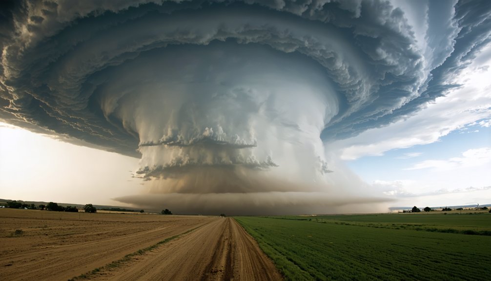
Storm chasers are watching climate change redraw the rules of severe weather in real time. Tornadoes are shifting east out of traditional Tornado Alley, storm seasons now span the entire year, and nighttime activity is spiking in ways historical data never predicted. Warmer, moisture-heavy air is fueling stronger storms with shorter warning windows. Projections show a 20% tornado increase by 2050—and what chasers are discovering in the field goes much deeper than the numbers suggest.
Key Takeaways
- Tornadoes are shifting beyond traditional Tornado Alley, increasing frequency in southeastern and Gulf Coast states with inadequate storm infrastructure.
- Warmer air holds more moisture, intensifying storms and extending severe weather beyond the traditional spring peak season.
- Nighttime tornado activity is surging, reducing visibility and reaction time while complicating storm tracking for chasers.
- Road fatalities among chasers now surpass tornado strike deaths, driven by high-speed repositioning and distracted driving.
- Annual hail losses exceeding $10 billion are accelerating demand for advanced forecasting tools like drones, AI, and mobile radar.
What Storm Chasers Are Witnessing as Climate Patterns Shift
Storm chasers are witnessing firsthand what climate data has long projected: tornadoes are abandoning their traditional boundaries.
You’re no longer tracking twisters exclusively across Kansas flatlands — you’re intercepting them through Tennessee valleys and Gulf Coast suburbs. Climate adaptation isn’t optional anymore; it’s operationally critical.
Storm prediction models built on decades of historical patterns are breaking down.
The forecasting playbooks storm chasers once trusted are failing — rewritten by an atmosphere that no longer follows old rules.
Chasers report outbreaks clustering into larger, more intense events while appearing in calendar windows previously considered low-risk. Tornado Alley‘s geographic dominance is eroding, shifting pressure toward densely populated eastern corridors that lack both infrastructure resilience and cultural preparedness.
The atmosphere’s growing moisture capacity is intensifying every variable you track — updraft velocity, precipitation density, and storm duration.
What you’re observing in the field confirms what the instruments measure: the baseline has permanently shifted.
Tornadoes Are Leaving Tornado Alley Behind
If you’ve been chasing storms across the Great Plains for years, you’ve likely noticed that the action is increasingly happening elsewhere.
Tornado outbreaks are migrating toward the southeastern U.S. and Gulf Coast states, regions that historically saw far less activity, with frequency projections suggesting a 20% increase by 2050 if warming trends continue.
Densely populated eastern states are now facing elevated tornado risk, forcing you to expand your operational range and rethink traditional targeting strategies.
Shifting Away From Plains
For decades, Tornado Alley—spanning Texas, Oklahoma, Kansas, and Nebraska—defined where chasers deployed.
That’s changing fast. Tornado activity is migrating toward the southeastern U.S. and Gulf Coast states, where denser populations face greater exposure. You’re now tracking systems forming in Mississippi, Tennessee, and Alabama with increasing regularity.
Historical data confirms this geographic pivot isn’t random—it reflects measurable atmospheric shifts driven by warming trends.
Your evolving storm tracking methods must account for new formation zones that traditional models weren’t built to handle. Fixed deployment strategies no longer work.
Climate adaptation strategies are essential for staying ahead of this migration. You can’t rely on yesterday’s playbook when the storms have rewritten the rules.
Flexibility, updated modeling tools, and real-time data keep you operationally relevant in this shifting landscape.
New Tornado Hotspots Emerge
Tornado Alley isn’t holding tornadoes the way it once did. Climate migration is pushing severe outbreaks into the southeastern U.S., Gulf Coast states, and densely populated eastern corridors—regions historically unprepared for this level of threat.
You’re watching tornado hotspots emerge in areas where building codes, emergency infrastructure, and public awareness haven’t caught up to the new reality.
The data backs this shift. Larger outbreak clusters are forming outside traditional plains geography, and frequency projections suggest a 20% increase by 2050 under current warming trends.
That means you’re chasing storms in unfamiliar terrain, maneuvering road networks not designed for rapid repositioning. The freedom to predict where danger develops next is shrinking—because the atmosphere isn’t following historical boundaries anymore.
Eastern States Face Risk
What was once predictable geography is now a liability. Tornadoes are abandoning their traditional Tornado Alley corridor and pushing into eastern states where infrastructure, zoning codes, and emergency systems weren’t built for this threat level.
You’re looking at densely populated regions that lack the storm preparedness culture embedded in Oklahoma or Kansas communities.
The data backs this shift hard. Tornado outbreaks are concentrating in larger, more destructive clusters across the Southeast and Gulf Coast.
Historical patterns confirm a measurable westward-to-eastward migration, placing urban centers directly in harm’s way. Frequency projections suggest a 20% increase by 2050 if warming trends hold.
If you live east of the Mississippi, you can’t rely on outdated risk assumptions. Your preparedness window is shrinking, and the storms aren’t waiting for you to catch up.
Why Storms Are Growing Stronger, Not Just More Frequent
Beyond raw frequency, the atmosphere itself is becoming a more potent storm engine. Warmer air holds more moisture, directly amplifying storm intensity and accelerating storm evolution toward superstorm conditions.
That added atmospheric moisture acts as thermodynamic fuel — heavier downpours, stronger updrafts, and larger hailstones sustained longer before falling.
You’re looking at roughly 0.07 watts of additional heat per square meter driving all categories of extreme weather simultaneously. Traditional predictive modeling struggles to keep pace with these shifts, creating dangerous blind spots.
Urban vulnerability increases as cities outside historical storm corridors face infrastructure not built for these conditions.
Climate adaptation demands faster data collection, smarter safety technology, and real-time analysis. You can’t rely on yesterday’s forecasting tools when the atmosphere you’re chasing no longer behaves by yesterday’s rules.
Storm Seasons No Longer Follow the Old Calendar
If you’ve been chasing storms for years, you’ve already noticed that the traditional spring peak season no longer confines severe weather the way it once did.
Storm seasons are stretching beyond their historical boundaries, with significant tornado outbreaks now occurring in months that once offered predictable quiet periods.
You’re now tracking active systems in regions and timeframes that older forecasting models simply weren’t built to anticipate.
Extended Storm Season Duration
Storm seasons no longer align with the predictable windows that once defined them. Changing storm dynamics are pushing severe weather beyond historical boundaries, forcing you to reckon with threats that once felt seasonal but now operate year-round.
Extended storm awareness isn’t optional—it’s survival.
Three measurable shifts are redefining the calendar:
- Severe weather events are occurring with greater frequency outside traditional warm-season months.
- Storm seasons are stretching geographically, reaching regions with no established response infrastructure.
- Nighttime storm activity is increasing, reducing your visibility and reaction time considerably.
These aren’t anomalies—they’re trends. Forecasting models built on decades of historical data are struggling to keep pace.
If you chase or live in affected regions, your preparation window must now span the entire year.
Storms Beyond Traditional Months
The calendar you’ve relied on for storm season planning is becoming obsolete. Storm seasonality trends now show severe weather erupting well outside historically predictable windows. You’re encountering tornado outbreaks in months that once offered reliable downtime, forcing continuous operational readiness rather than seasonal preparation.
Climate impact awareness among chasers has sharpened because the data is undeniable — nighttime storms are increasing, winter severe weather events are multiplying, and traditional “off-season” periods no longer guarantee reduced activity.
Warmer atmospheric conditions maintain sufficient moisture and instability year-round, sustaining storm-generating environments beyond summer boundaries.
For you, this means updated forecasting protocols, revised equipment deployment schedules, and mental recalibration around risk exposure. The fixed seasonal framework that once structured your planning simply doesn’t reflect current atmospheric realities.
Shifting Weather Calendar Patterns
What once served as reliable seasonal benchmarks for storm activity has fundamentally broken down.
You’re now tracking severe weather outside every traditional window, forcing real operational adjustments. Shifting calendars have dismantled the predictability storm chasers historically relied on.
Weather unpredictability now defines the field.
Three critical pattern shifts you’re contending with:
- Extended seasons — Tornado outbreaks increasingly occur beyond conventional spring peak months, stretching into fall and winter.
- Nighttime intensification — Nocturnal storm activity is rising, compressing your reaction windows considerably.
- Geographic migration — Severe events are penetrating new regions with zero historical precedent, invalidating legacy forecast models.
Traditional forecasting frameworks weren’t built for these conditions.
You must adapt your protocols continuously, treating every deployment as operating in partially uncharted meteorological territory.
Nighttime Storms and New Patterns That Didn’t Exist Before
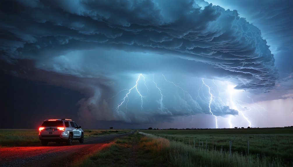
Among the most disorienting shifts storm chasers report is the surge in nighttime tornado activity—a pattern that barely registered in historical data.
You’re now deploying thermal imaging and mobile radar units because nighttime visibility drops to near zero when a tornado forms after midnight. Temperature fluctuations between surface air and upper atmospheric layers are intensifying after sunset, fueling convective activity that forecasting models never anticipated.
These aren’t isolated anomalies. Storm seasons are stretching beyond historical boundaries, and tornadoes are materializing in regions with zero prior exposure.
You’re operating without reliable precedent, forcing real-time tactical decisions with incomplete trajectory data. Traditional forecasting frameworks weren’t built for this volatility.
The patterns emerging today demand entirely new predictive infrastructure—because the atmosphere has fundamentally changed its behavior.
Why Old Forecasting Models Can’t Keep Up With New Storm Paths
Forecasting models built on decades of historical storm data are failing precisely because that data no longer reflects current atmospheric behavior.
You’re watching storm tracking systems struggle against trajectories that simply didn’t exist 30 years ago. These forecasting challenges aren’t minor calibration issues—they’re structural failures rooted in outdated assumptions.
Three critical breakdowns define the problem:
- Formation zones have shifted outside modeled boundaries, leaving prediction algorithms without valid reference points.
- Storm paths now cross terrain historically considered low-risk, invalidating probability maps.
- Seasonal timing extensions push storms beyond windows where models maintain accuracy.
You need to understand that atmospheric warming isn’t just intensifying storms—it’s fundamentally rewriting where and when they form.
Old models can’t chase what they weren’t built to recognize.
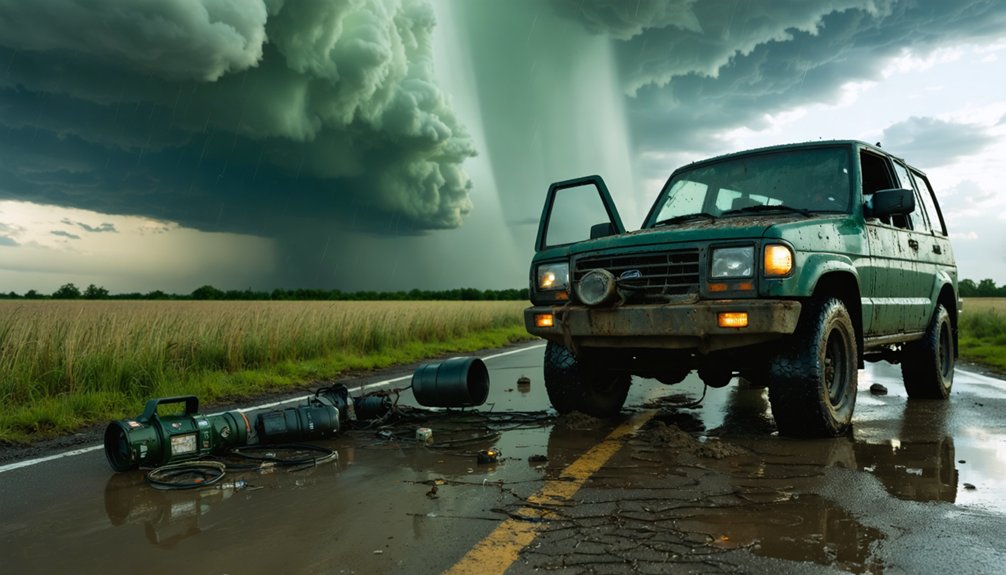
How Climate Change Is Making Storm Chasing More Dangerous
Shifting storm patterns aren’t just overwhelming forecasting models—they’re compressing the safety margins that storm chasers depend on to survive.
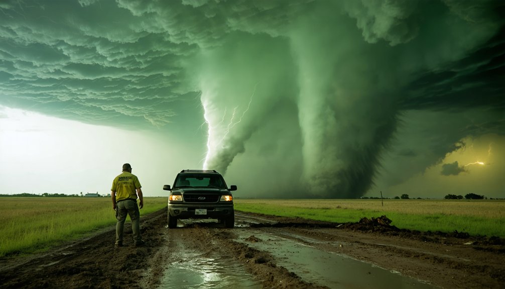
When tornadoes migrate into unfamiliar terrain like the southeastern U.S. and Gulf Coast, you’re traversing denser road networks with fewer escape routes. Road fatalities now kill more chasers than actual tornado strikes—a stat that exposes how dangerous repositioning has become.
Unfamiliar terrain means fewer escape routes—and road fatalities now claim more chasers than tornadoes ever do.
Climate adaptation strategies must evolve alongside intensifying conditions. Stronger updrafts, heavier precipitation, and unpredictable trajectories strain both your decision-making and your equipment.
Mental health assessments are increasingly standard protocol, reflecting cumulative psychological stress.
Storm chasing technology—mobile radar units, satellite imagery, AI-integrated platforms—has become non-negotiable for survival. You can’t rely on historical instincts when the atmosphere itself is rewriting the rules.
Why Road Deaths Now Outpace Tornado Strikes for Chasers
When you analyze storm chaser fatality data, the numbers reveal a counterintuitive truth: road deaths now claim more lives than direct tornado strikes.
You’re maneuvering unpredictable storm trajectories across increasingly congested eastern corridors, where shifting weather patterns force high-speed repositioning on unfamiliar roads.
This statistical shift is driving rapid evolution in chaser safety protocols, compelling teams to integrate real-time satellite imagery and mobile radar data to reduce vehicle collision risks.
Road Fatality Risks Rise
Ironically, the deadliest threat storm chasers face isn’t the tornado itself—it’s the drive to reach it. Road fatalities now outpace tornado strike deaths among chasers, driven by high-speed repositioning on unfamiliar rural roads.
You’re traversing dangerous intersections, blinding rain, and chaotic traffic—all while tracking a moving storm. Three critical road safety factors demand your attention:
- Distracted driving from simultaneous radar monitoring and navigation increases collision risk exponentially.
- Converging chaser traffic creates gridlock on rural roads, eliminating escape routes.
- Fatigue-driven errors during extended multi-day chase operations compromise reaction time.
Chaser training must now prioritize defensive driving protocols alongside meteorological skills. The storm isn’t your greatest enemy—the road to it is.
Evolving Chaser Safety Protocols
As storm activity grows more unpredictable and geographically dispersed, chaser safety protocols have had to evolve far beyond meteorological training.
Road fatalities now claim more chasers than tornado strikes themselves—a stark statistical shift demanding immediate structural changes in how you approach the field.
You’re no longer just tracking storm paths; you’re traversing unfamiliar road networks in regions historically outside traditional chase zones.
Evolving technologies like real-time mobile radar integration and satellite imagery give you critical path prediction advantages, but they don’t eliminate vehicular risk on congested eastern corridors.
Safety innovations now include standardized retreat protocols, mental health assessments, and equipment built for harsher atmospheric conditions.
Adapting independently to these realities—rather than waiting for institutional mandates—keeps you operationally effective and alive in an increasingly volatile environment.
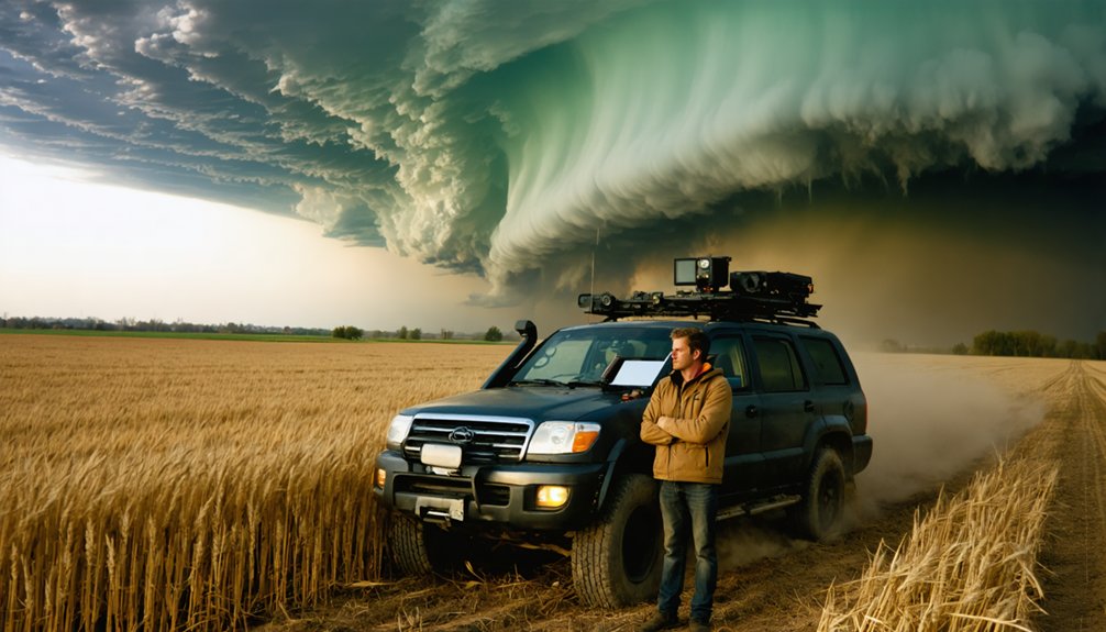
How Chasers Are Using Drones, AI, and Mobile Radar to Keep Up
Storm chasers aren’t just driving into danger anymore—they’re deploying cutting-edge technology to stay ahead of increasingly unpredictable severe weather.
Drone technology and AI integration are reshaping how you track, intercept, and analyze storms in real time.
Drone technology and AI aren’t just tools—they’re rewriting the rules of real-time storm tracking and interception.
Here’s what’s driving the evolution:
- Drone technology captures in-storm data previously impossible to collect safely, feeding live updraft measurements directly into forecast models.
- Mobile radar units let you position precision instrumentation within miles of active rotation, dramatically improving path prediction accuracy.
- AI integration processes massive atmospheric datasets instantly, identifying trajectory shifts that traditional models consistently miss.
Projects like ICECHIP use this exact stack—drones, radar, and AI—to study hail formation during active storms.
You’re no longer guessing; you’re computing.
What Hail Research Like ICECHIP Means for Storm Chasers in the Field
When hail losses exceed $10 billion annually, the pressure to build better prediction models isn’t academic—it’s financial.
ICECHIP—the largest hail research effort in 40 years—puts drones and mobile radars directly into storm environments to measure updraft strength and hail formation in real time.
For you in the field, that data matters. Improved hail forecasting means you’re not guessing about storm impacts—you’re working from hard intercept data that connects atmospheric warming to hail size and trajectory.
ICECHIP’s findings are actively shaping hail-resistant building materials and sharpening forecast models you rely on during rapid deployment.
Warmer atmospheres sustain larger hailstones longer before they fall. Understanding that mechanism gives you a measurable edge—and it’s exactly what targeted field research like ICECHIP delivers.
Frequently Asked Questions
How Does Climate Change Affect Storm Chaser Insurance and Liability Costs?
With road fatalities now surpassing tornado strikes, you’re facing rising insurance premiums and greater liability risks. Climate change’s unpredictable storm patterns force you to adapt coverage quickly, as harsher conditions strain your equipment and escalate operational costs considerably.
Are Storm Chasers Required to Have Formal Meteorological Training or Certifications?
No formal meteorological education or certification requirements bind you as a storm chaser. You’re free to pursue the field independently, though today’s unpredictable, climate-shifted storm patterns make technical training increasingly critical for your survival.
How Do Storm Chasers Coordinate With Emergency Management Agencies During Active Events?
You’ll share real-time storm tracking data directly with emergency management agencies through dedicated emergency communication channels, enabling faster public warnings. You’re transmitting GPS coordinates, wind speeds, and damage reports that help officials deploy resources precisely where they’re needed most.
What Psychological Support Resources Are Currently Available for Professional Storm Chasers?
You’re facing a mountain of stress! Mental health resources for storm chasers include peer support networks, crisis intervention hotlines, stress management training, and community resources offering coping strategies—all critical as severe storm frequency intensifies psychological demands on professional chasers.
How Are International Storm Chasers Adapting to Climate Shifts in Their Regions?
You’re adapting to regional adaptations by tracking shifting patterns as Sydney’s severe thunderstorms increase 40% and Melbourne’s storm environments rise 20% annually, forcing you to update forecasting models and deploy drones and mobile radar units.
References
- https://climatecosmos.com/climate-news/i-chased-tornadoes-for-a-decade-heres-what-i-learned-about-natures-fury/
- https://crazystormchasers.com/climate-change-and-the-future-challenges-for-storm-chasers/
- https://www.youtube.com/watch?v=uFGdZeKtYnI
- https://www.nationalgeographic.com/travel/article/storm-chasing-is-an-exhilarating-rush-but-is-it-safe
- https://www.arcticfocus.org/stories/meeting-george-kourounis-storm-chaser/
- https://www.youtube.com/watch?v=-DXTIqVbX4g
- https://www.nbcnews.com/science/climate-change/hail-chasers-rcna219122
- https://atmos.earth/science-and-nature/warming-skies-have-triggered-a-new-era-of-unpredictable-storms/
- https://www.nbcwashington.com/news/national-international/female-storm-chasers-pursue-passion-as-climate-change-creates-extreme-weather/3031901/
- https://www.youtube.com/watch?v=DIu3ADKpwJc