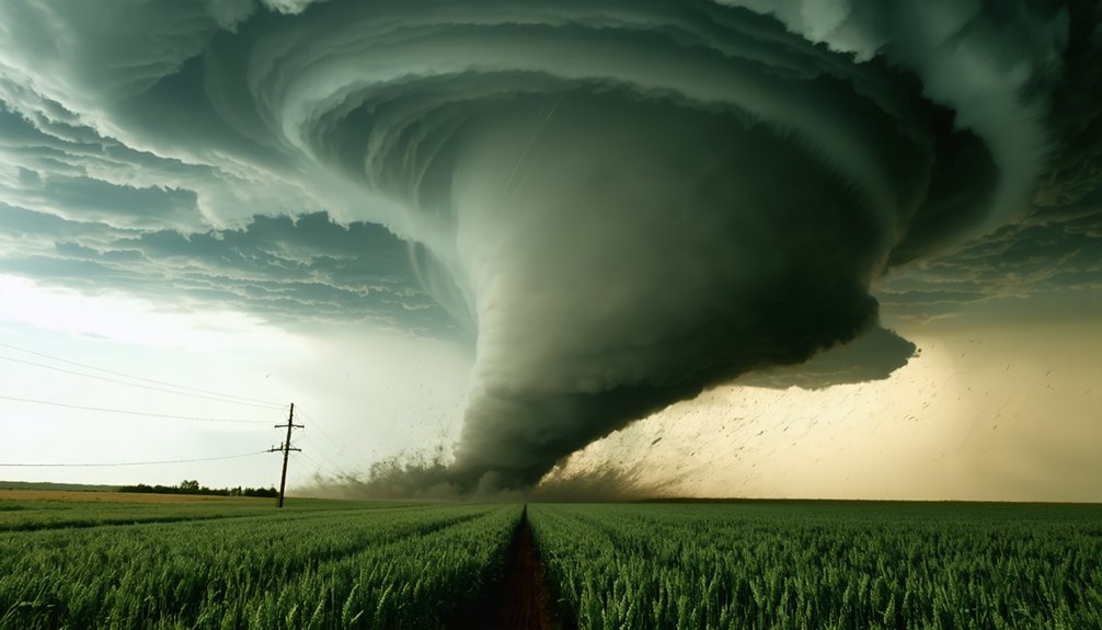
Storm chasing now demands tech that matches the speed and complexity of the storms you’re pursuing. You’ll need dual-polarization radar distinguishing hail from debris, Mobile Doppler on Wheels generating 3D wind maps, and AI algorithms flagging rotation before intensification. Starlink delivers 200 Mbps with under 40ms latency 200 miles from cell towers. Reinforced vehicle armor, night vision cameras, and 72-hour survival kits complete your setup. Every upgrade covered here could mean the difference between data and disaster.
Key Takeaways
- Dual-polarization radar distinguishes rain, hail, and tornado debris by transmitting microwave pulses in both horizontal and vertical orientations.
- Mobile Doppler on Wheels systems mount operational radar on vehicles, generating precise 3D wind circulation maps inside tornadoes.
- AI-driven algorithms flag rotation thresholds before intensification, while GOES satellites provide storm imagery updates every 30 seconds.
- Starlink satellite connectivity delivers speeds exceeding 200 Mbps with under 40ms latency, maintaining operations 200 miles from cell towers.
- Vehicle armor upgrades include steel-welded roll cages, reinforced suspension, undercarriage skid plates, and hail-resistant window reinforcements for storm protection.
Dual-Polarization Radar That Sees Inside Storms
Dual-polarization radar transmits microwave pulses in both horizontal and vertical orientations simultaneously, letting meteorologists distinguish between rain, hail, snow, and even debris lofted inside a tornado’s circulation.
You’re getting storm particle differentiation that traditional single-pol systems simply can’t deliver.
Dual polarization benefits include correlation coefficient data, differential reflectivity, and specific differential phase measurements — three variables that collectively reveal particle shape, size, and composition in real time.
When you’re tracking a supercell, you’ll detect hail signatures and debris balls with precision that sharpens your situational awareness considerably.
Mobile Doppler on Wheels units extend this capability directly into storm environments, generating 3D wind-field maps of funnel interiors.
Integrated with mobile networks, dual-pol data streams live to your devices, empowering independent, informed decisions in rapidly evolving severe weather scenarios.
Mobile Doppler on Wheels Storm Chasers Use for 3D Wind Mapping
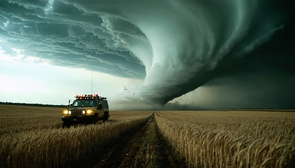
When you deploy a Mobile Doppler on Wheels (DOW) radar, you’re mounting a fully operational Doppler system on a vehicle to position it within kilometers of an active storm’s core.
You use the DOW’s scanning beams to collect radial velocity data from multiple elevation angles, which your software then synthesizes into precise 3D maps of wind circulation inside funnel structures.
This real-time analysis lets you quantify wind speed gradients, identify mesocyclone boundaries, and track structural changes in a tornado’s interior as they unfold.
DOW Radar Core Functions
Mobile Doppler on Wheels (DOW) radars mount directly onto vehicles, letting storm chasers drive into the immediate vicinity of a tornado and collect high-resolution 3D wind data that fixed radar installations simply can’t capture at close range.
DOW radar applications leverage Doppler technology benefits by measuring precise wind velocity, direction, and rotation within funnel structures. You’re getting storm tracking innovations that deliver mobile radar advantages no stationary system can match—real time data integration feeds 3D visualization techniques directly into forecasting pipelines.
Advanced radar capabilities allow you to detect wind shear gradients at resolutions under 100 meters, while wind mapping significance becomes clear when that data informs tornado intensity ratings and warnings.
DOW systems genuinely expand your operational freedom in the field.
3D Wind Mapping Process
To generate a 3D wind map, DOW radar systems execute rapid antenna elevation sweeps across multiple angles—typically ranging from 0.5° to 19.5°—while the vehicle repositions between scan intervals to triangulate volumetric wind data.
Each sweep captures radial velocity measurements, allowing you to reconstruct full wind field structures inside supercells and tornadoes. These wind mapping techniques rely on dual-Doppler coordination, where two or more DOW units operate simultaneously from separate positions, eliminating velocity ambiguities that single-radar setups can’t resolve.
You’re fundamentally building a real-time three-dimensional velocity grid of the storm’s interior. Among today’s most powerful storm tracking innovations, this process delivers sub-kilometer resolution wind profiles, letting forecasters and chasers identify rotation intensification, downdraft boundaries, and debris signatures with measurable precision that traditional fixed radar networks simply can’t match.
Real-Time Storm Analysis
Once the 3D wind field data streams in from coordinated DOW units, real-time storm analysis begins processing velocity grids and reflectivity signatures simultaneously.
You’re watching dual-polarization returns distinguish hail cores from rain bands while AI-driven storm prediction algorithms flag rotation thresholds before they intensify.
Data visualization platforms render live wind vectors across multiple elevation angles, giving you immediate spatial context for mesocyclone development.
RadarScope overlays velocity data onto GPS-referenced terrain maps, so you’re never guessing where shear boundaries exist.
You’re cross-referencing GOES-East rapid-scan imagery every 30 seconds against ground-truth DOW measurements, tightening forecast confidence rapidly.
This integrated pipeline—mobile radar, satellite feeds, and predictive modeling—puts precise, actionable intelligence directly in your hands, eliminating ambiguity when storm behavior shifts unexpectedly.
AI Forecasting Tools That Outpace Traditional Weather Models
As storm chasing grows more data-intensive, AI forecasting tools are redefining what’s possible in real-time weather prediction.
You’re no longer dependent on slow traditional models—machine learning integration accelerates data processing speed, delivering sharper forecasts faster.
Here’s what AI brings to your chase:
- AI model accuracy improves storm tracking by analyzing historical data analysis patterns traditional models frequently miss.
- Predictive algorithms identify weather pattern recognition signals hours before supercell development becomes visible on radar.
- Forecasting efficiency cuts decision time dramatically, letting you reposition before conditions deteriorate.
- Real-time data processing speed ingests live radar feeds, GPS positioning, and atmospheric sensor inputs simultaneously.
You gain tactical freedom—moving smarter, not reactively—because AI processes what human forecasters simply can’t match at speed.
Why GOES Satellite Imagery Updating Every 30 Seconds Changes Everything
While AI crunches historical data and live radar feeds on the ground, NOAA’s GOES-East and GOES-West satellites are feeding you a continuous overhead picture you simply can’t replicate from a vehicle.
Every 30 seconds, you’re receiving fresh imagery that captures rapid storm intensification, eye wall replacements, and supercell births before ground-based systems detect them.
These satellite imagery advantages translate directly into faster, smarter positioning decisions. You’re not guessing where a storm is heading — you’re watching it evolve in near real-time from space.
Among today’s storm tracking innovations, this rapid-scan capability stands apart because it eliminates blind spots that terrain and radar range limitations create.
When you’re operating in remote areas with no nearby radar towers, GOES coverage keeps your situational awareness sharp and your routes defensible.
Satellite Internet Keeping Storm Chasers Connected Anywhere
When you’re chasing storms in the most remote regions on Earth, Starlink’s low-earth-orbit satellite network keeps you connected with speeds exceeding 100 Mbps, eliminating the dead zones that once severed field teams from mission-critical data.
You can stream HD video, transmit dual-pol radar datasets, and push real-time storm metrics to coordination teams without interruption, regardless of how far you’ve pushed into isolated terrain.
This high-speed satellite backbone transforms your vehicle into a fully operational data hub, sustaining the continuous flow of information that modern storm chasing demands.
Global Connectivity In Storms
Staying connected in the middle of a raging supercell isn’t optional — it’s mission-critical. Storm connectivity separates successful operations from dangerous communication failures. Satellite resilience guarantees you maintain data transmission regardless of destroyed cell towers or remote terrain.
- Starlink terminals deliver low-latency broadband directly from orbit, eliminating ground-infrastructure dependency.
- GOES satellite feeds update every 30 seconds, giving you precise remote monitoring of evolving storm structures.
- Emergency response coordination requires real-time uploading of HD footage and radar overlays simultaneously.
- Redundant communication channels — combining satellite dishes, dual-band radios, and Wi-Fi car technology — eliminate single-point failures during critical communication challenges.
You’re operating beyond civilization’s reach. Satellite systems don’t ask permission from geography. They transmit your data, sustain your situational awareness, and keep your team coordinated when conventional networks collapse entirely.
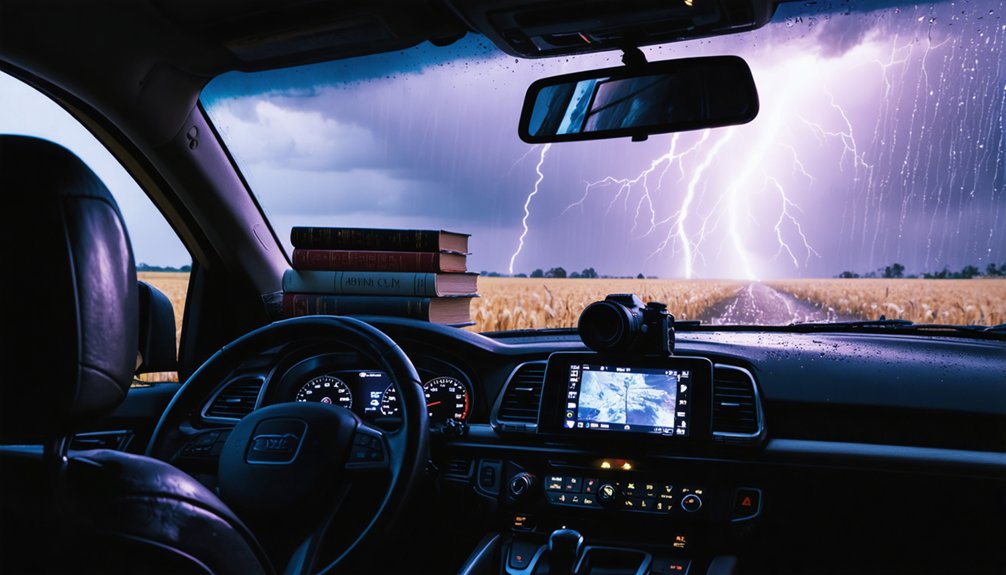
High-Speed Satellite Data Streaming
Satellite internet has redefined what’s possible when you’re operating 200 miles from the nearest cell tower. With Starlink’s low-earth-orbit constellation delivering download speeds exceeding 200 Mbps, you’re no longer bandwidth-constrained in remote terrain.
You can stream HD radar feeds, upload multi-gigabyte video files, and maintain live communication simultaneously.
Recent satellite advancements have slashed latency to under 40 milliseconds, making real-time data exchange genuinely viable during active chase operations.
You’re pulling GOES-East rapid-scan imagery updating every 30 seconds, feeding that directly into your AI forecasting tools without interruption.
High speed connectivity means your mobile command setup performs identically whether you’re parked outside Amarillo or deep inside Nebraska’s Sandhills.
Distance no longer dictates your operational capability.
Real-Time Apps Storm Chasers Actually Rely On
Few tools matter more to storm chasers than the real-time apps running on their phones and tablets. You gain decisive advantages when you harness real-time data streams for storm tracking, positioning yourself ahead of rapidly evolving systems.
- RadarScope – Renders dual-pol radar layers, velocity scans, and rotation alerts with professional-grade precision.
- RadarOmega – Delivers high-resolution mesocyclone detection and customizable overlays for pinpointing supercell structures.
- Lightning Maps – Displays live strike activity across North America, Europe, and Oceania, updating within seconds.
- GPS Navigation Integration – Syncs storm prediction data directly into route planning, letting you reposition fast without guesswork.
These apps transform raw atmospheric data into actionable intelligence, keeping you mobile, informed, and in control when conditions shift violently.
GPS navigation tools do more than plot a course—they sync live storm prediction data into your routing decisions, letting you reposition ahead of a rapidly intensifying system without losing situational awareness.
GPS optimization merges real-time storm alerts with terrain mapping, flagging flooded roads, debris fields, and low-clearance underpasses before you reach them.
Data integration pulls feeds from RadarScope and NOAA simultaneously, triggering automatic route adjustments when a supercell shifts unexpectedly.
You’ll encounter navigation challenges in rural corridors where cell coverage drops, so offline topographic layers keep emergency rerouting viable.
Safety protocols embedded in platforms like OnX Offroad lock out routes that cross projected storm paths.
The result is a dynamic, freedom-preserving system that keeps you mobile, informed, and decisively ahead of the storm.
Night Vision and 360-Degree Cameras for Storm Documentation

When you’re chasing storms in low-light or nighttime conditions, high-resolution night vision cameras let you capture precise structural details of rotating mesocyclones that standard lenses simply can’t resolve.
Pairing that capability with a 360-degree camera system gives you full panoramic coverage, eliminating blind spots and ensuring no wall cloud rotation or debris field goes undocumented.
You’ll typically mount action cameras as forward-facing dash cams, position 360-degree units on roof brackets for unobstructed sightlines, and secure night vision rigs on reinforced side mounts to maximize angular coverage across the storm’s entire visible profile.
Night Vision Camera Capabilities
Storm chasing doesn’t stop when the sun goes down, and high-resolution night vision cameras guarantee you won’t miss critical storm developments in low-light conditions.
Advanced imaging technology delivers precise storm documentation regardless of visibility challenges, keeping you informed and in control.
Key night vision camera features include:
- Low light performance — sensors capture sharp video quality at near-zero lux, revealing tornado debris fields invisible to the naked eye.
- Visibility enhancement — infrared illuminators extend your effective range beyond 300 feet in total darkness.
- Camera mounting — reinforced brackets secure equipment to vehicle exteriors, withstanding 100+ mph winds.
- Equipment reliability — weatherproof housing rated IP67 guarantees storm safety without compromising continuous storm documentation during rain, hail, or flying debris encounters.
360-Degree Storm Coverage
Capturing a full 360-degree view of a tornado’s rotation, wall cloud development, and debris field simultaneously transforms how you document and analyze severe weather events.
These multi-lens systems eliminate blind spots, giving you complete situational awareness across all weather patterns simultaneously. You’re integrating real-time storm tracking data with immersive visual documentation, correlating radar technology overlays against live footage for precise data visualization.
Mobile connectivity streams your 360-degree feeds directly to command centers, enhancing collaborative storm preparedness decisions. You’ll distinguish precipitation types visually while cross-referencing dual-pol radar returns, confirming hail cores or rain wrapping around mesocyclones.
Mounting these systems on reinforced vehicles guarantees continuous capture through violent inflow and outflow winds, delivering thorough, uninterrupted footage that sharpens your analytical edge during rapidly evolving severe weather scenarios.
Mounting and Deployment Strategies
Deploying 3 or more camera systems across your chase vehicle demands deliberate placement to eliminate coverage gaps and protect hardware against debris impacts. Your mounting techniques and deployment strategies determine data quality under extreme conditions.
- Hood & Roof Mounts: Secure wide-angle cameras using reinforced brackets with armor enhancements, protecting lenses from 100+ mph debris.
- Rear Deployment: Position night-vision units at 170-degree angles, integrating data feeds directly into your mobile setups for continuous coverage.
- Interior Camera Placements: Mount dash-facing units behind reinforced glass, connecting footage through communication systems for real-time data integration.
- Equipment Storage: Use foam-lined, waterproof cases with vehicle modifications including dedicated compartments, ensuring rapid deployment without compromising safety protocols during active chase sequences.
Reinforced Vehicle Armor Against Flying Debris and Direct Impact
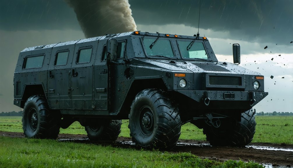
When venturing into the path of violent storms, reinforced vehicle armor isn’t a luxury—it’s a critical survival system. Modern storm debris safety demands hardened steel plating across doors, roofs, and undercarriages, rated to withstand debris traveling at 150+ mph.
You’ll want polycarbonate window reinforcements that resist shattering under direct hail impact without compromising visibility.
Vehicle durability enhancements extend beyond surface armor. Undercarriage skid plates protect critical mechanical components from ground-level projectiles, while reinforced suspension systems maintain control on debris-strewn terrain.
Steel-welded roll cages add structural integrity during rollovers or direct collisions.
You’re operating in environments where one compromised component ends your chase—or worse.
Prioritize bolt-on modular armor systems that let you customize protection levels based on storm intensity, keeping your response capability fast and your team protected.
Emergency Survival Gear Every Storm Chaser Needs in the Field
Survival gear is your last line of defense when armor and situational awareness fail. When conditions collapse faster than forecasts predict, you’ll need survival kit essentials ready for immediate deployment.
Survival gear is your last line of defense — deploy it before conditions collapse faster than any forecast predicts.
Pack these four non-negotiables:
- Portable shelter — lightweight, debris-resistant pod deploying in under 60 seconds during violent wind events
- First aid kit — trauma-rated supplies including tourniquets, compression bandages, and wound-sealing agents
- Emergency communication tools — dual-band radios plus satellite communicators maintaining contact when cell networks fail
- 72-hour sustenance pack — calorie-dense rations, water purification tablets, and thermal blankets for post-storm isolation scenarios
Each item directly addresses a specific failure point.
You’re not packing for comfort — you’re engineering your survival margin against unpredictable, life-threatening conditions.
Frequently Asked Questions
What Licensing or Certifications Are Required to Legally Chase Storms Professionally?
No universal storm chasing regulations exist—over 95% of chasers operate without mandatory licenses. You’ll need professional qualifications like meteorology degrees or emergency management certifications to boost credibility, secure funding, and partner with research institutions effectively.
How Do Storm Chasers Fund Their Expensive Equipment and Technology Upgrades?
You’ll fund your gear through sponsorship opportunities with tech and weather brands, crowdfunding platforms like Kickstarter, media licensing deals, and research grants—each revenue stream directly offsetting high-cost radar systems, satellite communications, and AI-driven forecasting tools.
What Psychological Training Prepares Storm Chasers for Extreme High-Stress Situations?
Like steel forged in fire, you’ll build mental resilience through scenario-based drills, mindfulness techniques, and debriefing sessions. You actively practice stress management by simulating high-pressure situations, sharpening decision-making, and maintaining psychological control when chaos surrounds you.
How Do Storm Chasers Coordinate With Local Law Enforcement During Active Chases?
You’ll coordinate with local law enforcement through established communication protocols using dual-band radios, sharing real-time GPS positions and storm data. You’re responsible for adhering to safety measures, respecting road closures, and maintaining transparent, continuous contact throughout active chases.
What Environmental Impact Does Frequent Storm Chasing Have on Surrounding Ecosystems?
Treading on thin ice, you’re disrupting ecosystems with frequent chases—vehicle emissions, off-road travel, and noise pollution actively alter wildlife behavior, fragment habitats, and accelerate soil erosion, compounding storm-driven ecosystem disruption beyond natural weather impacts.
References
- https://www.accio.com/blog/next-gen-tornado-chase-vehicles-redefining-storm-intercept
- https://crazystormchasers.com/leveraging-technology-for-response-coordination/
- https://rammount.com/blogs/product-tips-tricks/copy-storm-chasing-tool-kit-an-evolution-in-must-have-tech
- https://wickedwxlive.com/chasing-the-future-how-advancing-weather-technology-is-changing-storm-tracking/
- https://crazystormchasers.com/how-technology-transformed-storm-chasing/
- https://en.wikipedia.org/wiki/Storm_chasing
- https://www.asmag.com/showpost/13855.aspx
- https://crazystormchasers.com/upgraded-storm-chasing-vehicle-accessories/
- https://www.stemjobs.com/awesome-storm-chasing-technology/
- https://stormtrack.org/threads/what-will-you-add-change-to-your-chasing-in-2026.33258/